
Articles | Volume 9, issue 1
https://doi.org/10.5194/tc-9-139-2015
© Author(s) 2015. This work is distributed under
the Creative Commons Attribution 3.0 License.
the Creative Commons Attribution 3.0 License.
https://doi.org/10.5194/tc-9-139-2015
© Author(s) 2015. This work is distributed under
the Creative Commons Attribution 3.0 License.
the Creative Commons Attribution 3.0 License.
Research article
| 
27 Jan 2015
Research article |
| 27 Jan 2015
Mass changes in Arctic ice caps and glaciers: implications of regionalizing elevation changes
Department of Geodynamics, DTU Space, Technical University of Denmark, Elektrovej 327, 2800 Lyngby, Denmark
L. Sandberg Sørensen
Department of Geodynamics, DTU Space, Technical University of Denmark, Elektrovej 327, 2800 Lyngby, Denmark
V. R. Barletta
Department of Geodynamics, DTU Space, Technical University of Denmark, Elektrovej 327, 2800 Lyngby, Denmark
Ohio State University, 275 Mendenhall Lab, 125 S. Oval Mall, Columbus, Ohio, 43214, USA
R. Forsberg
Department of Geodynamics, DTU Space, Technical University of Denmark, Elektrovej 327, 2800 Lyngby, Denmark
Related authors
Thorsten Seehaus, Alex S. Gardner, and Johan Nilsson
The Cryosphere, 20, 6107–6130, https://doi.org/10.5194/tc-20-6107-2026, https://doi.org/10.5194/tc-20-6107-2026, 2026
Short summary
Short summary
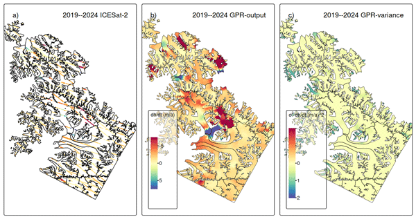
Satellite altimeters only sample surface heights at scattered points. We developed a method to turn these measurements into maps of glacier height change while also estimating how reliable the results are. Applying this approach to glaciers in Svalbard and Antarctica shows strong ice loss and clearly captures short-lived events such as glacier surges. Our results improve the ability to monitor glacier change in difficult terrain and help better assess future contributions to sea level rise.
David N. Wiese, Johan Nilsson, Nicole-Jeanne Schlegel, Alex S. Gardner, Matthias Ellmer, and Felix W. Landerer
EGUsphere, https://doi.org/10.5194/egusphere-2026-4404, https://doi.org/10.5194/egusphere-2026-4404, 2026
This preprint is open for discussion and under review for The Cryosphere (TC).
Short summary
Short summary
Tracking Antarctic ice loss is vital for predicting sea-level rise. Satellite gravity measurements reliably track overall mass changes, while height measurements capture fine local details. We combined two decades of both satellite records into a unified model. This boosts mapping clarity tenfold, revealing ice loss from broad regional scales down to individual glaciers. These refined maps help scientists monitor vulnerable ice streams and improve climate projections.
Johan Nilsson and Alex S. Gardner
Earth Syst. Sci. Data, 18, 1729–1745, https://doi.org/10.5194/essd-18-1729-2026, https://doi.org/10.5194/essd-18-1729-2026, 2026
Short summary
Short summary
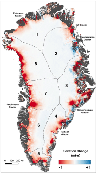
Integrating data from multiple satellite altimetry missions, we analyzed Greenland’s peripheral glaciers and Ice Sheet (GrIS) from 1992–2023. Our methodology ensures consistent, reliable elevation change data, now publicly available via NASA's ITS_LIVE project. The GrIS lost an average of -160 ± 17 Gt a-1 and peripheral glaciers -23 ± 5 Gt a-1 from 1992–2023. The study highlights the importance of continued monitoring to understand climate change impacts on Earth's Cryosphere.
Maria T. Kappelsberger, Johan Nilsson, Martin Horwath, Veit Helm, and Alex S. Gardner
EGUsphere, https://doi.org/10.5194/egusphere-2025-5745, https://doi.org/10.5194/egusphere-2025-5745, 2025
Short summary
Short summary
We compare surface elevation changes of the Antarctic Ice Sheet interior as derived from satellite radar altimetry and laser altimetry between 2019 and 2024. Both methods indicate an increase in surface elevation across most of the study area, coinciding with an episode of excess snow accumulation as modelled. However, rates of surface elevation increase from radar altimetry are systematically lower than those from laser altimetry.
Ankita Vashishtha, Pietro Milillo, Alexandre Becker Campos, Jose Luis Bueso Bello, Paola Rizzoli, and Johan Nilsson
EGUsphere, https://doi.org/10.5194/egusphere-2025-1979, https://doi.org/10.5194/egusphere-2025-1979, 2025
Short summary
Short summary
We developed a new method to improve satellite elevation models of Antarctica by using artificial intelligence. Our method combines radar and laser satellite data with weather information to correct for measurement errors caused by radar signals penetrating snow and ice. This makes elevation maps up to ten times more accurate compared to current , helping scientists better track changes in ice and snow. Our results directly inform future space missions to monitor Earth’s changing surface.
Fernando S. Paolo, Alex S. Gardner, Chad A. Greene, Johan Nilsson, Michael P. Schodlok, Nicole-Jeanne Schlegel, and Helen A. Fricker
The Cryosphere, 17, 3409–3433, https://doi.org/10.5194/tc-17-3409-2023, https://doi.org/10.5194/tc-17-3409-2023, 2023
Short summary
Short summary
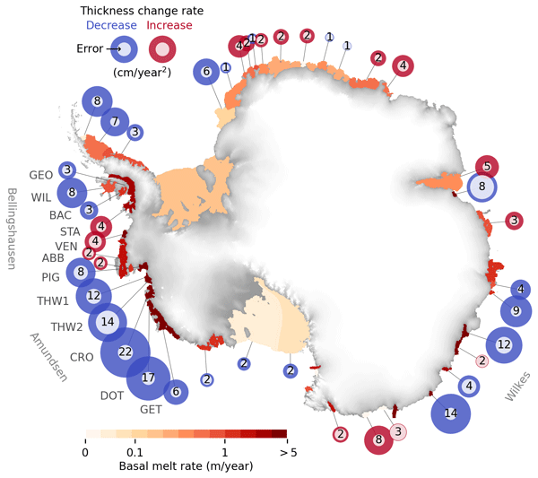
We report on a slowdown in the rate of thinning and melting of West Antarctic ice shelves. We present a comprehensive assessment of the Antarctic ice shelves, where we analyze at a continental scale the changes in thickness, flow, and basal melt over the past 26 years. We also present a novel method to estimate ice shelf change from satellite altimetry and a time-dependent data set of ice shelf thickness and basal melt rates at an unprecedented resolution.
Inès N. Otosaka, Andrew Shepherd, Erik R. Ivins, Nicole-Jeanne Schlegel, Charles Amory, Michiel R. van den Broeke, Martin Horwath, Ian Joughin, Michalea D. King, Gerhard Krinner, Sophie Nowicki, Anthony J. Payne, Eric Rignot, Ted Scambos, Karen M. Simon, Benjamin E. Smith, Louise S. Sørensen, Isabella Velicogna, Pippa L. Whitehouse, Geruo A, Cécile Agosta, Andreas P. Ahlstrøm, Alejandro Blazquez, William Colgan, Marcus E. Engdahl, Xavier Fettweis, Rene Forsberg, Hubert Gallée, Alex Gardner, Lin Gilbert, Noel Gourmelen, Andreas Groh, Brian C. Gunter, Christopher Harig, Veit Helm, Shfaqat Abbas Khan, Christoph Kittel, Hannes Konrad, Peter L. Langen, Benoit S. Lecavalier, Chia-Chun Liang, Bryant D. Loomis, Malcolm McMillan, Daniele Melini, Sebastian H. Mernild, Ruth Mottram, Jeremie Mouginot, Johan Nilsson, Brice Noël, Mark E. Pattle, William R. Peltier, Nadege Pie, Mònica Roca, Ingo Sasgen, Himanshu V. Save, Ki-Weon Seo, Bernd Scheuchl, Ernst J. O. Schrama, Ludwig Schröder, Sebastian B. Simonsen, Thomas Slater, Giorgio Spada, Tyler C. Sutterley, Bramha Dutt Vishwakarma, Jan Melchior van Wessem, David Wiese, Wouter van der Wal, and Bert Wouters
Earth Syst. Sci. Data, 15, 1597–1616, https://doi.org/10.5194/essd-15-1597-2023, https://doi.org/10.5194/essd-15-1597-2023, 2023
Short summary
Short summary
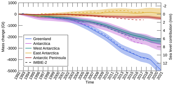
By measuring changes in the volume, gravitational attraction, and ice flow of Greenland and Antarctica from space, we can monitor their mass gain and loss over time. Here, we present a new record of the Earth’s polar ice sheet mass balance produced by aggregating 50 satellite-based estimates of ice sheet mass change. This new assessment shows that the ice sheets have lost (7.5 x 10¹²) t of ice between 1992 and 2020, contributing 21 mm to sea level rise.
Johan Nilsson, Alex S. Gardner, and Fernando S. Paolo
Earth Syst. Sci. Data, 14, 3573–3598, https://doi.org/10.5194/essd-14-3573-2022, https://doi.org/10.5194/essd-14-3573-2022, 2022
Short summary
Short summary
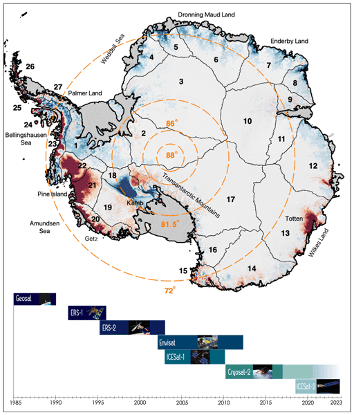
The longest observational record available to study the mass balance of the Earth’s ice sheets comes from satellite altimeters. This record consists of multiple satellite missions with different measurements and quality, and it must be cross-calibrated and integrated into a consistent record for scientific use. Here, we present a novel approach for generating such a record providing a seamless record of elevation change for the Antarctic Ice Sheet that spans the period 1985 to 2020.
Thorsten Seehaus, Alex S. Gardner, and Johan Nilsson
The Cryosphere, 20, 6107–6130, https://doi.org/10.5194/tc-20-6107-2026, https://doi.org/10.5194/tc-20-6107-2026, 2026
Short summary
Short summary
Satellite altimeters only sample surface heights at scattered points. We developed a method to turn these measurements into maps of glacier height change while also estimating how reliable the results are. Applying this approach to glaciers in Svalbard and Antarctica shows strong ice loss and clearly captures short-lived events such as glacier surges. Our results improve the ability to monitor glacier change in difficult terrain and help better assess future contributions to sea level rise.
David N. Wiese, Johan Nilsson, Nicole-Jeanne Schlegel, Alex S. Gardner, Matthias Ellmer, and Felix W. Landerer
EGUsphere, https://doi.org/10.5194/egusphere-2026-4404, https://doi.org/10.5194/egusphere-2026-4404, 2026
This preprint is open for discussion and under review for The Cryosphere (TC).
Short summary
Short summary
Tracking Antarctic ice loss is vital for predicting sea-level rise. Satellite gravity measurements reliably track overall mass changes, while height measurements capture fine local details. We combined two decades of both satellite records into a unified model. This boosts mapping clarity tenfold, revealing ice loss from broad regional scales down to individual glaciers. These refined maps help scientists monitor vulnerable ice streams and improve climate projections.
Natalia H. Andersen, Sebastian B. Simonsen, Karina Nielsen, Mai Winstrup, Baptiste Vandecrux, Hui Gao, Beata Csatho, Anton Schenk, and Louise Sandberg Sørensen
The Cryosphere, 20, 4327–4344, https://doi.org/10.5194/tc-20-4327-2026, https://doi.org/10.5194/tc-20-4327-2026, 2026
Short summary
Short summary
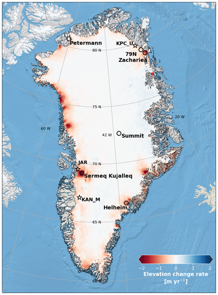
We developed a new statistical approach to track monthly changes in the surface height of the Greenland Ice Sheet using radar data from the CryoSat-2 satellite (2011–2025). The method lets seasonal and long-term variations emerge directly from the data, creating a consistent record of elevation change that helps reveal how Greenland responds to ongoing climate change.
Barbara Jenny, Tim Enzlberger Jensen, and René Forsberg
EGUsphere, https://doi.org/10.5194/egusphere-2026-2451, https://doi.org/10.5194/egusphere-2026-2451, 2026
Short summary
Short summary
Our study shows that satellite measurements can track changes in Greenland’s ice mass every few days, revealing short‑term melt events that monthly products cannot capture. We combine the range acceleration of a gravity mission with surface-height data to improve the spatial distribution of these changes. This approach helps us better understand rapid ice‑loss patterns and should be considered for future satellite missions.
Johan Nilsson and Alex S. Gardner
Earth Syst. Sci. Data, 18, 1729–1745, https://doi.org/10.5194/essd-18-1729-2026, https://doi.org/10.5194/essd-18-1729-2026, 2026
Short summary
Short summary
Integrating data from multiple satellite altimetry missions, we analyzed Greenland’s peripheral glaciers and Ice Sheet (GrIS) from 1992–2023. Our methodology ensures consistent, reliable elevation change data, now publicly available via NASA's ITS_LIVE project. The GrIS lost an average of -160 ± 17 Gt a-1 and peripheral glaciers -23 ± 5 Gt a-1 from 1992–2023. The study highlights the importance of continued monitoring to understand climate change impacts on Earth's Cryosphere.
Maria T. Kappelsberger, Johan Nilsson, Martin Horwath, Veit Helm, and Alex S. Gardner
EGUsphere, https://doi.org/10.5194/egusphere-2025-5745, https://doi.org/10.5194/egusphere-2025-5745, 2025
Short summary
Short summary
We compare surface elevation changes of the Antarctic Ice Sheet interior as derived from satellite radar altimetry and laser altimetry between 2019 and 2024. Both methods indicate an increase in surface elevation across most of the study area, coinciding with an episode of excess snow accumulation as modelled. However, rates of surface elevation increase from radar altimetry are systematically lower than those from laser altimetry.
Renée Mie Fredensborg Hansen, Henriette Skourup, Eero Rinne, Arttu Jutila, Isobel R. Lawrence, Andrew Shepherd, Knut Vilhelm Høyland, Jilu Li, Fernando Rodriguez-Morales, Sebastian Bjerregaaard Simonsen, Jeremy Wilkinson, Gaelle Veyssiere, Donghui Yi, René Forsberg, and Taniâ Gil Duarte Casal
The Cryosphere, 19, 4193–4209, https://doi.org/10.5194/tc-19-4193-2025, https://doi.org/10.5194/tc-19-4193-2025, 2025
Short summary
Short summary
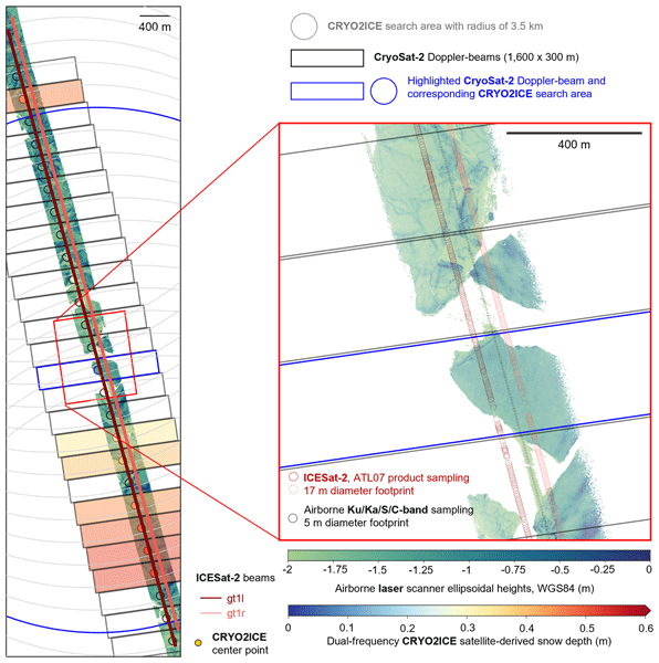
An airborne campaign collected unprecedented coincident multi-frequency radar and lidar data over sea ice along a CryoSat-2 and ICESat-2 (CRYO2ICE) orbit in the Weddell Sea, useful for evaluating microwave snow penetration. Ka-band and Ku-band had limited penetration with significant contributions from the air–snow interface, contradicting traditional assumptions with discrepancies between commonly used C/S-band "snow-radar" methodologies, all challenging comparisons of airborne and spaceborne estimates.
Renée Mie Fredensborg Hansen, Henriette Skourup, Eero Rinne, Arttu Jutila, Isobel R. Lawrence, Andrew Shepherd, Knut Vilhelm Høyland, Jilu Li, Fernando Rodriguez-Morales, Sebastian Bjerregaaard Simonsen, Jeremy Wilkinson, Gaelle Veyssiere, Donghui Yi, René Forsberg, and Taniâ Gil Duarte Casal
The Cryosphere, 19, 4167–4192, https://doi.org/10.5194/tc-19-4167-2025, https://doi.org/10.5194/tc-19-4167-2025, 2025
Short summary
Short summary
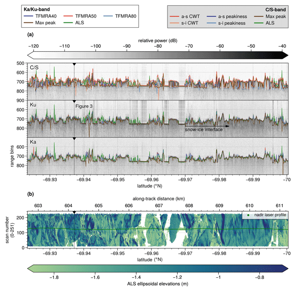
An airborne campaign collected unprecedented coincident multi-frequency radar and lidar data over sea ice along a CryoSat-2 and ICESat-2 (CRYO2ICE) orbit in the Weddell Sea, useful for evaluating microwave snow penetration. Ka-band and Ku-band had limited penetration with significant contributions from the air–snow interface, contradicting traditional assumptions with discrepancies between commonly used C/S-band "snow-radar" methodologies, all challenging comparisons of airborne and spaceborne estimates.
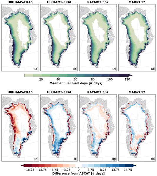
Anna Puggaard, Nicolaj Hansen, Ruth Mottram, Thomas Nagler, Stefan Scheiblauer, Sebastian B. Simonsen, Louise S. Sørensen, Jan Wuite, and Anne M. Solgaard
The Cryosphere, 19, 2963–2981, https://doi.org/10.5194/tc-19-2963-2025, https://doi.org/10.5194/tc-19-2963-2025, 2025
Short summary
Short summary
Regional climate models are currently the only source for assessing the melt volume of the Greenland Ice Sheet on a global scale. This study compares the modeled melt volume with observations from weather stations and melt extent observed from the Advanced SCATterometer (ASCAT) to assess the performance of the models. It highlights the importance of critically evaluating model outputs with high-quality satellite measurements to improve the understanding of variability among models.
Ankita Vashishtha, Pietro Milillo, Alexandre Becker Campos, Jose Luis Bueso Bello, Paola Rizzoli, and Johan Nilsson
EGUsphere, https://doi.org/10.5194/egusphere-2025-1979, https://doi.org/10.5194/egusphere-2025-1979, 2025
Short summary
Short summary
We developed a new method to improve satellite elevation models of Antarctica by using artificial intelligence. Our method combines radar and laser satellite data with weather information to correct for measurement errors caused by radar signals penetrating snow and ice. This makes elevation maps up to ten times more accurate compared to current , helping scientists better track changes in ice and snow. Our results directly inform future space missions to monitor Earth’s changing surface.
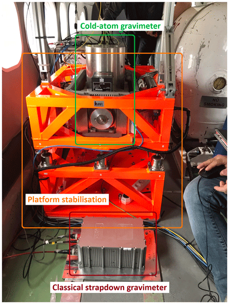
Tim Enzlberger Jensen, Bjørnar Dale, Andreas Stokholm, René Forsberg, Alexandre Bresson, Nassim Zahzam, Alexis Bonnin, and Yannick Bidel
Earth Syst. Sci. Data, 17, 1667–1684, https://doi.org/10.5194/essd-17-1667-2025, https://doi.org/10.5194/essd-17-1667-2025, 2025
Short summary
Short summary
The availability of data from two airborne gravity campaigns using sensors based on both classical and quantum technology is presented. Data are made available by the European Space Agency as raw, intermediate, and final data products. Here “raw” refers to the sensor output, while “final” refers to the along-track gravity estimates. This makes the data relevant for users interested in applications ranging from data processing and quantum studies to geophysical studies using gravity observations.
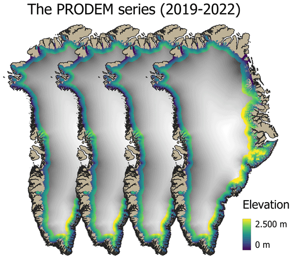
Mai Winstrup, Heidi Ranndal, Signe Hillerup Larsen, Sebastian B. Simonsen, Kenneth D. Mankoff, Robert S. Fausto, and Louise Sandberg Sørensen
Earth Syst. Sci. Data, 16, 5405–5428, https://doi.org/10.5194/essd-16-5405-2024, https://doi.org/10.5194/essd-16-5405-2024, 2024
Short summary
Short summary
Surface topography across the marginal zone of the Greenland Ice Sheet is constantly evolving. Here we present an annual series (2019–2022) of summer digital elevation models (PRODEMs) for the Greenland Ice Sheet margin, covering all outlet glaciers from the ice sheet. The PRODEMs are based on fusion of CryoSat-2 radar altimetry and ICESat-2 laser altimetry. With their high spatial and temporal resolution, the PRODEMs will enable detailed studies of the changes in marginal ice sheet elevations.
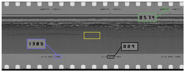
Nanna B. Karlsson, Dustin M. Schroeder, Louise Sandberg Sørensen, Winnie Chu, Jørgen Dall, Natalia H. Andersen, Reese Dobson, Emma J. Mackie, Simon J. Köhn, Jillian E. Steinmetz, Angelo S. Tarzona, Thomas O. Teisberg, and Niels Skou
Earth Syst. Sci. Data, 16, 3333–3344, https://doi.org/10.5194/essd-16-3333-2024, https://doi.org/10.5194/essd-16-3333-2024, 2024
Short summary
Short summary
In the 1970s, more than 177 000 km of observations were acquired from airborne radar over the Greenland ice sheet. The radar data contain information on not only the thickness of the ice, but also the properties of the ice itself. This information was recorded on film rolls and subsequently stored. In this study, we document the digitization of these film rolls that shed new and unprecedented detailed light on the Greenland ice sheet 50 years ago.
Laura Melling, Amber Leeson, Malcolm McMillan, Jennifer Maddalena, Jade Bowling, Emily Glen, Louise Sandberg Sørensen, Mai Winstrup, and Rasmus Lørup Arildsen
The Cryosphere, 18, 543–558, https://doi.org/10.5194/tc-18-543-2024, https://doi.org/10.5194/tc-18-543-2024, 2024
Short summary
Short summary
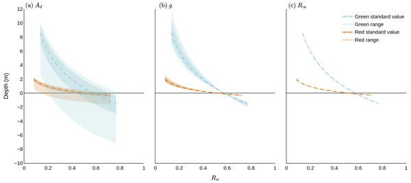
Lakes on glaciers hold large volumes of water which can drain through the ice, influencing estimates of sea level rise. To estimate water volume, we must calculate lake depth. We assessed the accuracy of three satellite-based depth detection methods on a study area in western Greenland and considered the implications for quantifying the volume of water within lakes. We found that the most popular method of detecting depth on the ice sheet scale has higher uncertainty than previously assumed.
Louise Sandberg Sørensen, Rasmus Bahbah, Sebastian B. Simonsen, Natalia Havelund Andersen, Jade Bowling, Noel Gourmelen, Alex Horton, Nanna B. Karlsson, Amber Leeson, Jennifer Maddalena, Malcolm McMillan, Anne Solgaard, and Birgit Wessel
The Cryosphere, 18, 505–523, https://doi.org/10.5194/tc-18-505-2024, https://doi.org/10.5194/tc-18-505-2024, 2024
Short summary
Short summary
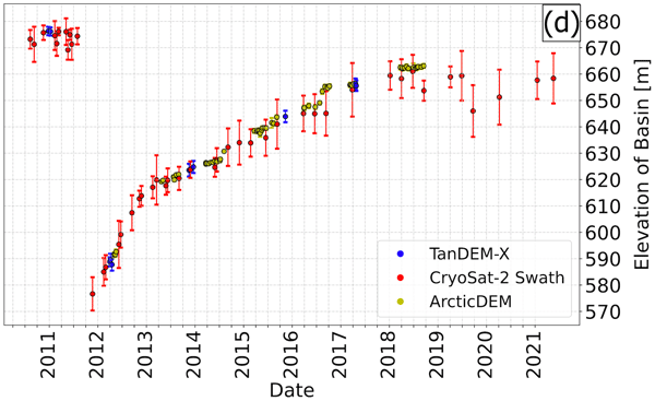
Under the right topographic and hydrological conditions, lakes may form beneath the large ice sheets. Some of these subglacial lakes are active, meaning that they periodically drain and refill. When a subglacial lake drains rapidly, it may cause the ice surface above to collapse, and here we investigate how to improve the monitoring of active subglacial lakes in Greenland by monitoring how their associated collapse basins change over time.
Fernando S. Paolo, Alex S. Gardner, Chad A. Greene, Johan Nilsson, Michael P. Schodlok, Nicole-Jeanne Schlegel, and Helen A. Fricker
The Cryosphere, 17, 3409–3433, https://doi.org/10.5194/tc-17-3409-2023, https://doi.org/10.5194/tc-17-3409-2023, 2023
Short summary
Short summary
We report on a slowdown in the rate of thinning and melting of West Antarctic ice shelves. We present a comprehensive assessment of the Antarctic ice shelves, where we analyze at a continental scale the changes in thickness, flow, and basal melt over the past 26 years. We also present a novel method to estimate ice shelf change from satellite altimetry and a time-dependent data set of ice shelf thickness and basal melt rates at an unprecedented resolution.
Nicolaj Hansen, Louise Sandberg Sørensen, Giorgio Spada, Daniele Melini, Rene Forsberg, Ruth Mottram, and Sebastian B. Simonsen
The Cryosphere Discuss., https://doi.org/10.5194/tc-2023-104, https://doi.org/10.5194/tc-2023-104, 2023
Preprint withdrawn
Short summary
Short summary
We use ICESat-2 to estimate the surface elevation change over Greenland and Antarctica in the period of 2018 to 2021. Numerical models have been used the compute the firn compaction and the vertical bedrock movement so non-mass-related elevation changes can be taken into account. We have made a parameterization of the surface density so we can convert the volume change to mass change. We find that Antarctica has lost 135.7±27.3 Gt per year, and the Greenland ice sheet 237.5±14.0 Gt per year.
Alice C. Frémand, Peter Fretwell, Julien A. Bodart, Hamish D. Pritchard, Alan Aitken, Jonathan L. Bamber, Robin Bell, Cesidio Bianchi, Robert G. Bingham, Donald D. Blankenship, Gino Casassa, Ginny Catania, Knut Christianson, Howard Conway, Hugh F. J. Corr, Xiangbin Cui, Detlef Damaske, Volkmar Damm, Reinhard Drews, Graeme Eagles, Olaf Eisen, Hannes Eisermann, Fausto Ferraccioli, Elena Field, René Forsberg, Steven Franke, Shuji Fujita, Yonggyu Gim, Vikram Goel, Siva Prasad Gogineni, Jamin Greenbaum, Benjamin Hills, Richard C. A. Hindmarsh, Andrew O. Hoffman, Per Holmlund, Nicholas Holschuh, John W. Holt, Annika N. Horlings, Angelika Humbert, Robert W. Jacobel, Daniela Jansen, Adrian Jenkins, Wilfried Jokat, Tom Jordan, Edward King, Jack Kohler, William Krabill, Mette Kusk Gillespie, Kirsty Langley, Joohan Lee, German Leitchenkov, Carlton Leuschen, Bruce Luyendyk, Joseph MacGregor, Emma MacKie, Kenichi Matsuoka, Mathieu Morlighem, Jérémie Mouginot, Frank O. Nitsche, Yoshifumi Nogi, Ole A. Nost, John Paden, Frank Pattyn, Sergey V. Popov, Eric Rignot, David M. Rippin, Andrés Rivera, Jason Roberts, Neil Ross, Anotonia Ruppel, Dustin M. Schroeder, Martin J. Siegert, Andrew M. Smith, Daniel Steinhage, Michael Studinger, Bo Sun, Ignazio Tabacco, Kirsty Tinto, Stefano Urbini, David Vaughan, Brian C. Welch, Douglas S. Wilson, Duncan A. Young, and Achille Zirizzotti
Earth Syst. Sci. Data, 15, 2695–2710, https://doi.org/10.5194/essd-15-2695-2023, https://doi.org/10.5194/essd-15-2695-2023, 2023
Short summary
Short summary
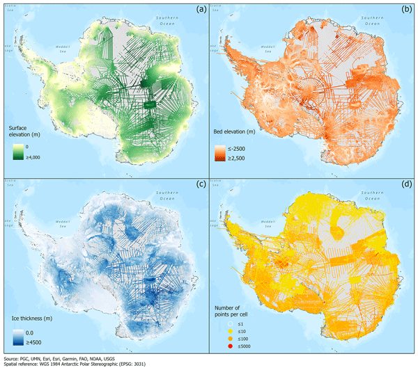
This paper presents the release of over 60 years of ice thickness, bed elevation, and surface elevation data acquired over Antarctica by the international community. These data are a crucial component of the Antarctic Bedmap initiative which aims to produce a new map and datasets of Antarctic ice thickness and bed topography for the international glaciology and geophysical community.
Inès N. Otosaka, Andrew Shepherd, Erik R. Ivins, Nicole-Jeanne Schlegel, Charles Amory, Michiel R. van den Broeke, Martin Horwath, Ian Joughin, Michalea D. King, Gerhard Krinner, Sophie Nowicki, Anthony J. Payne, Eric Rignot, Ted Scambos, Karen M. Simon, Benjamin E. Smith, Louise S. Sørensen, Isabella Velicogna, Pippa L. Whitehouse, Geruo A, Cécile Agosta, Andreas P. Ahlstrøm, Alejandro Blazquez, William Colgan, Marcus E. Engdahl, Xavier Fettweis, Rene Forsberg, Hubert Gallée, Alex Gardner, Lin Gilbert, Noel Gourmelen, Andreas Groh, Brian C. Gunter, Christopher Harig, Veit Helm, Shfaqat Abbas Khan, Christoph Kittel, Hannes Konrad, Peter L. Langen, Benoit S. Lecavalier, Chia-Chun Liang, Bryant D. Loomis, Malcolm McMillan, Daniele Melini, Sebastian H. Mernild, Ruth Mottram, Jeremie Mouginot, Johan Nilsson, Brice Noël, Mark E. Pattle, William R. Peltier, Nadege Pie, Mònica Roca, Ingo Sasgen, Himanshu V. Save, Ki-Weon Seo, Bernd Scheuchl, Ernst J. O. Schrama, Ludwig Schröder, Sebastian B. Simonsen, Thomas Slater, Giorgio Spada, Tyler C. Sutterley, Bramha Dutt Vishwakarma, Jan Melchior van Wessem, David Wiese, Wouter van der Wal, and Bert Wouters
Earth Syst. Sci. Data, 15, 1597–1616, https://doi.org/10.5194/essd-15-1597-2023, https://doi.org/10.5194/essd-15-1597-2023, 2023
Short summary
Short summary
By measuring changes in the volume, gravitational attraction, and ice flow of Greenland and Antarctica from space, we can monitor their mass gain and loss over time. Here, we present a new record of the Earth’s polar ice sheet mass balance produced by aggregating 50 satellite-based estimates of ice sheet mass change. This new assessment shows that the ice sheets have lost (7.5 x 10¹²) t of ice between 1992 and 2020, contributing 21 mm to sea level rise.
Johan Nilsson, Alex S. Gardner, and Fernando S. Paolo
Earth Syst. Sci. Data, 14, 3573–3598, https://doi.org/10.5194/essd-14-3573-2022, https://doi.org/10.5194/essd-14-3573-2022, 2022
Short summary
Short summary
The longest observational record available to study the mass balance of the Earth’s ice sheets comes from satellite altimeters. This record consists of multiple satellite missions with different measurements and quality, and it must be cross-calibrated and integrated into a consistent record for scientific use. Here, we present a novel approach for generating such a record providing a seamless record of elevation change for the Antarctic Ice Sheet that spans the period 1985 to 2020.
Martin Horwath, Benjamin D. Gutknecht, Anny Cazenave, Hindumathi Kulaiappan Palanisamy, Florence Marti, Ben Marzeion, Frank Paul, Raymond Le Bris, Anna E. Hogg, Inès Otosaka, Andrew Shepherd, Petra Döll, Denise Cáceres, Hannes Müller Schmied, Johnny A. Johannessen, Jan Even Øie Nilsen, Roshin P. Raj, René Forsberg, Louise Sandberg Sørensen, Valentina R. Barletta, Sebastian B. Simonsen, Per Knudsen, Ole Baltazar Andersen, Heidi Ranndal, Stine K. Rose, Christopher J. Merchant, Claire R. Macintosh, Karina von Schuckmann, Kristin Novotny, Andreas Groh, Marco Restano, and Jérôme Benveniste
Earth Syst. Sci. Data, 14, 411–447, https://doi.org/10.5194/essd-14-411-2022, https://doi.org/10.5194/essd-14-411-2022, 2022
Short summary
Short summary
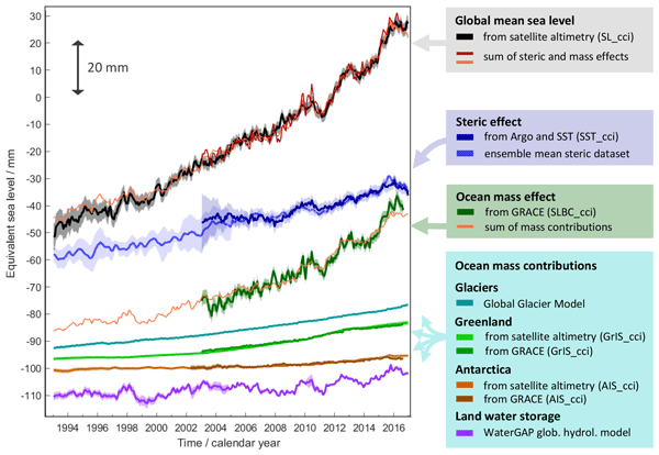
Global mean sea-level change observed from 1993 to 2016 (mean rate of 3.05 mm yr−1) matches the combined effect of changes in water density (thermal expansion) and ocean mass. Ocean-mass change has been assessed through the contributions from glaciers, ice sheets, and land water storage or directly from satellite data since 2003. Our budget assessments of linear trends and monthly anomalies utilise new datasets and uncertainty characterisations developed within ESA's Climate Change Initiative.
Cited articles
Abdalati, W., Krabill, W., Fredrick, E., Manizade, S., Martin, C., Sonntag, J., Swift, R., Thomas, R., Yungel, J., and Koerner, R.: Elevation changes of ice caps in the Canadian Arctic Archipelago, J. Geophys. Res., 109, F04007, https://doi.org/10.1029/2003JF000045, 2004.
AMAP: Arctic Climate Issues 2011: Changes in Arctic Snow, Water, Ice and Permafrost, SWIPA 2011 Overview Report, ISBN: 978-82-7971-073-8, 2012.
Arendt, A., Echelmeyer, K., Harrison, W., Lingle, C., and Valentine, V.: Rapid Wastage of Alaska Glaciers and Their Contribution to Rising Sea Level, Science, 297, 382–386, https://doi.org/10.1126/science.1072497, 2002.
Arendt, A. A., Echelmeyer, K., Harrison, W., Lingle, C., Zirnheld, S., Valentine, V., Ritchie, B., and Druckenmiller, M.: Updated estimates of glacier volume changes in the western Chugach Mountains, Alaska, and a comparison of regional extrapolation methods, J. Geophys. Res.-Earth Surf., 111, F03019, https://doi.org/10.1029/2005JF000436, 2006.
Bamber, J., Krabill, W., Raper, V., and Dowdeswell, J.: Anomalous recent growth of part of a large Arctic ice cap: Austfonna, Svalbard, Geophys. Res. Lett., 31, L12402, https://doi.org/10.1029/2004GL019667, 2004.
Björnsson, H., Pálsson, F., Gudmundsson, S., Magnússon, E., Adalgeirsdóóttir, G., Jóóhannesson, T., Berthier, E., Sigurdsson, O., and Thorsteinsson, T.: Contribution of Icelandic ice caps to sea level rise: Trends and variability since the Little Ice Age, Geophys. Res., 40, 1–5, https://doi.org/10.1002/grl.50278, 2013.
Bolch, T., Sandberg Sörensen, L., Simonsen, S. B., Mölg, N., Machguth, H., Rastner, P., and Paul, F.: Mass loss of Greenland's glaciers and ice caps 2003–2008 revealed from ICESat laser altimetry data, Geophys. Res. Lett., 40, 875–881, https://doi.org/10.1002/grl.50270, 2013.
Borsa, A. A., Moholdt, G., Fricker, H. A., and Brunt, K. M.: A range correction for ICESat and its potential impact on ice-sheet mass balance studies, The Cryosphere, 8, 345–357, https://doi.org/10.5194/tc-8-345-2014, 2014.
Brenner, A., DiMarzio, J. P., and Zwally, H. J.: Precision and Accuracy of Satellite Radar and Laser Altimeter Data Over the Continental Ice Sheets, IEEE Trans. Geosci. Remote Sens., 45, 321–331, https://doi.org/10.1109/TGRS.2006.887172, 2007.
Forsberg, R. and Tscherning, C. C.: An overview manual for the GRAVSOFT Geodetic Gravity Field Modelling Programs, available at: http://www.gfy.ku.dk/ cct/publ_cct/cct1936.pdf (last access: 20 January 2015), 2008.
Gardner, A., Moholdt, G., Wouters, B., Wolken, G., Burgess, D., Sharp, M., Cogley, G., Braun, C., and Labine, C.: Sharply increased mass loss from glaciers and ice caps in the Canadian Arctic Archipelago, Nature, 473, 357–360, https://doi.org/10.1038/nature10089, 2011.
Gardner, A., Moholdt, G., Cogley, J. G., Wouters, B., Arendt, A., Wahr, J., Berthier, E., Hock, R., Pfeffer, W. T., Kaser G., Ligtenberg, S. R. M., Bolch, T., Martin, J., Sharp, M. J., Hagen, J. O., van den Broeke, M. R., and Paul, F.: A Reconciled Estimate of Glacier Contributions to Sea Level Rise: 2003 to 2009, Science, 340, 852–857, https://doi.org/10.1126/science.1234532, 2013.
Hofton, M. A., Luthcke, S. B., and Blair, J. B.: Estimation of ICESat intercampaign elevation biases from comparison of lidar data in East Antarctica, Geophys. Res. Lett., 40, 852–857, https://doi.org/10.1002/2013GL057652, 2013.
Huss, M.: Density assumptions for converting geodetic glacier volume change to mass change, The Cryosphere, 7, 877–887, https://doi.org/10.5194/tc-7-877-2013, 2013.
Jacob, T., Wahr, J., Pfeffer, W. T., and Swenson, S.: Recent contributions of glaciers and ice caps to sea level rise, LETTER, Nature, 483, 514–518, https://doi.org/10.1038/nature10847, 2012.
Kaser, G., Cogley, J., Dyurgerov, M. B., Meier, M. F., and Ohmura, A.: Mass balance of glaciers and ice caps: Consensus estimates for 1961–2004, Geophys. Res. Lett., 33, L19501, https://doi.org/10.1029/2006GL027511, 2006.
Krabill, W., Abdalati, W., Fredrick E., Manizade, S., Martin, C., Sonntag, J., Swift, R., Thomas, R., Wright, W., and Yungel, J.: Greenland ice sheet: High elevation balance and peripheral thinning, Science, 289, 428–430, https://doi.org/10.1126/science.289.5478.428, 2000.
Moholdt, G., Nuth, C., Hagen, J. O., Kohler, J.: Recent elevation changes of Svalbard glaciers derived from ICESat laser altimetry, Remote Sens. Environ., 114, 2756–2767, 2010a.
Moholdt, G., Hagen, J. O., Eiken, T., and Schuler, T. V.: Geometric changes and mass balance of the Austfonna ice cap, Svalbard, The Cryosphere, 4, 21–34, https://doi.org/10.5194/tc-4-21-2010, 2010.
Moholdt, G., Wouters, B., and Gardner, A.: Recent mass change of glaciers in the Russian High Arctic, Geophys. Res., 39, L10502, https://doi.org/10.1029/2012GL051466, 2012.
Moritz, H.: Least Squares Collocation, Reviews of Geophysics and Space Physics, 16, 421–430, https://doi.org/10.1029/RG016i003p00421, 1978.
Nuth, C., Moholdt, G., Kohler, J., Hagen, J. O., and Kääb, A.: Svalbard glacier elevation changes and contribution to sea level rise, J. Geophys. Res., 115, F01008, https://doi.org/10.1029/2008JF001223, 2010.
Pearson, K. R.: Outliers in process modeling and identification, IEEE, Transa. Control Syst. Technol., 10, 55–63, https://doi.org/10.1109/87.974338, 2002.
Pfeffer, T.W., Arendt, A. A., Bliss, A., Bolch, T., Cogley, J. G., Gardner, A. S., Hagen, J. O., Hock, R., Kaser, G., Kienholz, C., Miles, E. S., Moholdt, G., Mölg, N., Paul, F., Radić, V., Rastner, P., Raup, B. H., Rich, J., Sharp, M. J.: The Randolph Consortium, J. Glaciol., 221, 537–552, https://doi.org/10.3189/2014jog13j176, 2014.
Pritchard, H. D., Arthern, R. J., Vaughan, D. G., and Edwards, L. A.: Extensive dynamics thinning on the margins of the Greenland and Antartic ice sheets, Nature, 7266, 971–975, https://doi.org/10.1038/nature08471, 2009.
Rolstad, C., Haug, T., and Denby, B.: Spatially-integrated geodetic glacier mass balance and its uncertainty based on geostatistical analysis: application to the Western Svartisen ice cap, Norway, J. Glaciol., 55, 666–680, 2009.
Schutz, B. E., Zwally, H. J., Shuman, C. A., Hancock, D., and DiMarzio, J. P.: Overview of the ICESat Mission, Geophys. Res. Lett., 32, L21S01, https://doi.org/10.1029/2005GL024009, 2005.
Siegfried, M. R., Hawley, R. L., and Burkhart, J. F.: High-resolution ground-based GPS measurements show intercampaign bias in ICESat elevation data near summit, Greenland, IEEE, Geosci. Remote Sens., 9, 3393–3400, https://doi.org/10.1109/TGRS.2011.2127483, 2011.
Sørensen, L. S., Simonsen, S. B., Nielsen, K., Lucas-Picher, P., Spada, G., Adalgeirsdottir, G., Forsberg, R., and Hvidberg, C. S.: Mass balance of the Greenland ice sheet (2003–2008) from ICESat data – the impact of interpolation, sampling and firn density, The Cryosphere, 5, 173–186, https://doi.org/10.5194/tc-5-173-2011, 2011.
Vaughan, D. G., Comiso, J. C., Allison, I., Carrasco, J., Kaser, G., Kwok, R., Mote, P., Murray, T., Paul, F., Ren, J., Rignot, E., Solomina, O., Steffen, K., and Zhang, T.: Observations: Cryosphere, in: Climate Change 2013: The Physical Science Basis. Contribution of Working Group I to the Fifth Assessment Report of the Intergovernmental Panel on Climate Change, edited by: Stocker, T. F., Qin, D., Plattner, G.-K., Tignor, M., Allen, S. K., Boschung, J., Nauels, A., Xia, Y., Bex, V., and Midgley, P. M., Cambridge University Press, Cambridge, UK and New York, NY, USA, 2013.
Wingham, D., Ridout, A., Scharroo, R., Arthern, R., and Shum, C. K.: Antartic elevation change from 1992–1996, Science, 282, 456–4458, https://doi.org/10.1126/science.282.5388.456, 1998.
Zwally, H. J., Bindschadler, R. A., Major, J. A., and Brenner, A. C.: Ice measurements by Geosat radar altimetry, Johns Hopkins APL Technical Digest (ISSN 0270-5214), Vol. 8, April–June, 251–254, 1987.
Short summary
The aim of this study is to determine and quantify the impact of different regionalization schemes on surface elevation changes, and how they affect the estimated spread in mass balance of Arctic ice caps and glaciers. The study found that the choice of regionalization has an important effect in regions with maritime climate and high variability in elevation change. In these areas the spread in mass balance was in many cases larger than the estimated errors of the individual methods.
The aim of this study is to determine and quantify the impact of different regionalization...


Altmetrics
Final-revised paper
Preprint