Articles | Volume 16, issue 9
https://doi.org/10.5194/tc-16-3649-2022
© Author(s) 2022. This work is distributed under
the Creative Commons Attribution 4.0 License.
https://doi.org/10.5194/tc-16-3649-2022
© Author(s) 2022. This work is distributed under
the Creative Commons Attribution 4.0 License.
High-resolution imaging of supraglacial hydrological features on the Greenland Ice Sheet with NASA's Airborne Topographic Mapper (ATM) instrument suite
Michael Studinger
CORRESPONDING AUTHOR
Cryospheric Sciences Laboratory, NASA Goddard Space Flight Center, Greenbelt, MD 20771, USA
Serdar S. Manizade
Science Systems and Applications, Inc., Lanham, MD 20706, USA
NASA Wallops Flight Facility, Wallops Island, VA 23337, USA
Matthew A. Linkswiler
Science Systems and Applications, Inc., Lanham, MD 20706, USA
NASA Wallops Flight Facility, Wallops Island, VA 23337, USA
James K. Yungel
Science Systems and Applications, Inc., Lanham, MD 20706, USA
NASA Wallops Flight Facility, Wallops Island, VA 23337, USA
Related authors
Michael Studinger, C. Wayne Wright, and Oleg Alexandrov
EGUsphere, https://doi.org/10.5194/egusphere-2026-4143, https://doi.org/10.5194/egusphere-2026-4143, 2026
This preprint is open for discussion and under review for The Cryosphere (TC).
Short summary
Short summary
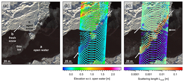
This research uses high-resolution airborne images and laser data to reveal the depth and shape of lakes on the Greenland Ice Sheet. By comparing imaging methods, it shows that detailed lake depth can be measured from the air, though thin ice cover and the presence of surface waves patterns can limit results. These findings improve our view of water flow and melting, and the work also shows green laser light penetrating below lake bottoms, offering insight into measurement bias.
Benjamin E. Smith, Michael Studinger, Tyler Sutterley, Zachary Fair, and Thomas Neumann
The Cryosphere, 19, 975–995, https://doi.org/10.5194/tc-19-975-2025, https://doi.org/10.5194/tc-19-975-2025, 2025
Short summary
Short summary
This study investigates errors (biases) that may result when green lasers are used to measure the elevation of glaciers and ice sheets. These biases are important because if the snow or ice on top of the ice sheet changes, it can make the elevation of the ice appear to change by the wrong amount. We measure these biases over the Greenland Ice Sheet with a laser system on an airplane and explore how the use of satellite data can let us correct for the biases.
Michael Studinger, Benjamin E. Smith, Nathan Kurtz, Alek Petty, Tyler Sutterley, and Rachel Tilling
The Cryosphere, 18, 2625–2652, https://doi.org/10.5194/tc-18-2625-2024, https://doi.org/10.5194/tc-18-2625-2024, 2024
Short summary
Short summary
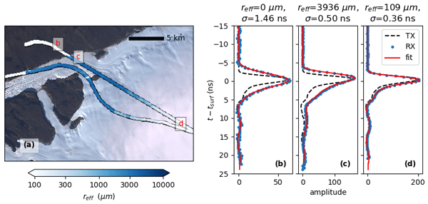
We use green lidar data and natural-color imagery over sea ice to quantify elevation biases potentially impacting estimates of change in ice thickness of the polar regions. We complement our analysis using a model of scattering of light in snow and ice that predicts the shape of lidar waveforms reflecting from snow and ice surfaces based on the shape of the transmitted pulse. We find that biased elevations exist in airborne and spaceborne data products from green lidars.
Alice C. Frémand, Peter Fretwell, Julien A. Bodart, Hamish D. Pritchard, Alan Aitken, Jonathan L. Bamber, Robin Bell, Cesidio Bianchi, Robert G. Bingham, Donald D. Blankenship, Gino Casassa, Ginny Catania, Knut Christianson, Howard Conway, Hugh F. J. Corr, Xiangbin Cui, Detlef Damaske, Volkmar Damm, Reinhard Drews, Graeme Eagles, Olaf Eisen, Hannes Eisermann, Fausto Ferraccioli, Elena Field, René Forsberg, Steven Franke, Shuji Fujita, Yonggyu Gim, Vikram Goel, Siva Prasad Gogineni, Jamin Greenbaum, Benjamin Hills, Richard C. A. Hindmarsh, Andrew O. Hoffman, Per Holmlund, Nicholas Holschuh, John W. Holt, Annika N. Horlings, Angelika Humbert, Robert W. Jacobel, Daniela Jansen, Adrian Jenkins, Wilfried Jokat, Tom Jordan, Edward King, Jack Kohler, William Krabill, Mette Kusk Gillespie, Kirsty Langley, Joohan Lee, German Leitchenkov, Carlton Leuschen, Bruce Luyendyk, Joseph MacGregor, Emma MacKie, Kenichi Matsuoka, Mathieu Morlighem, Jérémie Mouginot, Frank O. Nitsche, Yoshifumi Nogi, Ole A. Nost, John Paden, Frank Pattyn, Sergey V. Popov, Eric Rignot, David M. Rippin, Andrés Rivera, Jason Roberts, Neil Ross, Anotonia Ruppel, Dustin M. Schroeder, Martin J. Siegert, Andrew M. Smith, Daniel Steinhage, Michael Studinger, Bo Sun, Ignazio Tabacco, Kirsty Tinto, Stefano Urbini, David Vaughan, Brian C. Welch, Douglas S. Wilson, Duncan A. Young, and Achille Zirizzotti
Earth Syst. Sci. Data, 15, 2695–2710, https://doi.org/10.5194/essd-15-2695-2023, https://doi.org/10.5194/essd-15-2695-2023, 2023
Short summary
Short summary
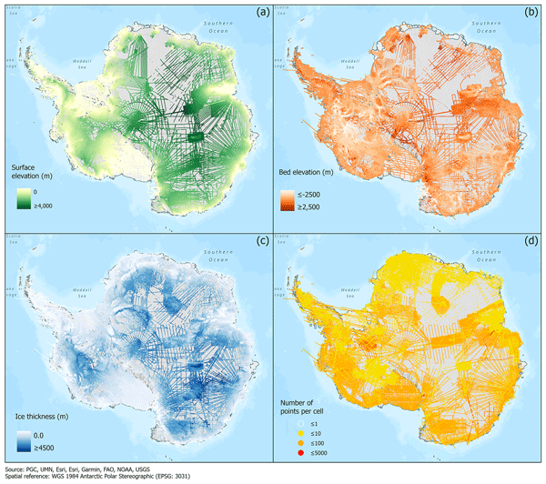
This paper presents the release of over 60 years of ice thickness, bed elevation, and surface elevation data acquired over Antarctica by the international community. These data are a crucial component of the Antarctic Bedmap initiative which aims to produce a new map and datasets of Antarctic ice thickness and bed topography for the international glaciology and geophysical community.
Joseph A. MacGregor, Winnie Chu, William T. Colgan, Mark A. Fahnestock, Denis Felikson, Nanna B. Karlsson, Sophie M. J. Nowicki, and Michael Studinger
The Cryosphere, 16, 3033–3049, https://doi.org/10.5194/tc-16-3033-2022, https://doi.org/10.5194/tc-16-3033-2022, 2022
Short summary
Short summary
Where the bottom of the Greenland Ice Sheet is frozen and where it is thawed is not well known, yet knowing this state is increasingly important to interpret modern changes in ice flow there. We produced a second synthesis of knowledge of the basal thermal state of the ice sheet using airborne and satellite observations and numerical models. About one-third of the ice sheet’s bed is likely thawed; two-fifths is likely frozen; and the remainder is too uncertain to specify.
Michael Studinger, C. Wayne Wright, and Oleg Alexandrov
EGUsphere, https://doi.org/10.5194/egusphere-2026-4143, https://doi.org/10.5194/egusphere-2026-4143, 2026
This preprint is open for discussion and under review for The Cryosphere (TC).
Short summary
Short summary
This research uses high-resolution airborne images and laser data to reveal the depth and shape of lakes on the Greenland Ice Sheet. By comparing imaging methods, it shows that detailed lake depth can be measured from the air, though thin ice cover and the presence of surface waves patterns can limit results. These findings improve our view of water flow and melting, and the work also shows green laser light penetrating below lake bottoms, offering insight into measurement bias.
Benjamin E. Smith, Michael Studinger, Tyler Sutterley, Zachary Fair, and Thomas Neumann
The Cryosphere, 19, 975–995, https://doi.org/10.5194/tc-19-975-2025, https://doi.org/10.5194/tc-19-975-2025, 2025
Short summary
Short summary
This study investigates errors (biases) that may result when green lasers are used to measure the elevation of glaciers and ice sheets. These biases are important because if the snow or ice on top of the ice sheet changes, it can make the elevation of the ice appear to change by the wrong amount. We measure these biases over the Greenland Ice Sheet with a laser system on an airplane and explore how the use of satellite data can let us correct for the biases.
Michael Studinger, Benjamin E. Smith, Nathan Kurtz, Alek Petty, Tyler Sutterley, and Rachel Tilling
The Cryosphere, 18, 2625–2652, https://doi.org/10.5194/tc-18-2625-2024, https://doi.org/10.5194/tc-18-2625-2024, 2024
Short summary
Short summary
We use green lidar data and natural-color imagery over sea ice to quantify elevation biases potentially impacting estimates of change in ice thickness of the polar regions. We complement our analysis using a model of scattering of light in snow and ice that predicts the shape of lidar waveforms reflecting from snow and ice surfaces based on the shape of the transmitted pulse. We find that biased elevations exist in airborne and spaceborne data products from green lidars.
Alice C. Frémand, Peter Fretwell, Julien A. Bodart, Hamish D. Pritchard, Alan Aitken, Jonathan L. Bamber, Robin Bell, Cesidio Bianchi, Robert G. Bingham, Donald D. Blankenship, Gino Casassa, Ginny Catania, Knut Christianson, Howard Conway, Hugh F. J. Corr, Xiangbin Cui, Detlef Damaske, Volkmar Damm, Reinhard Drews, Graeme Eagles, Olaf Eisen, Hannes Eisermann, Fausto Ferraccioli, Elena Field, René Forsberg, Steven Franke, Shuji Fujita, Yonggyu Gim, Vikram Goel, Siva Prasad Gogineni, Jamin Greenbaum, Benjamin Hills, Richard C. A. Hindmarsh, Andrew O. Hoffman, Per Holmlund, Nicholas Holschuh, John W. Holt, Annika N. Horlings, Angelika Humbert, Robert W. Jacobel, Daniela Jansen, Adrian Jenkins, Wilfried Jokat, Tom Jordan, Edward King, Jack Kohler, William Krabill, Mette Kusk Gillespie, Kirsty Langley, Joohan Lee, German Leitchenkov, Carlton Leuschen, Bruce Luyendyk, Joseph MacGregor, Emma MacKie, Kenichi Matsuoka, Mathieu Morlighem, Jérémie Mouginot, Frank O. Nitsche, Yoshifumi Nogi, Ole A. Nost, John Paden, Frank Pattyn, Sergey V. Popov, Eric Rignot, David M. Rippin, Andrés Rivera, Jason Roberts, Neil Ross, Anotonia Ruppel, Dustin M. Schroeder, Martin J. Siegert, Andrew M. Smith, Daniel Steinhage, Michael Studinger, Bo Sun, Ignazio Tabacco, Kirsty Tinto, Stefano Urbini, David Vaughan, Brian C. Welch, Douglas S. Wilson, Duncan A. Young, and Achille Zirizzotti
Earth Syst. Sci. Data, 15, 2695–2710, https://doi.org/10.5194/essd-15-2695-2023, https://doi.org/10.5194/essd-15-2695-2023, 2023
Short summary
Short summary
This paper presents the release of over 60 years of ice thickness, bed elevation, and surface elevation data acquired over Antarctica by the international community. These data are a crucial component of the Antarctic Bedmap initiative which aims to produce a new map and datasets of Antarctic ice thickness and bed topography for the international glaciology and geophysical community.
Joseph A. MacGregor, Winnie Chu, William T. Colgan, Mark A. Fahnestock, Denis Felikson, Nanna B. Karlsson, Sophie M. J. Nowicki, and Michael Studinger
The Cryosphere, 16, 3033–3049, https://doi.org/10.5194/tc-16-3033-2022, https://doi.org/10.5194/tc-16-3033-2022, 2022
Short summary
Short summary
Where the bottom of the Greenland Ice Sheet is frozen and where it is thawed is not well known, yet knowing this state is increasingly important to interpret modern changes in ice flow there. We produced a second synthesis of knowledge of the basal thermal state of the ice sheet using airborne and satellite observations and numerical models. About one-third of the ice sheet’s bed is likely thawed; two-fifths is likely frozen; and the remainder is too uncertain to specify.
Cited articles
Box, J. E. and Ski, K.: Remote sounding of Greenland supraglacial melt
lakes: implications for subglacial hydraulics, J. Glaciol., 53,
257–265, https://doi.org/10.3189/172756507782202883, 2007.
Chu, V. W.: Greenland ice sheet hydrology:A review, Prog. Phys.
Geog., 38, 19–54, https://doi.org/10.1177/0309133313507075, 2014.
Corr, D., Leeson, A., McMillan, M., Zhang, C., and Barnes, T.: An inventory of supraglacial lakes and channels across the West Antarctic Ice Sheet, Earth Syst. Sci. Data, 14, 209–228, https://doi.org/10.5194/essd-14-209-2022, 2022.
Das, S. B., Joughin, I., Behn, M. D., Howat, I. M., King, M. A., Lizarralde,
D., and Bhatia, M. P.: Fracture Propagation to the Base of the Greenland Ice
Sheet During Supraglacial Lake Drainage, Science, 320, 778–781,
https://doi.org/10.1126/science.1153360, 2008.
Datta, R. T. and Wouters, B.: Supraglacial lake bathymetry automatically derived from ICESat-2 constraining lake depth estimates from multi-source satellite imagery, The Cryosphere, 15, 5115–5132, https://doi.org/10.5194/tc-15-5115-2021, 2021.
Enderlin, E. M., Howat, I. M., Jeong, S., Noh, M.-J., van Angelen, J. H.,
and van den Broeke, M. R.: An improved mass budget for the Greenland ice
sheet, Geophys. Res. Lett., 41, 866–872, https://doi.org/10.1002/2013gl059010,
2014.
European Space Agency: USGS EROS Archive – Sentinel-2, USGS Earth Resources Observation and Science Center [data set], https://doi.org/10.5066/F76W992G, 2022.
Fair, Z., Flanner, M., Brunt, K. M., Fricker, H. A., and Gardner, A.: Using ICESat-2 and Operation IceBridge altimetry for supraglacial lake depth retrievals, The Cryosphere, 14, 4253–4263, https://doi.org/10.5194/tc-14-4253-2020, 2020.
Flowers, G. E.: Hydrology and the future of the Greenland Ice Sheet, Nat.
Commun., 9, 2729, https://doi.org/10.1038/s41467-018-05002-0, 2018.
Greene, C: geotiffinterp, MATLAB Central File Exchange [data set], https://www.mathworks.com/matlabcentral/fileexchange/47899-geotiffinterp, 2022.
Hall, D. K. and DiGirolamo, N. E.: Multilayer Greenland Ice Surface Temperature, Surface Albedo, and Water Vapor from MODIS, Version 1 (MODGRNLD), NASA [data set],
https://doi.org/10.5067/7THUWT9NMPDK, 2019.
Hall, D. K., Cullather, R. I., DiGirolamo, N. E., Comiso, J. C., Medley, B.
C., and Nowicki, S. M.: A Multilayer Surface Temperature, Surface Albedo,
and Water Vapor Product of Greenland from MODIS, Remote Sensing, 10, 555, https://doi.org/10.3390/rs10040555,
2018.
Harpold, R., Yungel, J., Linkswiler, M., and Studinger, M.: Intra-scan
intersection method for the determination of pointing biases of an airborne
altimeter, Int. J. Remote Sens., 37, 648–668,
https://doi.org/10.1080/01431161.2015.1137989, 2016.
Howat, I. M., Negrete, A., and Smith, B. E.: The Greenland Ice Mapping Project (GIMP) land classification and surface elevation data sets, The Cryosphere, 8, 1509–1518, https://doi.org/10.5194/tc-8-1509-2014, 2014.
Krabill, W. B., Abdalati, W., Frederick, E. B., Manizade, S. S., Martin, C.
F., Sonntag, J. G., Swift, R. N., Thomas, R. H., and Yungel, J. G.: Aircraft
laser altimetry measurement of elevation changes of the greenland ice sheet:
technique and accuracy assessment, J. Geodyn., 34, 357–376,
https://doi.org/10.1016/s0264-3707(02)00040-6, 2002.
Legleiter, C. J., Tedesco, M., Smith, L. C., Behar, A. E., and Overstreet, B. T.: Mapping the bathymetry of supraglacial lakes and streams on the Greenland ice sheet using field measurements and high-resolution satellite images, The Cryosphere, 8, 215–228, https://doi.org/10.5194/tc-8-215-2014, 2014.
MacGregor, J. A., Fahnestock, M. A., Colgan, W. T., Larsen, N. K., Kjeldsen,
K. K., and Welker, J. M.: The age of surface-exposed ice along the northern
margin of the Greenland Ice Sheet, J. Glaciol., 66, 667–684,
https://doi.org/10.1017/jog.2020.62, 2020.
MacGregor, J. A., Boisvert, L. N., Medley, B., Petty, A. A., Harbeck, J. P.,
Bell, R. E., Blair, J. B., Blanchard-Wrigglesworth, E., Buckley, E. M.,
Christoffersen, M. S., Cochran, J. R., Csathó, B. M., De Marco, E. L.,
Dominguez, R. T., Fahnestock, M. A., Farrell, S. L., Gogineni, S. P.,
Greenbaum, J. S., Hansen, C. M., Hofton, M. A., Holt, J. W., Jezek, K. C.,
Koenig, L. S., Kurtz, N. T., Kwok, R., Larsen, C. F., Leuschen, C. J.,
Locke, C. D., Manizade, S. S., Martin, S., Neumann, T. A., Nowicki, S. M.
J., Paden, J. D., Richter-Menge, J. A., Rignot, E. J.,
Rodríguez-Morales, F., Siegfried, M. R., Smith, B. E., Sonntag, J. G.,
Studinger, M., Tinto, K. J., Truffer, M., Wagner, T. P., Woods, J. E.,
Young, D. A., and Yungel, J. K.: The scientific legacy of NASA's Operation
IceBridge, Rev. Geophys., 59, e2020RG000712, https://doi.org/10.1029/2020RG000712, 2021.
Martin, C. F., Krabill, W. B., Manizade, S. S., Russell, R. L., Sonntag, J. G., Swift, R. N., and Yungel, J. K.: Airborne Topographic Mapper Calibration Procedures and Accuracy Assessment, NASA Goddard Space Flight Center, Greenbelt, MD, report number NASA/TM-2012-215891, GSFC.TM.5893.2012, https://ntrs.nasa.gov/citations/20120008479 (last access: September 2020), 2012.
Moon, T., Fisher, M., Harden, L., and Stafford, T.: QGreenland (v1.0.2), Zenodo [data set], https://doi.org/10.5281/zenodo.5548326, 2021.
Morlighem, M.: IceBridge BedMachine Greenland, Version 4 (IDBMG4), NASA [data set], https://doi.org/10.5067/VLJ5YXKCNGXO (last access: March 2022), 2020.
Nienow, P. W., Sole, A. J., Slater, D. A., and Cowton, T. R.: Recent
Advances in Our Understanding of the Role of Meltwater in the Greenland Ice
Sheet System, Current Climate Change Reports, 3, 330–344,
https://doi.org/10.1007/s40641-017-0083-9, 2017.
Pitcher, L. H. and Smith, L. C.: Supraglacial Streams and Rivers, Annu.
Rev. Earth Pl. Sc., 47, 421–452,
https://doi.org/10.1146/annurev-earth-053018-060212, 2019.
Pope, A., Scambos, T. A., Moussavi, M., Tedesco, M., Willis, M., Shean, D., and Grigsby, S.: Estimating supraglacial lake depth in West Greenland using Landsat 8 and comparison with other multispectral methods, The Cryosphere, 10, 15–27, https://doi.org/10.5194/tc-10-15-2016, 2016.
Smith, B., Fricker, H., Gardner, A., Siegfried, M., and Adusumilli, S.: ATLAS/ICESat-2 L3A Land Ice Height, Version 4 (ATL06), NASA [data set], https://doi.org/10.5067/ATLAS/ATL06.004, 2021.
Smith, L. C., Chu, V. W., Yang, K., Gleason, C. J., Pitcher, L. H.,
Rennermalm, A. K., Legleiter, C. J., Behar, A. E., Overstreet, B. T.,
Moustafa, S. E., Tedesco, M., Forster, R. R., LeWinter, A. L., Finnegan, D.
C., Sheng, Y., and Balog, J.: Efficient meltwater drainage through
supraglacial streams and rivers on the southwest Greenland ice sheet,
P. Natl. Acad. Sci. USA, 112, 1001–1006,
https://doi.org/10.1073/pnas.1413024112, 2015.
Smith, L. C., Yang, K., Pitcher, L. H., Overstreet, B. T., Chu, V. W.,
Rennermalm, Å. K., Ryan, J. C., Cooper, M. G., Gleason, C. J., Tedesco,
M., Jeyaratnam, J., van As, D., van den Broeke, M. R., van de Berg, W. J.,
Noël, B., Langen, P. L., Cullather, R. I., Zhao, B., Willis, M. J.,
Hubbard, A., Box, J. E., Jenner, B. A., and Behar, A. E.: Direct
measurements of meltwater runoff on the Greenland ice sheet surface,
P. Natl. Acad. Sci. USA, 114, E10622–E10631,
https://doi.org/10.1073/pnas.1707743114, 2017.
Sneed, W. A. and Hamilton, G. S.: Evolution of melt pond volume on the
surface of the Greenland Ice Sheet, Geophys. Res. Lett., 34, L03501,
https://doi.org/10.1029/2006GL028697, 2007.
Sneed, W. A. and Hamilton, G. S.: Validation of a method for determining
the depth of glacial melt ponds using satellite imagery, Ann.
Glaciol., 52, 15–22, https://doi.org/10.3189/172756411799096240, 2011.
Studinger, M.: IceBridge ATM L1B Elevation and Return Strength with
Waveforms, Version 1, NASA National Snow and Ice Data Center Distributed
Active Archive Center [data set], https://doi.org/10.5067/EZQ5U3R3XWBS,
2018.
Studinger, M.: IceBridge KT19 IR Surface Temperature, Version 2,
NASA National Snow and Ice Data Center Distributed
Active Archive Center, Boulder, Colorado USA [data set], https://doi.org/10.5067/UHE07J35I3NB, 2019.
Studinger, M.: Airborne Topographic Mapper (ATM) Bathymetry Toolkit (1.0), Zenodo [code], https://doi.org/10.5281/zenodo.6341230, 2022.
Studinger, M. and Harbeck, J. P.: IceBridge CAMBOT L1B Geolocated Images,
Version 2, NASA National Snow and Ice Data Center Distributed Active Archive
Center [data set], https://doi.org/10.5067/B0HL940D452L, 2019.
Studinger, M. and Harbeck, J. P.: IceBridge CAMBOT L0 Raw Imagery, Version
1, NASA National Snow and Ice Data Center Distributed Active Archive Center [data set],
https://doi.org/10.5067/IOJH8A5F48J5, 2020.
Studinger, M., Medley, B. C., Brunt, K. M., Casey, K. A., Kurtz, N. T., Manizade, S. S., Neumann, T. A., and Overly, T. B.: Temporal and spatial variability in surface roughness and accumulation rate around 88∘ S from repeat airborne geophysical surveys, The Cryosphere, 14, 3287–3308, https://doi.org/10.5194/tc-14-3287-2020, 2020.
Studinger, M., Manizade, S., Linkswiler, M., and Yungel, J.: NASA’s Airborne Topographic Mapper (ATM) ground calibration
data for the Arctic Spring campaign 2019, Zenodo [data set] , https://doi.org/10.5281/zenodo.6248437, 2022.
Tedesco, M. and Steiner, N.: In-situ multispectral and bathymetric measurements over a supraglacial lake in western Greenland using a remotely controlled watercraft, The Cryosphere, 5, 445–452, https://doi.org/10.5194/tc-5-445-2011, 2011.
van den Broeke, M. R., Enderlin, E. M., Howat, I. M., Kuipers Munneke, P., Noël, B. P. Y., van de Berg, W. J., van Meijgaard, E., and Wouters, B.: On the recent contribution of the Greenland ice sheet to sea level change, The Cryosphere, 10, 1933–1946, https://doi.org/10.5194/tc-10-1933-2016, 2016.
Yang, K. and Smith, L. C.: Supraglacial Streams on the Greenland Ice Sheet
Delineated From Combined Spectral–Shape Information in High-Resolution
Satellite Imagery, IEEE Geosci. Remote Sens. Lett., 10, 801–805,
https://doi.org/10.1109/LGRS.2012.2224316, 2013.
Yang, K. and Smith, L. C.: Internally drained catchments dominate
supraglacial hydrology of the southwest Greenland Ice Sheet, J.
Geophys. Res.-Earth, 121, 1891–1910, https://doi.org/10.1002/2016JF003927, 2016.
Yang, K., Karlstrom, L., Smith, L. C., and Li, M.: Automated High-Resolution
Satellite Image Registration Using Supraglacial Rivers on the Greenland Ice
Sheet, IEEE J. Sel. Top. Appl., 10, 845–856, https://doi.org/10.1109/JSTARS.2016.2617822, 2017.
Short summary
The footprint density and high-resolution imagery of airborne surveys reveal details in supraglacial hydrological features that are currently not obtainable from spaceborne data. The accuracy and resolution of airborne measurements complement spaceborne measurements, can support calibration and validation of spaceborne methods, and provide information necessary for process studies of the hydrological system on ice sheets that currently cannot be achieved from spaceborne observations alone.
The footprint density and high-resolution imagery of airborne surveys reveal details in...