
Articles | Volume 20, issue 9
https://doi.org/10.5194/tc-20-4811-2026
© Author(s) 2026. This work is distributed under
the Creative Commons Attribution 4.0 License.
the Creative Commons Attribution 4.0 License.
https://doi.org/10.5194/tc-20-4811-2026
© Author(s) 2026. This work is distributed under
the Creative Commons Attribution 4.0 License.
the Creative Commons Attribution 4.0 License.
Research article
| 
31 Aug 2026
Research article |
| 31 Aug 2026
| 31 Aug 2026
Wet snow avalanche preconditions from Sentinel-1 multi-track composites
Gwendolyn Dasser
CORRESPONDING AUTHOR

WSL Institute for Snow and Avalanche Research, SLF, Davos Dorf, Switzerland
Climate Change, Extremes and Natural Hazards in Alpine Regions Research Centre, CERC, Davos Dorf, Switzerland
now at: Department of Earth and Planetary Sciences, Engineering Geology, ETH Zurich, Zürich, Switzerland
Valentin T. Bickel
Laboratory of Hydraulics, Hydrology and Glaciology, ETH Zurich, Zürich, Switzerland
Swiss Federal Institute for Forest, Snow and Landscape Research WSL, Birmensdorf, Switzerland
now at: Center for Space and Habitability, University of Bern, Bern, Switzerland
Marius Rüetschi
Swiss Federal Institute for Forest, Snow and Landscape Research WSL, Birmensdorf, Switzerland
Department of Geography, University of Zurich, Zürich, Switzerland
Mylène Jacquemart
Laboratory of Hydraulics, Hydrology and Glaciology, ETH Zurich, Zürich, Switzerland
Swiss Federal Institute for Forest, Snow and Landscape Research WSL, Birmensdorf, Switzerland
Mathias Bavay
WSL Institute for Snow and Avalanche Research, SLF, Davos Dorf, Switzerland
Elisabeth Hafner-Aeschbacher
WSL Institute for Snow and Avalanche Research, SLF, Davos Dorf, Switzerland
Climate Change, Extremes and Natural Hazards in Alpine Regions Research Centre, CERC, Davos Dorf, Switzerland
now at: Darnuzer Ingenieure AG, Davos Platz, Switzerland
Alec van Herwijnen
WSL Institute for Snow and Avalanche Research, SLF, Davos Dorf, Switzerland
David Small
Department of Geography, University of Zurich, Zürich, Switzerland
Andrea Manconi
WSL Institute for Snow and Avalanche Research, SLF, Davos Dorf, Switzerland
Climate Change, Extremes and Natural Hazards in Alpine Regions Research Centre, CERC, Davos Dorf, Switzerland
Related authors
Gwendolyn Dasser, Alessandro Maissen, Michele Volpi, Jordan Aaron, Florian Denzinger, Hugo Raetzo, and Andrea Manconi
EGUsphere, https://doi.org/10.5194/egusphere-2026-375, https://doi.org/10.5194/egusphere-2026-375, 2026
Short summary
Short summary
We aim to improve early landslide detection and monitoring by automating signal segmentation of Sentinel-1 radar interferograms. We first compared how different experts map mass-movement related signals on interferograms using ten case studies, identifying dataset uncertainties and limitations. We then trained and evaluated deep learning approaches to perform segmentation. Finally showing that models can achieve results comparable to expert variability while improving efficiency.
Tiziana Lazzarina Zendrini, Luca Carturan, Michael Lehning, Mathias Bavay, Federico Cazorzi, Paolo Gabrielli, Nander Wever, and Giancarlo Dalla Fontana
The Cryosphere, 20, 5199–5224, https://doi.org/10.5194/tc-20-5199-2026, https://doi.org/10.5194/tc-20-5199-2026, 2026
Short summary
Short summary
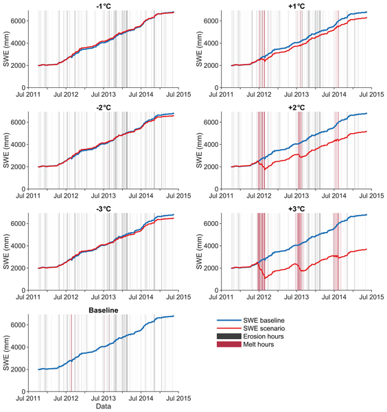
By combining in situ mass balance data with a physics‐based snow model at Mt. Ortles, in the Italian Alps, we investigate snow accumulation, erosion and melt processes, and their sensitivity to air temperature. We found that wind erosion is currently the major ablation process at this high-elevation site, whereas melt plays a minor role. Quickly rising air temperature is affecting this partitioning and suggests a future shift from an erosion-dominated to a melt-dominated mass balance regime.
Alexandre Pellet, Bastian Bergfeld, Alec van Herwijnen, and Johan Gaume
EGUsphere, https://doi.org/10.5194/egusphere-2026-3388, https://doi.org/10.5194/egusphere-2026-3388, 2026
This preprint is open for discussion and under review for The Cryosphere (TC).
Short summary
Short summary
Snow slab avalanches release when a crack propagates through a weak layer buried beneath a dense snow slab. In supershear avalanches, this crack outruns shear waves and creates a Mach-cone pattern, similar to a sonic boom. We show that snow layering bends this cone, offering new insight into fracture experiments and avalanche release.
Melin Walet, Jakob Schöttner, Valentin Adam, Florian Rheinschmidt, Philipp Rosendahl, Philipp Weißgraeber, Jürg Schweizer, and Alec van Herwijnen
EGUsphere, https://doi.org/10.5194/egusphere-2026-3554, https://doi.org/10.5194/egusphere-2026-3554, 2026
This preprint is open for discussion and under review for The Cryosphere (TC).
Short summary
Short summary
Dry snow avalanches start when a weak snow layer fails and a crack spreads through the snowpack, but field data is limited. We tested a weak layer of coarse snow grains in field fracture experiments. Using videos of snow movement, we derived the stiffness of the weak layer and calculated the resistance to crack growth. Crack resistance increased during the season as the grains in the weak layer grew and bonded more strongly. This data can be used to improve avalanche release models.
Robert Law, Mylène Jacquemart, Matthias Bühler, Mauro Angelo Werder, and Janosch Beer
EGUsphere, https://doi.org/10.5194/egusphere-2026-3329, https://doi.org/10.5194/egusphere-2026-3329, 2026
Short summary
Short summary
To understand how glaciers move and predict related hazards, we need detailed measurements of ice deformation. We tested a new approach using fibre-optic cables down a borehole drilled into a small Swiss Alpine glacier. The cables successfully tracked ice movement at an incredibly fine scale, supporting laboratory experiments showing nearly linear flow for ice close to its melting point. This method marks an important advance for studying glacier motion and predicting ice-related hazards.
Janosch Beer, Mylène Jacquemart, Matthias Huss, Ilaria Santin, Gabriela Clara Racz, Christophe Ogier, Saskia Gindraux, Leo Hösli, Raphael Moser, James Irving, Mauro Fischer, and Daniel Farinotti
EGUsphere, https://doi.org/10.5194/egusphere-2026-3042, https://doi.org/10.5194/egusphere-2026-3042, 2026
Short summary
Short summary
Small Alpine glaciers can exhibit a mix of cold and temperate ice, a polythermal structure, which can promote hazardous conditions. We drilled into six small Swiss glaciers and measured ice temperatures in boreholes. We found polythermal conditions in three of six sites and show that the thermal structure is linked to firn cover loss. Our results suggest that polythermal glaciers may be more common in the Alps than previously recognised.
Pascal Edme, Cristina Pérez-Guillén, Alec van Herwijnen, Johannes Aichele, Andri Simeon, Patrick Paitz, Fabian Walter, and Andreas Fichtner
EGUsphere, https://doi.org/10.5194/egusphere-2026-2373, https://doi.org/10.5194/egusphere-2026-2373, 2026
Short summary
Short summary
We present a near real-time snow avalanche detection method using Distributed Acoustic Sensing (DAS) on a ~10 km telecom cable following a road pass in the Swiss Alps. Avalanches are discriminated from vehicle traffic through distinct dual frequency spatio-temporal signatures. The proposed workflow achieved low false alert rates and detected 73 avalanches over one winter, demonstrating robust and cost-effective monitoring potential.
Tazio Strozzi, Nina Jones, Federico Agliardi, Alessandro De Pedrini, Othmar Frey, Philipp Bernhard, Rafael Caduff, Christian Ambrosi, and Andrea Manconi
Nat. Hazards Earth Syst. Sci., 26, 2579–2607, https://doi.org/10.5194/nhess-26-2579-2026, https://doi.org/10.5194/nhess-26-2579-2026, 2026
Short summary
Short summary
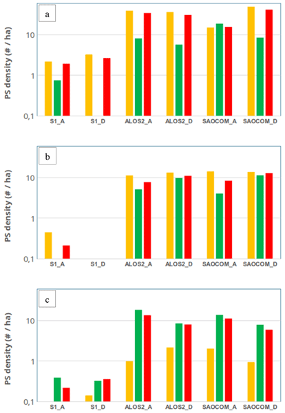
The latest satellite technology with longer wavelength radar improves our ability to detect and monitor large alpine rock slope instabilities. This approach works better than current satellite systems in forested areas and on fast-moving slopes, giving experts more reliable data to understand these major hazards. Our results from three locations in Italy and Switzerland also provide important recommendations for the preparation of future satellite radar missions.
Francesca Carletti, Nora Helbig, Nander Wever, Loïc Brouet, Mathias Bavay, Benjamin Walter, and Michael Lehning
EGUsphere, https://doi.org/10.5194/egusphere-2026-3049, https://doi.org/10.5194/egusphere-2026-3049, 2026
Short summary
Short summary
Melting alpine snowfields develop cup-shaped hollows that reduce how much sunlight the snow reflects, accelerating melt. Over three seasons in the Swiss Alps, we monitored how these hollows form and grow with a laser scanner. Two processes reduce reflectivity simultaneously: hollows trap light through internal reflections, and meltwater washes dark particles into them. Because they are difficult to separate, surface roughness alone emerges as a reliable proxy for overall reflectivity loss.
Gwendolyn Dasser, Alessandro Maissen, Michele Volpi, Jordan Aaron, Florian Denzinger, Hugo Raetzo, and Andrea Manconi
EGUsphere, https://doi.org/10.5194/egusphere-2026-375, https://doi.org/10.5194/egusphere-2026-375, 2026
Short summary
Short summary
We aim to improve early landslide detection and monitoring by automating signal segmentation of Sentinel-1 radar interferograms. We first compared how different experts map mass-movement related signals on interferograms using ten case studies, identifying dataset uncertainties and limitations. We then trained and evaluated deep learning approaches to perform segmentation. Finally showing that models can achieve results comparable to expert variability while improving efficiency.

Jaeyoung Lim, Elisabeth Hafner-Aeschbacher, Florian Achermann, Rik Girod, David Rohr, Nicholas Lawrance, Yves Bühler, and Roland Siegwart
Nat. Hazards Earth Syst. Sci., 26, 411–431, https://doi.org/10.5194/nhess-26-411-2026, https://doi.org/10.5194/nhess-26-411-2026, 2026
Short summary
Short summary
As avalanches occur in remote and potentially dangerous locations, data relevant to avalanche monitoring is difficult to obtain. Uncrewed fixed-wing aerial vehicles are promising platforms for gathering aerial imagery to map avalanche activity over a large area. In this work, we present an unmanned aerial system (UAS) capable of autonomously navigating and mapping avalanches in steep mountainous terrain. We expect our work to enable efficient large-scale autonomous avalanche monitoring.
Andri Simeon, Cristina Pérez-Guillén, Michele Volpi, Christine Seupel, and Alec van Herwijnen
Geosci. Model Dev., 18, 8751–8776, https://doi.org/10.5194/gmd-18-8751-2025, https://doi.org/10.5194/gmd-18-8751-2025, 2025
Short summary
Short summary
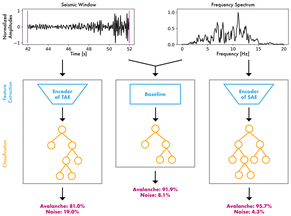
Avalanche detection systems are crucial for forecasting, but distinguishing avalanches from other seismic sources remains a challenge. We propose novel autoencoder models to automatically extract features and compare them with engineered seismic features. These features are then used to classify avalanches and noise events. The autoencoder feature classifiers exhibit the highest sensitivity in detecting avalanches, while the engineered seismic classifier performs better overall.
Francesca Carletti, Carlo Marin, Chiara Ghielmini, Mathias Bavay, and Michael Lehning
The Cryosphere, 19, 5579–5612, https://doi.org/10.5194/tc-19-5579-2025, https://doi.org/10.5194/tc-19-5579-2025, 2025
Short summary
Short summary
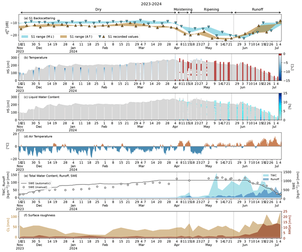
This work presents the first high-resolution dataset of wet-snow properties for satellite applications. With it, we validate links between Sentinel-1 backscatter and snowmelt stages and investigate scattering mechanisms through a radiative transfer model. We disclose the influence of liquid water content and surface roughness at different melting stages and address future challenges, such as capturing large-scale scattering mechanisms and enhancing radiative transfer modules for wet snow.
Michael Lombardo, Amelie Fees, Anders Kaestner, Alec van Herwijnen, Jürg Schweizer, and Peter Lehmann
The Cryosphere, 19, 4437–4458, https://doi.org/10.5194/tc-19-4437-2025, https://doi.org/10.5194/tc-19-4437-2025, 2025
Short summary
Short summary
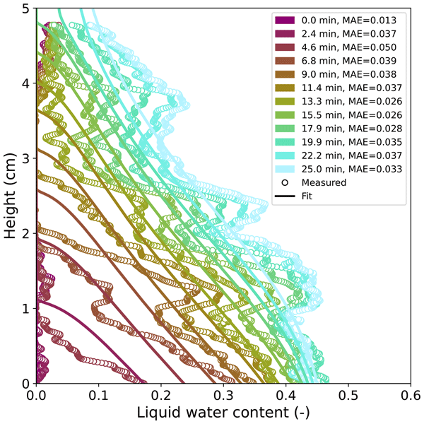
Water flow in snow is important for many applications including snow hydrology and avalanche forecasting. This work investigated the role of capillary forces at the soil-snow interface during capillary rise experiments using neutron radiography. The results showed that the properties of both the snow and the transitional layer below the snow affected the water flow. This work will allow for better representations of water flow across the soil–snow interface in snowpack models.
Grégoire Bobillier, Bertil Trottet, Bastian Bergfeld, Ron Simenhois, Alec van Herwijnen, Jürg Schweizer, and Johan Gaume
Nat. Hazards Earth Syst. Sci., 25, 2215–2223, https://doi.org/10.5194/nhess-25-2215-2025, https://doi.org/10.5194/nhess-25-2215-2025, 2025
Short summary
Short summary
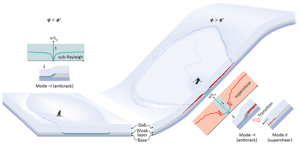
Our study investigates the initiation of snow slab avalanches. Combining experimental data with numerical simulations, we show that on gentle slopes, cracks form and propagate due to compressive fractures within a weak layer. On steeper slopes, crack velocity can increase dramatically after approximately 5 m due to a fracture mode transition from compression to shear. Understanding these dynamics provides a crucial missing piece in the puzzle of dry-snow slab avalanche formation.
Jane Walden, Mylène Jacquemart, Bretwood Higman, Romain Hugonnet, Andrea Manconi, and Daniel Farinotti
Nat. Hazards Earth Syst. Sci., 25, 2045–2073, https://doi.org/10.5194/nhess-25-2045-2025, https://doi.org/10.5194/nhess-25-2045-2025, 2025
Short summary
Short summary
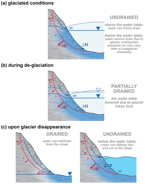
We studied eight glacier-adjacent landslides in Alaska and found that slope movement increased at four sites as the glacier retreated past the landslide area. Movement at other sites may be due to heavy precipitation or increased glacier thinning, and two sites showed little to no motion. We suggest that landslides near waterbodies may be especially vulnerable to acceleration, which we guess is due to faster retreat rates of water-terminating glaciers and changing water flow in the slope.
Philipp L. Rosendahl, Johannes Schneider, Grégoire Bobillier, Florian Rheinschmidt, Bastian Bergfeld, Alec van Herwijnen, and Philipp Weißgraeber
Nat. Hazards Earth Syst. Sci., 25, 1975–1991, https://doi.org/10.5194/nhess-25-1975-2025, https://doi.org/10.5194/nhess-25-1975-2025, 2025
Short summary
Short summary
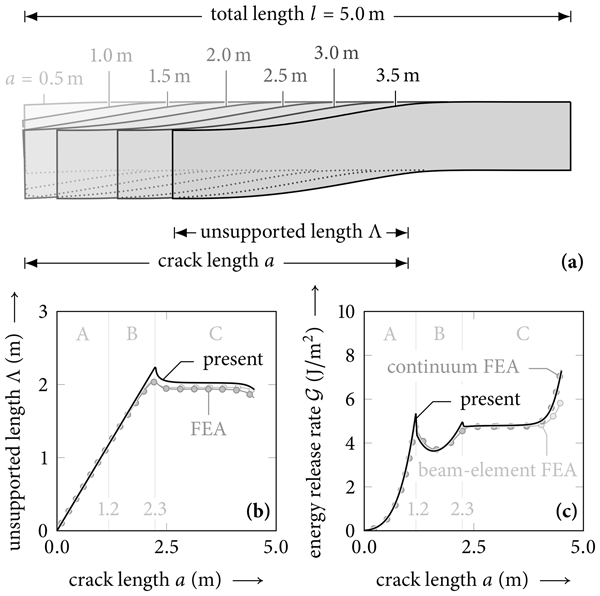
Avalanche formation depends on crack propagation in weak snow layers, but the conditions that stop a crack remain unclear. We show that slab touchdown reduces the energy driving crack growth, which can halt propagation even under static conditions. This suggests that crack arrest is influenced not only by snowpack variability or dynamics but also by mechanical interactions within the snowpack. Our findings refine avalanche prediction models and improve hazard assessment.
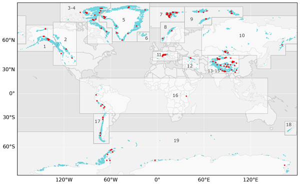
Mylène Jacquemart, Ethan Welty, Marcus Gastaldello, and Guillem Carcanade
Earth Syst. Sci. Data, 17, 1627–1666, https://doi.org/10.5194/essd-17-1627-2025, https://doi.org/10.5194/essd-17-1627-2025, 2025
Short summary
Short summary
We present glenglat, a database that contains measurements of ice temperature from 213 glaciers measured in 788 boreholes between 1842 and 2023. Even though ice temperature is a defining characteristic of any glacier, such measurements have been conducted on less than 1 ‰ of all glaciers globally. Our database permits us, for the first time, to investigate glacier temperature distributions at global or regional scales.
Andrea Manconi, Gwendolyn Dasser, Mylène Jacquemart, Nicolas Oestreicher, Livia Piermattei, and Tazio Strozzi
Abstr. Int. Cartogr. Assoc., 9, 41, https://doi.org/10.5194/ica-abs-9-41-2025, https://doi.org/10.5194/ica-abs-9-41-2025, 2025
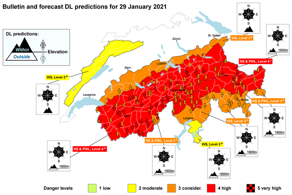
Cristina Pérez-Guillén, Frank Techel, Michele Volpi, and Alec van Herwijnen
Nat. Hazards Earth Syst. Sci., 25, 1331–1351, https://doi.org/10.5194/nhess-25-1331-2025, https://doi.org/10.5194/nhess-25-1331-2025, 2025
Short summary
Short summary
This study assesses the performance and explainability of a random-forest classifier for predicting dry-snow avalanche danger levels during initial live testing. The model achieved ∼ 70 % agreement with human forecasts, performing equally well in nowcast and forecast modes, while capturing the temporal dynamics of avalanche forecasting. The explainability approach enhances the transparency of the model's decision-making process, providing a valuable tool for operational avalanche forecasting.
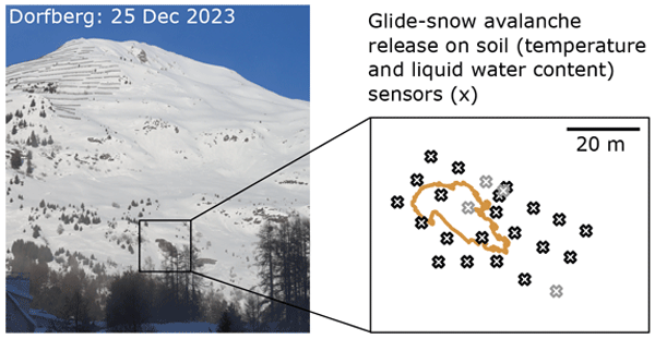
Amelie Fees, Michael Lombardo, Alec van Herwijnen, Peter Lehmann, and Jürg Schweizer
The Cryosphere, 19, 1453–1468, https://doi.org/10.5194/tc-19-1453-2025, https://doi.org/10.5194/tc-19-1453-2025, 2025
Short summary
Short summary
Glide-snow avalanches release at the soil–snow interface due to a loss of friction, which is suspected to be linked to interfacial water. The importance of the interfacial water was investigated with a spatio-temporal monitoring setup for soil and local snow on an avalanche-prone slope. Seven glide-snow avalanches were released on the monitoring grid (winter seasons 2021/22 to 2023/24) and provided insights into the source, quantity, and spatial distribution of interfacial water before avalanche release.
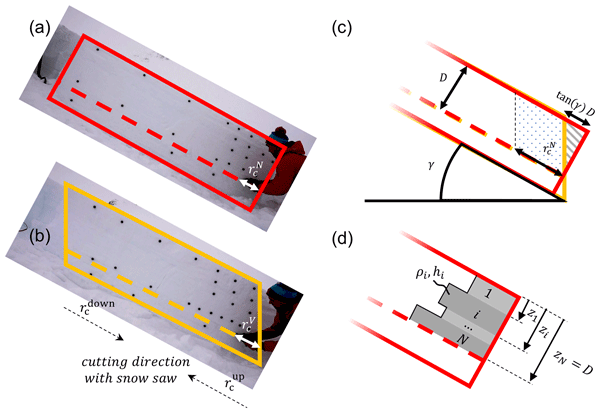
Bastian Bergfeld, Karl W. Birkeland, Valentin Adam, Philipp L. Rosendahl, and Alec van Herwijnen
Nat. Hazards Earth Syst. Sci., 25, 321–334, https://doi.org/10.5194/nhess-25-321-2025, https://doi.org/10.5194/nhess-25-321-2025, 2025
Short summary
Short summary
To release a slab avalanche, a crack in a weak snow layer beneath a cohesive slab has to propagate. Information on that is essential for assessing avalanche risk. In the field, information can be gathered with the propagation saw test (PST). However, there are different standards on how to cut the PST. In this study, we experimentally investigate the effect of these different column geometries and provide models to correct for imprecise field test geometry effects on the critical cut length.
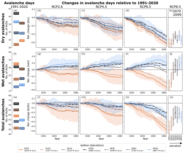
Stephanie Mayer, Martin Hendrick, Adrien Michel, Bettina Richter, Jürg Schweizer, Heini Wernli, and Alec van Herwijnen
The Cryosphere, 18, 5495–5517, https://doi.org/10.5194/tc-18-5495-2024, https://doi.org/10.5194/tc-18-5495-2024, 2024
Short summary
Short summary
Understanding the impact of climate change on snow avalanche activity is crucial for safeguarding lives and infrastructure. Here, we project changes in avalanche activity in the Swiss Alps throughout the 21st century. Our findings reveal elevation-dependent patterns of change, indicating a decrease in dry-snow avalanches alongside an increase in wet-snow avalanches at elevations above the current treeline. These results underscore the necessity to revisit measures for avalanche risk mitigation.
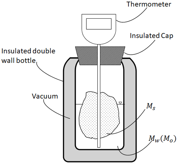
Riccardo Barella, Mathias Bavay, Francesca Carletti, Nicola Ciapponi, Valentina Premier, and Carlo Marin
The Cryosphere, 18, 5323–5345, https://doi.org/10.5194/tc-18-5323-2024, https://doi.org/10.5194/tc-18-5323-2024, 2024
Short summary
Short summary
This research revisits a classic scientific technique, melting calorimetry, to measure snow liquid water content. This study shows with a novel uncertainty propagation framework that melting calorimetry, traditionally less trusted than freezing calorimetry, can produce accurate results. The study defines optimal experiment parameters and a robust field protocol. Melting calorimetry has the potential to become a valuable tool for validating other liquid water content measuring techniques.
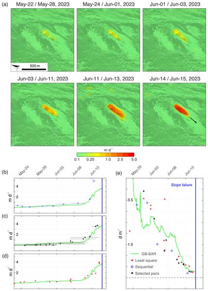
Andrea Manconi, Yves Bühler, Andreas Stoffel, Johan Gaume, Qiaoping Zhang, and Valentyn Tolpekin
Nat. Hazards Earth Syst. Sci., 24, 3833–3839, https://doi.org/10.5194/nhess-24-3833-2024, https://doi.org/10.5194/nhess-24-3833-2024, 2024
Short summary
Short summary
Our research reveals the power of high-resolution satellite synthetic-aperture radar (SAR) imagery for slope deformation monitoring. Using ICEYE data over the Brienz/Brinzauls instability, we measured surface velocity and mapped the landslide event with unprecedented precision. This underscores the potential of satellite SAR for timely hazard assessment in remote regions and aiding disaster mitigation efforts effectively.
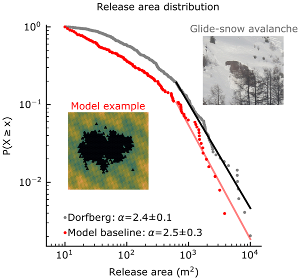
Amelie Fees, Alec van Herwijnen, Michael Lombardo, Jürg Schweizer, and Peter Lehmann
Nat. Hazards Earth Syst. Sci., 24, 3387–3400, https://doi.org/10.5194/nhess-24-3387-2024, https://doi.org/10.5194/nhess-24-3387-2024, 2024
Short summary
Short summary
Glide-snow avalanches release at the ground–snow interface, and their release process is poorly understood. To investigate the influence of spatial variability (snowpack and basal friction) on avalanche release, we developed a 3D, mechanical, threshold-based model that reproduces an observed release area distribution. A sensitivity analysis showed that the distribution was mostly influenced by the basal friction uniformity, while the variations in snowpack properties had little influence.
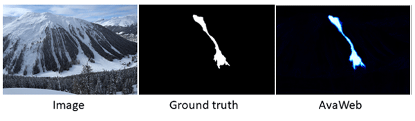
Elisabeth D. Hafner, Theodora Kontogianni, Rodrigo Caye Daudt, Lucien Oberson, Jan Dirk Wegner, Konrad Schindler, and Yves Bühler
The Cryosphere, 18, 3807–3823, https://doi.org/10.5194/tc-18-3807-2024, https://doi.org/10.5194/tc-18-3807-2024, 2024
Short summary
Short summary
For many safety-related applications such as road management, well-documented avalanches are important. To enlarge the information, webcams may be used. We propose supporting the mapping of avalanches from webcams with a machine learning model that interactively works together with the human. Relying on that model, there is a 90% saving of time compared to the "traditional" mapping. This gives a better base for safety-critical decisions and planning in avalanche-prone mountain regions.
Riccardo Barella, Mathias Bavay, Francesca Carletti, Nicola Ciapponi, Valentina Premier, and Carlo Marin
EGUsphere, https://doi.org/10.5194/egusphere-2023-2892, https://doi.org/10.5194/egusphere-2023-2892, 2024
Preprint archived
Short summary
Short summary
Unlocking the potential of melting calorimetry, traditionally confined to school labs, this paper demonstrates its application in the field for accurate measurement of liquid water content in snow. Dispelling misconceptions about measurement uncertainty, it provide a robust protocol and quantifies associated uncertainties. The findings endorse the broader adoption of melting calorimetry for quantification of snow liquid water content in operational context.
Kristina Juliana Reinders, Govert Frederik Verhoeven, Luca Sartorelli, Ramon Hanssen, and Andrea Manconi
EGUsphere, https://doi.org/10.5194/egusphere-2023-2321, https://doi.org/10.5194/egusphere-2023-2321, 2023
Preprint archived
Short summary
Short summary
We investigated if radar data from the Sentinel-1 satellite can be used to assess displacements in permafrost areas in the Swiss alps. We discovered that 92 % of the permafrost areas can be visible with Sentinel-1. Next, based on displacement times series derived from radar data we revealed that the ground movements in permafrost areas are 2–3 times as large than in permafrost without areas. This result can help in monitoring permafrost areas and update current permafrost maps.
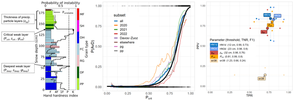
Stephanie Mayer, Frank Techel, Jürg Schweizer, and Alec van Herwijnen
Nat. Hazards Earth Syst. Sci., 23, 3445–3465, https://doi.org/10.5194/nhess-23-3445-2023, https://doi.org/10.5194/nhess-23-3445-2023, 2023
Short summary
Short summary
We present statistical models to estimate the probability for natural dry-snow avalanche release and avalanche size based on the simulated layering of the snowpack. The benefit of these models is demonstrated in comparison with benchmark models based on the amount of new snow. From the validation with data sets of quality-controlled avalanche observations and danger levels, we conclude that these models may be valuable tools to support forecasting natural dry-snow avalanche activity.
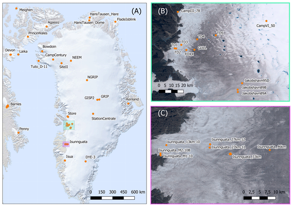
Anja Løkkegaard, Kenneth D. Mankoff, Christian Zdanowicz, Gary D. Clow, Martin P. Lüthi, Samuel H. Doyle, Henrik H. Thomsen, David Fisher, Joel Harper, Andy Aschwanden, Bo M. Vinther, Dorthe Dahl-Jensen, Harry Zekollari, Toby Meierbachtol, Ian McDowell, Neil Humphrey, Anne Solgaard, Nanna B. Karlsson, Shfaqat A. Khan, Benjamin Hills, Robert Law, Bryn Hubbard, Poul Christoffersen, Mylène Jacquemart, Julien Seguinot, Robert S. Fausto, and William T. Colgan
The Cryosphere, 17, 3829–3845, https://doi.org/10.5194/tc-17-3829-2023, https://doi.org/10.5194/tc-17-3829-2023, 2023
Short summary
Short summary
This study presents a database compiling 95 ice temperature profiles from the Greenland ice sheet and peripheral ice caps. Ice viscosity and hence ice flow are highly sensitive to ice temperature. To highlight the value of the database in evaluating ice flow simulations, profiles from the Greenland ice sheet are compared to a modeled temperature field. Reoccurring discrepancies between modeled and observed temperatures provide insight on the difficulties faced when simulating ice temperatures.
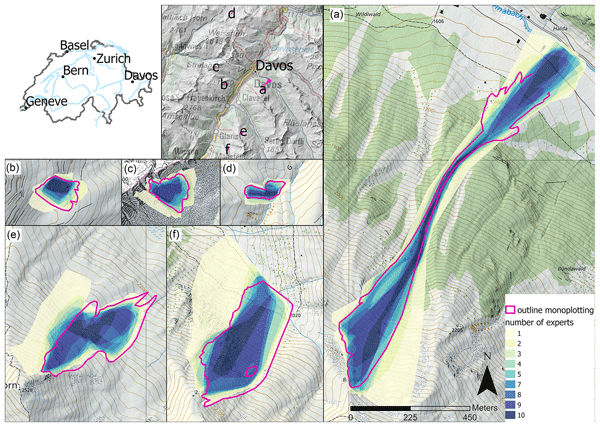
Elisabeth D. Hafner, Frank Techel, Rodrigo Caye Daudt, Jan Dirk Wegner, Konrad Schindler, and Yves Bühler
Nat. Hazards Earth Syst. Sci., 23, 2895–2914, https://doi.org/10.5194/nhess-23-2895-2023, https://doi.org/10.5194/nhess-23-2895-2023, 2023
Short summary
Short summary
Oftentimes when objective measurements are not possible, human estimates are used instead. In our study, we investigate the reproducibility of human judgement for size estimates, the mappings of avalanches from oblique photographs and remotely sensed imagery. The variability that we found in those estimates is worth considering as it may influence results and should be kept in mind for several applications.
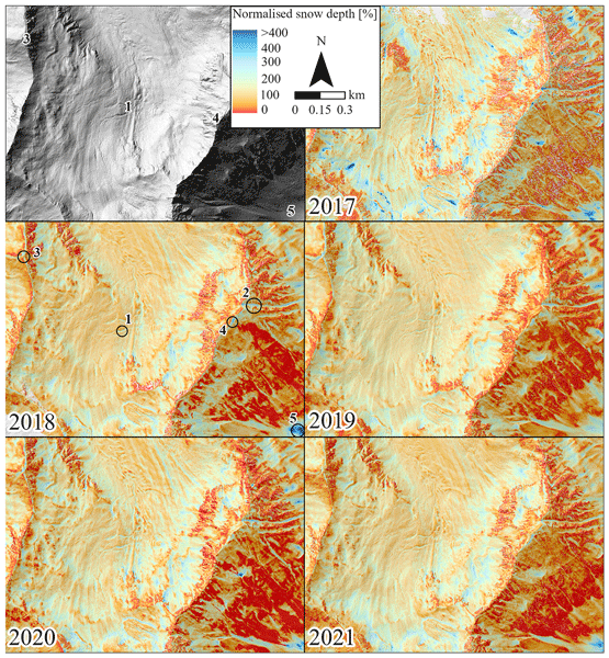
Leon J. Bührle, Mauro Marty, Lucie A. Eberhard, Andreas Stoffel, Elisabeth D. Hafner, and Yves Bühler
The Cryosphere, 17, 3383–3408, https://doi.org/10.5194/tc-17-3383-2023, https://doi.org/10.5194/tc-17-3383-2023, 2023
Short summary
Short summary
Information on the snow depth distribution is crucial for numerous applications in high-mountain regions. However, only specific measurements can accurately map the present variability of snow depths within complex terrain. In this study, we show the reliable processing of images from aeroplane to large (> 100 km2) detailed and accurate snow depth maps around Davos (CH). We use these maps to describe the existing snow depth distribution, other special features and potential applications.
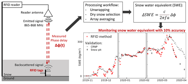
Mathieu Le Breton, Éric Larose, Laurent Baillet, Yves Lejeune, and Alec van Herwijnen
The Cryosphere, 17, 3137–3156, https://doi.org/10.5194/tc-17-3137-2023, https://doi.org/10.5194/tc-17-3137-2023, 2023
Short summary
Short summary
We monitor the amount of snow on the ground using passive radiofrequency identification (RFID) tags. These small and inexpensive tags are wirelessly read by a stationary reader placed above the snowpack. Variations in the radiofrequency phase delay accurately reflect variations in snow amount, known as snow water equivalent. Additionally, each tag is equipped with a sensor that monitors the snow temperature.
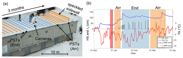
Bastian Bergfeld, Alec van Herwijnen, Grégoire Bobillier, Philipp L. Rosendahl, Philipp Weißgraeber, Valentin Adam, Jürg Dual, and Jürg Schweizer
Nat. Hazards Earth Syst. Sci., 23, 293–315, https://doi.org/10.5194/nhess-23-293-2023, https://doi.org/10.5194/nhess-23-293-2023, 2023
Short summary
Short summary
For a slab avalanche to release, the snowpack must facilitate crack propagation over large distances. Field measurements on crack propagation at this scale are very scarce. We performed a series of experiments, up to 10 m long, over a period of 10 weeks. Beside the temporal evolution of the mechanical properties of the snowpack, we found that crack speeds were highest for tests resulting in full propagation. Based on these findings, an index for self-sustained crack propagation is proposed.
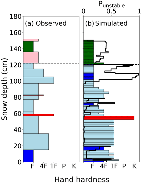
Stephanie Mayer, Alec van Herwijnen, Frank Techel, and Jürg Schweizer
The Cryosphere, 16, 4593–4615, https://doi.org/10.5194/tc-16-4593-2022, https://doi.org/10.5194/tc-16-4593-2022, 2022
Short summary
Short summary
Information on snow instability is crucial for avalanche forecasting. We introduce a novel machine-learning-based method to assess snow instability from snow stratigraphy simulated with the snow cover model SNOWPACK. To develop the model, we compared observed and simulated snow profiles. Our model provides a probability of instability for every layer of a simulated snow profile, which allows detection of the weakest layer and assessment of its degree of instability with one single index.
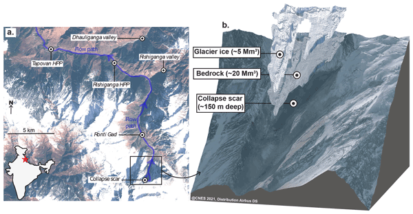
Maximillian Van Wyk de Vries, Shashank Bhushan, Mylène Jacquemart, César Deschamps-Berger, Etienne Berthier, Simon Gascoin, David E. Shean, Dan H. Shugar, and Andreas Kääb
Nat. Hazards Earth Syst. Sci., 22, 3309–3327, https://doi.org/10.5194/nhess-22-3309-2022, https://doi.org/10.5194/nhess-22-3309-2022, 2022
Short summary
Short summary
On 7 February 2021, a large rock–ice avalanche occurred in Chamoli, Indian Himalaya. The resulting debris flow swept down the nearby valley, leaving over 200 people dead or missing. We use a range of satellite datasets to investigate how the collapse area changed prior to collapse. We show that signs of instability were visible as early 5 years prior to collapse. However, it would likely not have been possible to predict the timing of the event from current satellite datasets.
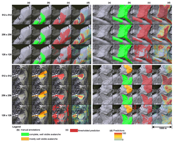
Elisabeth D. Hafner, Patrick Barton, Rodrigo Caye Daudt, Jan Dirk Wegner, Konrad Schindler, and Yves Bühler
The Cryosphere, 16, 3517–3530, https://doi.org/10.5194/tc-16-3517-2022, https://doi.org/10.5194/tc-16-3517-2022, 2022
Short summary
Short summary
Knowing where avalanches occur is very important information for several disciplines, for example avalanche warning, hazard zonation and risk management. Satellite imagery can provide such data systematically over large regions. In our work we propose a machine learning model to automate the time-consuming manual mapping. Additionally, we investigate expert agreement for manual avalanche mapping, showing that our network is equally as good as the experts in identifying avalanches.

Francesca Carletti, Adrien Michel, Francesca Casale, Alice Burri, Daniele Bocchiola, Mathias Bavay, and Michael Lehning
Hydrol. Earth Syst. Sci., 26, 3447–3475, https://doi.org/10.5194/hess-26-3447-2022, https://doi.org/10.5194/hess-26-3447-2022, 2022
Short summary
Short summary
High Alpine catchments are dominated by the melting of seasonal snow cover and glaciers, whose amount and seasonality are expected to be modified by climate change. This paper compares the performances of different types of models in reproducing discharge among two catchments under present conditions and climate change. Despite many advantages, the use of simpler models for climate change applications is controversial as they do not fully represent the physics of the involved processes.
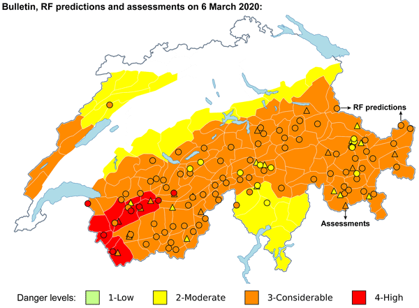
Cristina Pérez-Guillén, Frank Techel, Martin Hendrick, Michele Volpi, Alec van Herwijnen, Tasko Olevski, Guillaume Obozinski, Fernando Pérez-Cruz, and Jürg Schweizer
Nat. Hazards Earth Syst. Sci., 22, 2031–2056, https://doi.org/10.5194/nhess-22-2031-2022, https://doi.org/10.5194/nhess-22-2031-2022, 2022
Short summary
Short summary
A fully data-driven approach to predicting the danger level for dry-snow avalanche conditions in Switzerland was developed. Two classifiers were trained using a large database of meteorological data, snow cover simulations, and danger levels. The models performed well throughout the Swiss Alps, reaching a performance similar to the current experience-based avalanche forecasts. This approach shows the potential to be a valuable supplementary decision support tool for assessing avalanche hazard.
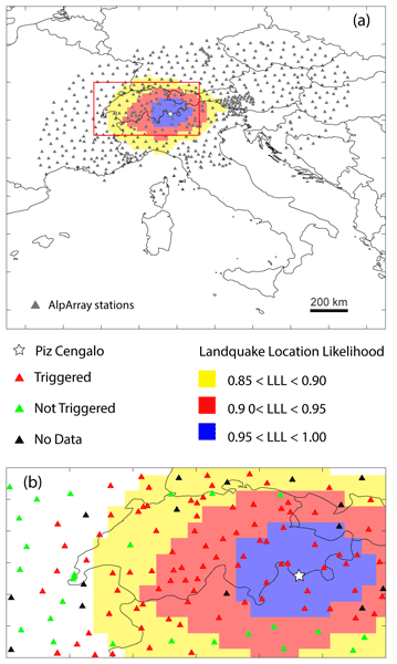
Andrea Manconi, Alessandro C. Mondini, and the AlpArray working group
Nat. Hazards Earth Syst. Sci., 22, 1655–1664, https://doi.org/10.5194/nhess-22-1655-2022, https://doi.org/10.5194/nhess-22-1655-2022, 2022
Short summary
Short summary
Information on when, where, and how landslide events occur is the key to building complete catalogues and performing accurate hazard assessments. Here we show a procedure that allows us to benefit from the increased density of seismic sensors installed on ground for earthquake monitoring and from the unprecedented availability of satellite radar data. We show how the procedure works on a recent sequence of landslides that occurred at Piz Cengalo (Swiss Alps) in 2017.
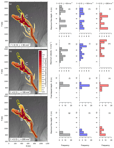
Andrew Mitchell, Sophia Zubrycky, Scott McDougall, Jordan Aaron, Mylène Jacquemart, Johannes Hübl, Roland Kaitna, and Christoph Graf
Nat. Hazards Earth Syst. Sci., 22, 1627–1654, https://doi.org/10.5194/nhess-22-1627-2022, https://doi.org/10.5194/nhess-22-1627-2022, 2022
Short summary
Short summary
Debris flows are complex, surging movements of sediment and water. Discharge observations from well-studied debris-flow channels were used as inputs for a numerical modelling study of the downstream effects of chaotic inflows. The results show that downstream impacts are sensitive to inflow conditions. Inflow conditions for predictive modelling are highly uncertain, and our method provides a means to estimate the potential variability in future events.
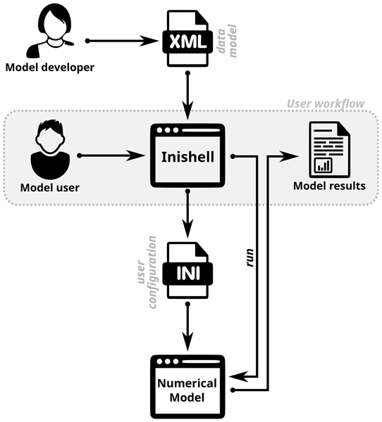
Mathias Bavay, Michael Reisecker, Thomas Egger, and Daniela Korhammer
Geosci. Model Dev., 15, 365–378, https://doi.org/10.5194/gmd-15-365-2022, https://doi.org/10.5194/gmd-15-365-2022, 2022
Short summary
Short summary
Most users struggle with the configuration of numerical models. This can be improved by relying on a GUI, but this requires a significant investment and a specific skill set and does not fit with the daily duties of model developers, leading to major maintenance burdens. Inishell generates a GUI on the fly based on an XML description of the required configuration elements, making maintenance very simple. This concept has been shown to work very well in our context.
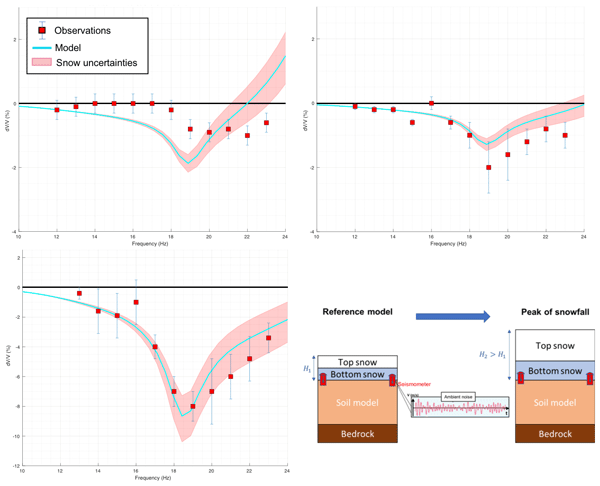
Antoine Guillemot, Alec van Herwijnen, Eric Larose, Stephanie Mayer, and Laurent Baillet
The Cryosphere, 15, 5805–5817, https://doi.org/10.5194/tc-15-5805-2021, https://doi.org/10.5194/tc-15-5805-2021, 2021
Short summary
Short summary
Ambient noise correlation is a broadly used method in seismology to monitor tiny changes in subsurface properties. Some environmental forcings may influence this method, including snow. During one winter season, we studied this snow effect on seismic velocity of the medium, recorded by a pair of seismic sensors. We detected and modeled a measurable effect during early snowfalls: the fresh new snow layer modifies rigidity and density of the medium, thus decreasing the recorded seismic velocity.
Ionuț Iosifescu Enescu, David Hanimann, Dominik Haas-Artho, Marius Rüetschi, Dirk Nikolaus Karger, Gian-Kasper Plattner, Martin Hägeli, Rebecca Kurup Buchholz, Lucia de Espona, Niklaus E. Zimmermann, and Loïc Pellissier
Abstr. Int. Cartogr. Assoc., 3, 119, https://doi.org/10.5194/ica-abs-3-119-2021, https://doi.org/10.5194/ica-abs-3-119-2021, 2021
Ionuț Iosifescu Enescu, David Hanimann, Dominik Haas-Artho, Marius Rüetschi, Dirk Nikolaus Karger, Gian-Kasper Plattner, Martin Hägeli, Rebecca Kurup Buchholz, Lucia de Espona, Niklaus E. Zimmermann, and Loïc Pellissier
Abstr. Int. Cartogr. Assoc., 3, 120, https://doi.org/10.5194/ica-abs-3-120-2021, https://doi.org/10.5194/ica-abs-3-120-2021, 2021
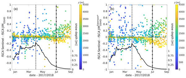
Nora Helbig, Michael Schirmer, Jan Magnusson, Flavia Mäder, Alec van Herwijnen, Louis Quéno, Yves Bühler, Jeff S. Deems, and Simon Gascoin
The Cryosphere, 15, 4607–4624, https://doi.org/10.5194/tc-15-4607-2021, https://doi.org/10.5194/tc-15-4607-2021, 2021
Short summary
Short summary
The snow cover spatial variability in mountains changes considerably over the course of a snow season. In applications such as weather, climate and hydrological predictions the fractional snow-covered area is therefore an essential parameter characterizing how much of the ground surface in a grid cell is currently covered by snow. We present a seasonal algorithm and a spatiotemporal evaluation suggesting that the algorithm can be applied in other geographic regions by any snow model application.
Cited articles
Baggi, S. and Schweizer, J.: Characteristics of wet-snow avalanche activity: 20 years of observations from a high alpine valley (Dischma, Switzerland), Nat. Hazards, 50, 97–108, https://doi.org/10.1007/S11069-008-9322-7, 2009. a
Bavay, M.: Snowpack operational reruns 2023 (2023-08), Zenodo [data set], https://doi.org/10.5281/zenodo.19388833, 2026a. a, b
Bavay, M.: Snowpack-3.6.5, Zenodo [data set], https://doi.org/10.5281/zenodo.19258679, 2026b. a, b, c
Bavay, M. and Egger, T.: MeteoIO 2.4.2: a preprocessing library for meteorological data, Tech. rep., 2013, http://models.slf.ch/p/meteoio (last access: 14 August 2026), 2013. a
Bavay, M., Reisecker, M., Egger, T., and Korhammer, D.: Inishell 2.0: Semantically driven automatic GUI generation for scientific models, Geosci. Model Dev., 15, 365–378, https://doi.org/10.5194/gmd-15-365-2022, 2022. a
Bourbigot, M., Johnsen, H., Piantanida, R., Hajduch, G., and Poullaouec, J.: Sentinel-1 product definition, Tech. rep., ISBN S1-RS-MDA-52-7440, 2016. a
Bühler, Y., von Rickenbach, D., Stoffel, A., Margreth, S., Stoffel, L., and Christen, M.: Automated snow avalanche release area delineation – validation of existing algorithms and proposition of a new object-based approach for large-scale hazard indication mapping, Nat. Hazards Earth Syst. Sci., 18, 3235–3251, https://doi.org/10.5194/nhess-18-3235-2018, 2018. a
Carletti, F., Marin, C., Ghielmini, C., Bavay, M., and Lehning, M.: Multitemporal analysis of Sentinel-1 backscatter during snowmelt using high-resolution field measurements and radiative transfer modelling, The Cryosphere, 19, 5579–5612, https://doi.org/10.5194/tc-19-5579-2025, 2025. a, b, c
Cluzet, B., Magnusson, J., Quéno, L., Mazzotti, G., Mott, R., and Jonas, T.: Exploring how Sentinel-1 wet-snow maps can inform fully distributed physically based snowpack models, The Cryosphere, 18, 5753–5767, https://doi.org/10.5194/tc-18-5753-2024, 2024. a
Copernicus Data Space Center: Sentinel-1 Documentation, https://documentation.dataspace.copernicus.eu/ (last access: 14 August 2026), 2026. a
Darychuk, S. E., Shea, J. M., and Derksen, C.: Comparison of snowmelt timing estimates from Sentinel-1 SAR and surface observations in British Columbia, Canada, Remote Sens. Environ., 328, 114863, https://doi.org/10.1016/j.rse.2025.114863, 2025. a, b
Detre, A., McGrath, D., Gagliano, E., Bonnell, R., Webb, R., Marshall, H. P., and Shean, D.: Sentinel-1 SAR Estimates of Snowmelt Onset Coincide With SNOTEL Soil Moisture Pulses Across the Western United States, Hydrol. Process., 39, https://doi.org/10.1002/HYP.70341, 2025. a, b, c
Dietz, A. J., Kuenzer, C., Gessner, U., and Dech, S.: Remote sensing of snow – a review of available methods, Int. J. Remote Sens., 33, 4094–4134, https://doi.org/10.1080/01431161.2011.640964, 2012. a
Eckert, N., Corona, C., Giacona, F., Gaume, J., Mayer, S., van Herwijnen, A., Hagenmuller, P., and Stoffel, M.: Climate change impacts on snow avalanche activity and related risks, Nat. Rev. Earth Environ., 5, 369–389, https://doi.org/10.1038/s43017-024-00540-2, 2024. a
EUMETSAT and ECMWF and EEA and Mercator Ocean International: Sentinel-1 – Documentation, European Space Agency, https://documentation.dataspace.copernicus.eu/Data/SentinelMissions/Sentinel1.html (last access: 23 June 2026), 2026. a
European Environment Agency: High Resolution layer: Wet/Dry Snow 2016-present; Algorithm theoretical basis document for snow products based on Sentinel-1 and Sentinel-2, Tech. rep., Pan European high-resolution snow & ice monitoring of the Copernicus land monitoring service, https://land.copernicus.eu/en/products/snow/high-resolution-wet-dry-snow (last access: 14 August 2026), 2023. a, b, c
European Space Agency: Mission ends for Copernicus Sentinel-1B satellite, European Space Agency, https://www.esa.int/Applications/Observing_the_Earth/ (last access: 14 August 2026), 2022. a
Gamma Remote Sensing: GAMMA Software, https://www.gamma-rs.ch/gamma-software (last access: 9 April 2026), 2025. a
Gao, B. and Ma, W.: Capturing Snowmelt Runoff Onset Date under Different Land Cover Types Using Synthetic Aperture Radar: Case Study of Sierra Nevada Mountains, USA, Appl. Sci. (Switzerland), 14, https://doi.org/10.3390/app14156844, 2024. a, b
Hendrick, M., Techel, F., Volpi, M., Olevski, T., Pérez-Guillén, C., Herwijnen, A. V., and Schweizer, J.: Automated prediction of wet-snow avalanche activity in the Swiss Alps, J. Glaciol., 50, 1–14, https://doi.org/10.1017/jog.2023.24, 2023. a, b
Hirashima, H., Kamiishi, I., Yamaguchi, S., Sato, A., and Lehning, M.: Application of a numerical snowpack model to estimate full-depth avalanche danger, in: Proceedings of the 2010 International Snow Science Workshop, Squaw Valley, CA, USA, 17–22 October 2010, 47–52, https://arc.lib.montana.edu/snow-science/item/342 (last access: 20 August 2026), 2010. a
Jafari, M., Sharma, V., and Lehning, M.: Convection of water vapour in snowpacks, J. Fluid Mech., 934, https://doi.org/10.1017/jfm.2021.1146, 2022. a
James, G., Karbou, F., and Durand, P.: Dynamical System Approach for Wet Snow Retrieval in Mountains Using Sentinel-1 SAR Images, IEEE Trans. Geosci. Remote Sens., 62, https://doi.org/10.1109/TGRS.2024.3431191, 2024. a, b
Jans, J. F., Beernaert, E., De Breuck, M., Brangers, I., Dunmire, D., De Lannoy, G., and Lievens, H.: Sensitivity of Sentinel-1 C-band SAR backscatter, polarimetry and interferometry to snow accumulation in the Alps, Remote Sens. Environ., 316, https://doi.org/10.1016/j.rse.2024.114477, 2025. a
Karbou, F., James, G., Fructus, M., and Marti, F.: On the Evaluation of the SAR-Based Copernicus Snow Products in the French Alps, Geosciences, 12, https://doi.org/10.3390/geosciences12110420, 2022. a, b
Köhler, A., Fischer, J. T., Scandroglio, R., Bavay, M., McElwaine, J., and Sovilla, B.: Cold-To-warm flow regime transition in snow avalanches, The Cryosphere, 12, 3759–3774, https://doi.org/10.5194/tc-12-3759-2018, 2018. a
Lehning, M., Bartelt, P., Brown, B., Russi, T., Stöckli, U., and Zimmerli, M.: SNOWPACK model calculations for avalanche warning based upon a new network of weather and snow stations, Cold Reg. Sci. Technol., 30, 145–157, https://doi.org/10.1016/S0165-232X(99)00022-1, 1999. a
Li, S., Huang, L., Bernhard, P., and Hajnsek, I.: Mapping seasonal snow melting in Karakoram using SAR and topographic data, The Cryosphere, 19, 1621–1639, https://doi.org/10.5194/tc-19-1621-2025, 2025. a, b, c, d
Lievens, H., Demuzere, M., Marshall, H.-p., Reichle, R. H., Brangers, I., Rosnay, P. D., Dumont, M., Girotto, M., Immerzeel, W., Jonas, T., Kim, E. J., Koch, I., Marty, C., Saloranta, T., Schöber, J., and De Lannoy, G. J.: Snow depth variability in the Northern Hemisphere mountains observed from space, Nat. Commun., 10, 1–33, https://doi.org/10.1038/s41467-019-12566-y, 2019. a
Linlor, W. I.: Permittivity and attenuation of wet snow between 4 and 12 GHz, J. Appl. Phys., 51, 2811–2816, https://doi.org/10.1063/1.327947, 1980. a
Liu, C., Li, Z., Zhang, P., Huang, L., Li, Z., and Gao, S.: Wet snow detection using dual-polarized Sentinel-1 SAR time series data considering different land categories, Geocarto Int., 37, 10907–10924, https://doi.org/10.1080/10106049.2022.2043450, 2022. a
Liu, Z., Filhol, S., and Treichler, D.: Retrieving snow depth distribution by downscaling ERA5 Reanalysis with ICESat-2 laser altimetry, Cold Reg. Sci. Technol., https://doi.org/10.1016/j.coldregions.2025.104580, 2025. a
Lund, J., Forster, R. R., Deeb, E. J., Liston, G. E., Skiles, S. M. K., and Marshall, H. P.: Interpreting Sentinel-1 SAR Backscatter Signals of Snowpack Surface Melt/Freeze, Warming, and Ripening, through Field Measurements and Physically-Based SnowModel, Remote Sens., 14, https://doi.org/10.3390/rs14164002, 2022. a
Marin, C., Bertoldi, G., Premier, V., Callegari, M., Brida, C., Hürkamp, K., Tschiersch, J., Zebisch, M., and Notarnicola, C.: Use of Sentinel-1 radar observations to evaluate snowmelt dynamics in alpine regions, The Cryosphere, 14, 935–956, https://doi.org/10.5194/tc-14-935-2020, 2020. a, b, c, d, e
Mendes, C. W., Neto, J. A., Hillebrand, F. L., DE FREITAS, M. W., Costi, J., and Simões, J. C.: Snowmelt retrieval algorithm for the Antarctic Peninsula using SAR imageries, Anais da Academia Brasileira de Ciencias, 94, https://doi.org/10.1590/0001-3765202220210217, 2022. a
Mitterer, C. and Schweizer, J.: Analysis of the snow-atmosphere energy balance during wet-snow instabilities and implications for avalanche prediction, The Cryosphere, 7, 205–216, https://doi.org/10.5194/tc-7-205-2013, 2013. a
Morin, S., Horton, S., Techel, F., Bavay, M., Coléou, C., Fierz, C., Gobiet, A., Hagenmuller, P., Lafaysse, M., Ližar, M., Mitterer, C., Monti, F., Müller, K., Olefs, M., Snook, J. S., van Herwijnen, A., and Vionnet, V.: Application of physical snowpack models in support of operational avalanche hazard forecasting: a status report on current implementations and prospects for the future, Cold Reg. Sci. Technol., 170, 102910, https://doi.org/10.1016/j.coldregions.2019.102910, 2020. a
Murfitt, J., Duguay, C., Picard, G., and Lemmetyinen, J.: Forward modelling of synthetic-aperture radar (SAR) backscatter during lake ice melt conditions using the Snow Microwave Radiative Transfer (SMRT) model, The Cryosphere, 18, 869–888, https://doi.org/10.5194/tc-18-869-2024, 2024. a, b
Nagler, T. and Rott, H.: Retrieval of wet snow by means of multitemporal SAR data, IEEE Trans. Geosci. Remote Sens., 38, 754–765, https://doi.org/10.1109/36.842004, 2000. a, b
Nagler, T., Rott, H., Ossowska, J., Schwaizer, G., Small, D., Malnes, E., Luojus, K., Metsämäki, S., and Pinnock, S.: Snow cover monitoring by synergistic use of sentinel-3 SLSTR and sentinel-1 SAR data, in: International Geoscience and Remote Sensing Symposium (IGARSS), 8727–8730, https://doi.org/10.1109/IGARSS.2018.8518203, 2018. a
Nagler, T., Schwaizer, G., Keuris, L., Rott, H., Luojus, K., Moisander, M., Small, D., Metsämäki, S., Malnes, E., and Eckerstorfer, M.: SEOM S1-4Sci Snow: Development of Pan-European Multi-Sensor Snow Mapping Methods Exploiting Sentinel-1, Final Report, Deliverable 4.2, Issue/Revision 1.2, ENVEO IT GmbH, Innsbruck, Austria, https://eo4society.esa.int/wp-content/uploads/2021/06/S14SciSnow.D4.2_v1_2_FR.pdf (last access: 18 August 2026), 2021. a
Oveisgharan, S., Zinke, R., Hoppinen, Z., and Marshall, H. P.: Snow water equivalent retrieval over Idaho - Part 1: Using Sentinel-1 repeat-pass interferometry, The Cryosphere, 18, 559–574, https://doi.org/10.5194/tc-18-559-2024, 2024. a
Reuter, B., Hagenmuller, P., and Eckert, N.: Trends in avalanche problems in the French Alps between 1958 and 2020, Cold Reg. Sci. Technol., 238, 104555, https://doi.org/10.1016/J.COLDREGIONS.2025.104555, 2025. a
Schweizer, J., Mitterer, C., Techel, F., Stoffel, A., and Reuter, B.: On the relation between avalanche occurrence and avalanche danger level, The Cryosphere, 14, 737–750, https://doi.org/10.5194/tc-14-737-2020, 2020. a, b, c
Singh, H. and Varade, D.: Inversion of snow geophysical parameters using the VHR PAZ X-band dual polarimetric SAR data: first known experiments in the Himalayan region, Int. J. Appl. Earth Obs., 141, https://doi.org/10.1016/j.jag.2025.104653, 2025. a
Small, D.: Flattening gamma: Radiometric terrain correction for SAR imagery, IEEE Trans. Geosci. Remote Sens., 49, 3081–3093, https://doi.org/10.1109/TGRS.2011.2120616, 2011. a
Small, D.: SAR backscatter multitemporal compositing via local resolution weighting, in: IGARSS 2012, 4521–4524, ISBN 9781467311595, https://doi.org/10.1109/IGARSS.2012.6350465, 2012. a
Small, D., Zuberbühler, L., Schubert, A., and Meier, E.: Terrain-flattened gamma nought Radarsat-2 backscatter, Can. J. Remote Sens., 37, https://doi.org/10.5589/m11-059, 2011. a, b
Stössel, F., Guala, M., Fierz, C., Manes, C., and Lehning, M.: Micrometeorological and morphological observations of surface hoar dynamics on a mountain snow cover, Water Resour. Res., 46, https://doi.org/10.1029/2009WR008198, 2010. a
Torres, R., Snoeij, P., Geudtner, D., Bibby, D., Davidson, M., Attema, E., Potin, P., Rommen, B. Ã., Floury, N., Brown, M., Traver, I. N., Deghaye, P., Duesmann, B., Rosich, B., Miranda, N., Bruno, C., L'Abbate, M., Croci, R., Pietropaolo, A., Huchler, M., and Rostan, F.: GMES Sentinel-1 mission, Remote Sens. Environ., 120, 9–24, https://doi.org/10.1016/j.rse.2011.05.028, 2012. a
Truckenbrodt, J., Freemantle, T., Williams, C., Jones, T., Small, D., Dubois, C., Thiel, C., Rossi, C., Syriou, A., and Giuliani, G.: Towards sentinel-1 SAR analysis-ready data: A best practices assessment on preparing backscatter data for the cube, Data, 4, https://doi.org/10.3390/data4030093, 2019. a
Tsai, Y. L. S., Dietz, A., Oppelt, N., and Kuenzer, C.: Remote sensing of snow cover using spaceborne SAR: A review, Remote Sens., 11, https://doi.org/10.3390/rs11121456, 2019. a
van Herwijnen, A. and Schweizer, J.: Monitoring avalanche activity using a seismic sensor, Cold Reg. Sci. Technol., 69, 165–176, https://doi.org/10.1016/j.coldregions.2011.06.008, 2011. a
Wendleder, A., Dietz, A. J., and Schork, K.: Mapping snow cover extent using optical and SAR data, Tech. rep., ISBN: 9781538671504, 2018. a
Wever, N., Fierz, C., Mitterer, C., Hirashima, H., and Lehning, M.: Solving Richards Equation for snow improves snowpack meltwater runoff estimations in detailed multi-layer snowpack model, The Cryosphere, 8, 257–274, https://doi.org/10.5194/tc-8-257-2014, 2014. a
Short summary
Understanding snowpack wetness is key to predicting wet snow avalanche releases, but detailed data is often limited. Using satellite radar, we monitored snowmelt over several seasons. We extracted a wet snow ratio threshold where the change from dry to wet snow avalanche dominated conditions is expected. By using local resolution weighting composites, we improved spatial resolution and showed our product to be more feasible for use in practice than the publicly available SAR Wet Snow layer.
Understanding snowpack wetness is key to predicting wet snow avalanche releases, but detailed...


