
Articles | Volume 20, issue 8
https://doi.org/10.5194/tc-20-4327-2026
© Author(s) 2026. This work is distributed under
the Creative Commons Attribution 4.0 License.
the Creative Commons Attribution 4.0 License.
https://doi.org/10.5194/tc-20-4327-2026
© Author(s) 2026. This work is distributed under
the Creative Commons Attribution 4.0 License.
the Creative Commons Attribution 4.0 License.
Research article
| 
07 Aug 2026
Research article |
| 07 Aug 2026
| 07 Aug 2026
A State-Space Model for Monitoring Greenland Ice Sheet Surface Elevation Change from CryoSat-2

DTU Space, Elektrovej 328, 2800 Kgs Lyngby, Denmark
Sebastian B. Simonsen
DTU Space, Elektrovej 328, 2800 Kgs Lyngby, Denmark
Karina Nielsen
DTU Space, Elektrovej 328, 2800 Kgs Lyngby, Denmark
Mai Winstrup
DTU Space, Elektrovej 328, 2800 Kgs Lyngby, Denmark
Baptiste Vandecrux
Department of Glaciology and Climate, Geological Survey of Denmark and Greenland, Øster Voldgade 10, 1350 Copenhagen K, Denmark
Department of Earth Sciences, University at Buffalo, 413 Hochstetter Hall, Buffalo NY 14260, United States
Beata Csatho
Department of Earth Sciences, University at Buffalo, 413 Hochstetter Hall, Buffalo NY 14260, United States
Anton Schenk
Department of Earth Sciences, University at Buffalo, 413 Hochstetter Hall, Buffalo NY 14260, United States
Louise Sandberg Sørensen
DTU Space, Elektrovej 328, 2800 Kgs Lyngby, Denmark
Related authors
Nanna B. Karlsson, Dustin M. Schroeder, Louise Sandberg Sørensen, Winnie Chu, Jørgen Dall, Natalia H. Andersen, Reese Dobson, Emma J. Mackie, Simon J. Köhn, Jillian E. Steinmetz, Angelo S. Tarzona, Thomas O. Teisberg, and Niels Skou
Earth Syst. Sci. Data, 16, 3333–3344, https://doi.org/10.5194/essd-16-3333-2024, https://doi.org/10.5194/essd-16-3333-2024, 2024
Short summary
Short summary
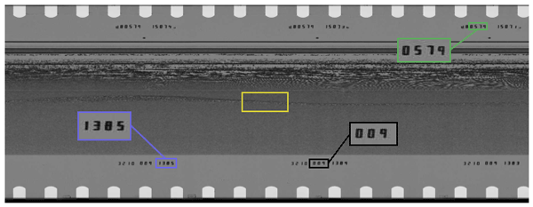
In the 1970s, more than 177 000 km of observations were acquired from airborne radar over the Greenland ice sheet. The radar data contain information on not only the thickness of the ice, but also the properties of the ice itself. This information was recorded on film rolls and subsequently stored. In this study, we document the digitization of these film rolls that shed new and unprecedented detailed light on the Greenland ice sheet 50 years ago.
Louise Sandberg Sørensen, Rasmus Bahbah, Sebastian B. Simonsen, Natalia Havelund Andersen, Jade Bowling, Noel Gourmelen, Alex Horton, Nanna B. Karlsson, Amber Leeson, Jennifer Maddalena, Malcolm McMillan, Anne Solgaard, and Birgit Wessel
The Cryosphere, 18, 505–523, https://doi.org/10.5194/tc-18-505-2024, https://doi.org/10.5194/tc-18-505-2024, 2024
Short summary
Short summary
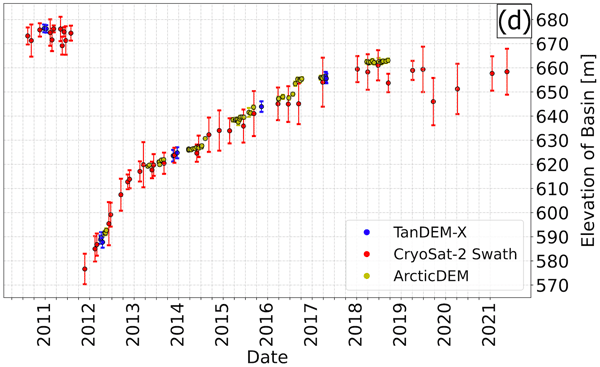
Under the right topographic and hydrological conditions, lakes may form beneath the large ice sheets. Some of these subglacial lakes are active, meaning that they periodically drain and refill. When a subglacial lake drains rapidly, it may cause the ice surface above to collapse, and here we investigate how to improve the monitoring of active subglacial lakes in Greenland by monitoring how their associated collapse basins change over time.
Ana Carolina Moraes Luzardi, Sophie Nowicki, Beata Csatho, Jason Briner, Mohammad Salmani, Hui Gao, Denis Felikson, Josh Cuzzone, and Kristin Poinar
EGUsphere, https://doi.org/10.5194/egusphere-2026-5841, https://doi.org/10.5194/egusphere-2026-5841, 2026
This preprint is open for discussion and under review for The Cryosphere (TC).
Short summary
Short summary
Before the satellite era, observations of Greenland ice sheet elevation were sparse in space and time. We reconstruct ice sheet-wide surface elevation for 1850 and 1980 using a 127-member ensemble. The reconstructions agree with observations and historical evidence, reveal patterns of thinning since the preindustrial era, and provide a resource for evaluating and initializing ice sheet simulations.

Enze Zhang, Ginny Catania, Ben Smith, Denis Felikson, Beata Csatho, and Daniel T. Trugman
The Cryosphere, 20, 3875–3891, https://doi.org/10.5194/tc-20-3875-2026, https://doi.org/10.5194/tc-20-3875-2026, 2026
Short summary
Short summary
Understanding seasonal changes in Greenland glaciers is vital for studying long-term trends. We use a simple model and high-resolution observation to reveal how multiple processes influence seasonal glacier velocity either alternately or simultaneously each year. Additional tests suggest a steepening glacier surface increases sensitivity of the surface velocity to terminus changes. Our approach can be applied to other glaciers decompose seasonal changes of glacier velocity.
Paolo Gabrielli, Theo M. Jenk, Michele Bertó, Giuliano Dreossi, Daniela Festi, Werner Kofler, Mai Winstrup, Klaus Oeggl, Margit Schwikowski, Barbara Stenni, and Carlo Barbante
Clim. Past, 22, 1037–1055, https://doi.org/10.5194/cp-22-1037-2026, https://doi.org/10.5194/cp-22-1037-2026, 2026
Short summary
Short summary
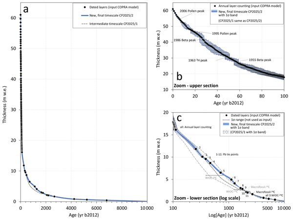
A low latitude-high altitude Alpine ice core record was obtained in 2011 from the glacier Alto dell’Ortles (Eastern Alps, Italy) and provided evidence of one of the oldest Alpine ice core records spanning the last ~7000 years, back to the last Northern Hemisphere Climatic Optimum. Here we provide a new Alto dell’Ortles chronology of improved accuracy that will allow to constrain Holocene climatic and environmental histories emerging from this high-altitude glacial archive of Central Europe.
Robert S. Fausto, Penelope How, Baptiste Vandecrux, Mads C. Lund, Jason E. Box, Kenneth D. Mankoff, Signe B. Andersen, Dirk van As, Rasmus Bahbah, Michele Citterio, William Colgan, Henrik T. Jakobsgaard, Nanna B. Karlsson, Kristian K. Kjeldsen, Signe H. Larsen, Charlotte Olsen, Falk M. Oraschewski, Anja Rutishauser, Christopher L. Shields, Anne M. Solgaard, Ian T. Stevens, Synne H. Svendsen, Kirsty Langley, Alexandra Messerli, Anders A. Bjørk, Jonas K. Andersen, Jakob Abermann, Jakob Steiner, Rainer Prinz, Berhard Hynek, James M. Lea, Stephen Brough, and Andreas P. Ahlstrøm
Earth Syst. Sci. Data, 18, 2829–2873, https://doi.org/10.5194/essd-18-2829-2026, https://doi.org/10.5194/essd-18-2829-2026, 2026
Short summary
Short summary
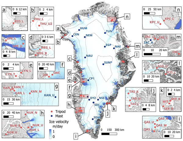
In summary, the PROMICE (Programme for Monitoring of the Greenland Ice Sheet ) | GC-NET AWS (Greenland Climate Network automatic weather station) data product update represents a significant advancement in Arctic climate monitoring. Through enhanced station designs, state-of-the-art instrumentation, and a transparent, automated data processing workflow, the dataset offers an essential resource for studying the Greenland Ice Sheet and its periphery, validating climate models, and supporting global assessments of cryospheric change.
Javed Hassan, Karina Nielsen, William Colgan, Rijan Bhakta Kayastha, Mira Khadka, and Shfaqat Abbas Khan
EGUsphere, https://doi.org/10.5194/egusphere-2026-808, https://doi.org/10.5194/egusphere-2026-808, 2026
Short summary
Short summary
High-altitude lakes in High Mountain Asia (HMA) are important sources of freshwater and sensitive indicators of environmental change. Using satellite data from 2010 to 2024, we examine water level changes in 232 lakes across HMA. Results show rising lake levels on the Tibetan Plateau, while lakes in the Himalaya are declining. These contrasting patterns highlight strong regional differences and provide valuable information for understanding water availability and associated hazards.
Josephine Lindsey-Clark, Aslak Grinsted, Baptiste Vandecrux, and Christine Schøtt Hvidberg
The Cryosphere, 20, 1463–1495, https://doi.org/10.5194/tc-20-1463-2026, https://doi.org/10.5194/tc-20-1463-2026, 2026
Short summary
Short summary
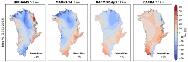
Accurate maps of snowfall over the Greenland ice sheet are essential for reliable projections of future sea-level rise. Climate models often struggle to capture realistic snowfall patterns, leading to significant long-term errors. We present a new method that corrects these errors using over two million observations. The corrected snowfall maps can help to reduce uncertainty in sea-level rise projections and improve understanding of Greenland’s proximity to irreversible melting thresholds.
Simon Jakob Köhn and Karina Nielsen
EGUsphere, https://doi.org/10.5194/egusphere-2025-6366, https://doi.org/10.5194/egusphere-2025-6366, 2026
Short summary
Short summary
The new Surface Water and Ocean Topography (SWOT) satellite represents a leap in satellite-based observations of surface water elevations. We evaluated SWOT’s ability to measure water levels in Danish lakes larger than 0.25km2. We compared data from the SWOT satellite with in-situ station data from 37 lakes. To ensure valid water levels, we tested six methods for selecting SWOT's data. Furthermore, we show that SWOT Pixel Cloud data contains indications of a time-varying residual roll error.
Joseph P. Tulenko, Sophie A. Goliber, Renette Jones-Ivey, Justin Quinn, Abani Patra, Kristin Poinar, Sophie Nowicki, Beata M. Csatho, and Jason P. Briner
The Cryosphere, 19, 4327–4333, https://doi.org/10.5194/tc-19-4327-2025, https://doi.org/10.5194/tc-19-4327-2025, 2025
Short summary
Short summary
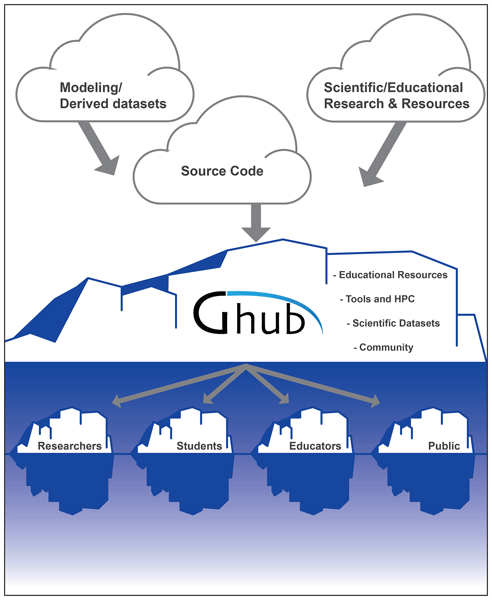
Ghub is an online platform that hosts tools, datasets, and educational resources related to ice sheet science. These resources are provided by ice sheet researchers and allow other researchers, students, educators, and interested members of the general public to analyze, visualize, and download datasets that researchers use to study past and present ice sheet behavior. We describe how users can interact with Ghub, showcase some available resources, and describe the future of the Ghub project.
Alamgir Hossan, Andreas Colliander, Baptiste Vandecrux, Nicole-Jeanne Schlegel, Joel Harper, Shawn Marshall, and Julie Z. Miller
The Cryosphere, 19, 4237–4258, https://doi.org/10.5194/tc-19-4237-2025, https://doi.org/10.5194/tc-19-4237-2025, 2025
Short summary
Short summary
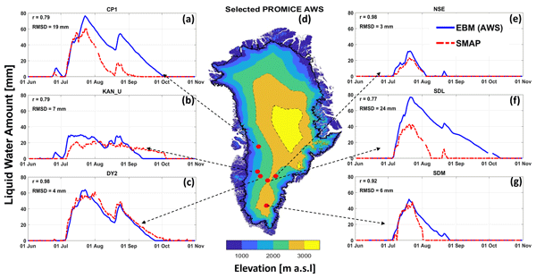
We used L-band observations from the Soil Moisture Active Passive (SMAP) mission to quantify the surface and subsurface liquid water amounts (LWAs) in the percolation zone of the Greenland ice sheet. The algorithm is described, and the validation results are provided. The results demonstrate the potential for creating an LWA data product across the Greenland ice sheet (GrIS), which will advance our understanding of ice sheet physical processes for better projection of Greenland’s contribution to global sea level rise.
Renée Mie Fredensborg Hansen, Henriette Skourup, Eero Rinne, Arttu Jutila, Isobel R. Lawrence, Andrew Shepherd, Knut Vilhelm Høyland, Jilu Li, Fernando Rodriguez-Morales, Sebastian Bjerregaaard Simonsen, Jeremy Wilkinson, Gaelle Veyssiere, Donghui Yi, René Forsberg, and Taniâ Gil Duarte Casal
The Cryosphere, 19, 4193–4209, https://doi.org/10.5194/tc-19-4193-2025, https://doi.org/10.5194/tc-19-4193-2025, 2025
Short summary
Short summary
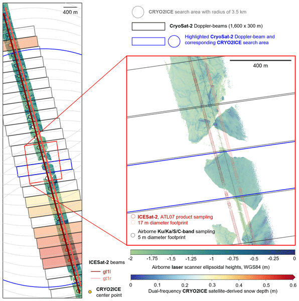
An airborne campaign collected unprecedented coincident multi-frequency radar and lidar data over sea ice along a CryoSat-2 and ICESat-2 (CRYO2ICE) orbit in the Weddell Sea, useful for evaluating microwave snow penetration. Ka-band and Ku-band had limited penetration with significant contributions from the air–snow interface, contradicting traditional assumptions with discrepancies between commonly used C/S-band "snow-radar" methodologies, all challenging comparisons of airborne and spaceborne estimates.
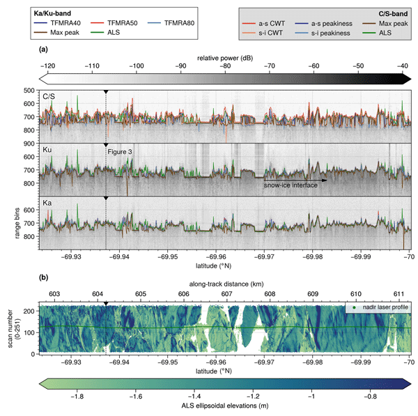
Renée Mie Fredensborg Hansen, Henriette Skourup, Eero Rinne, Arttu Jutila, Isobel R. Lawrence, Andrew Shepherd, Knut Vilhelm Høyland, Jilu Li, Fernando Rodriguez-Morales, Sebastian Bjerregaaard Simonsen, Jeremy Wilkinson, Gaelle Veyssiere, Donghui Yi, René Forsberg, and Taniâ Gil Duarte Casal
The Cryosphere, 19, 4167–4192, https://doi.org/10.5194/tc-19-4167-2025, https://doi.org/10.5194/tc-19-4167-2025, 2025
Short summary
Short summary
An airborne campaign collected unprecedented coincident multi-frequency radar and lidar data over sea ice along a CryoSat-2 and ICESat-2 (CRYO2ICE) orbit in the Weddell Sea, useful for evaluating microwave snow penetration. Ka-band and Ku-band had limited penetration with significant contributions from the air–snow interface, contradicting traditional assumptions with discrepancies between commonly used C/S-band "snow-radar" methodologies, all challenging comparisons of airborne and spaceborne estimates.
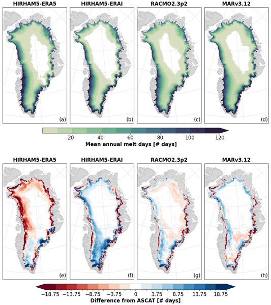
Anna Puggaard, Nicolaj Hansen, Ruth Mottram, Thomas Nagler, Stefan Scheiblauer, Sebastian B. Simonsen, Louise S. Sørensen, Jan Wuite, and Anne M. Solgaard
The Cryosphere, 19, 2963–2981, https://doi.org/10.5194/tc-19-2963-2025, https://doi.org/10.5194/tc-19-2963-2025, 2025
Short summary
Short summary
Regional climate models are currently the only source for assessing the melt volume of the Greenland Ice Sheet on a global scale. This study compares the modeled melt volume with observations from weather stations and melt extent observed from the Advanced SCATterometer (ASCAT) to assess the performance of the models. It highlights the importance of critically evaluating model outputs with high-quality satellite measurements to improve the understanding of variability among models.
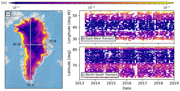
Kirk M. Scanlan, Anja Rutishauser, and Sebastian B. Simonsen
The Cryosphere, 19, 1221–1239, https://doi.org/10.5194/tc-19-1221-2025, https://doi.org/10.5194/tc-19-1221-2025, 2025
Short summary
Short summary
An ice sheet's surface modulates its response to climate change, and it is therefore critical to monitor how it evolves through time. Here, we investigate novel measurements of Greenland surface roughness based on the strength of reflected local airborne and pan-Greenland satellite radar signals. These measurements respond to roughness at scales typically larger than those considered in mass balance modelling while highlighting the scale dependency of surface roughness that is often overlooked.
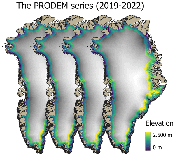
Mai Winstrup, Heidi Ranndal, Signe Hillerup Larsen, Sebastian B. Simonsen, Kenneth D. Mankoff, Robert S. Fausto, and Louise Sandberg Sørensen
Earth Syst. Sci. Data, 16, 5405–5428, https://doi.org/10.5194/essd-16-5405-2024, https://doi.org/10.5194/essd-16-5405-2024, 2024
Short summary
Short summary
Surface topography across the marginal zone of the Greenland Ice Sheet is constantly evolving. Here we present an annual series (2019–2022) of summer digital elevation models (PRODEMs) for the Greenland Ice Sheet margin, covering all outlet glaciers from the ice sheet. The PRODEMs are based on fusion of CryoSat-2 radar altimetry and ICESat-2 laser altimetry. With their high spatial and temporal resolution, the PRODEMs will enable detailed studies of the changes in marginal ice sheet elevations.
Beata Csatho, Tony Schenk, and Tom Neumann
Int. Arch. Photogramm. Remote Sens. Spatial Inf. Sci., XLVIII-3-2024, 83–88, https://doi.org/10.5194/isprs-archives-XLVIII-3-2024-83-2024, https://doi.org/10.5194/isprs-archives-XLVIII-3-2024-83-2024, 2024
Nanna B. Karlsson, Dustin M. Schroeder, Louise Sandberg Sørensen, Winnie Chu, Jørgen Dall, Natalia H. Andersen, Reese Dobson, Emma J. Mackie, Simon J. Köhn, Jillian E. Steinmetz, Angelo S. Tarzona, Thomas O. Teisberg, and Niels Skou
Earth Syst. Sci. Data, 16, 3333–3344, https://doi.org/10.5194/essd-16-3333-2024, https://doi.org/10.5194/essd-16-3333-2024, 2024
Short summary
Short summary
In the 1970s, more than 177 000 km of observations were acquired from airborne radar over the Greenland ice sheet. The radar data contain information on not only the thickness of the ice, but also the properties of the ice itself. This information was recorded on film rolls and subsequently stored. In this study, we document the digitization of these film rolls that shed new and unprecedented detailed light on the Greenland ice sheet 50 years ago.
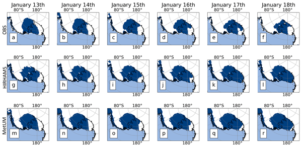
Nicolaj Hansen, Andrew Orr, Xun Zou, Fredrik Boberg, Thomas J. Bracegirdle, Ella Gilbert, Peter L. Langen, Matthew A. Lazzara, Ruth Mottram, Tony Phillips, Ruth Price, Sebastian B. Simonsen, and Stuart Webster
The Cryosphere, 18, 2897–2916, https://doi.org/10.5194/tc-18-2897-2024, https://doi.org/10.5194/tc-18-2897-2024, 2024
Short summary
Short summary
We investigated a melt event over the Ross Ice Shelf. We use regional climate models and a firn model to simulate the melt and compare the results with satellite data. We find that the firn model aligned well with observed melt days in certain parts of the ice shelf. The firn model had challenges accurately simulating the melt extent in the western sector. We identified potential reasons for these discrepancies, pointing to limitations in the models related to representing the cloud properties.
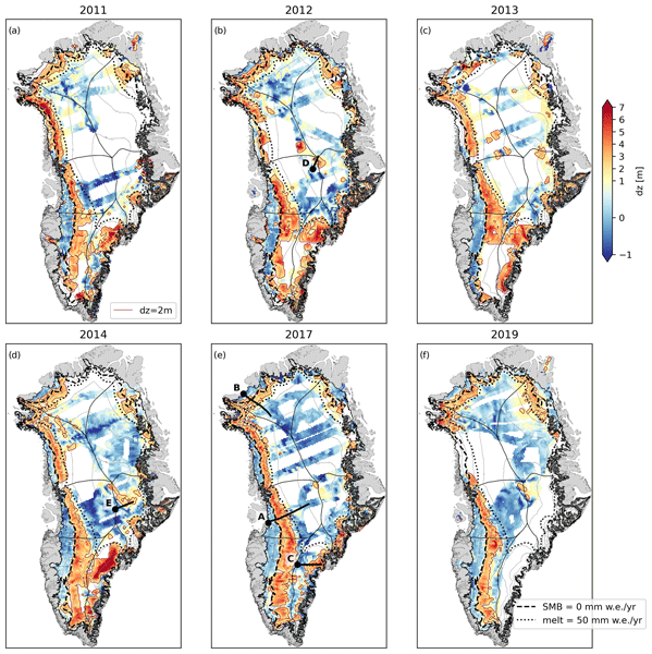
Anja Rutishauser, Kirk M. Scanlan, Baptiste Vandecrux, Nanna B. Karlsson, Nicolas Jullien, Andreas P. Ahlstrøm, Robert S. Fausto, and Penelope How
The Cryosphere, 18, 2455–2472, https://doi.org/10.5194/tc-18-2455-2024, https://doi.org/10.5194/tc-18-2455-2024, 2024
Short summary
Short summary
The Greenland Ice Sheet interior is covered by a layer of firn, which is important for surface meltwater runoff and contributions to global sea-level rise. Here, we combine airborne radar sounding and laser altimetry measurements to delineate vertically homogeneous and heterogeneous firn. Our results reveal changes in firn between 2011–2019, aligning well with known climatic events. This approach can be used to outline firn areas primed for significantly changing future meltwater runoff.
Jérôme Benveniste, Salvatore Dinardo, Luciana Fenoglio-Marc, Christopher Buchhaupt, Michele Scagliola, Marcello Passaro, Karina Nielsen, Marco Restano, Américo Ambrózio, Giovanni Sabatino, Carla Orrù, and Beniamino Abis
Proc. IAHS, 385, 457–463, https://doi.org/10.5194/piahs-385-457-2024, https://doi.org/10.5194/piahs-385-457-2024, 2024
Short summary
Short summary
This paper presents the RDSAR, SAR/SARin & FF-SAR altimetry processors available in the ESA Altimetry Virtual Lab (AVL) hosted on the EarthConsole® platform. An overview on processors and features as well as preliminary analyses using AVL output data are reported to demonstrate the quality of the ESA Altimetry Virtual Lab altimetry services in providing innovative solutions to the radar altimetry community. https://earthconsole.eu//
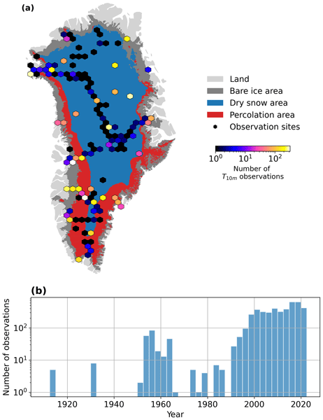
Baptiste Vandecrux, Robert S. Fausto, Jason E. Box, Federico Covi, Regine Hock, Åsa K. Rennermalm, Achim Heilig, Jakob Abermann, Dirk van As, Elisa Bjerre, Xavier Fettweis, Paul C. J. P. Smeets, Peter Kuipers Munneke, Michiel R. van den Broeke, Max Brils, Peter L. Langen, Ruth Mottram, and Andreas P. Ahlstrøm
The Cryosphere, 18, 609–631, https://doi.org/10.5194/tc-18-609-2024, https://doi.org/10.5194/tc-18-609-2024, 2024
Short summary
Short summary
How fast is the Greenland ice sheet warming? In this study, we compiled 4500+ temperature measurements at 10 m below the ice sheet surface (T10m) from 1912 to 2022. We trained a machine learning model on these data and reconstructed T10m for the ice sheet during 1950–2022. After a slight cooling during 1950–1985, the ice sheet warmed at a rate of 0.7 °C per decade until 2022. Climate models showed mixed results compared to our observations and underestimated the warming in key regions.
Laura Melling, Amber Leeson, Malcolm McMillan, Jennifer Maddalena, Jade Bowling, Emily Glen, Louise Sandberg Sørensen, Mai Winstrup, and Rasmus Lørup Arildsen
The Cryosphere, 18, 543–558, https://doi.org/10.5194/tc-18-543-2024, https://doi.org/10.5194/tc-18-543-2024, 2024
Short summary
Short summary
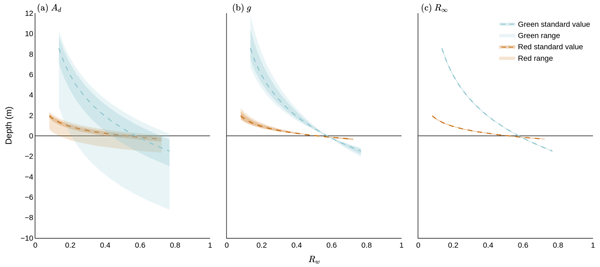
Lakes on glaciers hold large volumes of water which can drain through the ice, influencing estimates of sea level rise. To estimate water volume, we must calculate lake depth. We assessed the accuracy of three satellite-based depth detection methods on a study area in western Greenland and considered the implications for quantifying the volume of water within lakes. We found that the most popular method of detecting depth on the ice sheet scale has higher uncertainty than previously assumed.
Louise Sandberg Sørensen, Rasmus Bahbah, Sebastian B. Simonsen, Natalia Havelund Andersen, Jade Bowling, Noel Gourmelen, Alex Horton, Nanna B. Karlsson, Amber Leeson, Jennifer Maddalena, Malcolm McMillan, Anne Solgaard, and Birgit Wessel
The Cryosphere, 18, 505–523, https://doi.org/10.5194/tc-18-505-2024, https://doi.org/10.5194/tc-18-505-2024, 2024
Short summary
Short summary
Under the right topographic and hydrological conditions, lakes may form beneath the large ice sheets. Some of these subglacial lakes are active, meaning that they periodically drain and refill. When a subglacial lake drains rapidly, it may cause the ice surface above to collapse, and here we investigate how to improve the monitoring of active subglacial lakes in Greenland by monitoring how their associated collapse basins change over time.
Baptiste Vandecrux, Jason E. Box, Andreas P. Ahlstrøm, Signe B. Andersen, Nicolas Bayou, William T. Colgan, Nicolas J. Cullen, Robert S. Fausto, Dominik Haas-Artho, Achim Heilig, Derek A. Houtz, Penelope How, Ionut Iosifescu Enescu, Nanna B. Karlsson, Rebecca Kurup Buchholz, Kenneth D. Mankoff, Daniel McGrath, Noah P. Molotch, Bianca Perren, Maiken K. Revheim, Anja Rutishauser, Kevin Sampson, Martin Schneebeli, Sandy Starkweather, Simon Steffen, Jeff Weber, Patrick J. Wright, Henry Jay Zwally, and Konrad Steffen
Earth Syst. Sci. Data, 15, 5467–5489, https://doi.org/10.5194/essd-15-5467-2023, https://doi.org/10.5194/essd-15-5467-2023, 2023
Short summary
Short summary
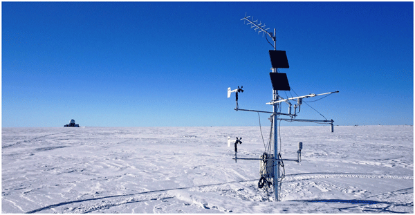
The Greenland Climate Network (GC-Net) comprises stations that have been monitoring the weather on the Greenland Ice Sheet for over 30 years. These stations are being replaced by newer ones maintained by the Geological Survey of Denmark and Greenland (GEUS). The historical data were reprocessed to improve their quality, and key information about the weather stations has been compiled. This augmented dataset is available at https://doi.org/10.22008/FK2/VVXGUT (Steffen et al., 2022).
Denis Felikson, Sophie Nowicki, Isabel Nias, Beata Csatho, Anton Schenk, Michael J. Croteau, and Bryant Loomis
The Cryosphere, 17, 4661–4673, https://doi.org/10.5194/tc-17-4661-2023, https://doi.org/10.5194/tc-17-4661-2023, 2023
Short summary
Short summary
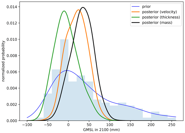
We narrow the spread in model simulations of the Greenland Ice Sheet using velocity change, dynamic thickness change, and mass change observations. We find that the type of observation chosen can lead to significantly different calibrated probability distributions. Further work is required to understand how to best calibrate ensembles of ice sheet simulations because this will improve probability distributions of projected sea-level rise, which is crucial for coastal planning and adaptation.
Nicolaj Hansen, Louise Sandberg Sørensen, Giorgio Spada, Daniele Melini, Rene Forsberg, Ruth Mottram, and Sebastian B. Simonsen
The Cryosphere Discuss., https://doi.org/10.5194/tc-2023-104, https://doi.org/10.5194/tc-2023-104, 2023
Preprint withdrawn
Short summary
Short summary
We use ICESat-2 to estimate the surface elevation change over Greenland and Antarctica in the period of 2018 to 2021. Numerical models have been used the compute the firn compaction and the vertical bedrock movement so non-mass-related elevation changes can be taken into account. We have made a parameterization of the surface density so we can convert the volume change to mass change. We find that Antarctica has lost 135.7±27.3 Gt per year, and the Greenland ice sheet 237.5±14.0 Gt per year.
Youjiang Shen, Karina Nielsen, Menaka Revel, Dedi Liu, and Dai Yamazaki
Earth Syst. Sci. Data, 15, 2781–2808, https://doi.org/10.5194/essd-15-2781-2023, https://doi.org/10.5194/essd-15-2781-2023, 2023
Short summary
Short summary
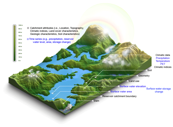
Res-CN fills a gap in a comprehensive and extensive dataset of reservoir-catchment characteristics for 3254 Chinese reservoirs with 512 catchment-level attributes and significantly enhanced spatial and temporal coverage (e.g., 67 % increase in water level and 225 % in storage anomaly) of time series of reservoir water level (data available for 20 % of 3254 reservoirs), water area (99 %), storage anomaly (92 %), and evaporation (98 %), supporting a wide range of applications and disciplines.
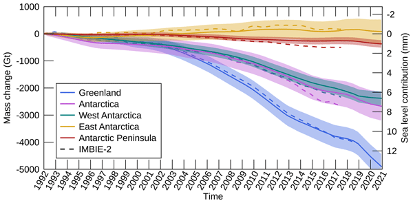
Inès N. Otosaka, Andrew Shepherd, Erik R. Ivins, Nicole-Jeanne Schlegel, Charles Amory, Michiel R. van den Broeke, Martin Horwath, Ian Joughin, Michalea D. King, Gerhard Krinner, Sophie Nowicki, Anthony J. Payne, Eric Rignot, Ted Scambos, Karen M. Simon, Benjamin E. Smith, Louise S. Sørensen, Isabella Velicogna, Pippa L. Whitehouse, Geruo A, Cécile Agosta, Andreas P. Ahlstrøm, Alejandro Blazquez, William Colgan, Marcus E. Engdahl, Xavier Fettweis, Rene Forsberg, Hubert Gallée, Alex Gardner, Lin Gilbert, Noel Gourmelen, Andreas Groh, Brian C. Gunter, Christopher Harig, Veit Helm, Shfaqat Abbas Khan, Christoph Kittel, Hannes Konrad, Peter L. Langen, Benoit S. Lecavalier, Chia-Chun Liang, Bryant D. Loomis, Malcolm McMillan, Daniele Melini, Sebastian H. Mernild, Ruth Mottram, Jeremie Mouginot, Johan Nilsson, Brice Noël, Mark E. Pattle, William R. Peltier, Nadege Pie, Mònica Roca, Ingo Sasgen, Himanshu V. Save, Ki-Weon Seo, Bernd Scheuchl, Ernst J. O. Schrama, Ludwig Schröder, Sebastian B. Simonsen, Thomas Slater, Giorgio Spada, Tyler C. Sutterley, Bramha Dutt Vishwakarma, Jan Melchior van Wessem, David Wiese, Wouter van der Wal, and Bert Wouters
Earth Syst. Sci. Data, 15, 1597–1616, https://doi.org/10.5194/essd-15-1597-2023, https://doi.org/10.5194/essd-15-1597-2023, 2023
Short summary
Short summary
By measuring changes in the volume, gravitational attraction, and ice flow of Greenland and Antarctica from space, we can monitor their mass gain and loss over time. Here, we present a new record of the Earth’s polar ice sheet mass balance produced by aggregating 50 satellite-based estimates of ice sheet mass change. This new assessment shows that the ice sheets have lost (7.5 x 10¹²) t of ice between 1992 and 2020, contributing 21 mm to sea level rise.
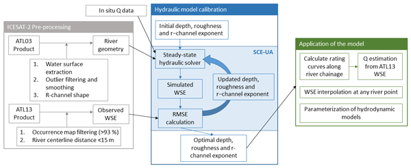
Monica Coppo Frias, Suxia Liu, Xingguo Mo, Karina Nielsen, Heidi Ranndal, Liguang Jiang, Jun Ma, and Peter Bauer-Gottwein
Hydrol. Earth Syst. Sci., 27, 1011–1032, https://doi.org/10.5194/hess-27-1011-2023, https://doi.org/10.5194/hess-27-1011-2023, 2023
Short summary
Short summary
This paper uses remote sensing data from ICESat-2 to calibrate a 1D hydraulic model. With the model, we can make estimations of discharge and water surface elevation, which are important indicators in flooding risk assessment. ICESat-2 data give an added value, thanks to the 0.7 m resolution, which allows the measurement of narrow river streams. In addition, ICESat-2 provides measurements on the river dry portion geometry that can be included in the model.

Youjiang Shen, Dedi Liu, Liguang Jiang, Karina Nielsen, Jiabo Yin, Jun Liu, and Peter Bauer-Gottwein
Earth Syst. Sci. Data, 14, 5671–5694, https://doi.org/10.5194/essd-14-5671-2022, https://doi.org/10.5194/essd-14-5671-2022, 2022
Short summary
Short summary
A data gap of 338 Chinese reservoirs with their surface water area (SWA), water surface elevation (WSE), and reservoir water storage change (RWSC) during 2010–2021. Validation against the in situ observations of 93 reservoirs indicates the relatively high accuracy and reliability of the datasets. The unique and novel remotely sensed dataset would benefit studies involving many aspects (e.g., hydrological models, water resources related studies, and more).
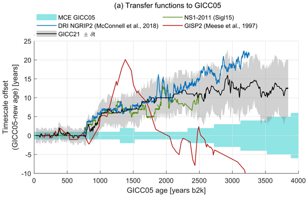
Giulia Sinnl, Mai Winstrup, Tobias Erhardt, Eliza Cook, Camilla Marie Jensen, Anders Svensson, Bo Møllesøe Vinther, Raimund Muscheler, and Sune Olander Rasmussen
Clim. Past, 18, 1125–1150, https://doi.org/10.5194/cp-18-1125-2022, https://doi.org/10.5194/cp-18-1125-2022, 2022
Short summary
Short summary
A new Greenland ice-core timescale, covering the last 3800 years, was produced using the machine learning algorithm StratiCounter. We synchronized the ice cores using volcanic eruptions and wildfires. We compared the new timescale to the tree-ring timescale, finding good alignment both between the common signatures of volcanic eruptions and of solar activity. Our Greenlandic timescales is safe to use for the Late Holocene, provided one uses our uncertainty estimate.
Paolo Gabrielli, Theo Manuel Jenk, Michele Bertó, Giuliano Dreossi, Daniela Festi, Werner Kofler, Mai Winstrup, Klaus Oeggl, Margit Schwikowski, Barbara Stenni, and Carlo Barbante
Clim. Past Discuss., https://doi.org/10.5194/cp-2022-20, https://doi.org/10.5194/cp-2022-20, 2022
Revised manuscript not accepted
Short summary
Short summary
We present a methodology that reduces the chronological uncertainty of an Alpine ice core record from the glacier Alto dell’Ortles, Italy. This chronology will allow the constraint of the Holocene climatic and environmental histories emerging from this archive of Central Europe. This method will allow to obtain accurate chronologies also from other ice cores from-low latitude/high-altitude glaciers that typically suffer from larger dating uncertainties compared with well dated polar records.
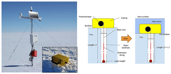
Michael J. MacFerrin, C. Max Stevens, Baptiste Vandecrux, Edwin D. Waddington, and Waleed Abdalati
Earth Syst. Sci. Data, 14, 955–971, https://doi.org/10.5194/essd-14-955-2022, https://doi.org/10.5194/essd-14-955-2022, 2022
Short summary
Short summary
The vast majority of the Greenland ice sheet's surface is covered by pluriannual snow, also called firn, that accumulates year after year and is compressed into glacial ice. The thickness of the firn layer changes through time and responds to the surface climate. We present continuous measurement of the firn compaction at various depths for eight sites. The dataset will help to evaluate firn models, interpret ice cores, and convert remotely sensed ice sheet surface height change to mass loss.
Nicolaj Hansen, Sebastian B. Simonsen, Fredrik Boberg, Christoph Kittel, Andrew Orr, Niels Souverijns, J. Melchior van Wessem, and Ruth Mottram
The Cryosphere, 16, 711–718, https://doi.org/10.5194/tc-16-711-2022, https://doi.org/10.5194/tc-16-711-2022, 2022
Short summary
Short summary
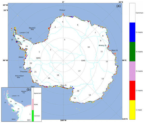
We investigate the impact of different ice masks when modelling surface mass balance over Antarctica. We used ice masks and data from five of the most used regional climate models and a common mask. We see large disagreement between the ice masks, which has a large impact on the surface mass balance, especially around the Antarctic Peninsula and some of the largest glaciers. We suggest a solution for creating a new, up-to-date, high-resolution ice mask that can be used in Antarctic modelling.
Martin Horwath, Benjamin D. Gutknecht, Anny Cazenave, Hindumathi Kulaiappan Palanisamy, Florence Marti, Ben Marzeion, Frank Paul, Raymond Le Bris, Anna E. Hogg, Inès Otosaka, Andrew Shepherd, Petra Döll, Denise Cáceres, Hannes Müller Schmied, Johnny A. Johannessen, Jan Even Øie Nilsen, Roshin P. Raj, René Forsberg, Louise Sandberg Sørensen, Valentina R. Barletta, Sebastian B. Simonsen, Per Knudsen, Ole Baltazar Andersen, Heidi Ranndal, Stine K. Rose, Christopher J. Merchant, Claire R. Macintosh, Karina von Schuckmann, Kristin Novotny, Andreas Groh, Marco Restano, and Jérôme Benveniste
Earth Syst. Sci. Data, 14, 411–447, https://doi.org/10.5194/essd-14-411-2022, https://doi.org/10.5194/essd-14-411-2022, 2022
Short summary
Short summary
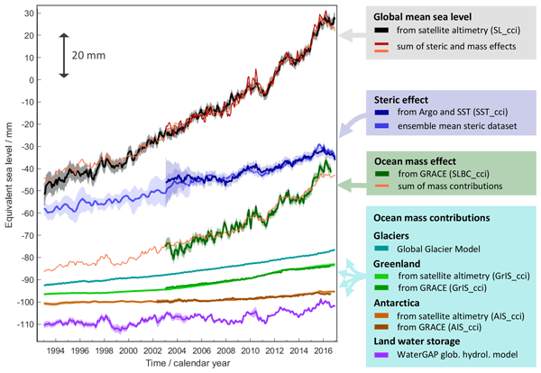
Global mean sea-level change observed from 1993 to 2016 (mean rate of 3.05 mm yr−1) matches the combined effect of changes in water density (thermal expansion) and ocean mass. Ocean-mass change has been assessed through the contributions from glaciers, ice sheets, and land water storage or directly from satellite data since 2003. Our budget assessments of linear trends and monthly anomalies utilise new datasets and uncertainty characterisations developed within ESA's Climate Change Initiative.
Kenneth D. Mankoff, Xavier Fettweis, Peter L. Langen, Martin Stendel, Kristian K. Kjeldsen, Nanna B. Karlsson, Brice Noël, Michiel R. van den Broeke, Anne Solgaard, William Colgan, Jason E. Box, Sebastian B. Simonsen, Michalea D. King, Andreas P. Ahlstrøm, Signe Bech Andersen, and Robert S. Fausto
Earth Syst. Sci. Data, 13, 5001–5025, https://doi.org/10.5194/essd-13-5001-2021, https://doi.org/10.5194/essd-13-5001-2021, 2021
Short summary
Short summary
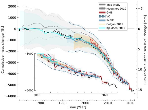
We estimate the daily mass balance and its components (surface, marine, and basal mass balance) for the Greenland ice sheet. Our time series begins in 1840 and has annual resolution through 1985 and then daily from 1986 through next week. Results are operational (updated daily) and provided for the entire ice sheet or by commonly used regions or sectors. This is the first input–output mass balance estimate to include the basal mass balance.
Cited articles
Adhikari, S., Milne, G. A., Caron, L., Khan, S. A., Kjeldsen, K. K., Nilsson, J., Larour, E., and Ivins, E. R.: Decadal to Centennial Timescale Mantle Viscosity Inferred From Modern Crustal Uplift Rates in Greenland, Geophys. Res. Lett., 48, https://doi.org/10.1029/2021GL094040, 2021. a
Ahlstrøm, A. P. and PROMICE project team: A new programme for monitoring the mass loss of the Greenland ice sheet, GEUS Bulletin, 15, 61–64, https://doi.org/10.34194/geusb.v15.5045, 2008. a
Andersen, N. H.: Monthly Surface Elevation Changes over the Greenland Ice Sheet from January 2011 to July 2024, Technical University of Denmark [data set], https://doi.org/10.11583/DTU.27143514, 2025. a
Andersen, N. H., Simonsen, S. B., Winstrup, M., Nilsson, J., and Sørensen, L. S.: Regional assessments of surface ice elevations from swath-processed SARin data from CryoSat-2, Remote Sens., 13, 1–15, https://doi.org/10.3390/rs13112213, 2021. a
Armitage, T. W. K. and Davidson, M. W. J.: Using the Interferometric Capabilities of the ESA CryoSat-2 Mission to Improve the Accuracy of Sea Ice Freeboard Retrievals, IEEE Trans. Geosci. Remote Sens., 52, 529–536, https://doi.org/10.1109/TGRS.2013.2242082, 2014. a
Aublanc, J., Thibaut, P., Guillot, A., Boy, F., and Picot, N.: Ice Sheet Topography from a New CryoSat-2 SARIn Processing Chain, and Assessment by Comparison to ICESat-2 over Antarctica, Remote Sens., 13, 4508, https://doi.org/10.3390/rs13224508, 2021. a
Bamber, J. and Riva, R.: The sea level fingerprint of recent ice mass fluxes, The Cryosphere, 4, 621–627, https://doi.org/10.5194/tc-4-621-2010, 2010. a
Bevan, S. L., Luckman, A., Khan, S. A., and Murray, T.: Seasonal dynamic thinning at Helheim Glacier, Earth Planet. Sci. Lett., 415, 47–53, https://doi.org/10.1016/j.epsl.2015.01.031, 2015. a
Box, J. E., Hubbard, A., Bahr, D. B., Colgan, W. T., Fettweis, X., Mankoff, K. D., Wehrlé, A., Noël, B., van den Broeke, M. R., Wouters, B., Bjørk, A. A., and Fausto, R. S.: Greenland ice sheet climate disequilibrium and committed sea-level rise, Nat. Clim. Change, 12, 808–813, https://doi.org/10.1038/s41558-022-01441-2, 2022. a
Chylek, P., Folland, C. K., Klett, J. D., Wang, M., Hengartner, N., Lesins, G., and Dubey, M. K.: Annual mean Arctic amplification 1970–2020: Observed and simulated by CMIP6 climate models, Geophys. Res. Lett., 49, https://doi.org/10.1029/2022GL099371, 2022. a
Csatho, B. M., Schenk, A. F., van der Veen, C. J., Babonis, G., Duncan, K., Rezvanbehbahani, S., van den Broeke, M. R., Simonsen, S. B., Nagarajan, S., and van Angelen, J. H.: Laser altimetry reveals complex pattern of Greenland Ice Sheet dynamics, Proc. Natl. Acad. Sci. USA, 111, 18478–18483, https://doi.org/10.1073/pnas.1411680112, 2014. a, b
Fausto, R. S., van As, D., Mankoff, K. D., Vandecrux, B., Citterio, M., Ahlstrøm, A. P., Andersen, S. B., Colgan, W., Karlsson, N. B., Kjeldsen, K. K., Korsgaard, N. J., Larsen, S. H., Nielsen, S., Pedersen, A. Ø., Shields, C. L., Solgaard, A. M., and Box, J. E.: Programme for Monitoring of the Greenland Ice Sheet (PROMICE) automatic weather station data, Earth Syst. Sci. Data, 13, 3819–3845, https://doi.org/10.5194/essd-13-3819-2021, 2021. a, b
Forsberg, R., Sørensen, L., and Simonsen, S.: Greenland and Antarctica Ice Sheet Mass Changes and Effects on Global Sea Level, in: Integrative Study of the Mean Sea Level and Its Components, edited by: Cazenave, A., Champollion, N., Paul, F., and Benveniste, J., Space Sciences Series of ISSI, vol. 58, 91–106, Springer, Cham, https://doi.org/10.1007/978-3-319-56490-6_5, 2017. a
Fredensborg Hansen, R. M., Skourup, H., Rinne, E., Jutila, A., Lawrence, I. R., Shepherd, A., Høyland, K. V., Li, J., Rodriguez-Morales, F., Simonsen, S. B., Wilkinson, J., Veyssiere, G., Yi, D., Forsberg, R., and Casal, T. G. D.: Multi-frequency altimetry snow depth estimates over heterogeneous snow-covered Antarctic summer sea ice – Part 1: C∕S-, Ku-, and Ka-band airborne observations, The Cryosphere, 19, 4167–4192, https://doi.org/10.5194/tc-19-4167-2025, 2025. a
Gallagher, N. B.: Savitzky-Golay smoothing and differentiation filter, Control System Engineering, https://doi.org/10.13140/RG.2.2.20339.50725, 2020. a
Gardner, A. S., Moholdt, G., Cogley, J. G., Wouters, B., Arendt, A. A., Wahr, J., Berthier, E., Hock, R., Pfeffer, W. T., Kaser, G., Ligtenberg, S. R. M., Bolch, T., Sharp, M. J., Hagen, J. O., van den Broeke, M. R., and Paul, F.: A reconciled estimate of glacier contributions to sea-level rise: 2003 to 2009, Science, 340, 852–857, https://doi.org/10.1126/science.1234532, 2013. a
Gardner, A. S., Schlegel, N.-J., and Larour, E.: Glacier Energy and Mass Balance (GEMB): a model of firn processes for cryosphere research, Geosci. Model Dev., 16, 2277–2302, https://doi.org/10.5194/gmd-16-2277-2023, 2023. a
Gourmelen, N., Escorihuela, M., Shepherd, A., Foresta, L., Muir, A., Garcia-Mondéjar, A., Roca, M., Baker, S. G., and Drinkwater, M. R.: CryoSat-2 swath interferometric altimetry for mapping ice elevation and elevation change, Adv. Space Res., 62, 1226–1242, https://doi.org/10.1016/j.asr.2017.11.014, 2018. a
Gray, L., Burgess, D., Copland, L., Cullen, R., Galin, N., Hawley, R., and Helm, V.: Interferometric swath processing of Cryosat data for glacial ice topography, The Cryosphere, 7, 1857–1867, https://doi.org/10.5194/tc-7-1857-2013, 2013. a
Helm, V., Dehghanpour, A., Hänsch, R., Loebel, E., Horwath, M., and Humbert, A.: AWI-ICENet1: a convolutional neural network retracker for ice altimetry, The Cryosphere, 18, 3933–3970, https://doi.org/10.5194/tc-18-3933-2024, 2024. a
Hansen, K., Truffer, M., Aschwanden, A., Mankoff, K., Bevis, M., Humbert, A., van den Broeke, M. R., Noël, B., Bjørk, A., Colgan, W., Kjær, K. H., Adhikari, S., Barletta, V., and Khan, S. A.: Estimating ice discharge at Greenland's three largest outlet glaciers using local bedrock uplift, Geophys. Res. Lett., 48, https://doi.org/10.1029/2021GL094252, 2021. a, b
Hugonnet, R., McNabb, R., Berthier, E., Menounos, B., Nuth, C., Girod, L., Farinotti, D., Huss, M., Dussaillant, I., Brun, F., and Kääb, A.: Accelerated global glacier mass loss in the early twenty-first century, Nature, 592, 726–731, https://doi.org/10.1038/s41586-021-03436-z, 2021. a
How, P., Lund, M. C., Ahlstrøm, A. P., Andersen, S. B., Box, J. E., Citterio, M., Colgan, W. T., Fausto, R. S., Karlsson, N. B., Jakobsen, J., Jakobsgaard, H. T., Larsen, S. H., Mankoff, K. D., Nielsen, R. B., Rutishauser, A., Shield, C. L., Solgaard, A. M., Stevens, I. T., van As, D., Vandecrux, B., Abermann, J., Bjørk, A. A., Langley, K., Lea, J., Messerli, A., and Prinz, R.: PROMICE and GC-Net automated weather station data in Greenland, GEUS Dataverse [data set], https://doi.org/10.22008/FK2/IW73UU, 2022. a
Hui: hui-97/SERAC-FDM-fusion: SERAC-FDM-fusion v1.0, Zenodo [data set], https://doi.org/10.5281/zenodo.21776195, 2026. a
Joughin, I., Smith, B. E., Shean, D. E., and Floricioiu, D.: Brief Communication: Further summer speedup of Jakobshavn Isbræ, The Cryosphere, 8, 209–214, https://doi.org/10.5194/tc-8-209-2014, 2014. a
Joughin, I., Shean, D. E., Smith, B. E., and Floricioiu, D.: A decade of variability on Jakobshavn Isbræ: ocean temperatures pace speed through influence on mélange rigidity, The Cryosphere, 14, 211–227, https://doi.org/10.5194/tc-14-211-2020, 2020. a
Kehrl, L. M., Joughin, I., Shean, D. E., Floricioiu, D., and Krieger, L.: Seasonal and interannual variabilities in terminus position, glacier velocity, and surface elevation at Helheim and Kangerlussuaq Glaciers from 2008 to 2016, J. Geophys. Res.-Earth Surf., 122, 1635–1652, https://doi.org/10.1002/2016JF004133, 2017. a
Khan, S. A., Mernild, S. H., and Kjeldsen, K. K.: Accelerating ice loss from peripheral glaciers in North Greenland, Geophys. Res. Lett., 49, https://doi.org/10.1029/2022GL098915, 2022. a, b
Khan, S. A., Seroussi, H., Morlighem, M., Colgan, W., Helm, V., Cheng, G., Berg, D., Barletta, V. R., Larsen, N. K., Kochtitzky, W., van den Broeke, M., Kjær, K. H., Aschwanden, A., Noël, B., Box, J. E., MacGregor, J. A., Fausto, R. S., Mankoff, K. D., Howat, I. M., Oniszk, K., Fahrner, D., Løkkegaard, A., Lippert, E. Y. H., Bråtner, A., and Hassan, J.: Smoothed monthly Greenland ice sheet elevation changes during 2003–2023, Earth Syst. Sci. Data, 17, 3047–3071, https://doi.org/10.5194/essd-17-3047-2025, 2025. a, b, c, d, e, f, g, h, i
Khazendar, A., Fenty, I. G., Carroll, D., Gardner, A., Lee, C. M., Fukumori, I., Wang, O., Zhang, H., Seroussi, H., Moller, D., Noël, B. P. Y., van den Broeke, M. R., Dinardo, S., and Willis, J.: Interruption of two decades of Jakobshavn Isbræ acceleration and thinning as regional ocean cools, Nature Geosci., 12, 277–283, https://doi.org/10.1038/s41561-019-0329-3, 2019. a
Kristensen, K., Nielsen, A., Berg, C. W., Skaug, H., and Bell, B. M.: TMB: Automatic Differentiation and Laplace Approximation, J. Stat. Softw., 70, 1–21, https://doi.org/10.18637/jss.v070.i05, 2016. a, b, c
Lai, Y.-R. and Wang, L.: Monthly surface elevation changes of the Greenland Ice Sheet from ICESat-1, CryoSat-2, and ICESat-2 altimetry missions, IEEE Geosci. Remote Sens. Lett., 19, 1–5, https://doi.org/10.1109/LGRS.2021.3058956, 2022. a, b
Lindgren, F., Rue, H., and Lindström, J.: An explicit link between Gaussian fields and Gaussian Markov random fields: the stochastic partial differential equation approach, J. R. Stat. Soc. Ser. B Stat. Methodol., 73, 423–498, https://doi.org/10.1111/j.1467-9868.2011.00777.x, 2011. a
Liu, L., Khan, S. A., van Dam, T., Ma, J. H. Y., and Bevis, M.: Annual variations in GPS-measured vertical displacements near Upernavik Isstrøm (Greenland) and contributions from surface mass loading, J. Geophys. Res.-Sol. Ea., 122, 718–734,https://doi.org/10.1002/2016JB013494, 2017. a
Løkkegaard, A., Colgan, W., Hansen, K., Thorsøe, K., Jakobsen, J., and Khan, S. A.: Ice acceleration and rotation in the Greenland Ice Sheet interior in recent decades, Commun. Earth Environ., 5, 211, https://doi.org/10.1038/s43247-024-01322-w, 2024. a
MacGregor, J. A., Boisvert, L. N., Medley, B., et al.: The Scientific Legacy of NASA’s Operation IceBridge, Rev. Geophys., 59, https://doi.org/10.1029/2020RG000712, 2021. a
Markus, T., Neumann, T., Martino, A., Abdalati, W., Brunt, K., Csatho, B., Farrell, S., Fricker, H., Gardner, A., Harding, D., Jasinski, M., Kwok, R., Magruder, L., Lubin, D., Luthcke, S., Morison, J., Nelson, R., Neuenschwander, A., Palm, S., Popescu, S., Shum, C. K., Schutz, B. E., Smith, B., Yang, Y., and Zwally, J.: The Ice, Cloud, and land Elevation Satellite-2 (ICESat-2): Science requirements, concept, and implementation, Remote Sens. Environ., 190, 260–273, https://doi.org/10.1016/j.rse.2016.12.029, 2017. a
Milne, G. A., Latychev, K., Schaeffer, A., Crowley, J. W., Lecavalier, B. S., and Audette, A.: The influence of lateral Earth structure on glacial isostatic adjustment in Greenland, Geophys. J. Int., 214, 1252–1266, https://doi.org/10.1093/gji/ggy189, 2018. a
Moon, T., Sutherland, D. A., Carroll, D., Felikson, D., Kehrl, L., and Straneo, F.: Subsurface iceberg melt key to Greenland fjord freshwater budget, Nature Geosci., 11, 49–54, https://doi.org/10.1038/s41561-017-0018-z, 2018. a
Mouginot, J., Rignot, E., Bjørk, A. A., van den Broeke, M., Millan, R., Morlighem, M., Noël, B., Scheuchl, B., and Wood, M.: Forty-six years of Greenland Ice Sheet mass balance from 1972 to 2018, Proc. Natl. Acad. Sci. USA, 116, https://doi.org/10.1073/pnas.1904242116, 2019. a, b
Nielsen, K., Zakharova, E., Tarpanelli, A., Andersen, O. B., and Benveniste, J.: River levels from multi mission altimetry, a statistical approach, Remote Sens. Environ., 270, 112876, https://doi.org/10.1016/j.rse.2021.112876, 2022. a
Nilsson, J. and Gardner, A. S.: Elevation change of the Greenland Ice Sheet and its peripheral glaciers: 1992–2023, Earth Syst. Sci. Data, 18, 1729–1745, https://doi.org/10.5194/essd-18-1729-2026, 2026. a
Nilsson, J., Gardner, A., Sandberg Sørensen, L., and Forsberg, R.: Improved retrieval of land ice topography from CryoSat-2 data and its impact for volume-change estimation of the Greenland Ice Sheet, The Cryosphere, 10, 2953–2969, https://doi.org/10.5194/tc-10-2953-2016, 2016. a
Otosaka, I. N., Horwath, M., Mottram, R., and Nowicki, S.: Mass Balances of the Antarctic and Greenland Ice Sheets Monitored from Space, Surv. Geophys., 44, 1615–1652, https://doi.org/10.1007/s10712-023-09795-8, 2023. a, b
Porter, C., Howat, I., Noh, M.-J., Husby, E., Khuvis, S., Danish, E., Tomko, K., Gardiner, J., Negrete, A., Yadav, B., Klassen, J., Kelleher, C., Cloutier, M., Bakker, J., Enos, J., Arnold, G., Bauer, G., and Morin, P.: ArcticDEM – Mosaics, Version 4.1, Harvard Dataverse, V1, https://doi.org/10.7910/DVN/3VDC4W, 2023. a
Rantanen, M., Karpechko, A. Y., Lipponen, A., Nordling, K., Hyvärinen, O., Ruosteenoja, K., Vihma, T., and Laaksonen, A.: The Arctic has warmed nearly four times faster than the globe since 1979, Commun. Earth Environ., 3, 168, https://doi.org/10.1038/s43247-022-00498-3, 2023. a
Ravinder, N., Shepherd, A., Otosaka, I., Slater, T., Muir, A., and Gilbert, L.: Greenland Ice Sheet elevation change from CryoSat‐2 and ICESat‐2, Geophys. Res. Lett., 51, https://doi.org/10.1029/2024GL110822, 2024. a, b
Rémy, F. and Parouty, S.: Antarctic Ice Sheet and Radar Altimetry: A Review, Remote Sens., 1, 1212–1239, https://doi.org/10.3390/rs1041212, 2009. a
Ricker, R., Hendricks, S., Helm, V., Skourup, H., and Davidson, M.: Sensitivity of CryoSat-2 Arctic sea-ice freeboard and thickness on radar-waveform interpretation, The Cryosphere, 8, 1607–1622, https://doi.org/10.5194/tc-8-1607-2014, 2014. a
Ridley, J. K. and Partington, K. C.: A model of satellite radar altimeter return from ice sheets, Int. J. Remote Sens., 9, 601–624, https://doi.org/10.1080/01431168808954881, 1988. a
Rignot, E. and Mouginot, J.: Ice flow in Greenland for the International Polar Year 2008–2009, Geophys. Res. Lett., 6, 115–123, https://doi.org/10.1029/2012GL051634, 2012.
Rue, H. and Held, L.: Gaussian Markov Random Fields: Theory and Applications, Chapman & Hall/CRC, Monographs on Statistics and Applied Probability, Vol. 104, https://doi.org/10.1201/9780203492024, 2005. a
Schenk, T. and Csatho, B.: A New Methodology for Detecting Ice Sheet Surface Elevation Changes From Laser Altimetry Data, IEEE Trans. Geosci. Remote Sens., 50, 3302–3316, https://doi.org/10.1109/TGRS.2011.2182357, 2012. a
Schenk, T., Csatho, B., van der Veen, C., and McCormick, D.: Fusion of multi-sensor surface elevation data for improved characterization of rapidly changing outlet glaciers in Greenland, Remote Sens. Environ., 149, 239–251, https://doi.org/10.1016/j.rse.2014.04.005, 2014. a
Shekhar, P., Csatho, B., Schenk, T., Roberts, C., and Patra, A. K.: ALPS: A Unified Framework for Modeling Time Series of Land Ice Changes, IEEE Trans. Geosci. Remote Sens., 59, 6466–6481, https://doi.org/10.1109/TGRS.2020.3027190, 2021. a, b, c
Simonsen, S. B. and Sørensen, L. S.: Implications of changing scattering properties on Greenland ice sheet volume change from CryoSat-2 altimetry, Remote Sens. Environ., 190, 207–216, https://doi.org/10.1016/j.rse.2016.12.012, 2017. a, b
Simonsen, S. B., Barletta, V. R., Colgan, W. T., and Sørensen, L. S.: Greenland Ice Sheet mass balance (1992–2020) from calibrated radar altimetry, Geophys. Res. Lett., 48, https://doi.org/10.1029/2020GL091216, 2021. a
Smith, B., Sutterley, T., Dickinson, S., Jelley, B. P., Felikson, D., Neumann, T. A., Fricker, H. A., Gardner, A. S., Padman, L., Markus, T., Kurtz, N., Bhardwaj, S., Hancock, D., and Lee, J.: ATLAS/ICESat-2 L3B Gridded Antarctic and Arctic Land Ice Height Change (ATL15, Version 2), NASA National Snow and Ice Data Center Distributed Active Archive Center [data set], https://doi.org/10.5067/ATLAS/ATL15.002, 2022. a, b
Studinger, M.: IceBridge ATM L4 Surface Elevation Rate of Change (IDHDT4, Version 1), NASA National Snow and Ice Data Center Distributed Active Archive Center [data set], https://doi.org/10.5067/BCW6CI3TXOCY, 2014. a, b
Sweeney, A. J., Fu, Q., Po‐Chedley, S., Wang, H., and Wang, M.: Internal variability increased Arctic amplification during 1980–2022, Geophys. Res. Lett., 50, https://doi.org/10.1029/2023GL106060, 2023. a
Sørensen, L., Simonsen, S., Forsberg, R., Khvorostovsky, K., Meister, R., and Engdahl, M. E.: 25 years of elevation changes of the Greenland Ice Sheet from ERS, Envisat, and CryoSat-2 radar altimetry, Earth Planet. Sci. Lett., 495, 234–241, https://doi.org/10.1016/j.epsl.2018.05.015, 2018. a, b, c, d
The IMBIE Team: Mass balance of the Greenland Ice Sheet from 1992 to 2018, Nature, 579, 233–239, https://doi.org/10.1038/s41586-019-1855-2, 2020. a, b
Vandecrux, B., Fausto, R. S., Box, J. E., Covi, F., Hock, R., Rennermalm, Å. K., Heilig, A., Abermann, J., van As, D., Bjerre, E., Fettweis, X., Smeets, P. C. J. P., Kuipers Munneke, P., van den Broeke, M. R., Brils, M., Langen, P. L., Mottram, R., and Ahlstrøm, A. P.: Recent warming trends of the Greenland ice sheet documented by historical firn and ice temperature observations and machine learning, The Cryosphere, 18, 609–631, https://doi.org/10.5194/tc-18-609-2024, 2024. a, b, c
Williams, J. J., Gourmelen, N., and Nienow, P.: Complex multi-decadal ice dynamical change inland of marine-terminating glaciers on the Greenland Ice Sheet, J. Glaciol., 67, 833–846, https://doi.org/10.1017/jog.2021.31, 2021. a
Wingham, D. J., Francis, C. R., Baker, S., Bouzinac, C., Brockley, D., Cullen, R., de Chateau-Thierry, P., Laxon, S. W., Mallow, U., Mavrocordatos, C., Phalippou, L., Ratier, G., Rey, L., Rostan, F., Viau, P., and Wallis, D. W.: CryoSat: A mission to determine the fluctuations in Earth’s land and marine ice fields, Adv. Space Res., 37, 841–871, https://doi.org/10.1016/j.asr.2005.07.027, 2006. a
Zwally, H. J., Schutz, B., Abdalati, W., Abshire, J., Bentley, C., Brenner, A., Bufton, J., Dezio, J., Hancock, D., Harding, D., Herring, T., Minster, B., Quinn, K., Palm, S., Spinhirne, J., and Thomas, R.: ICESat’s laser measurements of polar ice, atmosphere, ocean, and land, J. Geodyn., 34, 405–445, https://doi.org/10.1016/S0264-3707(02)00042-X, 2002. a
Short summary
We developed a new statistical approach to track monthly changes in the surface height of the Greenland Ice Sheet using radar data from the CryoSat-2 satellite (2011–2025). The method lets seasonal and long-term variations emerge directly from the data, creating a consistent record of elevation change that helps reveal how Greenland responds to ongoing climate change.
We developed a new statistical approach to track monthly changes in the surface height of the...


