
Articles | Volume 16, issue 8
https://doi.org/10.5194/tc-16-3393-2022
© Author(s) 2022. This work is distributed under
the Creative Commons Attribution 4.0 License.
the Creative Commons Attribution 4.0 License.
https://doi.org/10.5194/tc-16-3393-2022
© Author(s) 2022. This work is distributed under
the Creative Commons Attribution 4.0 License.
the Creative Commons Attribution 4.0 License.
Research article
| 
29 Aug 2022
Research article |
| 29 Aug 2022
| 29 Aug 2022
Using snow depth observations to provide insight into the quality of snowpack simulations for regional-scale avalanche forecasting
School of Resource and Environmental Management, Simon Fraser University, Burnaby, BC, Canada
Avalanche Canada, Revelstoke, BC, Canada
Pascal Haegeli
School of Resource and Environmental Management, Simon Fraser University, Burnaby, BC, Canada
Related authors
Florian Herla, Pascal Haegeli, Simon Horton, and Patrick Mair
Nat. Hazards Earth Syst. Sci., 25, 625–646, https://doi.org/10.5194/nhess-25-625-2025, https://doi.org/10.5194/nhess-25-625-2025, 2025
Short summary
Short summary
We present a spatial framework for extracting information about avalanche problems from detailed snowpack simulations and compare the numerical results against operational assessments from avalanche forecasters. Despite good agreement in seasonal summary statistics, a comparison of daily assessments revealed considerable differences, while it remained unclear which data source represented reality the best. We discuss how snowpack simulations can add value to the forecasting process.
Simon Horton, Florian Herla, and Pascal Haegeli
Geosci. Model Dev., 18, 193–209, https://doi.org/10.5194/gmd-18-193-2025, https://doi.org/10.5194/gmd-18-193-2025, 2025
Short summary
Short summary
We present a method for avalanche forecasters to analyze patterns in snowpack model simulations. It uses fuzzy clustering to group small regions into larger forecast areas based on snow characteristics, locations, and temporal history. Tested in the Columbia Mountains in two winter seasons, it closely matched real forecast regions regions and identified major avalanche hazard patterns. This approach simplifies complex model outputs, helping forecasters make informed decisions.
Florian Herla, Pascal Haegeli, Simon Horton, and Patrick Mair
Nat. Hazards Earth Syst. Sci., 24, 2727–2756, https://doi.org/10.5194/nhess-24-2727-2024, https://doi.org/10.5194/nhess-24-2727-2024, 2024
Short summary
Short summary
Snowpack simulations are increasingly employed by avalanche warning services to inform about critical avalanche layers buried in the snowpack. However, validity concerns limit their operational value. We present methods that enable meaningful comparisons between snowpack simulations and regional assessments of avalanche forecasters to quantify the performance of the Canadian weather and snowpack model chain to represent thin critical avalanche layers on a large scale and in real time.
John Sykes, Pascal Haegeli, Roger Atkins, Patrick Mair, and Yves Bühler
Nat. Hazards Earth Syst. Sci., 25, 1255–1292, https://doi.org/10.5194/nhess-25-1255-2025, https://doi.org/10.5194/nhess-25-1255-2025, 2025
Short summary
Short summary
We model the decision-making of professional ski guides and develop decision support tools to assist with determining appropriate terrain based on current conditions. Our approach compares a manually constructed Bayesian network with machine learning classification models. The models accurately capture the real-world decision-making outcomes in 85–93 % of cases. Our conclusions focus on strengths and weaknesses of each model and discuss ramifications for practical applications in ski guiding.
Florian Herla, Pascal Haegeli, Simon Horton, and Patrick Mair
Nat. Hazards Earth Syst. Sci., 25, 625–646, https://doi.org/10.5194/nhess-25-625-2025, https://doi.org/10.5194/nhess-25-625-2025, 2025
Short summary
Short summary
We present a spatial framework for extracting information about avalanche problems from detailed snowpack simulations and compare the numerical results against operational assessments from avalanche forecasters. Despite good agreement in seasonal summary statistics, a comparison of daily assessments revealed considerable differences, while it remained unclear which data source represented reality the best. We discuss how snowpack simulations can add value to the forecasting process.
Simon Horton, Florian Herla, and Pascal Haegeli
Geosci. Model Dev., 18, 193–209, https://doi.org/10.5194/gmd-18-193-2025, https://doi.org/10.5194/gmd-18-193-2025, 2025
Short summary
Short summary
We present a method for avalanche forecasters to analyze patterns in snowpack model simulations. It uses fuzzy clustering to group small regions into larger forecast areas based on snow characteristics, locations, and temporal history. Tested in the Columbia Mountains in two winter seasons, it closely matched real forecast regions regions and identified major avalanche hazard patterns. This approach simplifies complex model outputs, helping forecasters make informed decisions.
Florian Herla, Pascal Haegeli, Simon Horton, and Patrick Mair
Nat. Hazards Earth Syst. Sci., 24, 2727–2756, https://doi.org/10.5194/nhess-24-2727-2024, https://doi.org/10.5194/nhess-24-2727-2024, 2024
Short summary
Short summary
Snowpack simulations are increasingly employed by avalanche warning services to inform about critical avalanche layers buried in the snowpack. However, validity concerns limit their operational value. We present methods that enable meaningful comparisons between snowpack simulations and regional assessments of avalanche forecasters to quantify the performance of the Canadian weather and snowpack model chain to represent thin critical avalanche layers on a large scale and in real time.
John Sykes, Håvard Toft, Pascal Haegeli, and Grant Statham
Nat. Hazards Earth Syst. Sci., 24, 947–971, https://doi.org/10.5194/nhess-24-947-2024, https://doi.org/10.5194/nhess-24-947-2024, 2024
Short summary
Short summary
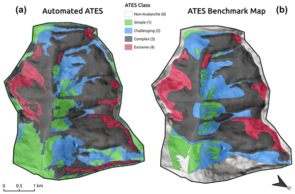
The research validates and optimizes an automated approach for creating classified snow avalanche terrain maps using open-source geospatial modeling tools. Validation is based on avalanche-expert-based maps for two study areas. Our results show that automated maps have an overall accuracy equivalent to the average accuracy of three human maps. Automated mapping requires a fraction of the time and cost of traditional methods and opens the door for large-scale mapping of mountainous terrain.
Abby Morgan, Pascal Haegeli, Henry Finn, and Patrick Mair
Nat. Hazards Earth Syst. Sci., 23, 1719–1742, https://doi.org/10.5194/nhess-23-1719-2023, https://doi.org/10.5194/nhess-23-1719-2023, 2023
Short summary
Short summary
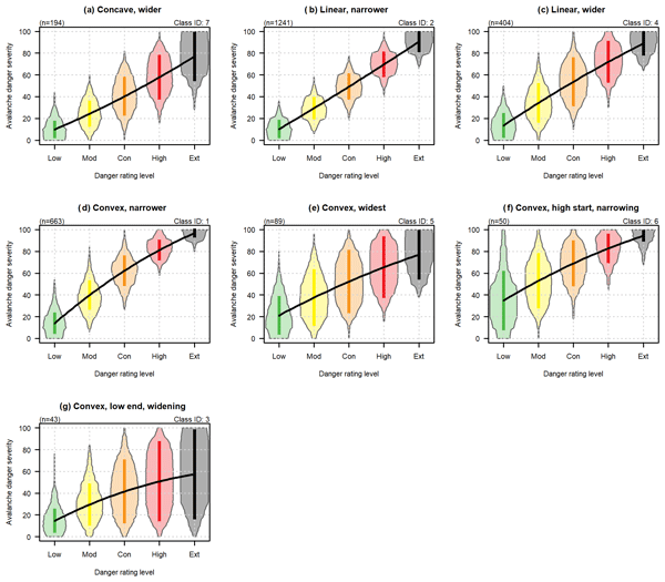
The avalanche danger scale is a critical component for communicating the severity of avalanche hazard conditions to the public. We examine how backcountry recreationists in North America understand and use the danger scale for planning trips into the backcountry. Our results provide an important user perspective on the strengths and weaknesses of the existing scale and highlight opportunities for future improvements.
John Sykes, Pascal Haegeli, and Yves Bühler
Nat. Hazards Earth Syst. Sci., 22, 3247–3270, https://doi.org/10.5194/nhess-22-3247-2022, https://doi.org/10.5194/nhess-22-3247-2022, 2022
Short summary
Short summary
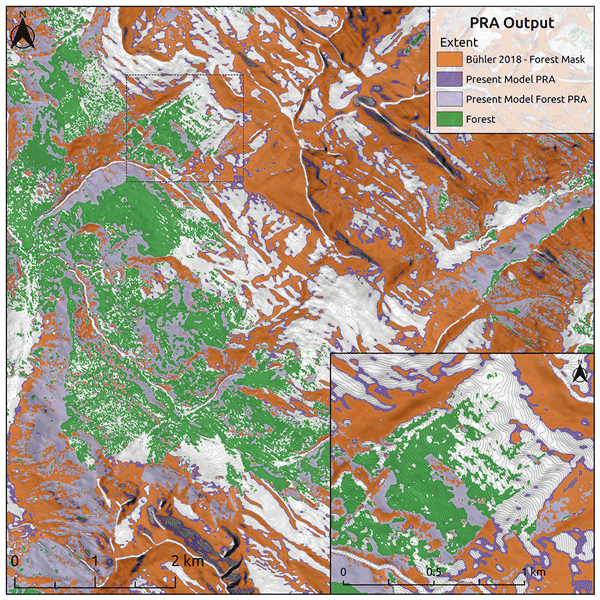
Automated snow avalanche terrain mapping provides an efficient method for large-scale assessment of avalanche hazards, which informs risk management decisions for transportation and recreation. This research reduces the cost of developing avalanche terrain maps by using satellite imagery and open-source software as well as improving performance in forested terrain. The research relies on local expertise to evaluate accuracy, so the methods are broadly applicable in mountainous regions worldwide.
Florian Herla, Pascal Haegeli, and Patrick Mair
The Cryosphere, 16, 3149–3162, https://doi.org/10.5194/tc-16-3149-2022, https://doi.org/10.5194/tc-16-3149-2022, 2022
Short summary
Short summary
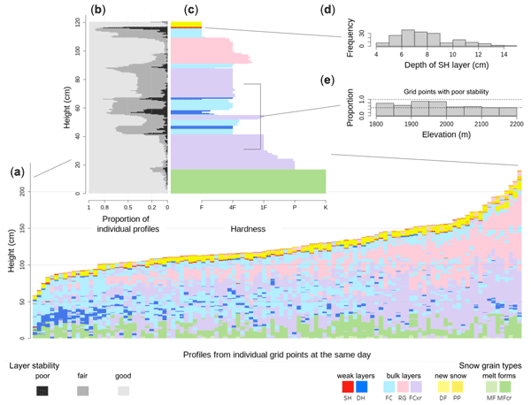
We present an averaging algorithm for multidimensional snow stratigraphy profiles that elicits the predominant snow layering among large numbers of profiles and allows for compiling of informative summary statistics and distributions of snowpack layer properties. This creates new opportunities for presenting and analyzing operational snowpack simulations in support of avalanche forecasting and may inspire new ways of processing profiles and time series in other geophysical contexts.

Kathryn C. Fisher, Pascal Haegeli, and Patrick Mair
Nat. Hazards Earth Syst. Sci., 22, 1973–2000, https://doi.org/10.5194/nhess-22-1973-2022, https://doi.org/10.5194/nhess-22-1973-2022, 2022
Short summary
Short summary
Avalanche bulletins include travel and terrain statements to provide recreationists with tangible guidance about how to apply the hazard information. We examined which bulletin users pay attention to these statements, what determines their usefulness, and how they could be improved. Our study shows that reducing jargon and adding simple explanations can significantly improve the usefulness of the statements for users with lower levels of avalanche awareness education who depend on this advice.
Animesh K. Gain, Yves Bühler, Pascal Haegeli, Daniela Molinari, Mario Parise, David J. Peres, Joaquim G. Pinto, Kai Schröter, Ricardo M. Trigo, María Carmen Llasat, and Heidi Kreibich
Nat. Hazards Earth Syst. Sci., 22, 985–993, https://doi.org/10.5194/nhess-22-985-2022, https://doi.org/10.5194/nhess-22-985-2022, 2022
Short summary
Short summary
To mark the 20th anniversary of Natural Hazards and Earth System Sciences (NHESS), an interdisciplinary and international journal dedicated to the public discussion and open-access publication of high-quality studies and original research on natural hazards and their consequences, we highlight 11 key publications covering major subject areas of NHESS that stood out within the past 20 years.
Kathryn C. Fisher, Pascal Haegeli, and Patrick Mair
Nat. Hazards Earth Syst. Sci., 21, 3219–3242, https://doi.org/10.5194/nhess-21-3219-2021, https://doi.org/10.5194/nhess-21-3219-2021, 2021
Short summary
Short summary
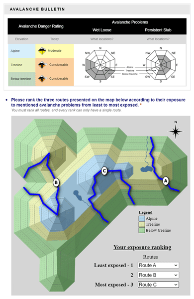
Avalanche warning services publish condition reports to help backcountry recreationists make informed decisions about when and where to travel in avalanche terrain. We tested how different graphic representations of terrain information can affect users’ ability to interpret and apply the provided information. Our study shows that a combined presentation of aspect and elevation information is the most effective. These results can be used to improve avalanche risk communication products.
Cited articles
Bellaire, S. and Jamieson, B.: Forecasting the formation of critical snow
layers using a coupled snow cover and weather model, Cold Reg. Sci. Technol.,
94, 37–44, https://doi.org/10.1016/j.coldregions.2013.06.007, 2013. a
Bellaire, S., Jamieson, J. B., and Fierz, C.: Forcing the snow-cover model SNOWPACK with forecasted weather data, The Cryosphere, 5, 1115–1125, https://doi.org/10.5194/tc-5-1115-2011, 2011. a
Bellaire, S., van Herwijnen, A., Mitterer, C., and Schweizer, J.: On
forecasting wet-snow avalanche activity using simulated snow cover data, Cold
Reg. Sci. Technol., 144, 28–38, https://doi.org/10.1016/j.coldregions.2017.09.013,
2017. a
Brun, E., David, P., Sudul, M., and Brunot, G.: A numerical model to simulate
snow-cover stratigraphy for operational avalanche forecasting, J. Glaciol.,
38, 13–22, https://doi.org/10.3189/S0022143000009552, 1992. a
Calonne, N., Richter, B., Löwe, H., Cetti, C., ter Schure, J., Van Herwijnen, A., Fierz, C., Jaggi, M., and Schneebeli, M.: The RHOSSA campaign: multi-resolution monitoring of the seasonal evolution of the structure and mechanical stability of an alpine snowpack, The Cryosphere, 14, 1829–1848, https://doi.org/10.5194/tc-14-1829-2020, 2020. a
Canadian Avalanche Association: Observation Guidelines and Recording
Standards for Weather, Snowpack, and Avalanches, Canadian Avalanche
Association, Revelstoke, BC,
http://cdn.ymaws.com/www.avalancheassociation.ca/resource/resmgr/standards_docs/OGRS2016web.pdf (last access: 23 August 2022),
2016. a, b, c
Charrois, L., Cosme, E., Dumont, M., Lafaysse, M., Morin, S., Libois, Q., and Picard, G.: On the assimilation of optical reflectances and snow depth observations into a detailed snowpack model, The Cryosphere, 10, 1021–1038, https://doi.org/10.5194/tc-10-1021-2016, 2016. a
Christensen, R.: ordinal – Regression Models for Ordinal Data, r package
version 2019.12-10, The Comprehensive R Archive Network [code], https://CRAN.R-project.org/package=ordinal (last access: 23 August 2022), 2019. a
Cluzet, B., Revuelto, J., Lafaysse, M., Tuzet, F., Cosme, E., Picard, G.,
Arnaud, L., and Dumont, M.: Towards the assimilation of satellite reflectance
into semi-distributed ensemble snowpack simulations, Cold Reg. Sci. Technol.,
170, 102918, https://doi.org/10.1016/j.coldregions.2019.102918, 2020. a
Cluzet, B., Lafaysse, M., Deschamps-Berger, C., Vernay, M., and Dumont, M.: Propagating information from snow observations with CrocO ensemble data assimilation system: a 10-years case study over a snow depth observation network, The Cryosphere, 16, 1281–1298, https://doi.org/10.5194/tc-16-1281-2022, 2022. a, b, c, d
Danielson, J. and Gesch, D.: Global multi-resolution terrain elevation data
2010 (GMTED2010), 2011-1073, US Department of the Interior, US Geological
Survey Washington, DC, USA, https://doi.org/10.3133/ofr20111073, 2011. a
Durand, Y., Giraud, G., Brun, E., Mérindol, L., and Martin, E.: A
computer-based system simulating snowpack structures as a tool for regional
avalanche forecasting, J. Glaciol., 45, 469–484,
https://doi.org/10.3189/S0022143000001337, 1999. a
Durand, Y., Laternser, M., Giraud, G., Etchevers, P., Lesaffre, B., and
Mérindol, L.: Reanalysis of 44 yr of climate in the French Alps
(1958–2002): methodology, model validation, climatology, and trends for air
temperature and precipitation, J. Appl. Meteorol. Clim., 48, 429–449,
https://doi.org/10.1175/2008JAMC1808.1, 2009. a
Fierz, C., Armstrong, R., Durand, Y., Etchevers, P., Greene, E., McClung, D.,
Nishimura, K., Satyawali, P., and Sokratov, S.: The International
Classification for Seasonal Snow on the Ground, IHP-VII Tech. Doc. Hyrdol.
No. 83, IACS Contrib. No. 1, UNESCO-IHP, Paris, 2009. a
Gilleland, E., Ahijevych, D., Brown, B., Casati, B., and Ebert, E.:
Intercomparison of spatial forecast verification methods, Weather
Forecast., 24, 1416–1430, https://doi.org/10.1175/2009WAF2222269.1, 2009. a
Giraud, G., Lafeuille, J., and Pahaut, E.: Evaluation de la qualité de la
prévision du risque d'avalanche, Int. Ass. Hydrol. Sci. Publ/, 162,
583–591, 1987. a
Helbig, N. and van Herwijnen, A.: Subgrid parameterization for snow depth over
mountainous terrain from flat field snow depth, Water Resour. Res., 53,
1444–1456, https://doi.org/10.1002/2016WR019872, 2017. a
Helfricht, K., Hartl, L., Koch, R., Marty, C., and Olefs, M.: Obtaining sub-daily new snow density from automated measurements in high mountain regions, Hydrol. Earth Syst. Sci., 22, 2655–2668, https://doi.org/10.5194/hess-22-2655-2018, 2018. a
Herla, F., Horton, S., Mair, P., and Haegeli, P.: Snow profile alignment and similarity assessment for aggregating, clustering, and evaluating snowpack model output for avalanche forecasting, Geosci. Model Dev., 14, 239–258, https://doi.org/10.5194/gmd-14-239-2021, 2021. a
Horton, S. and Haegeli, P.: Using snow depth observations to provide insight
into the quality of snowpack simulations for regional-scale avalanche
forecasting, OSF [code and data set], https://doi.org/10.17605/OSF.IO/A5PEK, 2022. a
Horton, S., Nowak, S., and Haegeli, P.: Enhancing the operational value of snowpack models with visualization design principles, Nat. Hazards Earth Syst. Sci., 20, 1557–1572, https://doi.org/10.5194/nhess-20-1557-2020, 2020a. a
Horton, S., Towell, M., and Haegeli, P.: Examining the operational use of avalanche problems with decision trees and model-generated weather and snowpack variables, Nat. Hazards Earth Syst. Sci., 20, 3551–3576, https://doi.org/10.5194/nhess-20-3551-2020, 2020. a, b
Lafaysse, M., Morin, S., Coléou, C., Vernay, M., Serça, D., Besson, F.,
Willemet, J.-M., Giraud, G., and Durand, Y.: Towards a new chain of models
for avalanche hazard forecasting in French mountain ranges, including low
altitude mountains, in: Proc. Int. Snow Sci. Workshop, Grenoble, France, 7–11
October, 162–166, 2013. a
Largeron, C., Dumont, M., Morin, S., Boone, A., Lafaysse, M., Metref, S.,
Cosme, E., Jonas, T., Winstral, A., and Margulis, S. A.: Toward Snow Cover
Estimation in Mountainous Areas Using Modern Data Assimilation Methods: A
Review, Front. Earth Sci., 8, 325, https://doi.org/10.3389/feart.2020.00325, 2020. a
Lehning, M., Bartelt, P., Brown, B., Russi, T., Stöckli, U., and Zimmerli,
M.: Snowpack model calculations for avalanche warning based upon a new
network of weather and snow stations, Cold Reg. Sci. Technol., 30, 145–157,
https://doi.org/10.1016/S0165-232X(02)00073-3, 1999. a
Lehning, M., Bartelt, P., Brown, B., Fierz, C., and Satyawali, P.: A physical
SNOWPACK model for the Swiss avalanche warning: Part II. Snow microstructure,
Cold Reg. Sci. Technol., 35, 147–167, 2002. a
Liston, G. and Elder, K.: A meteorological distribution system for
high-resolution terrestrial modeling (MicroMet), J. Hydrometeor., 7,
217–234, https://doi.org/10.1175/JHM486.1, 2006. a
Lundquist, J., Hughes, M., Gutmann, E., and Kapnick, S.: Our Skill in Modeling
Mountain Rain and Snow is Bypassing the Skill of Our Observational Networks,
B. Am. Meteorol. Soc., 100, 2473–2490, https://doi.org/10.1175/bams-d-19-0001.1,
2020. a, b
Milbrandt, J., Bélair, S., Faucher, M., Vallée, M., Carrera, M. L., and
Glazer, A.: The Pan-Canadian High Resolution (2.5 km) Deterministic
Prediction System, Weather Forecast., 31, 1791–1816,
https://doi.org/10.1175/waf-d-16-0035.1, 2016. a
Mo, R., Brugman, M., Milbrandt, J., Goosen, J., Geng, Q., Emond, C., Bau, J.,
and Erfani, A.: Impacts of hydrometeor drift on orographic precipitation: Two
case studies of landfalling atmospheric rivers in British Columbia, Canada,
Weather Forecast., 34, 1211–1237, https://doi.org/10.1175/WAF-D-18-0176.1, 2019. a
Morin, S., Horton, S., Techel, F., Bavay, M., Coléou, C., Fierz, C.,
Gobiet, A., Hagenmuller, P., Lafaysse, M., Ližar, M., Mitterer, C.,
Monti, F., Müller, K., Olefs, M., Snook, J., van Herwijnen, A., and
Vionnet, V.: Application of physical snowpack models in support of
operational avalanche hazard forecasting: A status report on current
implementations and prospects for the future, Cold Reg. Sci. Technol., 170,
102910, https://doi.org/10.1016/j.coldregions.2019.102910, 2020. a, b
North American Land Change Monitoring System: Land Cover 30m, 2015 (Landsat
and RapidEye),
http://www.cec.org/north-american-environmental-atlas/land-cover-30m-2015-landsat-and-rapideye (last access: 15 August 2021), 2015. a
Pebesma, E.: Multivariable geostatistics in S: the gstat package, Comput.
Geosci., 30, 683–691, https://doi.org/10.1016/j.cageo.2004.03.012, 2004. a
Quéno, L., Vionnet, V., Dombrowski-Etchevers, I., Lafaysse, M., Dumont, M., and Karbou, F.: Snowpack modelling in the Pyrenees driven by kilometric-resolution meteorological forecasts, The Cryosphere, 10, 1571–1589, https://doi.org/10.5194/tc-10-1571-2016, 2016. a, b
Raleigh, M. S., Lundquist, J. D., and Clark, M. P.: Exploring the impact of forcing error characteristics on physically based snow simulations within a global sensitivity analysis framework, Hydrol. Earth Syst. Sci., 19, 3153–3179, https://doi.org/10.5194/hess-19-3153-2015, 2015. a, b
Reuter, B., Schweizer, J., and van Herwijnen, A.: A process-based approach to estimate point snow instability, The Cryosphere, 9, 837–847, https://doi.org/10.5194/tc-9-837-2015, 2015. a
Richter, B., van Herwijnen, A., Rotach, M. W., and Schweizer, J.: Sensitivity of modeled snow stability data to meteorological input uncertainty, Nat. Hazards Earth Syst. Sci., 20, 2873–2888, https://doi.org/10.5194/nhess-20-2873-2020, 2020. a, b
Roy, G., Stadnyk, T., Koenig, K., Gasset, N., and Mahidjiba, A.: Ten Years of
Science Based on the Canadian Precipitation Analysis: A CaPA System Overview
and Literature Review AU – Fortin, V, Atmos. Ocean., 56, 178–196,
https://doi.org/10.1080/07055900.2018.1474728, 2018. a
Schirmer, M. and Jamieson, B.: Verification of analysed and forecasted winter precipitation in complex terrain, The Cryosphere, 9, 587–601, https://doi.org/10.5194/tc-9-587-2015, 2015. a
Schirmer, M., Lehning, M., and Schweizer, J.: Statistical forecasting of
regional avalanche danger using simulated snow-cover data, J. Glaciol., 55,
761–768, https://doi.org/10.3189/002214309790152429, 2009. a
Schmid, L., Heilig, A., Mitterer, C., Schweizer, J., Maurer, H., Okorn, R., and
Eisen, O.: Continuous snowpack monitoring using upward-looking
ground-penetrating radar technology, J. Glaciol., 60, 509–525,
https://doi.org/10.3189/2014JoG13J084, 2014. a
Schweizer, J., Bellaire, S., Fierz, C., Lehning, M., and Pielmeier, C.:
Evaluating and improving the stability predictions of the snow cover model
SNOWPACK, Cold Reg. Sci. Technol., 46, 52–59,
https://doi.org/10.1016/j.coldregions.2006.05.007, 2006. a
Shandro, B. and Haegeli, P.: Characterizing the nature and variability of avalanche hazard in western Canada, Nat. Hazards Earth Syst. Sci., 18, 1141–1158, https://doi.org/10.5194/nhess-18-1141-2018, 2018. a
Statham, G., Haegeli, P., Greene, E., Birkeland, K., Israelson, C., Tremper,
B., Stethem, C., McMahon, B., White, B., and Kelly, J.: A conceptual model of
avalanche hazard, Nat. Hazards, 90, 663–691,
https://doi.org/10.1007/s11069-017-3070-5, 2018. a, b
Thornton, P., Running, S., and White, M.: Generating surfaces of daily
meteorological variables over large regions of complex terrain, J. Hydrol.,
190, 214–251, https://doi.org/10.1016/S0022-1694(96)03128-9, 1997. a, b
Viallon-Galinier, L., Hagenmuller, P., and Lafaysse, M.: Forcing and evaluating
detailed snow cover models with stratigraphy observations, Cold Reg. Sci.
Technol., 180, 103163, https://doi.org/10.1016/j.coldregions.2020.103163, 2020. a
Vionnet, V., Six, D., Auger, L., Dumont, M., Lafaysse, M., Quéno, L.,
Réveillet, M., Dombrowski-Etchevers, I., Thibert, R., and Vincent, C.:
Sub-kilometer precipitation datasets for snowpack and glacier modeling in
alpine terrain, Front. Earth Sci., 7, 182, https://doi.org/10.3389/feart.2019.00182, 2019.
a, b
Wang, X. L., Xu, H., Qian, B., Feng, Y., and Mekis, E.: Adjusted daily rainfall
and snowfall data for Canada, Atmos. Ocean., 55, 155–168,
https://doi.org/10.1080/07055900.2017.1342163, 2017. a
Winstral, A., Magnusson, J., Schirmer, M., and Jonas, T.: The Bias Detecting
Ensemble: A New and Efficient Technique for Dynamically Incorporating
Observations into Physics-based, Multi-layer, Snow Models, Water Resour.
Res., 55, 613–631, https://doi.org/10.1029/2018WR024521, 2018. a, b, c
Short summary
Snowpack models can help avalanche forecasters but are difficult to verify. We present a method for evaluating the accuracy of simulated snow profiles using readily available observations of snow depth. This method could be easily applied to understand the representativeness of available observations, the agreement between modelled and observed snow depths, and the implications for interpreting avalanche conditions.
Snowpack models can help avalanche forecasters but are difficult to verify. We present a method...


