
Articles | Volume 20, issue 7
https://doi.org/10.5194/tc-20-3933-2026
© Author(s) 2026. This work is distributed under
the Creative Commons Attribution 4.0 License.
the Creative Commons Attribution 4.0 License.
https://doi.org/10.5194/tc-20-3933-2026
© Author(s) 2026. This work is distributed under
the Creative Commons Attribution 4.0 License.
the Creative Commons Attribution 4.0 License.
Research article
| 
17 Jul 2026
Research article |
| 17 Jul 2026
| 17 Jul 2026
Long-term InSAR and streamflow recession analysis reveal accelerated permafrost degradation in the mining area of the Qilian Mountains
Tian Chang
Center for Spatial Information Science and Sustainable Development Applications, Tongji University, Shanghai, 200092, China
College of Surveying and Geo-informatics, Tongji University, Shanghai, 200092, China
Graduate School of Science, Hokkaido University, Sapporo, 060-0810, Japan
Yonghong Yi
CORRESPONDING AUTHOR

Center for Spatial Information Science and Sustainable Development Applications, Tongji University, Shanghai, 200092, China
College of Surveying and Geo-informatics, Tongji University, Shanghai, 200092, China
Masato Furuya
Department of Earth and Planetary Sciences, Faculty of Science, Hokkaido University, Sapporo, 060-0810, Japan
Arctic Research Center, Hokkaido University, Sapporo, 001-0021, Japan
Huiru Jiang
Center for Spatial Information Science and Sustainable Development Applications, Tongji University, Shanghai, 200092, China
College of Surveying and Geo-informatics, Tongji University, Shanghai, 200092, China
Heihe Remote Sensing Experimental Research Station, State Key Laboratory of Cryospheric Science and Frozen Soil Engineering, Northwest Institute of Eco-Environment and Resources, Chinese Academy of Sciences, Lanzhou, 730000, China
Youhua Ran
Heihe Remote Sensing Experimental Research Station, State Key Laboratory of Cryospheric Science and Frozen Soil Engineering, Northwest Institute of Eco-Environment and Resources, Chinese Academy of Sciences, Lanzhou, 730000, China
Department of Earth and Environmental Sciences, Faculty of Science, The Chinese University of Hong Kong, Hong Kong, China
Rongxing Li
Center for Spatial Information Science and Sustainable Development Applications, Tongji University, Shanghai, 200092, China
College of Surveying and Geo-informatics, Tongji University, Shanghai, 200092, China
Related authors
Shuang Wu, Tian Chang, Lu An, and Rongxing Li
ISPRS Ann. Photogramm. Remote Sens. Spatial Inf. Sci., XI-3-2026, 679–685, https://doi.org/10.5194/isprs-annals-XI-3-2026-679-2026, https://doi.org/10.5194/isprs-annals-XI-3-2026-679-2026, 2026
S. Ge, Y. Cheng, R. Li, H. Cui, Z. Yu, T. Chang, S. Luo, Z. Li, G. Li, A. Zhao, X. Yuan, Y. Li, M. Xia, X. Wang, and G. Qiao
Int. Arch. Photogramm. Remote Sens. Spatial Inf. Sci., XLIII-B3-2022, 757–763, https://doi.org/10.5194/isprs-archives-XLIII-B3-2022-757-2022, https://doi.org/10.5194/isprs-archives-XLIII-B3-2022-757-2022, 2022
Han Yu, Mousong Wu, Dongjie Yin, Youhua Ran, and Yonghong Yi
Earth Syst. Sci. Data Discuss., https://doi.org/10.5194/essd-2026-683, https://doi.org/10.5194/essd-2026-683, 2026
Preprint under review for ESSD
Short summary
Short summary
To extend soil freeze-thaw records beyond the satellite era, we developed a daily 0.1° dataset for Northern Hemisphere frozen-ground regions from 1950 to 2025 at depths of 10, 30, and 50 cm. A knowledge-guided neural network combined process-based simulations with in situ observations and achieved 86-90% accuracy in independent evaluation. The dataset provides a consistent basis for analyses of multi-decadal freeze-thaw changes and their vertical propagation through the upper soil profile.
Erji Du, Tonghua Wu, Liyun Dai, Youhua Ran, Yufang Min, Lin Zhao, Lingxiao Wang, Jimin Yao, Zhibin Li, Keting Feng, Yao Xiao, Guojie Hu, Defu Zou, Guangyue Liu, Zanpin Xing, Xiaofan Zhu, and Ji Chen
Earth Syst. Sci. Data Discuss., https://doi.org/10.5194/essd-2026-330, https://doi.org/10.5194/essd-2026-330, 2026
Preprint under review for ESSD
Short summary
Short summary
We present the first 90 m resolution dataset of active layer moisture covering the entire permafrost region of the Qinghai–Tibet Plateau. It was produced from 342 field observations (2009–2024) using four machine learning models combined through bias-aware fusion, and is accompanied by an area-of-applicability mask and per-pixel uncertainty estimates. The dataset is freely available at https://doi.org/10.12072/ncdc.permafrost.db7312.2026.
Zhangyu Sun, Tobias Bolch, Daniel Falaschi, Atanu Bhattacharya, and Lin Liu
EGUsphere, https://doi.org/10.5194/egusphere-2026-3678, https://doi.org/10.5194/egusphere-2026-3678, 2026
This preprint is open for discussion and under review for The Cryosphere (TC).
Short summary
Short summary
Ice-debris complexes (IDC) are common, but their evolution remains poorly understood. We investigated 4 IDCs and identified 3 major zones: a glacier, a glacier-affected, and a periglacial zone. Although glacier-affected and periglacial zones cover much smaller areas than glaciers, their ice volume losses are comparable. IDCs can evolve through multiple pathways, incl. gradual transformation of glacier into rock glaciers and the advance or embedding of glaciers onto pre-existing rock glaciers.
Shuang Wu, Tian Chang, Lu An, and Rongxing Li
ISPRS Ann. Photogramm. Remote Sens. Spatial Inf. Sci., XI-3-2026, 679–685, https://doi.org/10.5194/isprs-annals-XI-3-2026-679-2026, https://doi.org/10.5194/isprs-annals-XI-3-2026-679-2026, 2026
Chen Zhang, Yifei Fan, Wenxia Han, Yingchun Ge, Jiabei Zhu, and Tao Che
Earth Syst. Sci. Data Discuss., https://doi.org/10.5194/essd-2026-409, https://doi.org/10.5194/essd-2026-409, 2026
Revised manuscript accepted for ESSD
Short summary
Short summary
Global groundwater depletion threatens water security, but coarse satellite data (GRACE) obscures local human impacts. To bridge this gap, we present a 1 km global monthly groundwater storage anomaly dataset (2002–2020) by downscaling GRACE using an aquifer-stratified XGBoost framework. Validated against 1,518 in-situ wells, this high-resolution product uniquely captures sharp boundaries of intensive agricultural pumping, offering a robust benchmark for water resource management.
Xuan Li, Fan Xu, Chen Zhang, Tao Che, Liyun Dai, and Yanli Zhang
The Cryosphere, 20, 2977–2997, https://doi.org/10.5194/tc-20-2977-2026, https://doi.org/10.5194/tc-20-2977-2026, 2026
Short summary
Short summary
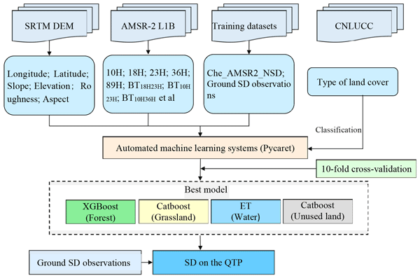
The microwaves used in current products to measure snow depth don't pick up on the small changes in snow depth on the Qinghai-Tibet Plateau. To deal with these issues, our study suggests a new way of doing things. This uses Auto Machine Learning, data from satellite and other geographical information. Our results show that the method we used is good for checking how snow cover changes in mountain areas.
Menglian Xia, Rongxing Li, Marco Scaioni, Lu An, Zhenshi Li, and Gang Qiao
The Cryosphere, 19, 6749–6770, https://doi.org/10.5194/tc-19-6749-2025, https://doi.org/10.5194/tc-19-6749-2025, 2025
Short summary
Short summary
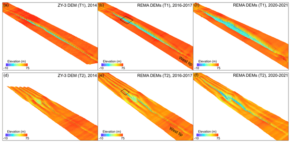
We propose an innovative multi-satellite DEM adjustment model (MDAM) that removes biases in elevation between sub-DEMs across ice shelves. Our results reveal quantitative 3D structural and mélange features of a ~50 km long rift. For first time, we found that while the mélange elevation decreased from 2014–2021, the mélange inside the rift experienced a rapid expansion, attributing to newly calved shelf ice from rift walls, associated rift widening, and other rift-mélange interaction factors.
Shi Li, Guojun Li, Yuan Cheng, Xuehui Pi, and Rongxing Li
Int. Arch. Photogramm. Remote Sens. Spatial Inf. Sci., XLVIII-4-W14-2025, 137–142, https://doi.org/10.5194/isprs-archives-XLVIII-4-W14-2025-137-2025, https://doi.org/10.5194/isprs-archives-XLVIII-4-W14-2025-137-2025, 2025
Guojun Li, Tong Hao, Zhongbo Huang, Chen Lv, Liang Tang, Shi Li, Xiangbin Cui, Bo Sun, Kenichi Matsuoka, and Rongxing Li
Int. Arch. Photogramm. Remote Sens. Spatial Inf. Sci., XLVIII-4-W14-2025, 113–119, https://doi.org/10.5194/isprs-archives-XLVIII-4-W14-2025-113-2025, https://doi.org/10.5194/isprs-archives-XLVIII-4-W14-2025-113-2025, 2025
Defeng Feng, Tianjie Zhao, Jingyao Zheng, Yu Bai, Youhua Ran, Xiaokang Kou, Lingmei Jiang, Ziqian Zhang, Pei Yu, Jinbiao Zhu, Jie Pan, Jiancheng Shi, and Yuei-An Liou
Earth Syst. Sci. Data, 17, 6273–6293, https://doi.org/10.5194/essd-17-6273-2025, https://doi.org/10.5194/essd-17-6273-2025, 2025
Short summary
Short summary
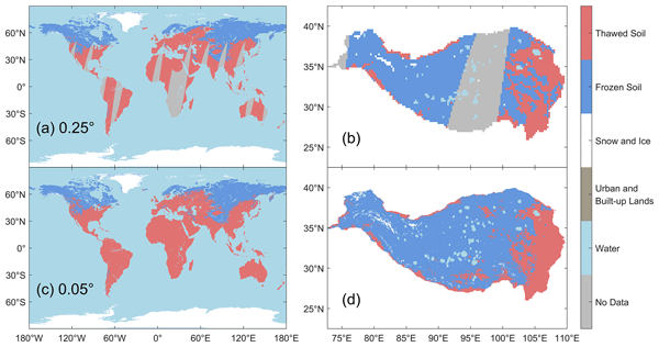
This study introduces a downscaling approach integrating passive microwave and optical satellite data to generate a long-term (2002–2023), high-resolution (0.05°) global near-surface freeze-thaw (FT) state dataset with daily seamless continuity. The dataset attains 83.78 % overall accuracy, consistent with the microwave-based products but with finer spatial detail. This detailed FT record provides valuable information to enhance the understanding of global hydrological and ecological impacts.
Kathrin Maier, Zhuoxuan Xia, Lin Liu, Mark J. Lara, Jurjen van der Sluijs, Philipp Bernhard, and Irena Hajnsek
The Cryosphere, 19, 4855–4873, https://doi.org/10.5194/tc-19-4855-2025, https://doi.org/10.5194/tc-19-4855-2025, 2025
Short summary
Short summary
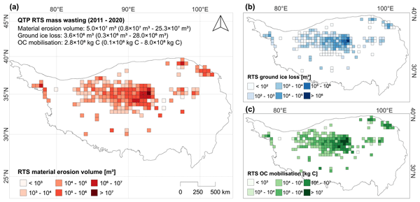
Our study explores how thawing permafrost on the Qinghai-Tibet Plateau triggers landslides, mobilising stored carbon. Using satellite data from 2011 to 2020, we measured soil erosion, ice loss, and carbon mobilisation. While current impacts are modest, increasing landslide activity suggests future significance. This research underscores the need to understand permafrost thaw's role in carbon dynamics and climate change.
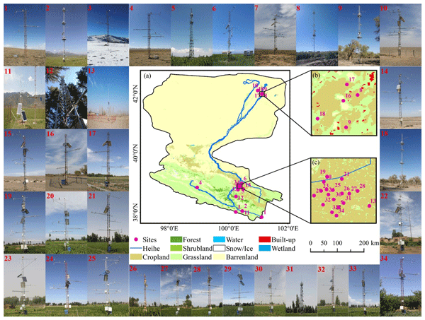
Xufeng Wang, Tao Che, Jingfeng Xiao, Tonghong Wang, Junlei Tan, Yang Zhang, Zhiguo Ren, Liying Geng, Haibo Wang, Ziwei Xu, Shaomin Liu, and Xin Li
Earth Syst. Sci. Data, 17, 1329–1346, https://doi.org/10.5194/essd-17-1329-2025, https://doi.org/10.5194/essd-17-1329-2025, 2025
Short summary
Short summary
In this study, carbon flux and auxiliary meteorological data are post-processed to create an analysis-ready dataset for 34 sites across six ecosystems in the Heihe River basin. Overall, 18 sites have multi-year observations, while 16 were observed only during the 2012 growing season, totaling 1513 site months. This dataset can be used to explore carbon exchange, assess ecosystem responses to climate change, support upscaling studies, and evaluate carbon cycle models.
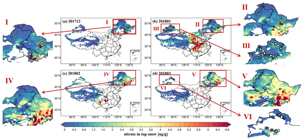
Xia Wang, Tao Che, Xueyin Ruan, Shanna Yue, Jing Wang, Chun Zhao, and Lei Geng
Geosci. Model Dev., 18, 651–670, https://doi.org/10.5194/gmd-18-651-2025, https://doi.org/10.5194/gmd-18-651-2025, 2025
Short summary
Short summary
We employed the WRF-Chem model to parameterize atmospheric nitrate deposition in snow and evaluate its performance in simulating snow cover, snow depth, and concentrations of dust and nitrate using new observations from northern China. The results generally exhibit reasonable agreement with field observations in northern China, demonstrating the model's capability to simulate snow properties, including concentrations of reservoir species.
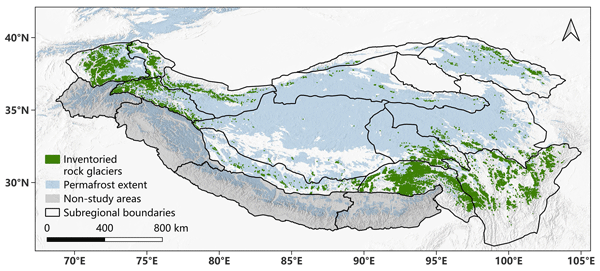
Zhangyu Sun, Yan Hu, Adina Racoviteanu, Lin Liu, Stephan Harrison, Xiaowen Wang, Jiaxin Cai, Xin Guo, Yujun He, and Hailun Yuan
Earth Syst. Sci. Data, 16, 5703–5721, https://doi.org/10.5194/essd-16-5703-2024, https://doi.org/10.5194/essd-16-5703-2024, 2024
Short summary
Short summary
We propose a new dataset, TPRoGI (v1.0), encompassing rock glaciers in the entire Tibetan Plateau. We used a neural network, DeepLabv3+, and images from Planet Basemaps. The inventory identified 44 273 rock glaciers, covering 6 000 km2, mainly at elevations of 4000 to 5500 m a.s.l. The dataset, with details on distribution and characteristics, aids in understanding permafrost distribution, mountain hydrology, and climate impacts in High Mountain Asia, filling a knowledge gap.
Litao Dai, Xingchen Liu, Lu An, and Rongxing Li
Int. Arch. Photogramm. Remote Sens. Spatial Inf. Sci., XLVIII-3-2024, 101–106, https://doi.org/10.5194/isprs-archives-XLVIII-3-2024-101-2024, https://doi.org/10.5194/isprs-archives-XLVIII-3-2024-101-2024, 2024
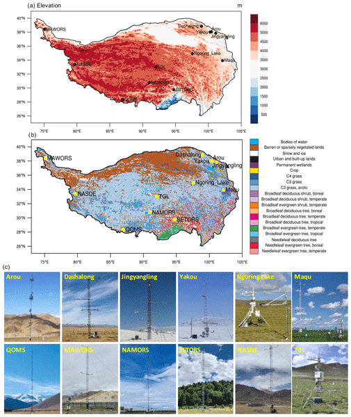
Yaoming Ma, Zhipeng Xie, Yingying Chen, Shaomin Liu, Tao Che, Ziwei Xu, Lunyu Shang, Xiaobo He, Xianhong Meng, Weiqiang Ma, Baiqing Xu, Huabiao Zhao, Junbo Wang, Guangjian Wu, and Xin Li
Earth Syst. Sci. Data, 16, 3017–3043, https://doi.org/10.5194/essd-16-3017-2024, https://doi.org/10.5194/essd-16-3017-2024, 2024
Short summary
Short summary
Current models and satellites struggle to accurately represent the land–atmosphere (L–A) interactions over the Tibetan Plateau. We present the most extensive compilation of in situ observations to date, comprising 17 years of data on L–A interactions across 12 sites. This quality-assured benchmark dataset provides independent validation to improve models and remote sensing for the region, and it enables new investigations of fine-scale L–A processes and their mechanistic drivers.
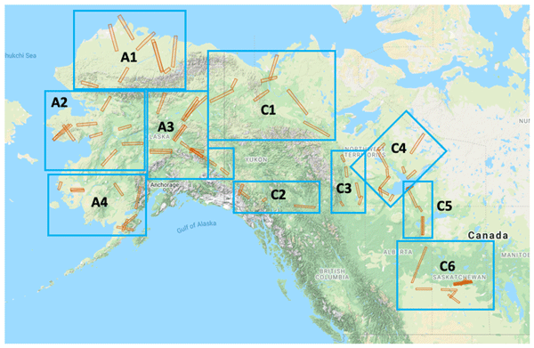
Charles E. Miller, Peter C. Griffith, Elizabeth Hoy, Naiara S. Pinto, Yunling Lou, Scott Hensley, Bruce D. Chapman, Jennifer Baltzer, Kazem Bakian-Dogaheh, W. Robert Bolton, Laura Bourgeau-Chavez, Richard H. Chen, Byung-Hun Choe, Leah K. Clayton, Thomas A. Douglas, Nancy French, Jean E. Holloway, Gang Hong, Lingcao Huang, Go Iwahana, Liza Jenkins, John S. Kimball, Tatiana Loboda, Michelle Mack, Philip Marsh, Roger J. Michaelides, Mahta Moghaddam, Andrew Parsekian, Kevin Schaefer, Paul R. Siqueira, Debjani Singh, Alireza Tabatabaeenejad, Merritt Turetsky, Ridha Touzi, Elizabeth Wig, Cathy J. Wilson, Paul Wilson, Stan D. Wullschleger, Yonghong Yi, Howard A. Zebker, Yu Zhang, Yuhuan Zhao, and Scott J. Goetz
Earth Syst. Sci. Data, 16, 2605–2624, https://doi.org/10.5194/essd-16-2605-2024, https://doi.org/10.5194/essd-16-2605-2024, 2024
Short summary
Short summary
NASA’s Arctic Boreal Vulnerability Experiment (ABoVE) conducted airborne synthetic aperture radar (SAR) surveys of over 120 000 km2 in Alaska and northwestern Canada during 2017, 2018, 2019, and 2022. This paper summarizes those results and provides links to details on ~ 80 individual flight lines. This paper is presented as a guide to enable interested readers to fully explore the ABoVE L- and P-band SAR data.
Xiaofeng Wang, Lu An, Peter L. Langen, and Rongxing Li
Int. Arch. Photogramm. Remote Sens. Spatial Inf. Sci., XLVIII-1-2024, 691–696, https://doi.org/10.5194/isprs-archives-XLVIII-1-2024-691-2024, https://doi.org/10.5194/isprs-archives-XLVIII-1-2024-691-2024, 2024
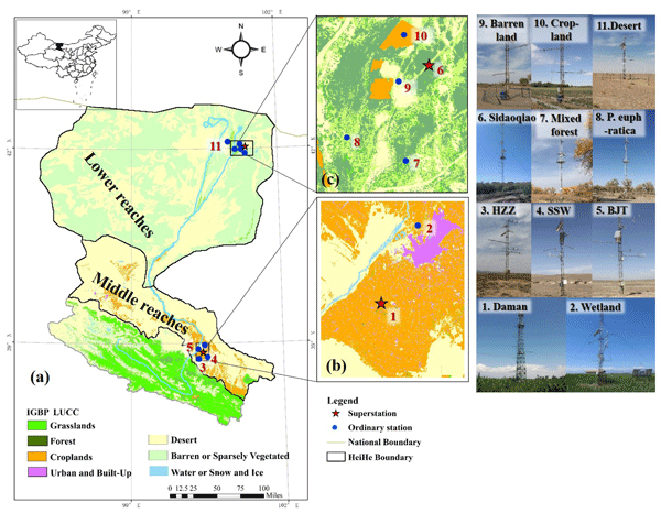
Shaomin Liu, Ziwei Xu, Tao Che, Xin Li, Tongren Xu, Zhiguo Ren, Yang Zhang, Junlei Tan, Lisheng Song, Ji Zhou, Zhongli Zhu, Xiaofan Yang, Rui Liu, and Yanfei Ma
Earth Syst. Sci. Data, 15, 4959–4981, https://doi.org/10.5194/essd-15-4959-2023, https://doi.org/10.5194/essd-15-4959-2023, 2023
Short summary
Short summary
We present a suite of observational datasets from artificial and natural oases–desert systems that consist of long-term turbulent flux and auxiliary data, including hydrometeorological, vegetation, and soil parameters, from 2012 to 2021. We confirm that the 10-year, long-term dataset presented in this study is of high quality with few missing data, and we believe that the data will support ecological security and sustainable development in oasis–desert areas.
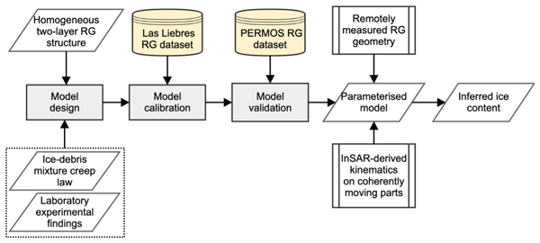
Yan Hu, Stephan Harrison, Lin Liu, and Joanne Laura Wood
The Cryosphere, 17, 2305–2321, https://doi.org/10.5194/tc-17-2305-2023, https://doi.org/10.5194/tc-17-2305-2023, 2023
Short summary
Short summary
Rock glaciers are considered to be important freshwater reservoirs in the future climate. However, the amount of ice stored in rock glaciers is poorly quantified. Here we developed an empirical model to estimate ice content in rock the glaciers in the Khumbu and Lhotse valleys, Nepal. The modelling results confirmed the hydrological importance of rock glaciers in the study area. The developed approach shows promise in being applied to permafrost regions to assess water storage of rock glaciers.

Huadong Wang, Xueliang Zhang, Pengfeng Xiao, Tao Che, Zhaojun Zheng, Liyun Dai, and Wenbo Luan
The Cryosphere, 17, 33–50, https://doi.org/10.5194/tc-17-33-2023, https://doi.org/10.5194/tc-17-33-2023, 2023
Short summary
Short summary
The geographically and temporally weighted neural network (GTWNN) model is constructed for estimating large-scale daily snow density by integrating satellite, ground, and reanalysis data, which addresses the importance of spatiotemporal heterogeneity and a nonlinear relationship between snow density and impact variables, as well as allows us to understand the spatiotemporal pattern and heterogeneity of snow density in different snow periods and snow cover regions in China from 2013 to 2020.
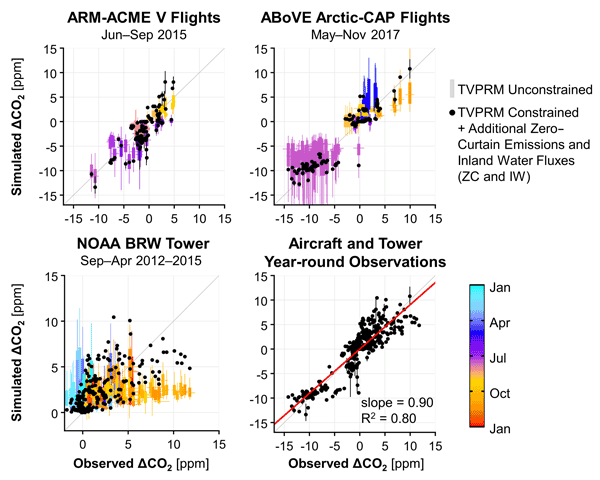
Luke D. Schiferl, Jennifer D. Watts, Erik J. L. Larson, Kyle A. Arndt, Sébastien C. Biraud, Eugénie S. Euskirchen, Jordan P. Goodrich, John M. Henderson, Aram Kalhori, Kathryn McKain, Marikate E. Mountain, J. William Munger, Walter C. Oechel, Colm Sweeney, Yonghong Yi, Donatella Zona, and Róisín Commane
Biogeosciences, 19, 5953–5972, https://doi.org/10.5194/bg-19-5953-2022, https://doi.org/10.5194/bg-19-5953-2022, 2022
Short summary
Short summary
As the Arctic rapidly warms, vast stores of thawing permafrost could release carbon dioxide (CO2) into the atmosphere. We combined observations of atmospheric CO2 concentrations from aircraft and a tower with observed CO2 fluxes from tundra ecosystems and found that the Alaskan North Slope in not a consistent source nor sink of CO2. Our study shows the importance of using both site-level and atmospheric measurements to constrain regional net CO2 fluxes and improve biogenic processes in models.
Hui Guo, Xiaoyan Wang, Zecheng Guo, Gaofeng Zhu, Tao Che, Jian Wang, Xiaodong Huang, Chao Han, and Zhiqi Ouyang
The Cryosphere Discuss., https://doi.org/10.5194/tc-2022-229, https://doi.org/10.5194/tc-2022-229, 2022
Revised manuscript not accepted
Short summary
Short summary
Snow phenology is a seasonal pattern in snow cover and snowfall. In this review, we found that during the past 50 years in the Northern Hemisphere, the snow cover end date has shown a significantly advanced change trend. Eurasia contributes more to the snow phenology in the Northern Hemisphere than does North America. Snow phenology is related to climate and atmospheric circulation, and the response to vegetation phenology depends on geographical regions, temperature and precipitation gradients.
Brendan Byrne, Junjie Liu, Yonghong Yi, Abhishek Chatterjee, Sourish Basu, Rui Cheng, Russell Doughty, Frédéric Chevallier, Kevin W. Bowman, Nicholas C. Parazoo, David Crisp, Xing Li, Jingfeng Xiao, Stephen Sitch, Bertrand Guenet, Feng Deng, Matthew S. Johnson, Sajeev Philip, Patrick C. McGuire, and Charles E. Miller
Biogeosciences, 19, 4779–4799, https://doi.org/10.5194/bg-19-4779-2022, https://doi.org/10.5194/bg-19-4779-2022, 2022
Short summary
Short summary
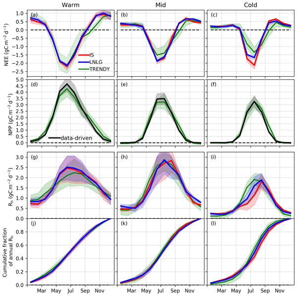
Plants draw CO2 from the atmosphere during the growing season, while respiration releases CO2 to the atmosphere throughout the year, driving seasonal variations in atmospheric CO2 that can be observed by satellites, such as the Orbiting Carbon Observatory 2 (OCO-2). Using OCO-2 XCO2 data and space-based constraints on plant growth, we show that permafrost-rich northeast Eurasia has a strong seasonal release of CO2 during the autumn, hinting at an unexpectedly large respiration signal from soils.
Zhuoxuan Xia, Lingcao Huang, Chengyan Fan, Shichao Jia, Zhanjun Lin, Lin Liu, Jing Luo, Fujun Niu, and Tingjun Zhang
Earth Syst. Sci. Data, 14, 3875–3887, https://doi.org/10.5194/essd-14-3875-2022, https://doi.org/10.5194/essd-14-3875-2022, 2022
Short summary
Short summary
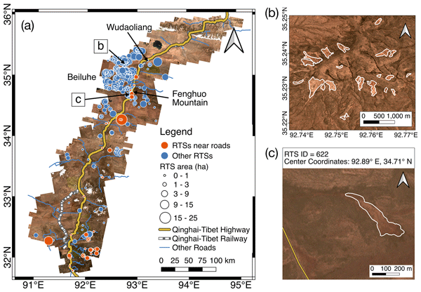
Retrogressive thaw slumps are slope failures resulting from abrupt permafrost thaw, and are widely distributed along the Qinghai–Tibet Engineering Corridor. The potential damage to infrastructure and carbon emission of thaw slumps motivated us to obtain an inventory of thaw slumps. We used a semi-automatic method to map 875 thaw slumps, filling the knowledge gap of thaw slump locations and providing key benchmarks for analysing the distribution features and quantifying spatio-temporal changes.

Liyun Dai, Tao Che, Yang Zhang, Zhiguo Ren, Junlei Tan, Meerzhan Akynbekkyzy, Lin Xiao, Shengnan Zhou, Yuna Yan, Yan Liu, Hongyi Li, and Lifu Wang
Earth Syst. Sci. Data, 14, 3509–3530, https://doi.org/10.5194/essd-14-3509-2022, https://doi.org/10.5194/essd-14-3509-2022, 2022
Short summary
Short summary
An Integrated Microwave Radiometry Campaign for Snow (IMCS) was conducted to collect ground-based passive microwave and optical remote-sensing data, snow pit and underlying soil data, and meteorological parameters. The dataset is unique in continuously providing electromagnetic and physical features of snowpack and environment. The dataset is expected to serve the evaluation and development of microwave radiative transfer models and snow process models, along with land surface process models.
A. Zhao, Y. Cheng, D. Lv, M. Xia, R. Li, L. An, S. Liu, and Y. Tian
Int. Arch. Photogramm. Remote Sens. Spatial Inf. Sci., XLIII-B3-2022, 805–811, https://doi.org/10.5194/isprs-archives-XLIII-B3-2022-805-2022, https://doi.org/10.5194/isprs-archives-XLIII-B3-2022-805-2022, 2022
Z. Yu, Z. Cao, C. Yu, G. Qiao, and R. Li
Int. Arch. Photogramm. Remote Sens. Spatial Inf. Sci., XLIII-B3-2022, 799–804, https://doi.org/10.5194/isprs-archives-XLIII-B3-2022-799-2022, https://doi.org/10.5194/isprs-archives-XLIII-B3-2022-799-2022, 2022
S. Ge, Y. Cheng, R. Li, H. Cui, Z. Yu, T. Chang, S. Luo, Z. Li, G. Li, A. Zhao, X. Yuan, Y. Li, M. Xia, X. Wang, and G. Qiao
Int. Arch. Photogramm. Remote Sens. Spatial Inf. Sci., XLIII-B3-2022, 757–763, https://doi.org/10.5194/isprs-archives-XLIII-B3-2022-757-2022, https://doi.org/10.5194/isprs-archives-XLIII-B3-2022-757-2022, 2022
Yanxing Hu, Tao Che, Liyun Dai, Yu Zhu, Lin Xiao, Jie Deng, and Xin Li
Earth Syst. Sci. Data Discuss., https://doi.org/10.5194/essd-2022-63, https://doi.org/10.5194/essd-2022-63, 2022
Preprint withdrawn
Short summary
Short summary
We propose a data fusion framework based on the random forest regression algorithm to derive a comprehensive snow depth product for the Northern Hemisphere from 1980 to 2019. This new fused snow depth dataset not only provides information about snow depth and its variation over the Northern Hemisphere but also presents potential value for hydrological and water cycle studies related to seasonal snowpacks.
Rongxing Li, Yuan Cheng, Haotian Cui, Menglian Xia, Xiaohan Yuan, Zhen Li, Shulei Luo, and Gang Qiao
The Cryosphere, 16, 737–760, https://doi.org/10.5194/tc-16-737-2022, https://doi.org/10.5194/tc-16-737-2022, 2022
Short summary
Short summary
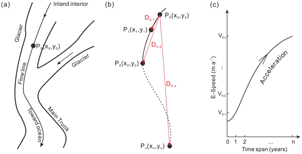
Historical velocity maps of the Antarctic ice sheet are valuable for long-term ice flow dynamics analysis. We developed an innovative method for correcting overestimations existing in historical velocity maps. The method is validated rigorously using high-quality Landsat 8 images and then successfully applied to historical velocity maps. The historical change signatures are preserved and can be used for assessing the impact of long-term global climate changes on the ice sheet.
Youhua Ran, Xin Li, Guodong Cheng, Jingxin Che, Juha Aalto, Olli Karjalainen, Jan Hjort, Miska Luoto, Huijun Jin, Jaroslav Obu, Masahiro Hori, Qihao Yu, and Xiaoli Chang
Earth Syst. Sci. Data, 14, 865–884, https://doi.org/10.5194/essd-14-865-2022, https://doi.org/10.5194/essd-14-865-2022, 2022
Short summary
Short summary
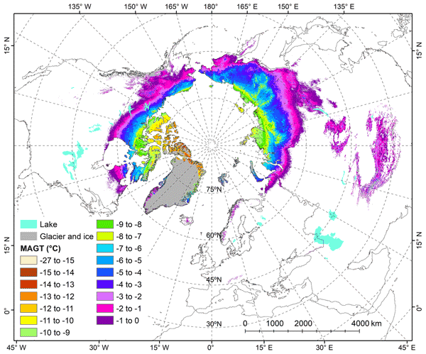
Datasets including ground temperature, active layer thickness, the probability of permafrost occurrence, and the zonation of hydrothermal condition with a 1 km resolution were released by integrating unprecedentedly large amounts of field data and multisource remote sensing data using multi-statistical\machine-learning models. It updates the understanding of the current thermal state and distribution for permafrost in the Northern Hemisphere.

Donghang Shao, Hongyi Li, Jian Wang, Xiaohua Hao, Tao Che, and Wenzheng Ji
Earth Syst. Sci. Data, 14, 795–809, https://doi.org/10.5194/essd-14-795-2022, https://doi.org/10.5194/essd-14-795-2022, 2022
Short summary
Short summary
The temporal series and spatial distribution discontinuity of the existing snow water equivalent (SWE) products in the pan-Arctic region severely restricts the use of SWE data in cryosphere change and climate change studies. Using a ridge regression machine learning algorithm, this study developed a set of spatiotemporally seamless and high-precision SWE products. This product could contribute to the study of cryosphere change and climate change at large spatial scales.
Lin Li, Aiguo Zhao, Tiantian Feng, Xiangbin Cui, Lu An, Ben Xu, Shinan Lang, Liwen Jing, Tong Hao, Jingxue Guo, Bo Sun, and Rongxing Li
The Cryosphere Discuss., https://doi.org/10.5194/tc-2021-332, https://doi.org/10.5194/tc-2021-332, 2021
Preprint withdrawn
Short summary
Short summary
No subglacial lakes have been reported in Princess Elizabeth Land (PEL), East Antarctica. In this study, thanks to a new suite of airborne geophysical observations in PEL, including RES and gravity data collected during the Chinese National Antarctic Research Expedition, we detected a large subglacial lake of ~45 km in length, ~11 km in width, and ~250 m in depth. These findings will help us understand ice sheet stability in the PEL region.
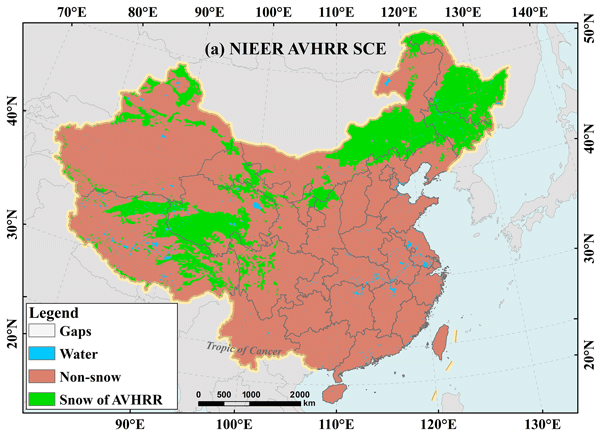
Xiaohua Hao, Guanghui Huang, Tao Che, Wenzheng Ji, Xingliang Sun, Qin Zhao, Hongyu Zhao, Jian Wang, Hongyi Li, and Qian Yang
Earth Syst. Sci. Data, 13, 4711–4726, https://doi.org/10.5194/essd-13-4711-2021, https://doi.org/10.5194/essd-13-4711-2021, 2021
Short summary
Short summary
Long-term snow cover data are not only of importance for climate research. Currently China still lacks a high-quality snow cover extent (SCE) product for climate research. This study develops a multi-level decision tree algorithm for cloud and snow discrimination and gap-filled technique based on AVHRR surface reflectance data. We generate a daily 5 km SCE product across China from 1981 to 2019. It has high accuracy and will serve as baseline data for climate and other applications.
Cited articles
Abe, T., Iwahana, G., Tadono, T., and Iijima, Y.: Ground Surface Displacement After a Forest Fire Near Mayya, Eastern Siberia, Using InSAR: Observation and Implication for Geophysical Modeling, Earth and Space Science, 9, e2022EA002476, https://doi.org/10.1029/2022EA002476, 2022.
Bazaluk, O., Kuchyn, O., Saik, P., Soltabayeva, S., Brui, H., Lozynskyi, V., and Cherniaiev, O.: Impact of ground surface subsidence caused by underground coal mining on natural gas pipeline, Sci. Rep., 13, 19327, https://doi.org/10.1038/s41598-023-46814-5, 2023.
Bense, V. F., Kooi, H., Ferguson, G., and Read, T.: Permafrost degradation as a control on hydrogeological regime shifts in a warming climate, J. Geophys. Res.-Earth, 117, https://doi.org/10.1029/2011JF002143, 2012.
Biggs, J., Wright, T., Lu, Z., and Parsons, B.: Multi-interferogram method for measuring interseismic deformation: Denali Fault, Alaska, Geophys. J. Int., 170, 1165–1179, https://doi.org/10.1111/j.1365-246X.2007.03415.x, 2007.
Biskaborn, B. K., Smith, S. L., Noetzli, J., Matthes, H., Vieira, G., Streletskiy, D. A., Schoeneich, P., Romanovsky, V. E., Lewkowicz, A. G., Abramov, A., Allard, M., Boike, J., Cable, W. L., Christiansen, H. H., Delaloye, R., Diekmann, B., Drozdov, D., Etzelmüller, B., Grosse, G., Guglielmin, M., Ingeman-Nielsen, T., Isaksen, K., Ishikawa, M., Johansson, M., Johannsson, H., Joo, A., Kaverin, D., Kholodov, A., Konstantinov, P., Kröger, T., Lambiel, C., Lanckman, J.-P., Luo, D., Malkova, G., Meiklejohn, I., Moskalenko, N., Oliva, M., Phillips, M., Ramos, M., Sannel, A. B. K., Sergeev, D., Seybold, C., Skryabin, P., Vasiliev, A., Wu, Q., Yoshikawa, K., Zheleznyak, M., and Lantuit, H.: Permafrost is warming at a global scale, Nat. Commun., 10, 264, https://doi.org/10.1038/s41467-018-08240-4, 2019.
Cao, W., Sheng, Y., Wu, J., Li, J., Li, J., and Chou, Y.: Simulation analysis of the impact of excavation backfill on permafrost recovery in an opencast coal-mining pit, Environ. Earth Sci., 75, 837, https://doi.org/10.1007/s12665-016-5659-5, 2016.
Cao, Z. and Furuya, M.: Decades-Long Evolution of Post-Fire Permafrost Deformation Detected by InSAR: Insights From Chronosequence in North Yukon, AGU Advances, 6, e2025AV001849, https://doi.org/10.1029/2025AV001849, 2025.
Chang, T., Yi, Y., Jiang, H., Li, R., Lu, P., Liu, L., Wang, L., Zhao, L., Zwieback, S., and Zhao, J.: Unraveling the non-linear relationship between seasonal deformation and permafrost active layer thickness, npj Clim. Atmos. Sci., 7, 308, https://doi.org/10.1038/s41612-024-00866-0, 2024.
Chen, J., Wu, T., Zou, D., Liu, L., Wu, X., Gong, W., Zhu, X., Li, R., Hao, J., Hu, G., Pang, Q., Zhang, J., and Yang, S.: Magnitudes and patterns of large-scale permafrost ground deformation revealed by Sentinel-1 InSAR on the central Qinghai-Tibet Plateau, Remote Sens. Environ., 268, 112778, https://doi.org/10.1016/j.rse.2021.112778, 2022.
Chen, R. H., Michaelides, R. J., Zhao, Y., Huang, L., Wig, E., Sullivan, T. D., Parsekian, A. D., Zebker, H. A., Moghaddam, M., and Schaefer, K. M.: Permafrost Dynamics Observatory (PDO): 2. Joint Retrieval of Permafrost Active Layer Thickness and Soil Moisture From L-Band InSAR and P-Band PolSAR, Earth and Space Science, 10, e2022EA002453, https://doi.org/10.1029/2022EA002453, 2023.
Cooper, M. G., Zhou, T., Bennett, K. E., Bolton, W. R., Coon, E. T., Fleming, S. W., Rowland, J. C., and Schwenk, J.: Detecting Permafrost Active Layer Thickness Change From Nonlinear Baseflow Recession, Water Resour. Res., 59, e2022WR033154, https://doi.org/10.1029/2022WR033154, 2023.
Copernicus Climate Change Service (C3S): ERA5-Land hourly data from 1950 to present, Copernicus Climate Change Service (C3S) Climate Data Store (CDS) [data set], https://doi.org/10.24381/cds.e2161bac, 2019.
Costantini, M.: A novel phase unwrapping method based on network programming, IEEE T. Geosci. Remote, 36, 813–821, https://doi.org/10.1109/36.673674, 1998.
Daout, S., Doin, M.-P., Peltzer, G., Socquet, A., and Lasserre, C.: Large-scale InSAR monitoring of permafrost freeze–thaw cycles on the Tibetan Plateau, Geophys. Res. Lett., 44, 901–909, https://doi.org/10.1002/2016GL070781, 2017.
Daout, S., Dini, B., Haeberli, W., Doin, M.-P., and Parsons, B.: Ice loss in the Northeastern Tibetan Plateau permafrost as seen by 16 yr of ESA SAR missions, Earth Planet. Sc. Lett., 545, 116404, https://doi.org/10.1016/j.epsl.2020.116404, 2020.
Doin, M.-P., Lodge, F., Guillaso, S., Jolivet, R., Lasserre, C., Ducret, G., Grandin, R., Pathier, E., and Pinel, V.: Presentation of the Small Baseline NSBAS Processing Chain on a Case Example: The Etna Deformation Monitoring from 2003 to 2010 Using ENVISAT Data, in: Proceedings of the Fringe 2011 Workshop, Frascati, Italy, 19–23 September 2011, ESA SP-697, European Space Agency, ISBN 978-92-9092-261-2, https://www.geologie.ens.fr/~jolivet/Publications_files/PDFs/Proceedings_of_the_Fringe_symposium_2011_Doin.pdf (last access: 10 July 2026), 2012.
European Space Agency: Copernicus Global Digital Elevation Model, OpenTopography [data set], https://doi.org/10.5069/G9028PQB, 2021.
Evans, S. G., Yokeley, B., Stephens, C., and Brewer, B.: Potential mechanistic causes of increased baseflow across northern Eurasia catchments underlain by permafrost, Hydrol. Process., 34, 2676–2690, https://doi.org/10.1002/hyp.13759, 2020.
Fan, C., Liu, L., Zhao, Z., and Mu, C.: Pronounced Underestimation of Surface Deformation Due To Unwrapping Errors Over Tibetan Plateau Permafrost by Sentinel-1 InSAR: Identification and Correction, J. Geophys. Res.-Earth, 130, e2024JF007854, https://doi.org/10.1029/2024JF007854, 2025a.
Fan, C., Mu, C., Liu, L., Zhang, T., Jia, S., Wang, S., Sun, W., and Zhao, Z.: Time-Series models for ground subsidence and heave over permafrost in InSAR Processing: A comprehensive assessment and new improvement, ISPRS J. Photogramm., 222, 167–185, https://doi.org/10.1016/j.isprsjprs.2025.02.019, 2025b.
Fan, L., Ji, F., Kuang, X., Guo, Z., Zhang, R., and Zheng, C.: Impacts of permafrost degradation on streamflow in the northern Himalayas, Sci. China Earth Sci., 67, 1990–2000, https://doi.org/10.1007/s11430-023-1297-4, 2024.
Feng, X., Duan, L., Kurylyk, B. L., and Cai, T.: Impacts of permafrost thaw on streamflow recession in a discontinuous permafrost watershed of northeastern China, Sci. Total Environ., 847, 157624, https://doi.org/10.1016/j.scitotenv.2022.157624, 2022.
Gao, H., Han, C., Chen, R., Feng, Z., Wang, K., Fenicia, F., and Savenije, H.: Frozen soil hydrological modeling for a mountainous catchment northeast of the Qinghai–Tibet Plateau, Hydrol. Earth Syst. Sci., 26, 4187–4208, https://doi.org/10.5194/hess-26-4187-2022, 2022.
Goldstein, R. M. and Werner, C. L.: Radar interferogram filtering for geophysical applications, Geophys. Res. Lett., 25, 4035–4038, https://doi.org/10.1029/1998GL900033, 1998.
Guan, S., Wang, C., Tang, Y., Zou, L., Yu, P., Li, T., and Zhang, H.: North American Circum-Arctic Permafrost Degradation Observation Using Sentinel-1 InSAR Data, Remote Sens-Basel, 16, 2809, https://doi.org/10.3390/rs16152809, 2024.
Guo, J., Qi, Y., Wang, H., Zhang, J., Yang, R., and Cao, Y.: Variation of land surface temperature and its influencing factors in Muli Coalfield, Qinghai Province, Journal of Glaciology and Geocryology, 45, 980–992, https://doi.org/10.7522/j.issn.1000-0240.2023.0074, 2023.
Hinzman, A. M., Sjöberg, Y., Lyon, S., Schaap, P., and van der Velde, Y.: Using a mechanistic model to explain the rising non-linearity in storage discharge relationships as the extent of permafrost decreases in Arctic catchments, J. Hydrol., 612, 128162, https://doi.org/10.1016/j.jhydrol.2022.128162, 2022.
Hjort, J., Streletskiy, D., Doré, G., Wu, Q., Bjella, K., and Luoto, M.: Impacts of permafrost degradation on infrastructure, Nat. Rev. Earth Environ., 3, 24–38, https://doi.org/10.1038/s43017-021-00247-8, 2022.
Hu, L., Tang, X., Tomás, R., Li, T., Zhang, X., Li, Z., Yao, J., and Lu, J.: Monitoring surface deformation dynamics in the mining subsidence area using LT-1 InSAR interferometry: A case study of Datong, China, Int. J. Appl. Earth Obs., 131, 103936, https://doi.org/10.1016/j.jag.2024.103936, 2024.
Jiang, H., Yi, Y., Yang, K., Zhao, L., Chen, D., Kimball, J. S., and Lu, F.: Soil freeze/thaw dynamics strongly influences runoff regime in a Tibetan permafrost watershed: Insights from a process-based model, CATENA, 243, 108182, https://doi.org/10.1016/j.catena.2024.108182, 2024.
Jin, X., Jin, H., Iwahana, G., Marchenko, S. S., Luo, D., Li, X., and Liang, S.: Impacts of climate-induced permafrost degradation on vegetation: A review, Advances in Climate Change Research, 12, 29–47, https://doi.org/10.1016/j.accre.2020.07.002, 2021.
Jones, B. M., Grosse, G., Arp, C. D., Jones, M. C., Walter Anthony, K. M., and Romanovsky, V. E.: Modern thermokarst lake dynamics in the continuous permafrost zone, northern Seward Peninsula, Alaska, J Geophys. Res.-Biogeo., 116, https://doi.org/10.1029/2011JG001666, 2011.
Jorgenson, K. L., Douglas, T. A., Jorgenson, M. T., Pastick, N. J., and Harms, T. K.: Permafrost and Rain Influence Summer Hydrologic Flowpaths in Boreal Catchments, Water Resour. Res., 61, e2024WR039024, https://doi.org/10.1029/2024WR039024, 2025.
Kirchner, J. W.: Catchments as simple dynamical systems: Catchment characterization, rainfall–runoff modeling, and doing hydrology backward, Water Resour. Res., 45, https://doi.org/10.1029/2008WR006912, 2009.
Li, C., Zhao, L., Wang, L., Liu, S., Zhou, H., Li, Z., Liu, G., Du, E., Zou, D., and Hou, Y.: Ground Deformation and Permafrost Degradation in the Source Region of the Yellow River, in the Northeast of the Qinghai-Tibet Plateau, Remote Sens.-Basel, 15, 3153, https://doi.org/10.3390/rs15123153, 2023.
Li, J., Sheng, Y., Chen, J., Zhang, X., Zhang, B., Wu, J., and Cao, Y.: Modeling permafrost distribution using remote sensing-derived vegetation data in the source region of the Datong River in the northwestern China, in: 2011 IEEE International Geoscience and Remote Sensing Symposium, Vancouver, British Columbia, Canada, 24–29 July 2011, 2225–2228, https://doi.org/10.1109/IGARSS.2011.6049611, 2011.
Li, S., Xu, W., and Li, Z.: Review of the SBAS InSAR Time-series algorithms, applications, and challenges, Geodesy and Geodynamics, 13, 114–126, https://doi.org/10.1016/j.geog.2021.09.007, 2022a.
Li, Y., Yang, K., Zhang, J., Hou, Z., Wang, S., and Ding, X.: Research on time series InSAR monitoring method for multiple types of surface deformation in mining area, Nat. Hazards, 114, 2479–2508, https://doi.org/10.1007/s11069-022-05476-8, 2022b.
Lin, L., Gao, M., Liu, J., Wang, J., Wang, S., Chen, X., and Liu, H.: Understanding the effects of climate warming on streamflow and active groundwater storage in an alpine catchment: the upper Lhasa River, Hydrol. Earth Syst. Sci., 24, 1145–1157, https://doi.org/10.5194/hess-24-1145-2020, 2020.
Lin, X., Wu, T., Chen, J., Chen, J., Li, R., Zhu, X., and Lou, P.: Revealing the impacts of environmental and anthropogenic factors on permafrost deformation in the central Qinghai-Tibet Plateau using InSAR and interpretable machine learning, Ecol. Indic., 178, 113977, https://doi.org/10.1016/j.ecolind.2025.113977, 2025.
Liu, L., Zhang, T., and Wahr, J.: InSAR measurements of surface deformation over permafrost on the North Slope of Alaska, J. Geophys. Res.-Earth, 115, https://doi.org/10.1029/2009JF001547, 2010.
Liu, L., Schaefer, K., Zhang, T., and Wahr, J.: Estimating 1992–2000 average active layer thickness on the Alaskan North Slope from remotely sensed surface subsidence, J. Geophys. Res.-Earth, 117, https://doi.org/10.1029/2011JF002041, 2012.
Liu, L., Yi, Y., Jiang, H., Ran, Y., and Chen, D.: ERA5-Land overestimates runoff coefficient but underestimates runoff recession rate in the central Tibetan permafrost region, Journal of Hydrology: Regional Studies, 53, 101792, https://doi.org/10.1016/j.ejrh.2024.101792, 2024.
Liu, S., Li, X., Xu, Z., Che, T., Xiao, Q., Ma, M., Liu, Q., Jin, R., Guo, J., Wang, L., Wang, W., Qi, Y., Li, H., Xu, T., Ran, Y., Hu, X., Shi, S., Zhu, Z., Tan, J., Zhang, Y., and Ren, Z.: The Heihe Integrated Observatory Network: A Basin-Scale Land Surface Processes Observatory in China, Vadose Zone J., 17, 1–21, https://doi.org/10.2136/vzj2018.04.0072, 2018.
Liu, S., Che, T., Xu, Z., Zhang, Y., Tan, J., Ren, Z., and Li, X.: Dataset of Heihe integrated observatory network: automatic weather station of Yakou station, 2022, National Tibetan Plateau/Third Pole Environment Data Center [data set], https://doi.org/10.11888/Atmos.tpdc.300652, 2023.
Liu, S., Zhao, L., Wang, L., Liu, L., Zou, D., Hu, G., Sun, Z., Zhang, Y., Chen, W., Wang, X., Wang, M., Zhou, H., and Qiao, Y.: Ground surface deformation in permafrost region on the Qinghai-Tibet Plateau: A review, Earth-Sci. Rev., 265, 105109, https://doi.org/10.1016/j.earscirev.2025.105109, 2025.
Lu, P., Han, J., Yi, Y., Hao, T., Zhou, F., Meng, X., Zhang, Y., and Li, R.: MT-InSAR Unveils Dynamic Permafrost Disturbances in Hoh Xil (Kekexili) on the Tibetan Plateau Hinterland, IEEE T. Geosci. Remote, 61, 1–16, https://doi.org/10.1109/TGRS.2023.3253937, 2023.
Meng, F., Su, F., Li, Y., and Tong, K.: Changes in Terrestrial Water Storage During 2003–2014 and Possible Causes in Tibetan Plateau, J. Geophys. Res.-Atmos., 124, 2909–2931, https://doi.org/10.1029/2018JD029552, 2019.
Morishita, Y., Lazecky, M., Wright, T. J., Weiss, J. R., Elliott, J. R., and Hooper, A.: LiCSBAS: An Open-Source InSAR Time Series Analysis Package Integrated with the LiCSAR Automated Sentinel-1 InSAR Processor, Remote Sens.-Basel, 12, 424, https://doi.org/10.3390/rs12030424, 2020.
Mu, C., Wu, X., Zhao, Q., Smoak, J. M., Yang, Y., Hu, L., Zhong, W., Liu, G., Xu, H., and Zhang, T.: Relict Mountain Permafrost Area (Loess Plateau, China) Exhibits High Ecosystem Respiration Rates and Accelerating Rates in Response to Warming, J. Geophys. Res.-Biogeo., 122, 2580–2592, https://doi.org/10.1002/2017JG004060, 2017.
Muñoz-Sabater, J., Dutra, E., Agustí-Panareda, A., Albergel, C., Arduini, G., Balsamo, G., Boussetta, S., Choulga, M., Harrigan, S., Hersbach, H., Martens, B., Miralles, D. G., Piles, M., Rodríguez-Fernández, N. J., Zsoter, E., Buontempo, C., and Thépaut, J.-N.: ERA5-Land: a state-of-the-art global reanalysis dataset for land applications, Earth Syst. Sci. Data, 13, 4349–4383, https://doi.org/10.5194/essd-13-4349-2021, 2021.
Murton, J. B.: Permafrost and climate change, Chapt. 14, in: Climate Change, 3rd edn., edited by: Letcher, T. M., Elsevier, 281–326, https://doi.org/10.1016/B978-0-12-821575-3.00014-1, 2021.
Nitzbon, J., Westermann, S., Langer, M., Martin, L. C. P., Strauss, J., Laboor, S., and Boike, J.: Fast response of cold ice-rich permafrost in northeast Siberia to a warming climate, Nat. Commun., 11, 2201, https://doi.org/10.1038/s41467-020-15725-8, 2020.
Oliver-Cabrera, T., Jones, C. E., Yunjun, Z., and Simard, M.: InSAR Phase Unwrapping Error Correction for Rapid Repeat Measurements of Water Level Change in Wetlands, IEEE T. Geosci. Remote, 60, 1–15, https://doi.org/10.1109/TGRS.2021.3108751, 2022.
Peng, S., Peng, X., Frauenfeld, O. W., Yang, G., Tian, W., Tian, J., and Ma, J.: Using InSAR for Surface Deformation Monitoring and Active Layer Thickness Retrieval in the Heihe River Basin on the Northeast Qinghai-Tibet Plateau, J. Geophys. Res.-Earth, 128, e2022JF006782, https://doi.org/10.1029/2022JF006782, 2023.
Qin, J., Ding, Y., Shi, F., Cui, J., Chang, Y., Han, T., and Zhao, Q.: Links between seasonal suprapermafrost groundwater, the hydrothermal change of the active layer, and river runoff in alpine permafrost watersheds, Hydrol. Earth Syst. Sci., 28, 973–987, https://doi.org/10.5194/hess-28-973-2024, 2024.
Ran, Y., Li, X., and Cheng, G.: Climate warming over the past half century has led to thermal degradation of permafrost on the Qinghai–Tibet Plateau, The Cryosphere, 12, 595–608, https://doi.org/10.5194/tc-12-595-2018, 2018.
Ran, Y., Cheng, G., Dong, Y., Hjort, J., Lovecraft, A. L., Kang, S., Tan, M., and Li, X.: Permafrost degradation increases risk and large future costs of infrastructure on the Third Pole, Commun. Earth Environ., 3, 1–10, https://doi.org/10.1038/s43247-022-00568-6, 2022.
Rogger, M., Chirico, G. B., Hausmann, H., Krainer, K., Brückl, E., Stadler, P., and Blöschl, G.: Impact of mountain permafrost on flow path and runoff response in a high alpine catchment, Water Resour. Res., 53, 1288–1308, https://doi.org/10.1002/2016WR019341, 2017.
Runge, A., Nitze, I., and Grosse, G.: Remote sensing annual dynamics of rapid permafrost thaw disturbances with LandTrendr, Remote Sens. Environ., 268, 112752, https://doi.org/10.1016/j.rse.2021.112752, 2022.
Schaaf, C. and Wang, Z.: MODIS/Terra + Aqua BRDF/Albedo Daily L3 Global – 500 m V061, NASA Land Processes Distributed Active Archive Center, https://doi.org/10.5067/MODIS/MCD43A3.061, 2025.
Sheng, Y.: Distribution data of underground ice in permafrost regions of Qilian Mountains (2013–2015), National Tibetan Plateau/Third Pole Environment Data Center [data set], https://doi.org/10.11888/Geocry.tpdc.270933, 2020.
St. Jacques, J.-M. and Sauchyn, D. J.: Increasing winter baseflow and mean annual streamflow from possible permafrost thawing in the Northwest Territories, Canada, Geophys. Res. Lett., 36, https://doi.org/10.1029/2008GL035822, 2009.
Tao, R., Lau, A., Mossefin, M. E., Kong, G., Nordal, S., and Pan, Y.: Monitoring of ground displacement-induced railway anomalies using PS-InSAR techniques, Measurement, 248, 116863, https://doi.org/10.1016/j.measurement.2025.116863, 2025.
Vermote, E. and Wolfe, R.: MODIS/Terra Surface Reflectance Daily L2G Global 1 km and 500 m SIN Grid V006, NASA Land Processes Distributed Active Archive Center, https://doi.org/10.5067/MODIS/MOD09GA.006, 2025.
Walvoord, M. A. and Kurylyk, B. L.: Hydrologic Impacts of Thawing Permafrost – A Review, Vadose Zone J., 15, vzj2016.01.0010, https://doi.org/10.2136/vzj2016.01.0010, 2016.
Wan, Z., Hook, S., and Hulley, G.: MODIS/Aqua Land Surface Temperature/Emissivity Daily L3 Global 1 km SIN Grid V061, NASA Land Processes Distributed Active Archive Center, https://doi.org/10.5067/MODIS/MYD11A1.061, 2025.
Wang, H., Qi, Y., Zhang, J., Zhang, J., Yang, R., Guo, J., Luo, D., Wu, J., and Zhou, S.: Influence of Open-Pit Coal Mining on Ground Surface Deformation of Permafrost in the Muli Region in the Qinghai-Tibet Plateau, China, Remote Sens.-Basel, 14, 2352, https://doi.org/10.3390/rs14102352, 2022.
Wang, J., Zhang, T., and Fu, B.: A measure of spatial stratified heterogeneity, Ecol. Indic., 67, 250–256, https://doi.org/10.1016/j.ecolind.2016.02.052, 2016.
Wang, L., Qu, J. J., Hao, X., and Zhu, Q.: Sensitivity studies of the moisture effects on MODIS SWIR reflectance and vegetation water indices, Int. J. Remote Sens., 29, 7065–7075, https://doi.org/10.1080/01431160802226034, 2008.
Wang, L., Marzahn, P., Bernier, M., Jacome, A., Poulin, J., and Ludwig, R.: Comparison of TerraSAR-X and ALOS PALSAR Differential Interferometry With Multisource DEMs for Monitoring Ground Displacement in a Discontinuous Permafrost Region, IEEE J.-STARS, 10, 4074–4093, https://doi.org/10.1109/JSTARS.2017.2707337, 2017.
Wang, S., Sheng, Y., Wu, J., Li, J., and Huang, L.: Based on geomorphic classification to estimate the permafrost ground ice reserves in the source area of the Datong River, Qilian Mountains, Journal of Glaciology and Geocryology, 42, 1186–1194, https://doi.org/10.7522/j.issn.1000-0240.2018.0305, 2020.
Wang, T., Yang, H., Yang, D., Qin, Y., and Wang, Y.: Quantifying the streamflow response to frozen ground degradation in the source region of the Yellow River within the Budyko framework, J. Hydrol., 558, 301–313, https://doi.org/10.1016/j.jhydrol.2018.01.050, 2018.
Werner, C., Wegmüller, U., Strozzi, T., and Wiesmann, A.: GAMMA SAR and interferometric processing software, in: Proceedings of the ERS–ENVISAT Symposium, Gothenburg, Sweden, 16–20 October 2000, Gamma Remote Sensing AG, https://www.gamma-rs.ch/uploads/media/2000-1_GAMMA_Software.pdf (last access: 10 July 2026), 2000.
Xiao, W., Guo, J., He, T., Lei, K., and Deng, X.: Assessing the ecological impacts of opencast coal mining in Qinghai-Tibet Plateau – a case study in Muli coal field, China, Ecol. Indic., 153, 110454, https://doi.org/10.1016/j.ecolind.2023.110454, 2023.
Yanagiya, K. and Furuya, M.: Post-Wildfire Surface Deformation Near Batagay, Eastern Siberia, Detected by L-Band and C-Band InSAR, J. Geophys. Res.-Earth, 125, e2019JF005473, https://doi.org/10.1029/2019JF005473, 2020.
Yang, K.: A high-resolution near-surface meteorological forcing dataset for the Third Pole region (TPMFD, 1979–2022), https://doi.org/10.11888/Atmos.tpdc.300398, 2023.
Yi, Y., Wu, T., Wu, M., Jiang, H., Yang, Y., and Rogers, B. M.: Abrupt thaw and its effects on permafrost carbon emissions in the Tibetan Plateau: A remote sensing and modeling perspective, Earth-Sci. Rev., 261, 105020, https://doi.org/10.1016/j.earscirev.2024.105020, 2025.
Yu, C., Li, Z., Penna, N. T., and Crippa, P.: Generic Atmospheric Correction Model for Interferometric Synthetic Aperture Radar Observations, J. Geophys. Res.-Sol. Ea., 123, 9202–9222, https://doi.org/10.1029/2017JB015305, 2018.
Zhang, J., Liu, L., Su, L., and Che, T.: Three in one: GPS-IR measurements of ground surface elevation changes, soil moisture, and snow depth at a permafrost site in the northeastern Qinghai-Tibet Plateau, The Cryosphere, 15, 3021–3033, https://doi.org/10.5194/tc-15-3021-2021, 2021.
Zhang, Z., Lin, H., Wang, M., Liu, X., Chen, Q., Wang, C., and Zhang, H.: A Review of Satellite Synthetic Aperture Radar Interferometry Applications in Permafrost Regions: Current status, challenges, and trends, IEEE Geoscience and Remote Sensing Magazine, 10, 93–114, https://doi.org/10.1109/MGRS.2022.3170350, 2022.
Zou, D., Zhao, L., Sheng, Y., Chen, J., Hu, G., Wu, T., Wu, J., Xie, C., Wu, X., Pang, Q., Wang, W., Du, E., Li, W., Liu, G., Li, J., Qin, Y., Qiao, Y., Wang, Z., Shi, J., and Cheng, G.: A new map of permafrost distribution on the Tibetan Plateau, The Cryosphere, 11, 2527–2542, https://doi.org/10.5194/tc-11-2527-2017, 2017.
Zwieback, S., Liu, L., Rouyet, L., Short, N., and Strozzi, T.: Advances in InSAR Analysis of Permafrost Terrain, Permafrost Periglac., 35, 544–556, https://doi.org/10.1002/ppp.2248, 2024.
Short summary
We combined a long-term surface deformation dataset derived from multi-frequency Interferometric Synthetic Aperture Radar with streamflow recession analysis to assess potential destruction effects of historic mining on permafrost in the Qilian Mountains. Results show that post-mining surface deformation intensifies alongside marked recession slowdown, signaling permafrost thaw. These findings highlight long-lasting effects of human disturbance on permafrost degradation under regional warming.
We combined a long-term surface deformation dataset derived from multi-frequency Interferometric...


