
Articles | Volume 20, issue 8
https://doi.org/10.5194/tc-20-4619-2026
© Author(s) 2026. This work is distributed under
the Creative Commons Attribution 4.0 License.
the Creative Commons Attribution 4.0 License.
https://doi.org/10.5194/tc-20-4619-2026
© Author(s) 2026. This work is distributed under
the Creative Commons Attribution 4.0 License.
the Creative Commons Attribution 4.0 License.
Research article
| Highlight paper
| 
21 Aug 2026
Research article | Highlight paper |
| 21 Aug 2026
| 21 Aug 2026
Spatial heterogeneity in post-fire permafrost evolution as revealed by satellite radar observations
Barbara Widhalm
CORRESPONDING AUTHOR

b.geos, Industriestrasse 1, 2100 Korneuburg, Austria
Austrian Polar Research Institute, c/o Universität Wien, Vienna, Austria
Annett Bartsch
b.geos, Industriestrasse 1, 2100 Korneuburg, Austria
Austrian Polar Research Institute, c/o Universität Wien, Vienna, Austria
Benjamin Jones
University of Alaska Fairbanks, Fairbanks, United States
Related authors
Tazio Strozzi, Barbara Widhalm, Nina Jones, Julia Boike, Sofia Antonova, Birgit Heim, Sebastian Westermann, Andreas Kääb, and Annett Bartsch
EGUsphere, https://doi.org/10.5194/egusphere-2026-5477, https://doi.org/10.5194/egusphere-2026-5477, 2026
This preprint is open for discussion and under review for Earth Observation (EO).
Short summary
Short summary
Monitoring long-term surface subsidence induced by ground ice thaw across the pan-Arctic is crucial to detect permafrost changes and assess impacts caused by recent atmospheric warming. Using Sentinel-1 satellite radar data, we successfully measured subsidence rates in Siberia’s Lena Delta and found that they vary remarkably among the three main geomorphological units. To enable continuous, large-scale monitoring, satellite data records must maintain coherence from one summer season to the next.
Kseniia Ivanova, Anna-Maria Virkkala, Victor Brovkin, Tobias Stacke, Barbara Widhalm, Annett Bartsch, Carolina Voigt, Oliver Sonnentag, and Mathias Göckede
Biogeosciences, 23, 233–262, https://doi.org/10.5194/bg-23-233-2026, https://doi.org/10.5194/bg-23-233-2026, 2026
Short summary
Short summary
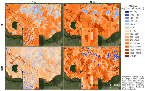
We measured over 13,000 methane fluxes at a site in the Canadian Arctic and linked them with drone and free satellite images. We tested four machine-learning methods and two map scales. Metre-scale maps captured small wet and dry features that strongly affect methane release, while coarser maps blurred them. Different models shifted the monthly methane estimate. This helps choose the right data and tools to map methane, design monitoring networks, and check climate models.
Barbara Widhalm, Annett Bartsch, Tazio Strozzi, Nina Jones, Artem Khomutov, Elena Babkina, Marina Leibman, Rustam Khairullin, Mathias Göckede, Helena Bergstedt, Clemens von Baeckmann, and Xaver Muri
The Cryosphere, 19, 1103–1133, https://doi.org/10.5194/tc-19-1103-2025, https://doi.org/10.5194/tc-19-1103-2025, 2025
Short summary
Short summary
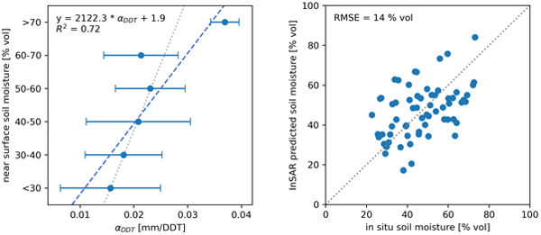
Mapping soil moisture in Arctic permafrost regions is crucial for various activities, but it is challenging with typical satellite methods due to the landscape's diversity. Seasonal freezing and thawing cause the ground to periodically rise and subside. Our research demonstrates that this seasonal ground settlement, measured with Sentinel-1 satellite data, is larger in areas with wetter soils. This method helps to monitor permafrost degradation.
Clemens von Baeckmann, Annett Bartsch, Helena Bergstedt, Aleksandra Efimova, Barbara Widhalm, Dorothee Ehrich, Timo Kumpula, Alexander Sokolov, and Svetlana Abdulmanova
The Cryosphere, 18, 4703–4722, https://doi.org/10.5194/tc-18-4703-2024, https://doi.org/10.5194/tc-18-4703-2024, 2024
Short summary
Short summary
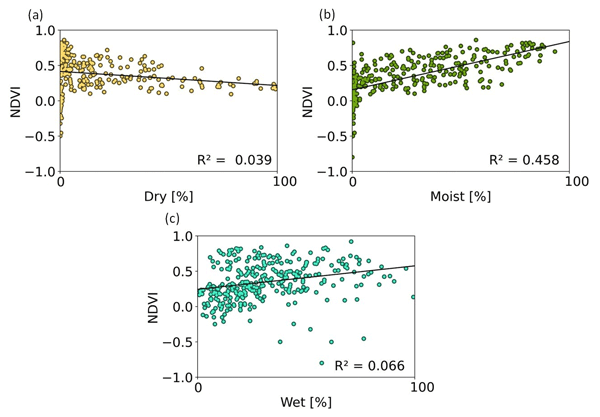
Lakes are common features in Arctic permafrost areas. Land cover change following their drainage needs to be monitored since it has implications for ecology and the carbon cycle. Satellite data are key in this context. We compared a common vegetation index approach with a novel land-cover-monitoring scheme. Land cover information provides specific information on wetland features. We also showed that the bioclimatic gradients play a significant role after drainage within the first 10 years.
Annett Bartsch, Aleksandra Efimova, Barbara Widhalm, Xaver Muri, Clemens von Baeckmann, Helena Bergstedt, Ksenia Ermokhina, Gustaf Hugelius, Birgit Heim, and Marina Leibman
Hydrol. Earth Syst. Sci., 28, 2421–2481, https://doi.org/10.5194/hess-28-2421-2024, https://doi.org/10.5194/hess-28-2421-2024, 2024
Short summary
Short summary
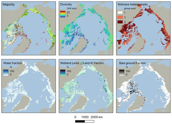
Wetness gradients and landcover diversity for the entire Arctic tundra have been assessed using a novel satellite-data-based map. Patterns of lakes, wetlands, general soil moisture conditions and vegetation physiognomy are represented at 10 m. About 40 % of the area north of the treeline falls into three units of dry types, with limited shrub growth. Wetter regions have higher landcover diversity than drier regions.
Tazio Strozzi, Barbara Widhalm, Nina Jones, Julia Boike, Sofia Antonova, Birgit Heim, Sebastian Westermann, Andreas Kääb, and Annett Bartsch
EGUsphere, https://doi.org/10.5194/egusphere-2026-5477, https://doi.org/10.5194/egusphere-2026-5477, 2026
This preprint is open for discussion and under review for Earth Observation (EO).
Short summary
Short summary
Monitoring long-term surface subsidence induced by ground ice thaw across the pan-Arctic is crucial to detect permafrost changes and assess impacts caused by recent atmospheric warming. Using Sentinel-1 satellite radar data, we successfully measured subsidence rates in Siberia’s Lena Delta and found that they vary remarkably among the three main geomorphological units. To enable continuous, large-scale monitoring, satellite data records must maintain coherence from one summer season to the next.
Jaya Sree Mugunthan, Claude R. Duguay, Justin Murfitt, Elena Zakharova, and Benjamin M. Jones
EGUsphere, https://doi.org/10.5194/egusphere-2026-4309, https://doi.org/10.5194/egusphere-2026-4309, 2026
This preprint is open for discussion and under review for The Cryosphere (TC).
Short summary
Short summary
This paper explores how the new Surface Water and Ocean Topography (SWOT) satellite can improve monitoring of lake ice and seasonal changes in cold regions. Although SWOT observes water surfaces worldwide, how its measurements respond to frozen lakes is not yet well understood. We show that these observations can reveal important ice features, freeze–melt transitions, and changes in snow and ice conditions. The results provide new opportunities for monitoring frozen freshwater environments.
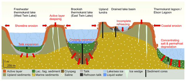
Fabian Seemann, Michael Zech, Maren Jenrich, Guido Grosse, Benjamin M. Jones, Claire Treat, Lutz Schirrmeister, Susanne Liebner, and Jens Strauss
Biogeosciences, 23, 3675–3695, https://doi.org/10.5194/bg-23-3675-2026, https://doi.org/10.5194/bg-23-3675-2026, 2026
Short summary
Short summary
Arctic coastal landscapes, like those in northernmost Alaska, are often characterized by saline permafrost which is prone to thawing. We studied six sediment cores to understand how thawing and salinity affect organic matter breakdown and landscape change. Our results show that salinity accelerates organic matter degradation when permafrost thaws. This highlights the overlooked risk of salinity in shaping Arctic landscapes and carbon mineralization as the climate continues to warm.
Valeria Briones, Hélène Genet, Elchin Jafarov, Brendan Rogers, Jennifer Watts, Anna-Maria Virkkala, Annett Bartsch, Benjamin Maglio, Joshua Rady, and Susan Natali
Earth Syst. Sci. Data Discuss., https://doi.org/10.5194/essd-2026-29, https://doi.org/10.5194/essd-2026-29, 2026
Preprint under review for ESSD
Short summary
Short summary
Rapid warming is reshaping Arctic landscapes as frozen ground thaws, affecting ecosystems and climate. To better understand these changes, we created a map showing the distribution of land types such as forests, shrubs, and wetlands across the Arctic and northern regions. We combined several existing maps using computer-based pattern recognition to develop a harmonized circumpolar land cover dataset that maps ecosystems across the Arctic–Boreal region at 1-km resolution for the period 2000–2023.
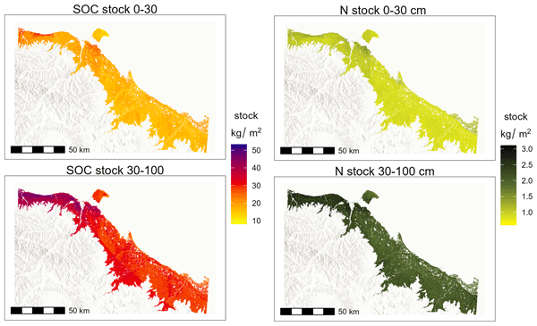
Julia Wagner, Juliane Wolter, Justine Ramage, Victoria Martin, Andreas Richter, Niek Jesse Speetjens, Jorien E. Vonk, Rachele Lodi, Annett Bartsch, Michael Fritz, Hugues Lantuit, and Gustaf Hugelius
SOIL, 12, 113–132, https://doi.org/10.5194/soil-12-113-2026, https://doi.org/10.5194/soil-12-113-2026, 2026
Short summary
Short summary
Permafrost soils store vast amounts of organic carbon, key to understanding climate change. This study uses machine learning and combines existing data with new field data to create detailed regional maps of soil carbon and nitrogen stocks for the Yukon coastal plain. The results show how soil properties vary across the landscape highlighting the importance of data selection for accurate predictions. These findings improve carbon storage estimates and may aid regional carbon budget assessments.
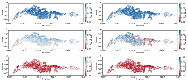
Hong Lin, Jinyang Du, John S. Kimball, Xiao Cheng, J. Patrick Donnelly, Jennifer D. Watts, and Annett Bartsch
Earth Syst. Sci. Data, 18, 535–549, https://doi.org/10.5194/essd-18-535-2026, https://doi.org/10.5194/essd-18-535-2026, 2026
Short summary
Short summary
Ice cover on small water bodies is highly sensitive to climate change and influences ecosystems, water, and the carbon cycle. We produced a satellite-based ice fraction dataset for small water bodies on the Arctic Coastal Plain from 2017 to 2023. The dataset captures freeze-up and break-up timing and reveals spatial variability. It will support studies of climate–ice interactions and improve models of water and carbon processes.
Kseniia Ivanova, Anna-Maria Virkkala, Victor Brovkin, Tobias Stacke, Barbara Widhalm, Annett Bartsch, Carolina Voigt, Oliver Sonnentag, and Mathias Göckede
Biogeosciences, 23, 233–262, https://doi.org/10.5194/bg-23-233-2026, https://doi.org/10.5194/bg-23-233-2026, 2026
Short summary
Short summary
We measured over 13,000 methane fluxes at a site in the Canadian Arctic and linked them with drone and free satellite images. We tested four machine-learning methods and two map scales. Metre-scale maps captured small wet and dry features that strongly affect methane release, while coarser maps blurred them. Different models shifted the monthly methane estimate. This helps choose the right data and tools to map methane, design monitoring networks, and check climate models.
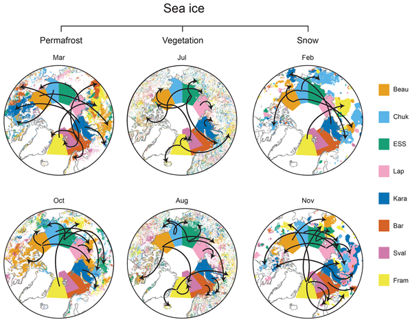
Annett Bartsch, Rodrigue Tanguy, Helena Bergstedt, Clemens von Baeckmann, Hans Tømmervik, Marc Macias-Fauria, Juha Lemmetyinen, Kimmo Rautiainen, Chiara Gruber, and Bruce C. Forbes
The Cryosphere, 19, 4929–4967, https://doi.org/10.5194/tc-19-4929-2025, https://doi.org/10.5194/tc-19-4929-2025, 2025
Short summary
Short summary
We identified similarities between sea ice dynamics and conditions on land across the Arctic, above 60° N, for 2000–2019. Significant correlations were more common for snow water equivalent and permafrost ground temperature than for the vegetation parameters. Changes across all the different parameters could specifically be determined for eastern Siberia. The results provide a baseline for future studies on common drivers of essential climate variables and causative effects across the Arctic.
Frieda P. Giest, Maren Jenrich, Guido Grosse, Benjamin M. Jones, Kai Mangelsdorf, Torben Windirsch, and Jens Strauss
Biogeosciences, 22, 2871–2887, https://doi.org/10.5194/bg-22-2871-2025, https://doi.org/10.5194/bg-22-2871-2025, 2025
Short summary
Short summary
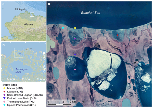
Climate warming causes permafrost to thaw, releasing greenhouse gases and affecting ecosystems. We studied sediments from Arctic coastal landscapes, including land, lakes, lagoons, and the ocean, finding that organic carbon storage and quality vary with landscape features and saltwater influence. Freshwater and land areas store more carbon, while saltwater reduces its quality. These findings improve predictions of Arctic responses to climate change and their impact on global carbon cycling.
Qing Ying, Benjamin Poulter, Jennifer D. Watts, Kyle A. Arndt, Anna-Maria Virkkala, Lori Bruhwiler, Youmi Oh, Brendan M. Rogers, Susan M. Natali, Hilary Sullivan, Amanda Armstrong, Eric J. Ward, Luke D. Schiferl, Clayton D. Elder, Olli Peltola, Annett Bartsch, Ankur R. Desai, Eugénie Euskirchen, Mathias Göckede, Bernhard Lehner, Mats B. Nilsson, Matthias Peichl, Oliver Sonnentag, Eeva-Stiina Tuittila, Torsten Sachs, Aram Kalhori, Masahito Ueyama, and Zhen Zhang
Earth Syst. Sci. Data, 17, 2507–2534, https://doi.org/10.5194/essd-17-2507-2025, https://doi.org/10.5194/essd-17-2507-2025, 2025
Short summary
Short summary
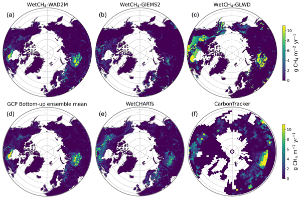
We present daily methane (CH4) fluxes of northern wetlands at 10 km resolution during 2016–2022 (WetCH4) derived from a novel machine learning framework. We estimated an average annual CH4 emission of 22.8 ± 2.4 Tg CH4 yr−1 (15.7–51.6 Tg CH4 yr−1). Emissions were intensified in 2016, 2020, and 2022, with the largest interannual variation coming from Western Siberia. Continued, all-season tower observations and improved soil moisture products are needed for future improvement of CH4 upscaling.
Valeria Briones, Hélène Genet, Elchin E. Jafarov, Brendan M. Rogers, Jennifer D. Watts, Anna-Maria Virkkala, Annett Bartsch, Benjamin C. Maglio, Joshua Rady, and Susan M. Natali
Earth Syst. Sci. Data Discuss., https://doi.org/10.5194/essd-2025-226, https://doi.org/10.5194/essd-2025-226, 2025
Manuscript not accepted for further review
Short summary
Short summary
Arctic warming is causing permafrost to thaw, affecting ecosystems and climate. Since land cover, especially vegetation, shapes how permafrost responds, accurate maps are crucial. Using machine learning, we combined existing global and regional datasets to create a hybrid detailed 1-km map of Arctic-Boreal land cover, improving the representation of forests, shrubs, and wetlands across the circumpolar.
Barbara Widhalm, Annett Bartsch, Tazio Strozzi, Nina Jones, Artem Khomutov, Elena Babkina, Marina Leibman, Rustam Khairullin, Mathias Göckede, Helena Bergstedt, Clemens von Baeckmann, and Xaver Muri
The Cryosphere, 19, 1103–1133, https://doi.org/10.5194/tc-19-1103-2025, https://doi.org/10.5194/tc-19-1103-2025, 2025
Short summary
Short summary
Mapping soil moisture in Arctic permafrost regions is crucial for various activities, but it is challenging with typical satellite methods due to the landscape's diversity. Seasonal freezing and thawing cause the ground to periodically rise and subside. Our research demonstrates that this seasonal ground settlement, measured with Sentinel-1 satellite data, is larger in areas with wetter soils. This method helps to monitor permafrost degradation.
Annett Bartsch, Xaver Muri, Markus Hetzenecker, Kimmo Rautiainen, Helena Bergstedt, Jan Wuite, Thomas Nagler, and Dmitry Nicolsky
The Cryosphere, 19, 459–483, https://doi.org/10.5194/tc-19-459-2025, https://doi.org/10.5194/tc-19-459-2025, 2025
Short summary
Short summary
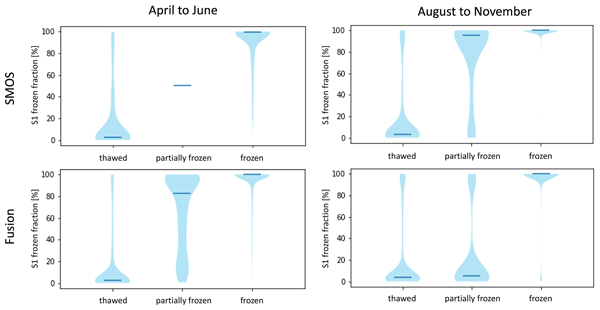
We developed a robust freeze–thaw detection approach, applying a constant threshold to Copernicus Sentinel-1 data that is suitable for tundra regions. All global, coarser-resolution products, tested with the resulting benchmarking dataset, are of value for freeze–thaw retrieval, although differences were found depending on the seasons, particularly during the spring and autumn transition.
Noriaki Ohara, Andrew D. Parsekian, Benjamin M. Jones, Rodrigo C. Rangel, Kenneth M. Hinkel, and Rui A. P. Perdigão
The Cryosphere, 18, 5139–5152, https://doi.org/10.5194/tc-18-5139-2024, https://doi.org/10.5194/tc-18-5139-2024, 2024
Short summary
Short summary
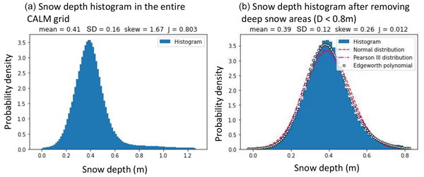
Snow distribution characterization is essential for accurate snow water estimation for water resource prediction from existing in situ observations and remote-sensing data at a finite spatial resolution. Four different observed snow distribution datasets were analyzed for Gaussianity. We found that non-Gaussianity of snow distribution is a signature of the wind redistribution effect. Generally, seasonal snowpack can be approximated well by a Gaussian distribution for a fully snow-covered area.
Lydia Stolpmann, Ingmar Nitze, Ingeborg Bussmann, Benjamin M. Jones, Josefine Lenz, Hanno Meyer, Juliane Wolter, and Guido Grosse
EGUsphere, https://doi.org/10.5194/egusphere-2024-2822, https://doi.org/10.5194/egusphere-2024-2822, 2024
Preprint archived
Short summary
Short summary
We combine hydrochemical and lake change data to show consequences of permafrost thaw induced lake changes on hydrochemistry, which are relevant for the global carbon cycle. We found higher methane concentrations in lakes that do not freeze to the ground and show that lagoons have lower methane concentrations than lakes. Our detailed lake sampling approach show higher concentrations in Dissolved Organic Carbon in areas of higher erosion rates, that might increase under the climate warming.
Clemens von Baeckmann, Annett Bartsch, Helena Bergstedt, Aleksandra Efimova, Barbara Widhalm, Dorothee Ehrich, Timo Kumpula, Alexander Sokolov, and Svetlana Abdulmanova
The Cryosphere, 18, 4703–4722, https://doi.org/10.5194/tc-18-4703-2024, https://doi.org/10.5194/tc-18-4703-2024, 2024
Short summary
Short summary
Lakes are common features in Arctic permafrost areas. Land cover change following their drainage needs to be monitored since it has implications for ecology and the carbon cycle. Satellite data are key in this context. We compared a common vegetation index approach with a novel land-cover-monitoring scheme. Land cover information provides specific information on wetland features. We also showed that the bioclimatic gradients play a significant role after drainage within the first 10 years.
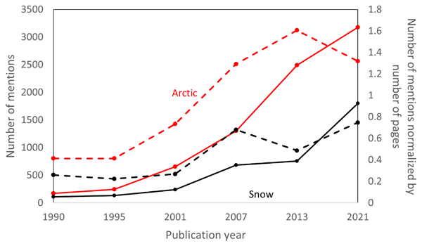
Cecile B. Menard, Sirpa Rasmus, Ioanna Merkouriadi, Gianpaolo Balsamo, Annett Bartsch, Chris Derksen, Florent Domine, Marie Dumont, Dorothee Ehrich, Richard Essery, Bruce C. Forbes, Gerhard Krinner, David Lawrence, Glen Liston, Heidrun Matthes, Nick Rutter, Melody Sandells, Martin Schneebeli, and Sari Stark
The Cryosphere, 18, 4671–4686, https://doi.org/10.5194/tc-18-4671-2024, https://doi.org/10.5194/tc-18-4671-2024, 2024
Short summary
Short summary
Computer models, like those used in climate change studies, are written by modellers who have to decide how best to construct the models in order to satisfy the purpose they serve. Using snow modelling as an example, we examine the process behind the decisions to understand what motivates or limits modellers in their decision-making. We find that the context in which research is undertaken is often more crucial than scientific limitations. We argue for more transparency in our research practice.
Annett Bartsch, Aleksandra Efimova, Barbara Widhalm, Xaver Muri, Clemens von Baeckmann, Helena Bergstedt, Ksenia Ermokhina, Gustaf Hugelius, Birgit Heim, and Marina Leibman
Hydrol. Earth Syst. Sci., 28, 2421–2481, https://doi.org/10.5194/hess-28-2421-2024, https://doi.org/10.5194/hess-28-2421-2024, 2024
Short summary
Short summary
Wetness gradients and landcover diversity for the entire Arctic tundra have been assessed using a novel satellite-data-based map. Patterns of lakes, wetlands, general soil moisture conditions and vegetation physiognomy are represented at 10 m. About 40 % of the area north of the treeline falls into three units of dry types, with limited shrub growth. Wetter regions have higher landcover diversity than drier regions.
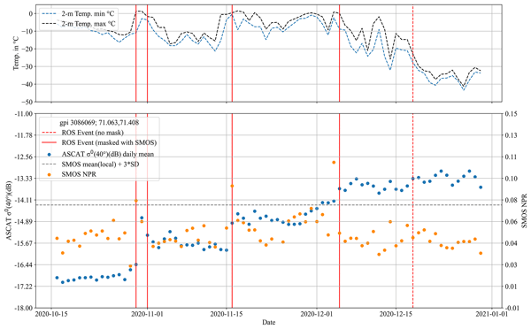
Annett Bartsch, Helena Bergstedt, Georg Pointner, Xaver Muri, Kimmo Rautiainen, Leena Leppänen, Kyle Joly, Aleksandr Sokolov, Pavel Orekhov, Dorothee Ehrich, and Eeva Mariatta Soininen
The Cryosphere, 17, 889–915, https://doi.org/10.5194/tc-17-889-2023, https://doi.org/10.5194/tc-17-889-2023, 2023
Short summary
Short summary
Rain-on-snow (ROS) events occur across many regions of the terrestrial Arctic in mid-winter. In extreme cases ice layers form which affect wildlife, vegetation and soils beyond the duration of the event. The fusion of multiple types of microwave satellite observations is suggested for the creation of a climate data record. Retrieval is most robust in the tundra biome, where records can be used to identify extremes and the results can be applied to impact studies at regional scale.
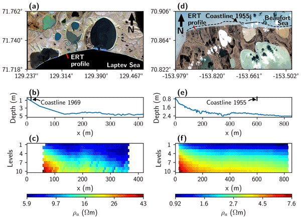
Mauricio Arboleda-Zapata, Michael Angelopoulos, Pier Paul Overduin, Guido Grosse, Benjamin M. Jones, and Jens Tronicke
The Cryosphere, 16, 4423–4445, https://doi.org/10.5194/tc-16-4423-2022, https://doi.org/10.5194/tc-16-4423-2022, 2022
Short summary
Short summary
We demonstrate how we can reliably estimate the thawed–frozen permafrost interface with its associated uncertainties in subsea permafrost environments using 2D electrical resistivity tomography (ERT) data. In addition, we show how further analyses considering 1D inversion and sensitivity assessments can help quantify and better understand 2D ERT inversion results. Our results illustrate the capabilities of the ERT method to get insights into the development of the subsea permafrost.
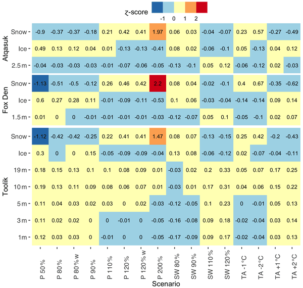
Jason A. Clark, Elchin E. Jafarov, Ken D. Tape, Benjamin M. Jones, and Victor Stepanenko
Geosci. Model Dev., 15, 7421–7448, https://doi.org/10.5194/gmd-15-7421-2022, https://doi.org/10.5194/gmd-15-7421-2022, 2022
Short summary
Short summary
Lakes in the Arctic are important reservoirs of heat. Under climate warming scenarios, we expect Arctic lakes to warm the surrounding frozen ground. We simulate water temperatures in three Arctic lakes in northern Alaska over several years. Our results show that snow depth and lake ice strongly affect water temperatures during the frozen season and that more heat storage by lakes would enhance thawing of frozen ground.
M. R. Udawalpola, C. Witharana, A. Hasan, A. Liljedahl, M. Ward Jones, and B. Jones
Int. Arch. Photogramm. Remote Sens. Spatial Inf. Sci., XLVI-M-2-2022, 203–208, https://doi.org/10.5194/isprs-archives-XLVI-M-2-2022-203-2022, https://doi.org/10.5194/isprs-archives-XLVI-M-2-2022-203-2022, 2022
Noriaki Ohara, Benjamin M. Jones, Andrew D. Parsekian, Kenneth M. Hinkel, Katsu Yamatani, Mikhail Kanevskiy, Rodrigo C. Rangel, Amy L. Breen, and Helena Bergstedt
The Cryosphere, 16, 1247–1264, https://doi.org/10.5194/tc-16-1247-2022, https://doi.org/10.5194/tc-16-1247-2022, 2022
Short summary
Short summary
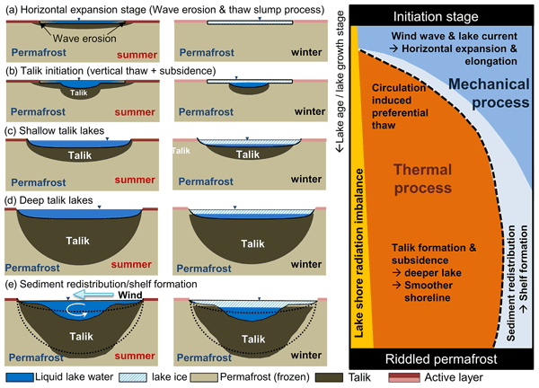
New variational principle suggests that a semi-ellipsoid talik shape (3D Stefan equation) is optimum for incoming energy. However, the lake bathymetry tends to be less ellipsoidal due to the ice-rich layers near the surface. Wind wave erosion is likely responsible for the elongation of lakes, while thaw subsidence slows the wave effect and stabilizes the thermokarst lakes. The derived 3D Stefan equation was compared to the field-observed talik thickness data using geophysical methods.
Cited articles
Abe, T., Iwahana, G., Tadono, T., and Iijima, Y.: Ground Surface Displacement After a Forest Fire Near Mayya, Eastern Siberia, Using InSAR: Observation and Implication for Geophysical Modeling, Earth and Space Science, 9, https://doi.org/10.1029/2022EA002476, 2022. a
Antonova, S., Sudhaus, H., Strozzi, T., Zwieback, S., Kääb, A., Heim, B., Langer, M., Bornemann, N., and Boike, J.: Thaw Subsidence of a Yedoma Landscape in Northern Siberia, Measured In Situ and Estimated from TerraSAR-X Interferometry, Remote Sensing, 10, https://doi.org/10.3390/rs10040494, 2018. a
Bartsch, A., Leibman, M., Strozzi, T., Khomutov, A., Widhalm, B., Babkina, E., Mullanurov, D., Ermokhina, K., Kroisleitner, C., and Bergstedt, H.: Seasonal Progression of Ground Displacement Identified with Satellite Radar Interferometry and the Impact of Unusually Warm Conditions on Permafrost at the Yamal Peninsula in 2016, Remote Sensing, 11, https://doi.org/10.3390/rs11161865, 2019. a, b
Bartsch, A., Widhalm, B., Leibman, M., Ermokhina, K., Kumpula, T., Skarin, A., Wilcox, E. J., Jones, B. M., Frost, G. V., Höfler, A., and Pointner, G.: Feasibility of tundra vegetation height retrieval from Sentinel-1 and Sentinel-2 data, Remote Sens. Environ., 237, 111515, https://doi.org/10.1016/j.rse.2019.111515, 2020. a, b, c
Bartsch, A., Bergstedt, H., Pointner, G., Muri, X., Rautiainen, K., Leppänen, L., Joly, K., Sokolov, A., Orekhov, P., Ehrich, D., and Soininen, E. M.: Towards long-term records of rain-on-snow events across the Arctic from satellite data, The Cryosphere, 17, 889–915, https://doi.org/10.5194/tc-17-889-2023, 2023. a
Bartsch, A., Efimova, A., Widhalm, B., Muri, X., von Baeckmann, C., Bergstedt, H., Ermokhina, K., Hugelius, G., Heim, B., and Leibman, M.: Circumarctic land cover diversity considering wetness gradients, Hydrol. Earth Syst. Sci., 28, 2421–2481, https://doi.org/10.5194/hess-28-2421-2024, 2024. a, b, c
Bartsch, A., Widhalm, B., Radha Krishnan, S. R., and Liu, Z.: Tracking land surface deformation in lowland permafrost regions across the Arctic exploiting the first decade of Copernicus Sentinel-1, Remote Sens. Environ., 340, 115409, https://doi.org/10.1016/j.rse.2026.115409, 2026. a
Berardino, P., Fornaro, G., Lanari, R., and Sansosti, E.: A new algorithm for surface deformation monitoring based on small baseline differential SAR interferograms, IEEE T. Geosci. Remote, 40, 2375–2383, https://doi.org/10.1109/TGRS.2002.803792, 2002. a
Bergstedt, H., Zwieback, S., Bartsch, A., and Leibman, M.: Dependence of C-Band Backscatter on Ground Temperature, Air Temperature and Snow Depth in Arctic Permafrost Regions, Remote Sensing, 10, https://doi.org/10.3390/rs10010142, 2018. a
Bliss, L. C. and Wein, R. W.: Plant community responses to disturbances in the western Canadian Arctic, Can. J. Botany, 50, 1097–1109, https://doi.org/10.1139/b72-136, 1972. a
Bureau of Land Management, Alaska Interagency Coordination Center: Alaska Fire History Perimeter Polygons, 1940–2024, AICC [data set], https://fire.ak.blm.gov/predsvcs/maps.php (last accessed: 1 April 2025), 2024. a
Burns, J. J.: Pingos in the Yukon-Kuskokwim Delta, Alaska: Their Plant Succession and Use by Mink, Arctic, 17, 203–210, http://www.jstor.org/stable/40507169 (last access: 20 August 2026), 1964. a
Chen, J., Wu, Y., O'Connor, M., Cardenas, M. B., Schaefer, K., Michaelides, R., and Kling, G.: Active layer freeze-thaw and water storage dynamics in permafrost environments inferred from InSAR, Remote Sens. Environ., 248, 112007, https://doi.org/10.1016/j.rse.2020.112007, 2020. a
Chen, R. H., Michaelides, R. J., Chen, J., Chen, A. C., Clayton, L. K., Bakian-Dogaheh, K., Huang, L., Jafarov, E., Liu, L., Moghaddam, M., Parsekian, A. D., Sullivan, T. D., Tabatabaeenejad, A., Wig, E., Zebker, H. A., and Zhao, Y.: ABoVE: Active Layer Thickness from Airborne L- and P-band SAR, Alaska, 2017, Ver. 3, ORNL Distributed Active Archive Center [data set], https://doi.org/10.3334/ORNLDAAC/2004, 2022. a, b, c
Chen, R. H., Michaelides, R. J., Zhao, Y., Huang, L., Wig, E., Sullivan, T. D., Parsekian, A. D., Zebker, H. A., Moghaddam, M., and Schaefer, K. M.: Permafrost Dynamics Observatory (PDO): 2. Joint Retrieval of Permafrost Active Layer Thickness and Soil Moisture From L-Band InSAR and P-Band PolSAR, Earth and Space Science, 10, e2022EA002453, https://doi.org/10.1029/2022EA002453, 2023. a
Chen, Y., Hu, F. S., and Lara, M. J.: Divergent shrub-cover responses driven by climate, wildfire, and permafrost interactions in Arctic tundra ecosystems, Glob. Change Biol., 27, 652–663, https://doi.org/10.1111/gcb.15451, 2021a. a
Chen, Y., Lara, M. J., Jones, B. M., Frost, G. V., and Hu, F. S.: Thermokarst acceleration in Arctic tundra driven by climate change and fire disturbance, One Earth, 4, 1718–1729, https://doi.org/10.1016/j.oneear.2021.11.011, 2021b. a
Copernicus: Copernicus DEM – Global Digital Elevation Model, CDSE [data set], https://doi.org/10.5270/ESA-c5d3d65, 2019. a, b
Costantini, M.: A novel phase unwrapping method based on network programming, IEEE T. Geosci. Remote, 36, 813–821, https://doi.org/10.1109/36.673674, 1998. a, b
Elias, S. A., Hamilton, T. D., Edwards, M. E., Begét, J. E., Krumhardt, A. P., and Lavoie, C.: Late Pleistocene environments of the western Noatak basin, northwestern Alaska, GSA Bulletin, 111, 769–789, https://doi.org/10.1130/0016-7606(1999)111<0769:LPEOTW>2.3.CO;2, 1999. a
Eshqi Molan, Y., Kim, J.-W., Lu, Z., Wylie, B., and Zhu, Z.: Modeling Wildfire-Induced Permafrost Deformation in an Alaskan Boreal Forest Using InSAR Observations, Remote Sensing, 10, https://doi.org/10.3390/rs10030405, 2018. a
Foster, A. C., Wang, J. A., Frost, G. V., Davidson, S. J., Hoy, E., Turner, K. W., Sonnentag, O., Epstein, H., Berner, L. T., Armstrong, A. H., Kang, M., Rogers, B. M., Campbell, E., Miner, K. R., Orndahl, K. M., Bourgeau-Chavez, L. L., Lutz, D. A., French, N., Chen, D., Du, J., Shestakova, T. A., Shuman, J. K., Tape, K., Virkkala, A.-M., Potter, C., and Goetz, S.: Disturbances in North American boreal forest and Arctic tundra: impacts, interactions, and responses, Environ. Res. Lett., 17, 113001, https://doi.org/10.1088/1748-9326/ac98d7, 2022. a
Frost, G. V., Loehman, R. A., Saperstein, L. B., Macander, M. J., Nelson, P. R., Paradis, D. P., and Natali, S. M.: Multi-decadal patterns of vegetation succession after tundra fire on the Yukon-Kuskokwim Delta, Alaska, Environ. Res. Lett., 15, 025003, https://doi.org/10.1088/1748-9326/ab5f49, 2020. a, b, c
Gaglioti, B. V., Berner, L. T., Jones, B. M., Orndahl, K. M., Williams, A. P., Andreu-Hayles, L., D'Arrigo, R. D., Goetz, S. J., and Mann, D. H.: Tussocks Enduring or Shrubs Greening: Alternate Responses to Changing Fire Regimes in the Noatak River Valley, Alaska, J. Geophys. Res.-Biogeo., 126, https://doi.org/10.1029/2020JG006009, 2021. a, b
Geological Survey of Canada: Surficial geology of Canada; Geological Survey of Canada, Canadian Geoscience Map 195 (preliminary, Surficial Data Model v. 2.0 conversion of Map1880A), scale 1:5 000 000, https://doi.org/10.4095/295462, 2014. a
Goldstein, R. M. and Werner, C. L.: Radar interferogram filtering for geophysical applications, Geophys. Res. Lett., 25, 4035–4038, https://doi.org/10.1029/1998GL900033, 1998. a, b
Heim, R. J., Rocha, A. V., Zemlianskii, V., Barrett, K., Bültmann, H., Breen, A., Frost, G. V., Hollingsworth, T. N., Jandt, R., Kozlova, M., Kurka, A., Jorgenson, M. T., Landhäusser, S. M., Loranty, M. M., Miller, E. A., Narita, K., Pravdolyubova, E., Hölzel, N., and Schaepman-Strub, G.: Arctic tundra ecosystems under fire – Alternative ecosystem states in a changing climate?, J. Ecol., 113, https://doi.org/10.1111/1365-2745.70022, 2025. a, b, c
Hersbach, H., Bell, B., Berrisford, P., Biavati, G., Horányi, A., Muñoz Sabater, J., Nicolas, J., Peubey, C., Radu, R., Rozum, I., Schepers, D., Simmons, A., Soci, C., Dee, D., and Thépaut, J.-N.: ERA5 hourly data on single levels from 1940 to present, Copernicus Climate Change Service (C3S) Climate Data Store (CDS) [data set], https://doi.org/10.24381/cds.adbb2d47, 2023. a
Holt, E., McCune, B., and Neitlich, P.: Macrolichen communities in relation to soils and vegetation in the Noatak National Preserve, Alaska, Botany, 87, 241–252, https://doi.org/10.1139/B08-142, 2009. a
Hu, F., Higuera, P., Duffy, P., Chipman, M., Rocha, A., Young, A., Kelly, R., and Dietze, M.: Arctic tundra fires: natural variability and responses to climate change, Front. Ecol. Environ., 13, 369–377, https://doi.org/10.1890/150063, 2015. a
Iwahana, G., Uchida, M., Liu, L., Gong, W., Meyer, F. J., Guritz, R., Yamanokuchi, T., and Hinzman, L.: InSAR Detection and Field Evidence for Thermokarst after a Tundra Wildfire, Using ALOS-PALSAR, Remote Sensing, 8, https://doi.org/10.3390/rs8030218, 2016. a
Jafarov, E. E., Romanovsky, V. E., Genet, H., McGuire, A. D., and Marchenko, S. S.: The effects of fire on the thermal stability of permafrost in lowland and upland black spruce forests of interior Alaska in a changing climate, Environ. Res. Lett., 8, 035030, https://doi.org/10.1088/1748-9326/8/3/035030, 2013. a
Jandt, R. R., Miller, E. A., and Jones, B. N.: Fire effects 10 years after the anaktuvuk river tundra fire, Tech. rep., US Department of the Interior, Bureau of Land Management, https://www.blm.gov/sites/default/files/docs/2021-06/BLM_AK_TR_64.pdf (last access: 20 August 2026), 2021. a
Jenkins, L., Bourgeau-Chavez, L., French, N., Loboda, T., and Thelen, B.: Development of Methods for Detection and Monitoring of Fire Disturbance in the Alaskan Tundra Using a Two-Decade Long Record of Synthetic Aperture Radar Satellite Images, Remote Sensing, 6, 6347–6364, https://doi.org/10.3390/rs6076347, 2014. a, b, c, d, e
Jones, B., Grosse, G., Arp, C. D., Miller, E., Liu, L., Hayes, D. J., and Larsen, C. F.: Recent Arctic tundra fire initiates widespread thermokarst development, Scientific Reports, 5, 15865, https://doi.org/10.1038/srep15865, 2015. a
Jones, B., Kanevskiy, M., Shur, Y., Gaglioti, B., Jorgenson, M., Ward Jones, M., Veremeeva, A., Miller, E., and Jandt, R.: Post-fire stabilization of thaw-affected permafrost terrain in northern Alaska, Scientific Reports, 14, https://doi.org/10.1038/s41598-024-58998-5, 2024a. a
Jones, B., Kanevskiy, M., Shur, Y., Ward Jones, M., Gaglioti, B., Jorgenson, T., Veremeeva, A., Miller, E., and Jandt, R.: Multi-temporal elevation data, ground temperature time-series, and permafrost borehole logs document the recovery of permafrost at the Anaktuvuk River tundra fire, 2009 to 2023, Arctic Data Center [data set], https://doi.org/10.18739/A2251FM9P, 2024b. a, b, c, d, e, f, g, h
Jones, B. M., Breen, A. L., Gaglioti, B. V., Mann, D. H., Rocha, A. V., Grosse, G., Arp, C. D., Kunz, M. L., and Walker, D. A.: Identification of unrecognized tundra fire events on the north slope of Alaska, J. Geophys. Res.-Biogeo., 118, 1334–1344, https://doi.org/10.1002/jgrg.20113, 2013. a
Jones, B. M., Tape, K. D., Clark, J. A., Bondurant, A. C., Ward Jones, M. K., Gaglioti, B. V., Elder, C. D., Witharana, C., and Miller, C. E.: Multi-Dimensional Remote Sensing Analysis Documents Beaver-Induced Permafrost Degradation, Seward Peninsula, Alaska, Remote Sensing, 13, https://doi.org/10.3390/rs13234863, 2021. a
Jorgenson, M. T. and Roth, J. E.: Landscape classification and mapping for the Yukon-Kuskokwim Delta, Alaska, Tech. rep., U.S. Fish and Wildlife Service by ABR, Inc., Environmental Research and Services, Fairbanks, AK, USA, https://www.academia.edu/106336923/LANDSCAPE_CLASSIFICATION (last access: 20 Augsut 2026), 2010. a
Kasischke, E., Williams, D., and Barry, D.: Analysis of patterns of large fires in the boreal forest region of Alaska, Int. J. Wildland Fire, 11.2, 131–144, https://doi.org/10.1071/WF02023, 2002. a
Kolden, C. A. and Rogan, J.: Mapping Wildfire Burn Severity in the Arctic Tundra from Downsampled MODIS Data, Arct. Antarct. Alp. Res., 45, 64–76, https://doi.org/10.1657/1938-4246-45.1.64, 2013. a, b
Liljedahl, A., Hinzman, L., Busey, R., and Yoshikawa, K.: Physical short-term changes after a tussock tundra fire, Seward Peninsula, Alaska, J. Geophys. Res.-Earth, 112, https://doi.org/10.1029/2006JF000554, 2007. a
Liu, L., Schaefer, K., Zhang, T., and Wahr, J.: Estimating 1992–2000 average active layer thickness on the Alaskan North Slope from remotely sensed surface subsidence, J. Geophys. Res.-Earth, 117, https://doi.org/10.1029/2011JF002041, 2012. a, b, c
Liu, L., Jafarov, E. E., Schaefer, K. M., Jones, B. M., Zebker, H. A., Williams, C. A., Rogan, J., and Zhang, T.: InSAR detects increase in surface subsidence caused by an Arctic tundra fire, Geophys. Res. Lett., 41, 3906–3913, https://doi.org/10.1002/2014GL060533, 2014. a, b
Mack, M., Bret-Harte, M., Hollingsworth, T., Jandt, R., Schuur, E., Shaver, G., and Verbyla, D.: Carbon loss from an unprecedented Arctic tundra wildfire, Nature, 475, 489–92, https://doi.org/10.1038/nature10283, 2011. a
Madaj, L.: Entangled climate risks: Interactions between permafrost thaw and wildfires, Cascade Institute, version 1.0, https://cascadeinstitute.org/technical-paper/permafrost-wildfires-brief/ (last access: 20 August 2026), 2025. a
Masrur, A., Petrov, A. N., and DeGroote, J.: Circumpolar spatio-temporal patterns and contributing climatic factors of wildfire activity in the Arctic tundra from 2001–2015, Environ. Res. Lett., 13, 014019, https://doi.org/10.1088/1748-9326/aa9a76, 2018. a
McCarty, J. L., Aalto, J., Paunu, V.-V., Arnold, S. R., Eckhardt, S., Klimont, Z., Fain, J. J., Evangeliou, N., Venäläinen, A., Tchebakova, N. M., Parfenova, E. I., Kupiainen, K., Soja, A. J., Huang, L., and Wilson, S.: Reviews and syntheses: Arctic fire regimes and emissions in the 21st century, Biogeosciences, 18, 5053–5083, https://doi.org/10.5194/bg-18-5053-2021, 2021. a, b, c
Michaelides, R. J., Schaefer, K., Zebker, H. A., Parsekian, A., Liu, L., Chen, J., Natali, S., Ludwig, S., and Schaefer, S. R.: Inference of the impact of wildfire on permafrost and active layer thickness in a discontinuous permafrost region using the remotely sensed active layer thickness (ReSALT) algorithm, Environ. Res. Lett., 14, 035007, https://doi.org/10.1088/1748-9326/aaf932, 2019. a, b, c, d, e, f, g, h, i, j, k, l, m, n, o, p, q, r, s, t, u, v, w, x
Miller, E. A., Jones, B. M., Baughman, C. A., Jandt, R. R., Jenkins, J. L., and Yokel, D. A.: Unrecorded Tundra Fires of the Arctic Slope, Alaska USA, Fire, 6, https://doi.org/10.3390/fire6030101, 2023. a, b
Muller, S., Walker, D., and Jorgenson, M.: Land Cover and Ecosystem Map Collection for Northern Alaska, ORNL DAAC, Oak Ridge, Tennessee, USA [data set], https://doi.org/10.3334/ORNLDAAC/1359, 2018. a
Myers-Smith, I. H., Forbes, B. C., Wilmking, M., Hallinger, M., Lantz, T., Blok, D., Tape, K. D., Macias-Fauria, M., Sass-Klaassen, U., Lévesque, E., Boudreau, S., Ropars, P., Hermanutz, L., Trant, A., Collier, L. S., Weijers, S., Rozema, J., Rayback, S. A., Schmidt, N. M., Schaepman-Strub, G., Wipf, S., Rixen, C., Ménard, C. B., Venn, S., Goetz, S., Andreu-Hayles, L., Elmendorf, S., Ravolainen, V., Welker, J., Grogan, P., Epstein, H. E., and Hik, D. S.: Shrub expansion in tundra ecosystems: dynamics, impacts and research priorities, Environ. Res. Lett., 6, 045509, https://doi.org/10.1088/1748-9326/6/4/045509, 2011. a
Nossov, D. R., Torre Jorgenson, M., Kielland, K., and Kanevskiy, M. Z.: Edaphic and microclimatic controls over permafrost response to fire in interior Alaska, Environ. Res. Lett., 8, 035013, https://doi.org/10.1088/1748-9326/8/3/035013, 2013. a
Obu, J., Westermann, S., Bartsch, A., Berdnikov, N., Christiansen, H. H., Dashtseren, A., Delaloye, R., Elberling, B., Etzelmüller, B., Kholodov, A., Khomutov, A., Kääb, A., Leibman, M. O., Lewkowicz, A. G., Panda, S. K., Romanovsky, V., Way, R. G., Westergaard-Nielsen, A., Wu, T., Yamkhin, J., and Zou, D.: Northern Hemisphere permafrost map based on TTOP modelling for 2000–2016 at 1 km2 scale, Earth-Sci. Rev., 193, 299–316, https://doi.org/10.1016/j.earscirev.2019.04.023, 2019. a, b, c
Racine, C. H., Dennis, J. G., and Patterson, W. A.: Tundra Fire Regimes in the Noatak River Watershed, Alaska: 1956-83, Arctic, 38, 194–200, http://www.jstor.org/stable/40510382, 1985. a
Schaefer, K., Liu, L., Parsekian, A., Jafarov, E., Chen, A., Zhang, T., Gusmeroli, A., Panda, S., Zebker, H. A., and Schaefer, T.: Remotely Sensed Active Layer Thickness (ReSALT) at Barrow, Alaska Using Interferometric Synthetic Aperture Radar, Remote Sensing, 7, 3735–3759, https://doi.org/10.3390/rs70403735, 2015. a
Smith, S., Riseborough, D., and Bonnaventure, P.: Eighteen Year Record of Forest Fire Effects on Ground Thermal Regimes and Permafrost in the Central Mackenzie Valley, NWT, Canada, Permafrost Periglac., 26, https://doi.org/10.1002/ppp.1849, 2015. a
Strozzi, T., Jones, N., Boike, J., Antonova, S., Heim, B., Leinss, S., Wegmüller, U., Westermann, S., Kääb, A., Grosse, G., and Bartsch, A.: Seasonal vertical surface thaw displacement in 2018 on Samoylov Island (Lena Delta, northeastern Siberia) measured by satellite SAR interferometry with X-, C- and L-band sensors, Remote Sens. Environ., 335, 115293, https://doi.org/10.1016/j.rse.2026.115293, 2026. a
Werner, C., Wegmüller, U., and Strozzi, T.: Deformation time-series of the Lost-Hills oil field using a multibaseline interferometric SAR inversion algorithm with finite difference smoothing constraints, in: Proceedings of the AGU Fall Meeting, San Francisco, CA, USA, https://www.gamma-rs.ch/uploads/media/2012-1_Multi-Baseline_Time-Series.pdf (last access: 20 August 2026), 2012. a
Westermann, S., Barboux, C., Bartsch, A., Delaloye, R., Grosse, G., Heim, B., Hugelius, G., Irrgang, A., Kääb, A., Matthes, H., Nitze, I., Pellet, C., Seifert, F., Strozzi, T., Wegmüller, U., Wieczorek, M., and Wiesmann, A.: ESA Permafrost Climate Change Initiative (Permafrost_cci): Permafrost version 4 data products, NERC EDS Centre for Environmental Data Analysis [data set], https://catalogue.ceda.ac.uk/uuid/e852d5caed0d40f7ad78432f9b42f9a4/ (last access: 20 August 2026), 2024. a, b, c, d, e, f, g
Widhalm, B., Bartsch, A., and Heim, B.: A novel approach for the characterization of tundra wetland regions with C-band SAR satellite data, Int. J. Remote Sens., 36, 5537–5556, https://doi.org/10.1080/01431161.2015.1101505, 2015. a
Widhalm, B., Bartsch, A., Strozzi, T., Jones, N., Khomutov, A., Babkina, E., Leibman, M., Khairullin, R., Göckede, M., Bergstedt, H., von Baeckmann, C., and Muri, X.: InSAR-derived seasonal subsidence reflects spatial soil moisture patterns in Arctic lowland permafrost regions, The Cryosphere, 19, 1103–1133, https://doi.org/10.5194/tc-19-1103-2025, 2025. a, b, c, d, e, f, g, h, i, j
Wig, E., Schaefer, K., Michaelides, R., Chen, R., Clayton, L. K., Fager, B., Huang, L., Parsekian, A. D., Zebker, H., Zhang, Y., and Zhao, Y.: Permafrost Dynamics Observatory: 3. Remote Sensing Big Data for the Active Layer, Soil Moisture, and Greening and Browning, Earth and Space Science, 12, https://doi.org/10.1029/2024EA003725, 2025. a, b, c, d
Yanagiya, K., Furuya, M., Danilov, P., and Iwahana, G.: Transient Freeze-Thaw Deformation Responses to the 2018 and 2019 Fires Near Batagaika Megaslump, Northeast Siberia, J. Geophys. Res.-Earth, 128, e2022JF006817, https://doi.org/10.1029/2022JF006817, 2023. a
Yi, Y., Chen, R. H., Moghaddam, M., Kimball, J. S., Jones, B. M., Jandt, R. R., Miller, E. A., and Miller, C. E.: Sensitivity of Multifrequency Polarimetric SAR Data to Postfire Permafrost Changes and Recovery Processes in Arctic Tundra, IEEE T. Geosci. Remote, 60, 1–15, https://doi.org/10.1109/TGRS.2021.3125715, 2022. a, b, c, d, e
Zhang, C., Douglas, T. A., Brodylo, D., Jorgenson, M. T., and Bosche, L. V.: Mapping permafrost thaw stages in interior Alaska, Remote Sens. Environ., 329, 114941, https://doi.org/10.1016/j.rse.2025.114941, 2025. a
Zhang, Y., Wolfe, S. A., Morse, P. D., Olthof, I., and Fraser, R. H.: Spatiotemporal impacts of wildfire and climate warming on permafrost across a subarctic region, Canada, J. Geophys. Res.-Earth, 120, 2338–2356, https://doi.org/10.1002/2015JF003679, 2015. a
Zhou, Z., Liu, L., Jiang, L., Feng, W., and Samsonov, S. V.: Using Long-Term SAR Backscatter Data to Monitor Post-Fire Vegetation Recovery in Tundra Environment, Remote Sensing, 11, https://doi.org/10.3390/rs11192230, 2019. a, b, c, d
Editorial statement
By tracking post-fire tundra recovery up to 90 years using satellite radar across North America, this study reveals that while annual permafrost degradation stabilizes within 7–13 years, seasonal deformation and elevated soil moisture persist for roughly 50 years. This study moves beyond localized, single-site studies to establish a scalable, regional framework across diverse permafrost zones. Ultimately, these findings resolve a major spatial gap in permafrost research by proving that recovery timelines are strongly controlled by regional thermal regimes, providing crucial observational constraints for Earth system models and climate research.
By tracking post-fire tundra recovery up to 90 years using satellite radar across North America,...
Short summary
This study examines the impacts of wildfires on permafrost thaw in the Arctic spanning up to ~90 years post-fire and explores the potential of using radar satellite observations to enhance our understanding of environmental change. By assessing diverse high-latitude permafrost landscapes, we show that ground deformation anomalies after fires display similar patterns across regions, while radar backscatter varies depending on predominant ground temperatures.
This study examines the impacts of wildfires on permafrost thaw in the Arctic spanning up to ~90...


