
Articles | Volume 13, issue 3
https://doi.org/10.5194/tc-13-955-2019
© Author(s) 2019. This work is distributed under
the Creative Commons Attribution 4.0 License.
the Creative Commons Attribution 4.0 License.
https://doi.org/10.5194/tc-13-955-2019
© Author(s) 2019. This work is distributed under
the Creative Commons Attribution 4.0 License.
the Creative Commons Attribution 4.0 License.
Research article
| 
19 Mar 2019
Research article |
| 19 Mar 2019
| 19 Mar 2019
High-accuracy UAV photogrammetry of ice sheet dynamics with no ground control
Scott Polar Research Institute, University of Cambridge, Cambridge, UK
Poul Christoffersen
Scott Polar Research Institute, University of Cambridge, Cambridge, UK
Samuel H. Doyle
Centre for Glaciology, Department of Geography and Earth Sciences, Aberystwyth University, Aberystwyth, UK
Antonio Abellan
Institute of Applied Geoscience, School of Earth and Environment, University of Leeds, Leeds, UK
Neal Snooke
Department of Computer Science, Aberystwyth University, Aberystwyth, UK
Related authors
Sjur Barndon, Robert Law, Andreas Born, Thomas Chudley, and Stefanie Brechtelsbauer
The Cryosphere, 20, 2757–2772, https://doi.org/10.5194/tc-20-2757-2026, https://doi.org/10.5194/tc-20-2757-2026, 2026
Short summary
Short summary
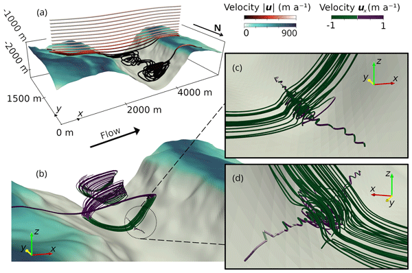
By simulating a section of the Scandinavian Ice Sheet over a deep fjord, we aim to understand the behaviour of ice sheets over rough landscapes. For perpendicular flow, we find reduced speed within the fjord and reverse flow at its base. Comparing real and smoothed topography shows that low-resolution models fail to capture these effects. Our findings have implications for Greenland ice sheet models, as commonly used bedrock resolutions likely overlook the influence of similar rough landscapes.
Thomas R. Chudley, Ian M. Howat, Bidhyananda Yadav, and Myoung-Jong Noh
The Cryosphere, 16, 2629–2642, https://doi.org/10.5194/tc-16-2629-2022, https://doi.org/10.5194/tc-16-2629-2022, 2022
Short summary
Short summary
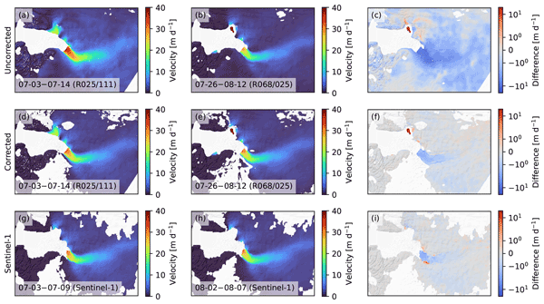
Sentinel-2 images are subject to distortion due to orthorectification error, which makes it difficult to extract reliable glacier velocity fields from images from different orbits. Here, we use a complete record of velocity fields at four Greenlandic outlet glaciers to empirically estimate the systematic error, allowing us to correct cross-track glacier velocity fields to a comparable accuracy to other medium-resolution satellite datasets.
Max T. Nilssen, Tessa R. Vance, Poul Christoffersen, Sue Cook, Alison S. Criscitiello, and Nerilie J. Abram
EGUsphere, https://doi.org/10.5194/egusphere-2026-4880, https://doi.org/10.5194/egusphere-2026-4880, 2026
This preprint is open for discussion and under review for Climate of the Past (CP).
Short summary
Short summary
To better understand how snowfall in East Antarctica changes over time, we reconstructed annual snow accumulation from the Mount Brown South ice core over the last millennium. The record shows significant variability across time scales, including multiple centennial-length periods with much less snowfall than observed in the satellite era. Our results raise implications for assessments of future sea level rise.
Samuel James Cook, Iain Wheel, Nick Hulton, Poul Christoffersen, and Doug Benn
EGUsphere, https://doi.org/10.5194/egusphere-2026-4213, https://doi.org/10.5194/egusphere-2026-4213, 2026
This preprint is open for discussion and under review for The Cryosphere (TC).
Short summary
Short summary
Accurate modelling of calving is a major problem that leads to uncertainties in sea-level rise. By modelling calving as a random process and testing how this interacts with water flow beneath the glacier, we show that including this water flow is essential to be able to fully reproduce real calving in a computer model. This may help guide future ice-sheet models as to how to improve their existing representations of Greenland and Antarctica.
Adam J. Hepburn, Sammie Buzzard, Andrew J. Sole, Stephen J. Livingstone, Felix Ng, Mathieu Morlighem, Elizabeth A. Bagshaw, Caroline Clason, Lisa Craw, Christine Dow, Samuel Doyle, Jonathan Hawkins, Matthew Peacey, and Robert Storrar
EGUsphere, https://doi.org/10.5194/egusphere-2026-2948, https://doi.org/10.5194/egusphere-2026-2948, 2026
Short summary
Short summary
Lakes at glacier margins can drain beneath the ice in sudden, devastating, floods called jökulhlaup. We present the first 2D model of jökulhlaup propagation, first applying it to a synthetic glacier, before then assessing its ability to reproduce an observed record of lake fill-drain cycles in Greenland. Our results match a 17-year record of flood timing but underpredicts peak discharge likely because we are missing certain physical processes. Our results hold promise for simulating jökulhlaup.
Sjur Barndon, Robert Law, Andreas Born, Thomas Chudley, and Stefanie Brechtelsbauer
The Cryosphere, 20, 2757–2772, https://doi.org/10.5194/tc-20-2757-2026, https://doi.org/10.5194/tc-20-2757-2026, 2026
Short summary
Short summary
By simulating a section of the Scandinavian Ice Sheet over a deep fjord, we aim to understand the behaviour of ice sheets over rough landscapes. For perpendicular flow, we find reduced speed within the fjord and reverse flow at its base. Comparing real and smoothed topography shows that low-resolution models fail to capture these effects. Our findings have implications for Greenland ice sheet models, as commonly used bedrock resolutions likely overlook the influence of similar rough landscapes.
Yu Wang, Chen Zhao, Rupert Gladstone, Thomas Zwinger, Benjamin K. Galton-Fenzi, and Poul Christoffersen
The Cryosphere, 18, 5117–5137, https://doi.org/10.5194/tc-18-5117-2024, https://doi.org/10.5194/tc-18-5117-2024, 2024
Short summary
Short summary
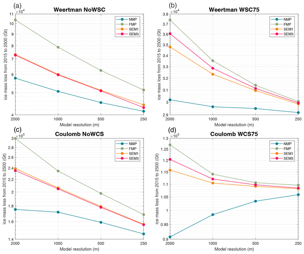
Our research delves into the future evolution of Antarctica's Wilkes Subglacial Basin (WSB) and its potential contribution to sea level rise, focusing on how basal melt is implemented at the grounding line in ice flow models. Our findings suggest that these implementation methods can significantly impact the magnitude of future ice loss projections. Under a high-emission scenario, the WSB ice sheet could undergo massive and rapid retreat between 2200 and 2300.
Xabier Blanch, Marta Guinau, Anette Eltner, and Antonio Abellan
Nat. Hazards Earth Syst. Sci., 23, 3285–3303, https://doi.org/10.5194/nhess-23-3285-2023, https://doi.org/10.5194/nhess-23-3285-2023, 2023
Short summary
Short summary
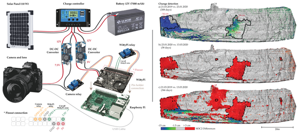
We present cost-effective photogrammetric systems for high-resolution rockfall monitoring. The paper outlines the components, assembly, and programming codes required. The systems utilize prime cameras to generate 3D models and offer comparable performance to lidar for change detection monitoring. Real-world applications highlight their potential in geohazard monitoring which enables accurate detection of pre-failure deformation and rockfalls with a high temporal resolution.
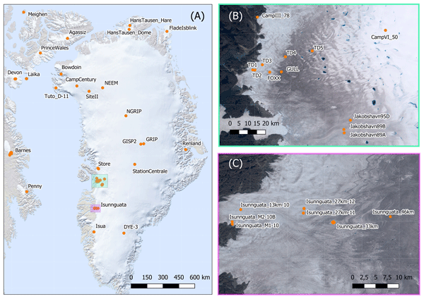
Anja Løkkegaard, Kenneth D. Mankoff, Christian Zdanowicz, Gary D. Clow, Martin P. Lüthi, Samuel H. Doyle, Henrik H. Thomsen, David Fisher, Joel Harper, Andy Aschwanden, Bo M. Vinther, Dorthe Dahl-Jensen, Harry Zekollari, Toby Meierbachtol, Ian McDowell, Neil Humphrey, Anne Solgaard, Nanna B. Karlsson, Shfaqat A. Khan, Benjamin Hills, Robert Law, Bryn Hubbard, Poul Christoffersen, Mylène Jacquemart, Julien Seguinot, Robert S. Fausto, and William T. Colgan
The Cryosphere, 17, 3829–3845, https://doi.org/10.5194/tc-17-3829-2023, https://doi.org/10.5194/tc-17-3829-2023, 2023
Short summary
Short summary
This study presents a database compiling 95 ice temperature profiles from the Greenland ice sheet and peripheral ice caps. Ice viscosity and hence ice flow are highly sensitive to ice temperature. To highlight the value of the database in evaluating ice flow simulations, profiles from the Greenland ice sheet are compared to a modeled temperature field. Reoccurring discrepancies between modeled and observed temperatures provide insight on the difficulties faced when simulating ice temperatures.
Thomas R. Chudley, Ian M. Howat, Bidhyananda Yadav, and Myoung-Jong Noh
The Cryosphere, 16, 2629–2642, https://doi.org/10.5194/tc-16-2629-2022, https://doi.org/10.5194/tc-16-2629-2022, 2022
Short summary
Short summary
Sentinel-2 images are subject to distortion due to orthorectification error, which makes it difficult to extract reliable glacier velocity fields from images from different orbits. Here, we use a complete record of velocity fields at four Greenlandic outlet glaciers to empirically estimate the systematic error, allowing us to correct cross-track glacier velocity fields to a comparable accuracy to other medium-resolution satellite datasets.
Cited articles
Bhardwaj, A., Sam, L., Akanksha, Martín-Torres, F. J., and Kumar, R.:
UAVs as remote sensing platform in glaciology: Present applications and
future prospects, Remote Sens. Environ., 175, 196–204,
https://doi.org/10.1016/j.rse.2015.12.029, 2016. a
Blankenberg, L. E.: GPS-supported aerial triangulation – state of the art,
The Photogrammetric Journal of Finland, 13, 4–16, 1992. a
Burkhart, J. F., Kylling, A., Schaaf, C. B., Wang, Z., Bogren, W., Storvold,
R., Solbø, S., Pedersen, C. A., and Gerland, S.: Unmanned aerial system
nadir reflectance and MODIS nadir BRDF-adjusted surface reflectances
intercompared over Greenland, The Cryosphere, 11, 1575–1589,
https://doi.org/10.5194/tc-11-1575-2017, 2017. a
Carrivick, J. L., Smith, M. W., and Quincey, D. J.: Structure from Motion in
the Geosciences, John Wiley & Sons, Chichester, UK, 2016. a
Chen, G.: GPS kinematic positioning for the airborne laser altimetry at Long
Valley, California, PhD thesis, Massachusetts Institute of Technology, Cambridge, Massachusetts, USA,
1998. a
Dow, J. M., Neilan, R. E., and Rizos, C.: The international GNSS service in a
changing landscape of global navigation satellite systems, J.
Geodesy, 83, 191–198, 2009. a
Doyle, S. H., Hubbard, A., van de Wal, R. S. W., Box, J. E., van As, D.,
Scharrer, K., Meierbachtol, T. W., Smeets, P. C. J. P., Harper, J. T.,
Johansson, E., Mottram, R. H., Mikkelsen, A. B., Wilhelms, F., Patton, H.,
Christoffersen, P., and Hubbard, B.: Amplified melt and flow of the
Greenland ice sheet driven by late-summer cyclonic rainfall, Nat.
Geosci., 8, 647–653, https://doi.org/10.1038/ngeo2482, 2015. a
Eltner, A., Kaiser, A., Castillo, C., Rock, G., Neugirg, F., and Abellán,
A.: Image-based surface reconstruction in geomorphometry – merits, limits
and developments, Earth Surf. Dynam., 4, 359–389,
https://doi.org/10.5194/esurf-4-359-2016, 2016. a
Fazeli, H., Samadzadegan, F., and Dadrasjavan, F.: Evaluating the potential
of RTK-UAV for automatic point cloud generation in 3D rapid mapping, Int.
Arch. Photogramm. Remote Sens. Spatial Inf. Sci., XLI-B6, 221–226,
https://doi.org/10.5194/isprs-archives-XLI-B6-221-2016, 2016. a, b
Fonstad, M. A., Dietrich, J. T., Courville, B. C., Jensen, J. L., and
Carbonneau, P. E.: Topographic structure from motion: a new development in
photogrammetric measurement, Earth Surf. Proc. Land., 38,
421–430, 2013. a
Gindraux, S., Boesch, R., and Farinotti, D.: Accuracy Assessment of Digital
Surface Models from Unmanned Aerial Vehicles' Imagery on
Glaciers, Remote Sensing, 9, 186, https://doi.org/10.3390/rs9020186, 2017. a, b, c, d
Hugenholtz, C., Brown, O., Walker, J., Barchyn, T., Nesbit, P., Kucharczyk, M.,
and Myshak, S.: Spatial Accuracy of UAV-Derived Orthoimagery and
Topography: Comparing Photogrammetric Models Processed with
Direct Geo-Referencing and Ground Control Points, GEOMATICA, 70,
21–30, https://doi.org/10.5623/cig2016-102, 2016. a
Immerzeel, W. W., Kraaijenbrink, P. D. A., Shea, J. M., Shrestha, A. B.,
Pellicciotti, F., Bierkens, M. F. P., and de Jong, S. M.: High-resolution
monitoring of Himalayan glacier dynamics using unmanned aerial vehicles,
Remote Sens. Environ., 150, 93–103, https://doi.org/10.1016/j.rse.2014.04.025,
2014. a, b
Johnson, K., Nissen, E., Saripalli, S., Arrowsmith, J. R., McGarey, P.,
Scharer, K., Williams, P., and Blisniuk, K.: Rapid mapping of ultrafine fault
zone topography with structure from motion, Geosphere, 10, 969–986, 2014. a
King, M.: Rigorous GPS data-processing strategies for glaciological
applications, J. Glaciol., 50, 601–607, 2004. a
Kraaijenbrink, P., Meijer, S. W., Shea, J. M., Pellicciotti, F., Jong, S.
M. D., and Immerzeel, W. W.: Seasonal surface velocities of a Himalayan
glacier derived by automated correlation of unmanned aerial vehicle imagery,
Ann. Glaciol., 57, 103–113, https://doi.org/10.3189/2016AoG71A072, 2016. a, b
Leick, A.: GPS satellite surveying, A Wiley – Interscience publication,
Hoboken, New Jersey, USA, 2004. a
Mian, O., Lutes, J., Lipa, G., Hutton, J., Gavelle, E., and Borghini, S.:
Direct georeferencing on small unmanned aerial platforms for improved
reliability and accuracy of mapping without the need for ground control
points, Int. Arch. Photogramm. Remote Sens. Spatial Inf. Sci., XL-1/W4, 397–402,
https://doi.org/10.5194/isprsarchives-XL-1-W4-397-2015, 2015. a
Minchew, B., Simons, M., Riel, B., and Milillo, P.: Tidally induced variations
in vertical and horizontal motion on Rutford Ice Stream, West
Antarctica, inferred from remotely sensed observations, J.
Geophys. Res.-Earth, 122, 167–190, 2017. a
Morlighem, M., Williams, C. N., Rignot, E., An, L., Arndt, J. E., Bamber,
J. L., Catania, G., Chauché, N., Dowdeswell, J. A., Dorschel, B., Fenty,
I., Hogan, K., Howat, I., Hubbard, A., Jakobsson, M., Jordan, T. M.,
Kjeldsen, K. K., Millan, R., Mayer, L., Mouginot, J., Noël, B. P. Y.,
O'Cofaigh, C., Palmer, S., Rysgaard, S., Seroussi, H., Siegert, M. J.,
Slabon, P., Straneo, F., van den Broeke, M. R., Weinrebe, W., Wood, M., and
Zinglersen, K. B.:
BedMachine v3: Complete bed topography and ocean bathymetry mapping of
Greenland from multibeam echo sounding combined with mass conservation,
Geophys. Res. Lett., 44, 11051–11061, https://doi.org/10.1002/2017GL074954, 2017. a, b
Mulsow, C., Kenner, R., Bühler, Y., Stoffel, A., and Maas, H.-G.:
Subaquatic digital elevation models from UAV-imagery, Int. Arch.
Photogramm. Remote Sens. Spatial Inf. Sci., XLII-2, 739–744,
https://doi.org/10.5194/isprs-archives-XLII-2-739-2018, 2018. a
Nesbit, P. R. and Hugenholtz, C. H.: Enhancing UAV–SfM 3D Model
Accuracy in High-Relief Landscapes by Incorporating Oblique
Images, Remote Sensing, 11, 239, https://doi.org/10.3390/rs11030239, 2019. a
Ng, Y. H. and Buchheim, J.: WingtraOne PPK Assessment, White Paper,
Wingtra, Zurich, Switzerland, 2018. a
Palmer, S., Shepherd, A., Nienow, P., and Joughin, I.: Seasonal speedup of the
Greenland Ice Sheet linked to routing of surface water, Earth
Planet. Sci. Lett., 302, 423–428, 2011. a
Porter, C., Morin, P., Howat, I., Noh, M.-J., Bates, B., Peterman, K., Keesey,
S., Schlenk, M., Gardiner, J., Tomko, K., Willis, M., Cloutier, M., Husby,
E., Foga, S., Nakamura, H., Platson, M., Wethington, Michael, J., Williamson,
C., Bauer, G., Enos, J., Arnold, G., Kramer, W., Becker, P., Doshi, A.,
D'Souza, C., Cummens, P., Laurier, F., and Bojesen, M.: ArcticDEM,
https://doi.org/10.7910/DVN/OHHUKH, 2018. a
Quincey, D. J., Glasser, N. F., Cook, S. J., and Luckman, A.: Heterogeneity in
Karakoram glacier surges, J. Geophys. Res.-Earth,
120, 1288–1300, 2015. a
Rignot, E., Box, J., Burgess, E., and Hanna, E.: Mass balance of the
Greenland ice sheet from 1958 to 2007, Geophys. Res. Lett., 35, L20502,
https://doi.org/10.1029/2008GL035417, 2008. a
Roze, A., Zufferey, J.-C., Beyeler, A., and McClellan, A.: eBee RTK
Accuracy Assessment, White Paper, SenseFly, Cheseaux-sur-Lausanne, Switzerland, 2014. a
Ryan, J. C., Hubbard, A. L., Box, J. E., Todd, J., Christoffersen, P., Carr,
J. R., Holt, T. O., and Snooke, N.: UAV photogrammetry and structure from
motion to assess calving dynamics at Store Glacier, a large outlet draining
the Greenland ice sheet, The Cryosphere, 9, 1–11,
https://doi.org/10.5194/tc-9-1-2015, 2015. a, b, c, d, e, f, g, h, i, j, k, l, m, n, o, p, q
Ryan, J. C., Hubbard, A., Box, J. E., Brough, S., Cameron, K., Cook, J. M.,
Cooper, M., Doyle, S. H., Edwards, A., Holt, T., Irvine-Fynn, T., Jones, C.,
Pitcher, L. H., Rennermalm, A. K., Smith, L. C., Stibal, M., and Snooke, N.:
Derivation of High Spatial Resolution Albedo from UAV Digital
Imagery: Application over the Greenland Ice Sheet, Front.
Earth Sci., 5, 40, https://doi.org/10.3389/feart.2017.00040, 2017. a
Seier, G., Kellerer-Pirklbauer, A., Wecht, M., Hirschmann, S., Kaufmann, V.,
Lieb, G. K., and Sulzer, W.: UAS-Based Change Detection of the
Glacial and Proglacial Transition Zone at Pasterze Glacier,
Austria, Remote Sensing, 9, 549, https://doi.org/10.3390/rs9060549, 2017. a
Shahbazi, M., Sohn, G., Théau, J., and Menard, P.: Development and
evaluation of a UAV-photogrammetry system for precise 3D environmental
modeling, Sensors, 15, 27493–27524, 2015. a
Strick, R. J., Ashworth, P. J., Sambrook Smith, G. H., Nicholas, A. P., Best,
J. L., Lane, S. N., Parsons, D. R., Simpson, C. J., Unsworth, C. A., and
Dale, J.: Quantification of bedform dynamics and bedload sediment flux in
sandy braided rivers from airborne and satellite imagery, Earth Surf.
Proc. Landf., https://doi.org/10.1002/esp.4558, 2018. a
Tahar, K.: An evaluation on different number of ground control points in
unmanned aerial vehicle photogrammetric block, Int. Arch. Photogramm. Remote
Sens. Spat. Inf. Sci, 40, 93–98, 2013. a
Taylor, Z. J., Gurka, R., Kopp, G. A., and Liberzon, A.: Long-duration
time-resolved PIV to study unsteady aerodynamics, IEEE T. Instrum. Meas.,
59, 3262–3269, 2010. a
Tedstone, A. J., Nienow, P. W., Gourmelen, N., Dehecq, A., Goldberg, D., and
Hanna, E.: Decadal slowdown of a land-terminating sector of the Greenland
Ice Sheet despite warming, Nature, 526, 692–695, https://doi.org/10.1038/nature15722, 2015. a
Todd, J., Christoffersen, P., Zwinger, T., Råback, P., Chauché, N., Benn, D.,
Luckman, A., Ryan, J., Toberg, N., Slater, D., and Hubbard, A.: A
Full-Stokes 3D Calving Model applied to a large Greenlandic
Glacier, J. Geophys. Res.-Earth, 123, 410–432,
https://doi.org/10.1002/2017JF004349, 2018. a, b, c, d
Tonkin, T. N. and Midgley, N. G.: Ground-Control Networks for Image
Based Surface Reconstruction: An Investigation of Optimum
Survey Designs Using UAV Derived Imagery and
Structure-from-Motion Photogrammetry, Remote Sensing, 8, 786,
https://doi.org/10.3390/rs8090786, 2016.
a, b
van der Sluijs, J., Kokelj, S., Fraser, R., Tunnicliffe, J., and Lacelle, D.:
Permafrost Terrain Dynamics and Infrastructure Impacts Revealed by
UAV Photogrammetry and Thermal Imaging, Remote Sensing, 10, 1734, https://doi.org/10.3390/rs10111734,
2018. a, b, c
Weidick, A.: Greenland, with a section on Landsat images of Greenland, in:
Satellite image atlas of glaciers of the world, edited by: Williams, R. S.
and Ferrigno, J. G., US Geological Survey, Washington, D.C., USA, C1-C105,
USGS Professional Paper 1386-C, 1995. a
Westoby, M. J., Brasington, J., Glasser, N. F., Hambrey, M. J., and Reynolds,
J.: “Structure-from-Motion” photogrammetry: A low-cost, effective tool
for geoscience applications, Geomorphology, 179, 300–314, 2012. a
Wigmore, O. and Mark, B.: Monitoring tropical debris-covered glacier dynamics
from high-resolution unmanned aerial vehicle photogrammetry, Cordillera
Blanca, Peru, The Cryosphere, 11, 2463–2480,
https://doi.org/10.5194/tc-11-2463-2017, 2017. a
Short summary
Unmanned Aerial Vehicles (UAVs) are increasingly common tools in the geosciences, but their use requires good ground control in order to make accurate georeferenced models. This is difficult in applications such as glaciology, where access to study sites can be hazardous. We show that a new technique utilising on-board GPS post-processing can match and even improve on ground-control-based methods, and, as a result, can produce accurate glacier velocity fields even on an inland ice sheet.
Unmanned Aerial Vehicles (UAVs) are increasingly common tools in the geosciences, but their use...


