
Articles | Volume 20, issue 7
https://doi.org/10.5194/tc-20-3847-2026
© Author(s) 2026. This work is distributed under
the Creative Commons Attribution 4.0 License.
the Creative Commons Attribution 4.0 License.
https://doi.org/10.5194/tc-20-3847-2026
© Author(s) 2026. This work is distributed under
the Creative Commons Attribution 4.0 License.
the Creative Commons Attribution 4.0 License.
Research article
| 
14 Jul 2026
Research article |
| 14 Jul 2026
| 14 Jul 2026
Evidence and interpretation of non-linear recession behaviour in a periglacial cliff at Port Foster, Deception Island (South Shetlands, Antarctica)
Dpt. Geological and Mining Engineering, School of Mines and Energy, Universidad Politécnica de Madrid, Rios Rosas 21, 28003 Madrid, Spain
Inés Santalices
Dpt. Geological and Mining Engineering, School of Mines and Energy, Universidad Politécnica de Madrid, Rios Rosas 21, 28003 Madrid, Spain
Celia Sanchíz
Laboratorio de Ingenieros del Ejército “General Marvá”, LABINGE, Instituto Nacional de Técnica Aeroespacial (INTA), Princesa 38, 28008 Madrid, Spain
Miguel Angel Ropero
Escuela Politécnica Superior del Ejército de Tierra (ESPOL), Ministerio de Defensa, Joaquín Costa 6, 28002 Madrid, Spain
Dpt. Geological and Mining Engineering, School of Mines and Energy, Universidad Politécnica de Madrid, Rios Rosas 21, 28003 Madrid, Spain
Related authors
Adrián José Rosario Beltré, Carlos Paredes Bartolomé, and Miguel Llorente Isidro
Nat. Hazards Earth Syst. Sci., 26, 4177–4200, https://doi.org/10.5194/nhess-26-4177-2026, https://doi.org/10.5194/nhess-26-4177-2026, 2026
Short summary
Short summary
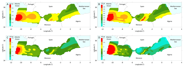
The Ibero-Maghrebian region has experienced major natural disasters affecting the coasts of the southern Iberian Peninsula and North Africa. This study presents a seismic hazard assessment using deterministic and probabilistic approaches across the marine strip between west Gulf of Cádiz and east Alboran Sea. The expected peak ground accelerations (PGA) exceed 1 g in certain submarine areas, indicating a high potential for earthquakes in the region and poses a risk to subsea infrastructures.
Adrián José Rosario Beltré, Carlos Paredes Bartolomé, and Miguel Llorente Isidro
Nat. Hazards Earth Syst. Sci. Discuss., https://doi.org/10.5194/nhess-2023-52, https://doi.org/10.5194/nhess-2023-52, 2023
Preprint withdrawn
Short summary
Short summary
The Ibero-Maghrebian region has been the scene of major natural disasters that have been devastating for the coasts of the southern Iberian Peninsula and North Africa. In our study, we carried out a DSHA in the marine strip between the W of the Gulf of Cádiz and the E of the Alboran Sea, and the results show that PGA values of up to 1.0 g have been reached in certain areas, making them potential tsunamigenic or submarine landslide sources.
Adrián José Rosario Beltré, Carlos Paredes Bartolomé, and Miguel Llorente Isidro
Nat. Hazards Earth Syst. Sci., 26, 4177–4200, https://doi.org/10.5194/nhess-26-4177-2026, https://doi.org/10.5194/nhess-26-4177-2026, 2026
Short summary
Short summary
The Ibero-Maghrebian region has experienced major natural disasters affecting the coasts of the southern Iberian Peninsula and North Africa. This study presents a seismic hazard assessment using deterministic and probabilistic approaches across the marine strip between west Gulf of Cádiz and east Alboran Sea. The expected peak ground accelerations (PGA) exceed 1 g in certain submarine areas, indicating a high potential for earthquakes in the region and poses a risk to subsea infrastructures.
Adrián José Rosario Beltré, Carlos Paredes Bartolomé, and Miguel Llorente Isidro
Nat. Hazards Earth Syst. Sci. Discuss., https://doi.org/10.5194/nhess-2023-52, https://doi.org/10.5194/nhess-2023-52, 2023
Preprint withdrawn
Short summary
Short summary
The Ibero-Maghrebian region has been the scene of major natural disasters that have been devastating for the coasts of the southern Iberian Peninsula and North Africa. In our study, we carried out a DSHA in the marine strip between the W of the Gulf of Cádiz and the E of the Alboran Sea, and the results show that PGA values of up to 1.0 g have been reached in certain areas, making them potential tsunamigenic or submarine landslide sources.
Cited articles
Aga, J., Piermattei, L., Girod, L., Aalstad, K., Eiken, T., Kääb, A., and Westermann, S.: Acceleration of coastal-retreat rates for high-Arctic rock cliffs on Brøggerhalvøya, Svalbard, over the past decade, Earth Surf. Dynam., 12, 1049–1070, https://doi.org/10.5194/esurf-12-1049-2024, 2024.
Agisoft LLC: Agisoft Metashape User Manual: Professional Edition, Version 2.1, Agisoft LLC: St. Petersburg, Russia, http://www.agisoft.com/, last access: 4 November 2024.
Albuquerque, M., Espinoza, J., Teixeira, P., de Oliveira, A., Corrêa, I., and Calliari, L.: Erosion or coastal variability: An evaluation of the DSAS and the change polygon methods for the determination of erosive processes on sandy beaches, J. Coastal Res., 65, 1710–1714, https://doi.org/10.2112/SI65-289.1, 2013.
Ali, T. A.: New methods for positional quality assessment and change analysis of shoreline features, Doctoral dissertation, The Ohio State University, 156 pp., http://rave.ohiolink.edu/etdc/view?acc_num=osu1070308923 (last access: 26 June 2026), 2003.
Ankrah, J., Monteiro, A., and Madureira, H.: Bibliometric analysis of data sources and tools for shoreline change analysis and detection, Sustainability, 14, 4895, https://doi.org/10.3390/su14094895, 2022.
Antelo, B. J., Vidal, J., and Berrocoso, M.: Determination of the tide constituents at Livingston and Deception Islands (South Shetland Islands, Antarctica), using annual time series, Dyna, 82, 209–218, https://doi.org/10.15446/dyna.v82n191.45207, 2015.
Antoniades, D., Giralt, S., Geyer, A., Alvarez-Valero, A. M., Pla-Rabes, S., Granados, I., Liu, E. J., Toro, M., Smellie, J. L., and Oliva, M.: The timing and widespread effects of the largest Holocene volcanic eruption in Antarctica, Sci. Rep., 8, 17279, https://doi.org/10.1038/s41598-018-35460-x, 2018.
ASTM: ASTM Standard D2487-00 Standard Classification of Soils for Engineering Purposes (Unified Soil ClassificationSystem), West Conshohocken, Pensilvania, Estados Unidos, 12 pp., https://doi.org/10.1520/D2487-00, 2000.
Balaji, R., Kumar, S. S., and Misra, A.: Understanding the Effects of Seawall Construction Using a Combination of Analytical Modelling and Remote Sensing Techniques: Case Study of Fansa, Gujarat, India, vol. 8, no. 3, SAGE Publications Sage UK, London, England, 153–160, https://doi.org/10.1177/1759313117712180, 2017.
Bamber, J. L., Oppenheimer, M., Kopp, R. E., Aspinall, W. P., and Cooke, R. M.: Ice sheet contributions to future sea-level rise from structured expert judgment, P. Natl. Acad. Sci. USA, 116, 11195–11200, https://doi.org/10.1073/pnas.1817205116, 2019.
Baptista, J., Vieira, G., Westermann, S., and Lee, H.: Cryogrid modelling of permafrost temperature in the Maritime Antarctic (Barton Peninsula, King George Island), European Geosciences Union General Assembly 2024 (EGU24), 17398, https://ui.adsabs.harvard.edu/link_gateway/2024EGUGA.2617398B/doi:10.5194/egusphere-egu24-17398 (last access: 26 June 2026), 2024.
Barnhart, K. R., Anderson, R. S., Overeem, I., Wobus, C., Clow, G. D., and Urban, F. E.: Modeling erosion of ice-rich permafrost bluffs along the Alaskan Beaufort Sea coast, J. Geophys. Res.-Earth, 119, 1155–1179, https://doi.org/10.1002/2013JF002845, 2014a.
Barnhart, K. R., Overeem, I., and Anderson, R. S.: The effect of changing sea ice on the physical vulnerability of Arctic coasts, The Cryosphere, 8, 1777–1799, https://doi.org/10.5194/tc-8-1777-2014, 2014b.
Belova, N., Ermolov, A., Novikova, A., Ogorodov, S., and Stanilovskaya, Y.: Dynamics of low-lying sandy coast of the Gydan peninsula, Kara Sea, Russia, based on multi-temporal remote sensing data, Remote Sens.-Basel, 15, 48, https://doi.org/10.3390/rs15010048, 2022.
Boak, E. H. and Turner, I. L.: Shoreline definition and detection: a review, J. Coastal Res., 21, 688–703, https://doi.org/10.2112/03-0071.1, 2005.
Bockheim, J., Vieira, G., Ramos, M., López-Martínez, J., Serrano, E., Guglielmin, M., Wilhelm, K., and Nieuwendam, A.: Climate warming and permafrost dynamics in the Antarctic Peninsula region, Global Planet. Change, 100, 215–223, https://doi.org/10.1016/j.gloplacha.2012.10.018, 2013.
Bonilla, M. J. G., Muñoz, J. M. C., Vázquez, N. C., and Priego, C. H.: The Scientific Exploitation of PAZ mission: PAZ Ciencia objectives and status, Procedia Comput. Sci., 239, 2223–2227, https://doi.org/10.1016/j.procs.2024.06.412, 2024.
Brecher, H. H.: Photogrammetric maps of a volcanic eruption area, Deception Island, Antarctica, in: Institute of Polar Studies Report, Research Foundation and the Institute of Polar Studies, vol. 52, The Ohio State University: Research foundation, Columbus, OH, USA, 19 pp., https://kb.osu.edu/bitstreams/6a932d01-e6eb-535e-951b-fb3086f42e51/download (last access: 26 June 2026), 1975.
Brooks, S. M. and Spencer, T.: Temporal and spatial variations in recession rates and sediment release from soft rock cliffs, Suffolk coast, UK, Geomorphology, 124, 26–41, https://doi.org/10.1016/j.geomorph.2010.08.005, 2010.
Burningham, H. and French, J.: Understanding coastal change using shoreline trend analysis supported by cluster-based segmentation, Geomorphology, 282, 131–149, https://doi.org/10.1016/J.GEOMORPH.2016.12.029, 2017.
Burningham, H. and Fernandez-Nunez, M.: Shoreline change analysis, Sandy Beach Morphodynamics, 439–460, https://doi.org/10.1016/B978-0-08-102927-5.00019-9, 2020.
Caballero-Martínez, O. A.: Proyecto de estabilización de la Base Antártica Española Gabriel de Castilla (Isla Decepción, Antártida), MS dissertation, ETSICCP, Universidad de Granada, 356 pp., 2023.
Caballero-Martínez, O. A., Paredes, C., Román, A., Navarro, G., and Díez-Minguito, M.: Study of Cliff ridge recession due to wind-induced waves in port Foster (Deception Island, Antarctica), in: 14th Symposium on River, Coastal, and Estuarine Morphodynamics, RCEM2025, Barcelona, Spain, 1–5 September, 1–22, https://esdeveniments.upc.edu/getFiles/hash/M5EGZ5gjMhFWZ 0YWMhBjZ0UmMygDMmR2NIjNmNmZmJz:YVUvUjNUZzd4 YzRGaW 5pS1BkOS9ueHRDV3BRdWFtVDNLYzZrVU5XWkly ZGJ6RXExNjFoeVoreWZtM1pmelRNSXRCMUVvOGxtMVZy WEdDZ1F2Q0E wdG1oL0xONWlLajVkVHdHRWtYQXpZN2 VBVDRqSmxZUDEvalorVTNVYm1XY3N4Vy9jN0g2Tjl5Vz RtR2tSNmlvMzV6MmlUSD lSQ3hjb0d0M3pIeVhOVmZ3YT c3aEdpay9UOXhLM3lDNjZidlpZUlRhV29ndFVRdmNKSSt JOGxKa3JRZz09 (last access: 26 June 2026), 2025.
Caselli, A., dos Santos Afonso, M., Risso, C., García, A., and Ortiz, R.: Caracterización geoquímica de los gases volcánicos de isla Decepción (Shetland del Sur, Antártida), Revista de la Asociación Geológica Argentina, 57, 69–79, 2002.
Child, S. F., Stearns, L. A., Girod, L., and Brecher, H. H.: Structure-from-motion photogrammetry of antarctic historical aerial photographs in conjunction with ground control derived from satellite data, Remote Sens.-Basel, 13, 21, https://doi.org/10.3390/rs13010021, 2021.
Clark, A., Moorman, B. J., and Whalen, D.: UAV-SfM and Geographic Object-Based Image Analysis for Measuring Multi-Temporal Planimetric and Volumetric Erosion of Arctic Coasts, Can. J. Remote Sens., 49, 2211679, https://doi.org/10.1080/07038992.2023.2211679, 2023.
Cook, K. L.: An Evaluation of the Effectiveness of Low-Cost UAVs and Structure from Motion for Geomorphic Change Detection, Geomorphology, 278, 195–208, https://doi.org/10.1016/j.geomorph.2016.11.009, 2017.
Crowell, M.; Leatherman, S. P., and Buckley, M. K.: Historical shoreline change: error analysis and mapping accuracy, J. Coastal Res., 7, 839–852, https://www.jstor.org/stable/4297899 (last access: 26 June 2026), 1991.
Danforth, W. W. and Thieler, E. R.: Digital Shoreline Analysis System (DSAS) user's guide, version 1.0, US Geological Survey, 92–355, https://doi.org/10.3133/ofr92355, 1992.
Davidson, M.: Forecasting coastal evolution on time-scales of days to decades, Coast. Eng., 103928, https://doi.org/10.1016/j.coastaleng.2021.103928, 2021.
De Pablo, M. A., Blanco, J. J., Molina, A., Ramos, M., Quesada, A., and Vieira, G.: Interannual active layer variability at the limnopolar Lake CALM site on Byers peninsula, Livingston island, Antarctica, Antarct. Sci., 25, 167–180, https://doi.org/10.1017/S0954102012000818, 2013.
De Pablo, M. A., Molina, A., Recio, C., and Ramos, M.: Estudio de la capa activa en relación al módulo principal de la Base “Gabriel de Castilla”, Isla Decepción, Antártida, Departamento de Geología, Geografía y Medio Ambiente, Universidad de Alcalá, Madrid, 51 pp., https://doi.org/10.13140/RG.2.1.4110.5529, 2015.
De Pablo, M. A., Ramos, M., Molina, A., Vieira, G., Hidalgo, M. A., Prieto, M., Jimenez, J. J., Fernández, S., Recondo, C., Calleja, J. F., Peón, J. J., and Mora, C.: Frozen ground and snow cover monitoring in the South Shetland Islands, Antarctica: Instrumentation, effects on ground thermal behaviour and future research, Cuadernos de Investigación Geográfica, 42, 475–495, https://doi.org/10.18172/cig.2917, 2016.
De Pablo, M. A., Molina, A., Recio, C., Ramos, M., Goyanes, G., and Ropero, M. A.: Análisis del estado de la capa activa en el emplazamiento de la base antártica española Gabriel de Castilla, Isla Decepción, Antártida, Boletín Geológico y Minero, 128, 69–92, https://doi.org/10.21701/bolgeomin.128.1.004, 2017.
De Pablo, M. A., Jiménez, J. J., Ramos, M., Prieto, M., Molina, A., Vieira, G., Hidalgo, M. A., Fernández, S., Recondo, C., Calleja, J. F., Peón, J. J., Corbea-Pérez, A., Maior, C. N., Morales, M., and Mora, C.: Frozen ground and snow cover monitoring in Livingston and Deception islands, Antarctica: preliminary results of the 2015–2019 PERMASNOW project, Cuadernos Investig. Geogr., 46, 187–222, https://doi.org/10.18172/cig.4381, 2020.
De Pablo, M. A., Ramos, M., Vieira, G., Molina, A., Ramos, R., Maior, C. N., Prieto, M., and Ruiz-Fernández, J.: Interannual variability of ground surface thermal regimes in Livingston and Deception islands, Antarctica (2007–2021), Land Degrad. Dev., 35, 378–393, https://doi.org/10.1002/ldr.4922, 2024.
De Pablo, M. A., Ramos, M., Vieira, G., Molina, A., and Ruiz-Fernández, J.: Thermal regimes and phases of surface temperature in Livingston and Deception islands, Antarctica, 2007–2021: influence of snow cover and implications for frozen ground, Antarct. Sci., 1–14, https://doi.org/10.1017/S095410202510028X, 2025.
Dolan, R., Hayden, B., and Heywood, J.: A new photogrammetric method for determining shoreline erosion, Coast. Eng., 2, 21–39, https://doi.org/10.1016/0378-3839(78)90003-0, 1978.
Dolan, R., Fenster, M. S., and Holme, S. J.: Temporal analysis of shoreline recession and accretion, J. Coastal Res., 723–744, https://www.jstor.org/stable/4297888 (last access: 26 June 2026), 1991.
ESA: SNAP (Sentinel Application Platform) (Version 10.0.0), Windows 64-Bit, Frascati, Italy, http://step.esa.int (last access: 26 June 2026), 2024.
Farquharson, L. M., Mann, D. H., Swanson, D. K., Jones, B. M., Buzard, R. M., and Jordan, J. W.: Temporal and spatial variability in coastline response to declining sea-ice in northwest Alaska, Mar. Geol., 404, 71–83, https://doi.org/10.1016/j.margeo.2018.07.007, 2018.
Fenster, M. S., Dolan, R., and Elder, J. F.: A new method for predicting shoreline positions from historical data, J. Coastal Res., 147–171, https://www.jstor.org/stable/4298075 (last access: 26 June 2026), 1993.
Fenster, M. S., Dolan, R., and Morton, R. A.: Coastal storms and shoreline change: signal or noise?. J. Coastal Res., 714–720, https://www.jstor.org/stable/4300222 (last access: 26 June 2026), 2001.
Figueiredo, D., Dos Santos, A., Mateus, M., and Pinto, L.: Hydrodynamic modelling of Port Foster, Deception Island, Antarctica, Antarct. Sci., 30, 115–124, https://doi.org/10.1017/S0954102017000463, 2018.
Fletcher, C., Rooney, J., Barbee, M., Lim, S. C., and Richmond, B.: Mapping shoreline change using digital orthophotogrammetry on Maui, Hawaii, in: Shoreline Mapping and Change Analysis: Technical Considerations & Management Implications, edited by: Byrnes, M. R., Crowell, M., and Fowler, C. J., Coastal Res. (Special Issue), 38, 106–124, https://www.jstor.org/stable/25736602 (last access: 26 June 2026), 2003.
Genz, A. S., Fletcher, C. H., Dunn, R. A., Frazer, L. N., and Rooney, J. J.: The predictive accuracy of shoreline change rate methods and alongshore beach variation on Maui, Hawaii, J. Coastal Res., 23, 87–105, https://doi.org/10.2112/05-0521.1, 2007.
Gibbs, A. E. and Richmond, B. M.: National assessment of shoreline change – Summary statistics for updated vector shorelines and associated shoreline change data for the north coast of Alaska, US-Canadian border to Icy Cape, US Geological Survey, No. 2017-1107, 21 pp., https://doi.org/10.3133/ofr20171107, 2017.
Gibbs, A. E., Nolan, M., Richmond, B. M., Snyder, A. G., and Erikson, L. H.: Assessing patterns of annual change to permafrost bluffs along the North Slope coast of Alaska using high-resolution imagery and elevation models, Geomorphology, 336, 152–164, https://doi.org/10.1016/j.geomorph.2019.03.029, 2019.
Gibbs, A. E., Erikson, L. H., Jones, B. M., Richmond, B. M., and Engelstad, A. C.: Seven decades of coastal change at Barter Island, Alaska: exploring the importance of waves and temperature on erosion of coastal permafrost bluffs, Remote Sens.-Basel, 13, 4420, https://doi.org/10.3390/rs13214420, 2021.
Gilbert, E. and Holmes, C.: 2023's Antarctic sea ice extent is the lowest on record, Weather, 79, 46–51, https://doi.org/10.1002/wea.4518, 2024.
Girod, L., Nielsen, N. I., Couderette, F., Nuth, C., and Kääb, A.: Precise DEM extraction from Svalbard using 1936 high oblique imagery, Geosci. Instrum. Method. Data Syst., 7, 277–288, https://doi.org/10.5194/gi-7-277-2018, 2018.
Gómez-Pazo, A., Payo, A., Paz-Delgado, M. V., and Delgadillo-Calzadilla, M. A.: Open digital shoreline analysis system: ODSAS v1.0, Journal of Marine Science and Engineering, 10, 26, https://doi.org/10.3390/jmse10010026, 2022.
González-Herrero, S., Barriopedro, D., Trigo, R. M., López-Bustins, J. A., and Oliva, M.: Climate warming amplified the 2020 record-breaking heatwave in the Antarctic Peninsula, Communications Earth & Environment, 3, 122, https://doi.org/10.1038/s43247-022-00450-5, 2022.
González-Herrero, S., Navarro, F., Pertierra, L. R., Oliva, M., Dadic, R., Peck, L., and Lehning, M.: Southward migration of the zero-degree isotherm latitude over the Southern Ocean and the Antarctic Peninsula: Cryospheric, biotic and societal implications, Sci. Total Environ., 912, 168473, https://doi.org/10.1016/j.scitotenv.2023.168473, 2024.
González-Posadas, J.: Relaciones entre los procesos geodinámicos modificadores de la costa en el entorno de la Base Antártica Española “Gabriel de Castilla”, Isla Decepción, Antártida, BSc dissertation, Universidad Politécnica de Madrid, 197 pp., 2019.
González-Posadas, J., Paredes, C., and Ropero, M. Á.: Ground deformation as a result of the foundation of a new module in the Spanish Antarctic Base Gabriel de Castilla, Deception Island, Antarctica, Boletin Geologico y Minero, 133, 95–121, https://doi.org/10.21701/bolgeomin/133.2/004, 2022.
Gorodetskaya, I. V., Durán-Alarcón, C., González-Herrero, S., Clem, K. R., Zou, X., Rowe, P., Rodriguez Imazio, P., Campos, D., Leroy-Dos Santos, C., Dutrievoz, N., Wille, J. D., Chyhareva, A., Favier, V., Blanchet, J., Pohl, B., Cordero, R. R., Park S- J., Colwell, S., Lazza, M. A., Carrasco, J., Gulisano, A. M., Krakovska, S., Ralph, M., Dethinne, T., and Picard, G.: Record-high Antarctic Peninsula temperatures and surface melt in February 2022: a compound event with an intense atmospheric river, npj Clim. Atmos. Sci., 6, 202, https://doi.org/10.1038/s41612-023-00529-6, 2023.
Goyanes, G.: Control climático e interacciones permafrost-volcanismo, Isla Decepción, Antártida, PhD dissertation, Universidad de Buenos Aires, Facultad de Ciencias Exactas y Naturales, 318 pp., https://hdl.handle.net/20.500.12110/tesis_n5676_Goyanes (last access: 26 June 2026), 2015.
Goyanes, G., Vieira, G., Caselli, A., Cardoso, M., Marmy, A., Santos, F., Bernardo, I., and Hauck, C.: Local influences of geothermal anomalies on permafrost distribution in an active volcanic island (Deception Island, Antarctica), Geomorphology, 225, 57–68, https://doi.org/10.1016/j.geomorph.2014.04.010, 2014a.
Goyanes, G., Vieira, G., Caselli, A., Mora, C., Ramos, M., de Pablo, M. A., Neves, M., Santos, F., Bernardo, I., Gilichinsky, Abramov, A., Batista, V., Melo, R., Nieuwendam, A., Ferreiran, A., and Oliva, M.: Régimen térmico y variabilidad espacial de la capa activa en isla decepcion, Antártica, Revista de la Asociación Geológica Argentina, 71, 112–124, http://ref.scielo.org/sh23gm (last access: 26 June 2026), 2014b.
Griggs, G. and Reguero, B. G.: Coastal adaptation to climate change and sea-level rise, Water, 13, 2151, https://doi.org/10.3390/W13162151, 2021.
Hapke, C. J., Himmelstoss, E. A., Kratzmann, M. G., List, J. H., and Thieler, E. R.: National assessment of shoreline change: Historical shoreline change along the New England and Mid-Atlantic coasts, US Geological Survey OpenFile Report 2010–1118, 57 pp., https://pubs.usgs.gov/of/2010/1118/ (last access: 26 June 2026), 2011.
Heo, J., Kim, J. H., and Kim, J. W.: A new methodology for measuring coastline recession using buffering and non-linear least squares estimation, Int. J. Geogr. Inf. Sci., 23, 1165–1177, https://doi.org/10.1080/13658810802035642, 2009.
Himmelstoss, E. A., FitzGerald, D. M., Rosen, P. S., and Allen, J. R.: Bluff evolution along coastal drumlins: Boston Harbor islands, Massachusetts, J. Coastal Res., 22, 1230–1240, https://doi.org/10.2112/06A-0005.1, 2006.
Himmelstoss, E. A., Henderson, R. E., Farris, A. S., Kratzmann, M. G., Bartlett, M. K., Ergul, A., McAndrews, J., Cibaj, R., Zichichi, J. L., and Thieler, E. R.: Digital Shoreline Analysis System version 6.0: US Geological Survey software release, https://doi.org/10.5066/P13WIZ8M, 2024.
Hopfenblatt, J., Geyer, A., Aulinas, M., Álvarez-Valero, A. M., Sánchez, A. P., Giralt, S., and Smellie, J. L.: DecTephra: A new database of Deception Island's tephra record (Antarctica), J. Volcanol. Geoth. Res., 425, 107516, https://doi.org/10.1016/j.jvolgeores.2022.107516, 2022.
Howat, I. M., Porter, C., Smith, B. E., Noh, M.-J., and Morin, P.: The Reference Elevation Model of Antarctica, The Cryosphere, 13, 665–674, https://doi.org/10.5194/tc-13-665-2019, 2019.
Hrbáček, F., Nývlt, D., and Láska, K.: Active layer thermal dynamics at two lithologically different sites on James Ross Island, Eastern Antarctic Peninsula, Catena, 149, 592–602, https://doi.org/10.1016/j.catena.2016.06.020, 2017.
Hrbáček, F., Vieira, G., Oliva, M., Balks, M., Guglielmin, M., de Pablo, M. A., Molina, A., Ramos, M., Goyanes, G., Meiklejohn, I., Abramov, A., Demidov, N., Fedorov-Davydov, D., Lupachev, A., Rivkina, E., Láska, K., Kňažková, M., Nývlt, D., Raffi, R., Strelin, J., Sone, T., Fukui, K., Dolgikh, A. Zazovskaya, E., Mergelov, N., Osokin, N., and Miamin, V.: Active layer monitoring in Antarctica: an overview of results from 2006–2015, Polar Geography, 44, 217–231, https://doi.org/10.1080/1088937X.2017.1420105, 2021.
Hrbáček, F., Oliva, M., Hansen, C., Balks, M., O'Neill, T. A., De Pablo, M. A., Ponti, S., Ramos, M., Vieira, G., Abramov, A., Pastíriková, L. K., Guglielmin, M., Goyanes, G., Francelino, M. R., Schaefer, C., and Lacelle, D.: Active layer and permafrost thermal regimes in the ice-free areas of Antarctica, Earth-Sci. Rev., 242, 104458, https://doi.org/10.1016/j.earscirev.2023.104458, 2023.
Irrgang, A. M., Lantuit, H., Manson, G. K., Günther, F., Grosse, G., and Overduin, P. P.: Variability in rates of coastal change along the Yukon coast, 1951–2015, J. Geophys. Res.-Earth, 123, 779–800, https://doi.org/10.1002/2017JF004326, 2018.
Irrgang, A. M., Bendixen, M., Farquharson, L. M., Baranskaya, A. V., Erikson, L. H., Gibbs, A. E., Ogorodov, S. A., Overduin, P. P., Lantuit, H., Grigoriev, M. N., Jones, B. M. Drivers, dynamics and impacts of changing Arctic coasts, Nature Reviews Earth and Environment, 3, 39–54, https://doi.org/10.1038/s43017-021-00232-1, 2022.
Islam, M. A. and Lubbad, R.: A process-based model for arctic coastal erosion driven by thermodenudation and thermoabrasion combined and including nearshore morphodynamics, Journal of Marine Science and Engineering, 10, 1602, https://doi.org/10.3390/jmse10111602, 2022.
Jackson, C. W.: Quantitative Shoreline Change Analysis of An Inlet-Influenced Transgressive Barrier System: Figure Eight Island, North Carolina, Master of Science dissertation, University of North Carolina at Wilmington, 95 pp., https://hdl.handle.net/20.500.14481/1050 (last access: 26 June 2026), 2004.
Jackson, C. W.: Spatio-temporal analysis of barrier island shoreline change: the Georgia coast, USA, Doctoral dissertation, University of Georgia, 296 pp., https://openscholar.uga.edu/record/8174?ln=en (last access: 26 June 2026), 2010.
Jackson, C. W., Jr., Alexander, C. R., and Bush, D. M.: Application of the AMBUR R package for spatio-temporal analysis of shoreline change: Jekyll Island, Georgia, USA, Comput. Geosci., 41, 199–207, https://doi.org/10.1016/j.cageo.2011.08.009, 2012.
Jódar, J., Schmid, T., Corella, J. P., Garralón, A., Sánchez, L., Lambán, L. J., Moreno, L., Urrutia, J., Herrera, C., Duque, C. Silva-Busso, A., and López-Martínez, J.: Hydrogeological behavior of freshwater lake systems in an Antarctic volcanic setting, Deception Island, South Shetlands archipelago, Journal of Hydrology: Regional Studies, 64, 103296, https://doi.org/10.1016/j.ejrh.2026.103296, 2026.
Jones, B. M., Hinkel, K. M., Arp, C. D., and Eisner, W. R.: Modern erosion rates and loss of coastal features and sites, Beaufort Sea coastline, Alaska, Arctic, 361–372, https://www.jstor.org/stable/40513223 (last access: 26 June 2026), 2008.
Jones, B. M., Irrgang, A. M., Farquharson, L. M., Lantuit, H., Whalen, D., Ogorodov, S., Grigoriev, M., Tweedie, C., Gibbs, A. E., Strzelecki, M. C., Baranskaya, A., Belova, N., Sinitsyn, A., Kroon, A., Maslakov, A., Vieira, G., Grosse, G., Overduin, P., Nitze, I., Maio, C., Overbeck, J., Bendixen, M., Zagórski, P., and Romanovsky, V. E.: Arctic Report Card 2020: Coastal Permafrost Erosion, NOAA ID 27897, 10 pp., https://doi.org/10.25923/e47w-dw52, 2020.
Kazhukalo, G., Novikova, A., Shabanova, N., Drugov, M., Myslenkov, S., Shabanov, P., Belova, N., and Ogorodov, S.: Coastal Dynamics at Kharasavey Key Site, Kara Sea, Based on Remote Sensing Data, Remote Sens.-Basel, 15, 4199, https://doi.org/10.3390/rs15174199, 2023.
King, J. and Turner, J.: Antarctic meteorology and climatology, Cambridge University Press, Cambridge, 409 pp., https://doi.org/10.1017/CBO9780511524967, 1997.
Köppen, W.: Klassifikation der Klimate nach Temperatur, Niederschlag und Jahresablauf (Classification of climates according to temperature, precipitation and seasonal cycle), Petermann. Geogr. Mitt., 193–203, https://koeppen-geiger.vu-wien.ac.at/pdf/Koppen_1918.pdf (last access: 26 June 2026), 1918.
Kupilik, M., Witmer, F. D. W., MacLeod, E.-A., Wang, C., and Ravens, T.: Gaussian Process Regression for Arctic Coastal Erosion Forecasting, IEEE T. Geosci. Remote, 57, 3, 1256–1264, https://doi.org/10.1109/TGRS.2018.2865429, 2017.
Lantuit, H., Overduin, P. P., Couture, N., Wetterich, S., Aré, F., Atkinson, D., Brown, J., Cherkashov, G., Drozdov, D., Forbes, D. L., Graves-Gaylord, A., Grigoriev, M., Hubberten, H. W., Jordan, J., Jorgenson, T., Odegârd, R. S., Ogorodov, S., Pollard, W. H., Rachold, W., Sedenko, S., Solomon, S., Steenhuisen, F., Streletskaya, I., and Vasiliev, A.: The Arctic coastal dynamics database: A new classification scheme and statistics on Arctic permafrost coastlines, Estuar. Coast., 35, 383–400, https://doi.org/10.1007/s12237-010-9362-6, 2012.
Li, R., Liu, J. K., and Felus, Y.: Spatial modeling and analysis for shoreline change detection and coastal erosion monitoring, Mar. Geod., 24, 1–12, https://doi.org/10.1080/01490410121502, 2001.
Li, W., Yan, D., Weng, B., and Zhu, L.: Research progress on hydrological effects of permafrost degradation in the Northern Hemisphere, Geoderma, 438, 116629, https://doi.org/10.1016/j.geoderma.2023.116629, 2023.
Liew, M., Xiao, M., Farquharson, L., Nicolsky, D., Jensen, A., Romanovsky, V., Peirce, J., Alessa, L., McComb, C., Zhang, X., Jones, B.: Understanding effects of permafrost degradation and coastal erosion on civil infrastructure in Arctic coastal villages: a community survey and knowledge co-production, Journal of Marine Science and Engineering, 10, 422, https://doi.org/10.3390/jmse10030422, 2022.
Limber, P. W., Barnard, P. L., Vitousek, S., and Erikson, L. H.: A model ensemble for projecting multidecadal coastal cliff retreat during the 21st century, J. Geophys. Res.-Earth, 123, 1566–1589, https://doi.org/10.1029/2017JF004401, 2018.
López-Martínez, J., Serrano, E., Schmid, T., Mink, S., and Lines, C.: Periglacial processes and landforms in the South Shetland Islands (northern Antarctic Peninsula region), Geomorphology, 155, 62–79, https://doi.org/10.1016/j.geomorph.2011.12.018, 2012.
López-Martínez, J., Sutter, T. S., Cañadas, E. S., Mink, S., Nieto, A., and Guillaso, S.: Geomorphology and surface landforms distribution in selected ice-free areas in the South Shetland Islands, Northern Antarctic Peninsula region, Cuadernos de investigación geográfica: Geographical Research Letters, 42, 435–455, https://doi.org/10.18172/cig.2965, 2016.
Lu, Z. S., Wang, Y., Liang, S. Y., and Li, Z. C.: Automatic regionalized coastline extraction method based on high-resolution images, IEEE Access, 12, 13537–13552, https://doi.org/10.1109/ACCESS.2024.3356710, 2024.
Martí, J., Geyer, A., and Aguirre-Diaz, G.: Origin and evolution of the Deception Island caldera (South Shetland Islands, Antarctica), B. Volcanol., 75, 1–18, https://doi.org/10.1007/s00445-013-0732-3, 2013.
Matsumoto, H., Dickson, M. E., Stephenson, W. J., Thompson, C. F., and Young, A. P.: Modeling future cliff-front waves during sea level rise and implications for coastal cliff retreat rates, Sci. Rep., 14, 7810, https://doi.org/10.1038/s41598-024-57923-0, 2024.
Mishra, M., Sudarsan, D., Kar, D., Naik, A. K., Das, P. P., Santos, C. A., and da Silva, R. M.: The development and research trend of using DSAS tool for shoreline change analysis: a scientometric analysis, Journal of Urban and Environmental Engineering, 14, 69–77, https://doi.org/10.4090/juee.2020.v14n1.069077, 2020.
Mott, P. G.: Wings over Ice: The Falkland Islands and Dependencies Aerial Survey Expedition, Long Sutton, UK, 167 pp., ISBN 10 0951169904, ISBN 13 978-0951169902, 1986.
Nguyen, L. D., Minh, N. T., Thy, P. T. M., Phung, H. P., and Huan, H. V.: Analysis of changes in the riverbanks of Mekong river-Vietnam by using multi-temporal remote sensing data, International Archives of the Photogrammetry, Remote Sensing and Spatial Information Science, 38, 287–292, 2010.
Nicholls, R. J. and Cazenave, A.: Sea-level rise and its impact on coastal zones, Science, 328, 1517–1520, https://doi.org/10.1126/science.1185782, 2010.
Nielsen, D. M., Pieper, P., Barkhordarian, A., Overduin, P., Ilyina, T., Brovkin, V., Baehr, J., and Dobrynin, M.: Increase in Arctic coastal erosion and its sensitivity to warming in the twenty-first century, Nat. Clim. Change, 12, 263–270, https://doi.org/10.1038/s41558-022-01281-0, 2022.
North, R. and Barrows, T. T.: High-resolution elevation models of Larsen B glaciers extracted from 1960s imagery, Sci. Rep., 14, 14536, https://doi.org/10.1038/s41598-024-65081-6, 2024.
Oliva, M., Navarro, F., Hrbáček, F., Hernandéz, A., Nývlt, D., Pereira, P., Ruiz-Fernandez, J., and Trigo, R.: Recent regional climate cooling on the Antarctic Peninsula and associated impacts on the cryosphere, Sci. Total Environ., 580, 210–223, https://doi.org/10.1016/j.scitotenv.2016.12.030, 2017.
Omonigbehin, O., Ben Said, H., Stolle, J., Francus, P., Kurylyk, B. L., Guimond, J. A., Didier, D., and Coulombe, S.: Physical modeling of coastal permafrost erosion: A new model for predicting niche depth evolution, J. Geophys. Res.-Earth, 130, e2025JF008528, https://doi.org/10.1029/2025JF008528, 2025.
Over, J. R., Ritchie, A. C., Kranenburg, C. J., Brown, J. A., Buscombe, D., Noble, T., Sherwood, C. R., Warrick, J. A., and Wernette, P. A.: Processing coastal imagery with Agisoft Metashape Professional Edition, version 1.6 – Structure from motion workflow documentation: US Geological Survey Open-File Report 2021–1039, 46 pp., https://doi.org/10.3133/ofr20211039, 2021.
Pang, T., Wang, X., Nawaz, R. A., Keefe, G., and Adekanmbi, T.: Coastal erosion and climate change: A review on coastal-change process and modeling, Ambio, 52, 2034–2052, 2023.
Paredes, C., Godoy, C., and Castedo, R.: Soft-Cliff Retreat, Self-Organized Critical Phenomena in the Limit of Predictability?, Fractals, 23, 1540009, https://doi.org/10.1142/S0218348X15400095, 2015.
Paredes, C., la Vega-Panizo, D., and Ropero, M.: Application of improved accuracy SFM-MVS for photogrammetric restitution and comparison of pre-and post-eruption archival aerial imagery on Deception Island (South Shetland, Antarctica), in: Proceedings 3rd Congress in Geomatics Engineering, Editorial Universitat Politècnica de València, Valencia, Spain, 15–25, https://doi.org/10.4995/CiGeo2021.2021.12755, 2021.
Pastíriková, L. K., Hrbáček, F., Uxa, T., and Láska, K.: Permafrost table temperature and active layer thickness variability on James Ross Island, Antarctic Peninsula, in 2004–2021, Sci. Total Environ., 869, 161690, https://doi.org/10.1016/j.scitotenv.2023.161690, 2023.
Pedro Baptista, J., Brito Guapo Teles Vieira, G., Manuel de Carvalho Soares Correia, A., Lee, H., and Westermann, S.: Modelling the evolution of permafrost temperatures and active layer thickness in King George Island, Antarctica, since 1950, The Cryosphere, 19, 3459–3476, https://doi.org/10.5194/tc-19-3459-2025, 2025.
Peel, M. C., Finlayson, B. L., and McMahon, T. A.: Updated world map of the Köppen-Geiger climate classification, Hydrol. Earth Syst. Sci., 11, 1633–1644, https://doi.org/10.5194/hess-11-1633-2007, 2007.
Petropoulos, G. P., Petsini, T., and Detsikas, S. E.: Geoinformation Technology in Support of Arctic Coastal Properties Characterization: State of the Art, Challenges, and Future Outlook, Land, 13, 776, https://doi.org/10.3390/land13060776, 2024.
Philipp, M., Dietz, A., Ullmann, T., and Kuenzer, C.: Automated extraction of annual erosion rates for Arctic permafrost coasts using Sentinel-1, deep learning, and change vector analysis, Remote Sens.-Basel, 14, 3656, https://doi.org/10.3390/rs14153656, 2022.
Prates, G. and Vieira, G.: Surface Displacement of Hurd Rock Glacier from 1956–2019 from Historical Aerial Frames and Satellite Imagery (Livingston Island, Antarctic Peninsula), Remote Sens.-Basel, 15, 3685, https://doi.org/10.3390/rs15143685, 2023.
Prates, G., Torrecillas, C., Berrocoso, M., Goyanes, G., and Vieira, G.: Deception Island 1967–1970 Volcano Eruptions from Historical Aerial Frames and Satellite Imagery (Antarctic Peninsula), Remote Sens.-Basel, 15, 2052, https://doi.org/10.3390/rs15082052, 2023.
Prémaillon, M., Regard, V., Dewez, T. J. B., and Auda, Y.: GlobR2C2 (Global Recession Rates of Coastal Cliffs): a global relational database to investigate coastal rocky cliff erosion rate variations, Earth Surf. Dynam., 6, 651–668, https://doi.org/10.5194/esurf-6-651-2018, 2018.
Prieto-Ballesteros, O., Gómez, F., Moreno, M., de Diego, G., Fernandez-Sampedro, M., Martín-Redondo, M. P., and Parro, V.: Underground warmed environments at cold regions, The case of Cerro Caliente in Deception island, Antarctica, in: European Planetary Science Congress, EPSC2012-466, Madrid, Spain, https://meetingorganizer.copernicus.org/EPSC2012/EPSC2012-466.pdf (last access: 26 June 2026), 2012.
Ramos, M., Vieira, G., de Pablo, M. A., Molina, A., Abramov, A., and Goyanes, G.: Recent shallowing of the thaw depth at Crater Lake, Deception Island, Antarctica (2006–2014), Catena, 149, 519–528, https://doi.org/10.1016/j.catena.2016.07.019, 2017.
Ramos, M., Vieira, G., de Pablo, M. A., Molina, A., and Jimenez, J. J.: Transition from a subaerial to a subnival permafrost temperature regime following increased snow cover (Livingston Island, maritime antarctic), Atmosphere, 11, 1332, https://doi.org/10.3390/atmos11121332, 2020.
Rantanen, M., Karpechko, A. Y., Lipponen, A., Nordling, K., Hyvärinen, O., Ruosteenoja, K., Vihma, T., and Laaksonen, A.: The Arctic has warmed nearly four times faster than the globe since 1979, Communications Earth and Environment, 3, 168, https://doi.org/10.1038/s43247-022-00498-3, 2022.
Ravens, T. M., Jones, B. M., Zhang, J., Arp, C. D., and Schmutz, J. A.: Process-based coastal erosion modeling for drew point, North Slope, Alaska, J. Waterw. Port Coast., 138, 122–130, https://doi.org/10.1061/(ASCE)WW.1943-5460.0000106, 2012.
Riquelme, A., Del Soldato, M., Tomás, R., Cano, M., Bordehore, L. J., and Moretti, S.: Digital landform reconstruction using old and recent open access digital aerial photos, Geomorphology, 329, 206–223, https://doi.org/10.1016/j.geomorph.2019.01.003, 2019.
Roland, T. P., Bartlett, O. T., Charman, D. J., Anderson, K., Hodson, K. A., Amesbury, M. J., Maclean, I., Fretwell, P. T., and Fleming, A.: Sustained greening of the Antarctic Peninsula observed from satellites, Nat. Geosci., https://doi.org/10.1038/s41561-024-01564-5, 2024.
Rousseeuw, P. J. and Leroy, A. M.: Robust regression and outlier detection, John wiley & Sons, 368 pp., ISBN 0-471-48855-0, 2003.
Ruggiero, P., Kratzmann, M. G., Himmelstoss, E. A., Reid, D. A. J., and Kaminsky, G.: National assessment of shoreline change: historical shoreline change along the Pacific Northwest coast, US Geological Survey Open-File Report, 2012–1007, 62 pp., https://doi.org/10.3133/ofr20121007, 2013.
Sam, S. C. and Gurugnanam, B.: Coastal transgression and regression from 1980–2020 and shoreline forecasting for 2030 and 2040, using DSAS along the southern coastal tip of Peninsular India, Geodesy and Geodynamics, 13, 585–594, https://doi.org/10.1016/j.geog.2022.04.004, 2022.
Scala, P., Manno, G., and Ciraolo, G.: Semantic segmentation of coastal aerial/satellite images using deep learning techniques: An application to coastline detection, Comput. Geosci.-UK, 192, 105704, https://doi.org/10.1016/j.cageo.2024.105704, 2024.
Schoonees, T., Gijón Mancheño, A., Scheres, B., Bouma, T. J., Silva, R., Schlurmann, T., and Schüttrumpf, H.: Hard structures for coastal protection, towards greener designs, Estuar. Coast., 42, 1709–1729, https://doi.org/10.1007/s12237-019-00551-z, 2019.
Silva-Busso, A., Yermolin, Y., and Manograsso Czalbowski, T.: Características del permafrost costero (criopeg) con el uso de técnicas geoeléctricas, arroyo Díaz, isla Marambio, península Antártica, Revista de la Asociación Geológica Argentina, 70, 583–595, http://ref.scielo.org/28dgst (last access: 26 June 2026), 2013.
Silva-Busso, A. and Moreno-Merino, L.: Permafrost and hydrogeology of quaternary deposits at Cape Welchness, Dundee Island (Antarctic Peninsula), Antarct. Sci., 36, 337–360, https://doi.org/10.1017/S0954102024000221, 2024.
Small, D. and Schubert, A.: Guide to S1 Geocoding, UZH-S1-GC-AD, Technical Note, 42 pp., https://sentinels.copernicus.eu/documents/247904/1653442/Guide-to-Sentinel-1-Geocoding.pdf (last access: 26 June 2026), 2022.
Smellie, J. L.: Geology, in: Geology and geomorphology of Deception Island, edited by: López-Martínez, J., Smellie, J. L., Thomson, J. W., and Thomson, M. R. A., BAS Geomap Series, 6-A and 6-B, 11–30, British Antarctic Survey, Cambridge, 77 pp., https://nora.nerc.ac.uk/id/eprint/17439 (last access: 26 June 2026), 2002.
Srivastava, A.: A least-squares approach to improved shoreline modelling, Doctoral dissertation, Ohio State University, 97 pp., https://etd.ohiolink.edu/acprod/odb_etd/ws/send_file/send?accession=osu1731939224171429&disposition=inline (last access: 26 June 2026), 2005.
Streletskiy, D.: Permafrost degradation, in: Snow and Ice-Related Hazards, Risks, and Disasters, edited by: Haeberli, W. and Whiteman, C., 2nd edn., Elsevier, 297–322, https://doi.org/10.1016/B978-0-12-394849-6.00010-X, 2021.
Sun, X., Lv, T., Sun, Q., Ding, Z., Shen, H., Gao, Y., He, Y., Fu, M., and Li, C.: Analysis of Spatiotemporal Variations and Influencing Factors of Sea Ice Extent in the Arctic and Antarctic, Remote Sens.-Basel, 15, 5563, https://doi.org/10.3390/rs15235563, 2023.
Sunamura, T.: Geomorphology of rocky coasts, vol. 3, Wiley, Chichester, 302 pp., ISBN 0471917753, 9780471917755, 1992.
Sunamura, T.: Rocky coast processes: with special reference to the recession of soft rock cliffs, Proc. Jpn. Acad., Series B, 91, 481–500, https://doi.org/10.2183/pjab.91.481, 2015.
Swirad, Z. M. and Young, A. P.: Automating coastal cliff erosion measurements from large-area LiDAR datasets in California, USA, Geomorphology, 389, 107799, https://doi.org/10.1016/j.geomorph.2021.107799, 2021.
Swirad, Z. M. and Young, A. P.: CliffDelineaTool v1.2.0: an algorithm for identifying coastal cliff base and top positions, Geosci. Model Dev., 15, 1499–1512, https://doi.org/10.5194/gmd-15-1499-2022, 2022.
Sziło, J. and Bialik, R. J.: Recession and ice surface elevation changes of Baranowski Glacier and its impact on proglacial relief (King George Island, West Antarctica), Geosciences, 8, 355, https://doi.org/10.3390/geosciences8100355, 2018.
Tanner, W. F.: Standards for Measuring Shoreline Change, Department of Geology, Florida State University, Tallahassee, Florida, 87 pp., 1978.
Torrecillas, C., Zarzuelo, C., de la Fuente, J., Jigena-Antelo, B., and Prates, G.: Evaluation and Modelling of the Coastal Geomorphological Changes of Deception Island since the 1970 Eruption and Its Involvement in Research Activity, Remote Sens.-Basel, 16, 512, https://doi.org/10.3390/rs16030512, 2024.
Trenhaile, A. S.: Predicting the response of hard and soft rock coasts to changes in sea level and wave height, Climatic Change, 109, 599–615, https://doi.org/10.1007/s10584-011-0035-7, 2011.
Tsai, Y. L. S.: Monitoring Arctic permafrost coastal erosion dynamics using a multidecadal cross-mission SAR dataset along an Alaskan Beaufort Sea coastline, Sci. Total Environ., 917, 170389, https://doi.org/10.1016/j.scitotenv.2024.170389, 2024.
Tsiakos, C. A. D. and Chalkias, C.: Use of machine learning and remote sensing techniques for shoreline monitoring: A review of recent literature, Applied Sciences, 13, 3268, https://doi.org/10.3390/app13053268, 2023.
Turner, J., Barrand, N. E., Bracegirdle, T. J., Convey, P., Hodgson, D. A., Jarvis, M., Jerkins, A., Marshall, G., Meredith, M. P., Roscoe, H., Shanklin, J., French, J., Goose, H., Guglielmin, M., Gutt, J., Jacobs, S., Kennicutt II, M. C., Masson-Delmotte, V., Mayewski, P., Navarro, F., Robinson, S., Scambos, T., Sparrow, M., Summerhayes, C., Speer, K., and Klepikov, A.: Antarctic climate change and the environment: an update, Polar Rec., 50, 237–259, https://doi.org/10.1017/S0032247413000296, 2014.
Turner, J., Lu, H., White, I., King, J. C., Phillips, T., Hosking, J. S., Bracegirdle, T. J., Marshall, G. J., Mulvaney, R., and Deb, P.: Absence of 21st century warming on Antarctic Peninsula consistent with natural variability, Nature, 535, 411–415, https://doi.org/10.1038/nature18645, 2016.
Vidal, J., Berrocoso, M., and Fernández-Ros, A.: Study of tides and sea levels at Deception and Livingston islands, Antarctica, Antarct. Sci., 24, 193–201, https://doi.org/10.1017/S095410201100068X, 2012.
Vieira, G., López-Martinez, J., Serrano, E., Ramos, M., Gruber, S., Hauck, C., and Blanco, J. J.: Geomorphological observations of permafrost and ground-ice degradation on Deception and Livingston Islands, Maritime Antarctica, in: 9th International Conference on Permafrost, Fairbanks, Alaska, 28 June to 3 July 2008, Extended Abstracts, edited by: Kane, D. and Hinkel, K., vol. 1, University of Alaska Press, Fairbanks, 1839–1844, https://doi.org/10.5167/uzh-3320, 2008.
Vukadinov, D., Jovanovic, R., and Tuba, M. I. L. A. N.: An algorithm for coastline extraction from satellite imagery, Int. J. Comput., 2, 8–15, 2017.
Wang, Z., Xiao, M., Nicolsky, D., Romanovsky, V., McComb, C., and Farquharson, L.: Arctic coastal hazard assessment considering permafrost thaw subsidence, coastal erosion, and flooding, Environ. Res. Lett., 18, 104003, https://doi.org/10.1088/1748-9326/acf4ac, 2023.
Warnasuriya, T. W. S., Kumara, M. P., Gunasekara, S. S., Gunaalan, K., and Jayathilaka, R. M. R. M.: An improved method to detect shoreline changes in small-scale beaches using Google Earth Pro, Mar. Geod., 43, 541–572, https://doi.org/10.1080/01490419.2020.1822478, 2020.
Warnasuriya, T. W. S.: Assessing the influence of transect interval in monitoring and analysis of shoreline change, Environ. Monit. Assess., 195, 532, https://doi.org/10.1007/s10661-023-11161-5, 2023.
Young, A. P., Flick, R. E., Gutierrez, R., and Guza, R. T.: Comparison of short-term seacliff retreat measurement methods in Del Mar, California, Geomorphology, 112, 318–323, https://doi.org/10.1016/j.geomorph.2009.06.018, 2009.
Young, A. P. and Carilli, J. E.: Global distribution of coastal cliffs, Earth Surf. Processes, 44, 1309–1316, https://doi.org/10.1002/esp.4574, 2019.
Zarillo, G. A., Kelley, J., and Larson, V.: A GIS based tool for extracting shoreline positions from aerial imagery (BeachTools) revised, Coastal and Hydraulics Laboratory Engineering Technical Note ERDC/CHL CHETN-IV-73, Vicksburg, MS, US Army Engineer Research and Development Center, 14 pp., https://hdl.handle.net/11681/1944 (last access: 27 June 2026), 2008.
Ziaja, W., Ostafin, K., Maciejowski, W., and Kruse, F.: Coastal landscape degradation and disappearance of Davislaguna Lake, Sørkappland, Svalbard, 1900–2021, Land Degrad. Dev., 34, 4823–4832, https://doi.org/10.1002/ldr.4765, 2023.
Short summary
This study analyses multidecadal coastal bluff erosion at Deception Island, Antarctica, using historical aerial and satellite imagery (1956–2023). A non-linear shoreline change approach reveals heterogeneous and accelerating recession patterns. Logistic sigmoidal models outperform traditional linear methods, offering improved insights into periglacial coastal dynamics under climate change.
This study analyses multidecadal coastal bluff erosion at Deception Island, Antarctica, using...


