
Articles | Volume 20, issue 8
https://doi.org/10.5194/tc-20-4681-2026
© Author(s) 2026. This work is distributed under
the Creative Commons Attribution 4.0 License.
the Creative Commons Attribution 4.0 License.
https://doi.org/10.5194/tc-20-4681-2026
© Author(s) 2026. This work is distributed under
the Creative Commons Attribution 4.0 License.
the Creative Commons Attribution 4.0 License.
Research article
| 
24 Aug 2026
Research article |
| 24 Aug 2026
| 24 Aug 2026
Modeling the Distribution of Mountain Permafrost in Chile
Alexander Brenning
CORRESPONDING AUTHOR

Department of Geography, Friedrich Schiller University Jena, Löbdergraben 32, 07743 Jena, Germany
Guillermo F. Azócar
CORRESPONDING AUTHOR
Atacama Ambiente Consultores, Huechuraba, Región Metropolitana, Chile
Pablo Iribarren Anacona
Universidad Austral de Chile, Instituto de Ciencias de la Tierra, Valdivia, Chile
Kenji Yoshikawa
University of Alaska Fairbanks, Institute of Northern Engineering, Water and Environmental Research Center, Fairbanks, Alaska, USA
Atacama Ambiente Consultores, Huechuraba, Región Metropolitana, Chile
Gino Casassa
Universidad de Magallanes, Punta Arenas, Chile
Instituto Antártico Chileno, Punta Arenas, Chile
Pedro Straub-Bustamante
Atacama Ambiente Consultores, Huechuraba, Región Metropolitana, Chile
Duilio Fonseca-Gallardo
Atacama Ambiente Consultores, Huechuraba, Región Metropolitana, Chile
Jorge Huenante
Dirección General de Aguas, Santiago, Chile
Related authors
Matthias Schlögl, Laura Waltersdorfer, Peter Regner, Andrea Siposova, and Alexander Brenning
EGUsphere, https://doi.org/10.5194/egusphere-2025-5210, https://doi.org/10.5194/egusphere-2025-5210, 2025
Short summary
Short summary
Reproducibility is essential for reliable scientific research, yet it remains challenging in (geo-)scientific practice. This perspective explores how to improve reproducibility in geospatial analyses by identifying key barriers and proposing actionable solutions. By encouraging both a cultural shift and offering strategies tailored to the unique needs of the field, our aim is to provide clear implementation strategies that foster transparent and reproducible geospatial research.
Raphael Knevels, Helene Petschko, Herwig Proske, Philip Leopold, Aditya N. Mishra, Douglas Maraun, and Alexander Brenning
Nat. Hazards Earth Syst. Sci., 23, 205–229, https://doi.org/10.5194/nhess-23-205-2023, https://doi.org/10.5194/nhess-23-205-2023, 2023
Short summary
Short summary
In summer 2009 and 2014, rainfall events occurred in the Styrian Basin (Austria), triggering thousands of landslides. Landslide storylines help to show potential future changes under changing environmental conditions. The often neglected uncertainty quantification was the aim of this study. We found uncertainty arising from the landslide model to be of the same order as climate scenario uncertainty. Understanding the dimensions of uncertainty is crucial for allowing informed decision-making.

Zhihao Wang, Jason Goetz, and Alexander Brenning
Geosci. Model Dev., 15, 8765–8784, https://doi.org/10.5194/gmd-15-8765-2022, https://doi.org/10.5194/gmd-15-8765-2022, 2022
Short summary
Short summary
A lack of inventory data can be a limiting factor in developing landslide predictive models, which are crucial for supporting hazard policy and decision-making. We show how case-based reasoning and domain adaptation (transfer-learning techniques) can effectively retrieve similar landslide modeling situations for prediction in new data-scarce areas. Using cases in Italy, Austria, and Ecuador, our findings support the application of transfer learning for areas that require rapid model development.
Melissa Ruiz-Vásquez, Sungmin O, Alexander Brenning, Randal D. Koster, Gianpaolo Balsamo, Ulrich Weber, Gabriele Arduini, Ana Bastos, Markus Reichstein, and René Orth
Earth Syst. Dynam., 13, 1451–1471, https://doi.org/10.5194/esd-13-1451-2022, https://doi.org/10.5194/esd-13-1451-2022, 2022
Short summary
Short summary
Subseasonal forecasts facilitate early warning of extreme events; however their predictability sources are not fully explored. We find that global temperature forecast errors in many regions are related to climate variables such as solar radiation and precipitation, as well as land surface variables such as soil moisture and evaporative fraction. A better representation of these variables in the forecasting and data assimilation systems can support the accuracy of temperature forecasts.
Alexis Caro, Javier Medina, Freddy Saavedra, Fernando Gimeno, Jorge Huenante, Mariano Masiokas, Cristian Orrego, Ana Hernández, James McPhee, Pierre Pitte, Sebastián Krogh, David Farías-Barahona, Nevenka Bulovic, Iñigo Irarrázaval, Shelley MacDonell, Mauricio Zambrano-Bigiarini, and Carlos Romero
Earth Syst. Sci. Data, 18, 7097–7123, https://doi.org/10.5194/essd-18-7097-2026, https://doi.org/10.5194/essd-18-7097-2026, 2026
Short summary
Short summary
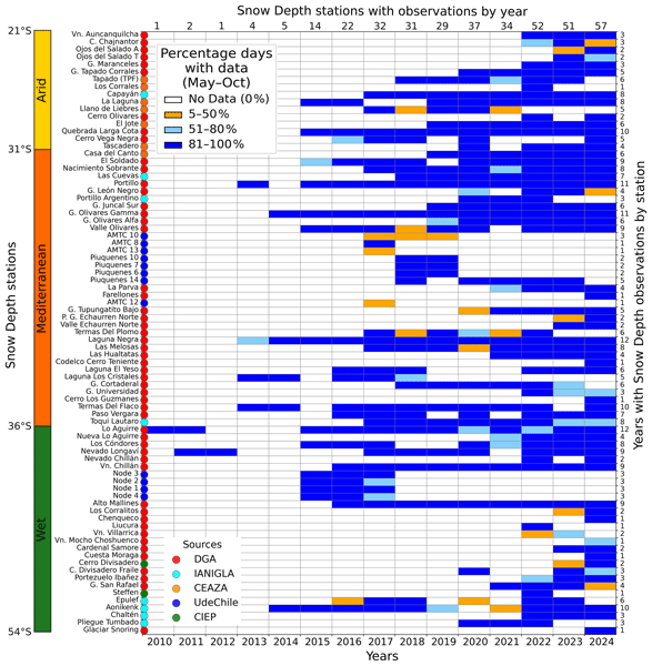
Snowpack dynamics in the Southern Andes remain poorly quantified due to sparse and inconsistent in situ data, limiting hydrological modeling. We compile and quality-control daily snow depth observations from 81 stations (21–54° S, 2010–2024). The resulting dataset improves the Physical Consistency Index (up to 95 %) despite reduced data availability, reveals a north–south increase in snow depth but no consistent positive relationship with elevation across river basins.
Matthias Schlögl, Laura Waltersdorfer, Peter Regner, Andrea Siposova, and Alexander Brenning
EGUsphere, https://doi.org/10.5194/egusphere-2025-5210, https://doi.org/10.5194/egusphere-2025-5210, 2025
Short summary
Short summary
Reproducibility is essential for reliable scientific research, yet it remains challenging in (geo-)scientific practice. This perspective explores how to improve reproducibility in geospatial analyses by identifying key barriers and proposing actionable solutions. By encouraging both a cultural shift and offering strategies tailored to the unique needs of the field, our aim is to provide clear implementation strategies that foster transparent and reproducible geospatial research.
Raphael Knevels, Helene Petschko, Herwig Proske, Philip Leopold, Aditya N. Mishra, Douglas Maraun, and Alexander Brenning
Nat. Hazards Earth Syst. Sci., 23, 205–229, https://doi.org/10.5194/nhess-23-205-2023, https://doi.org/10.5194/nhess-23-205-2023, 2023
Short summary
Short summary
In summer 2009 and 2014, rainfall events occurred in the Styrian Basin (Austria), triggering thousands of landslides. Landslide storylines help to show potential future changes under changing environmental conditions. The often neglected uncertainty quantification was the aim of this study. We found uncertainty arising from the landslide model to be of the same order as climate scenario uncertainty. Understanding the dimensions of uncertainty is crucial for allowing informed decision-making.
Zhihao Wang, Jason Goetz, and Alexander Brenning
Geosci. Model Dev., 15, 8765–8784, https://doi.org/10.5194/gmd-15-8765-2022, https://doi.org/10.5194/gmd-15-8765-2022, 2022
Short summary
Short summary
A lack of inventory data can be a limiting factor in developing landslide predictive models, which are crucial for supporting hazard policy and decision-making. We show how case-based reasoning and domain adaptation (transfer-learning techniques) can effectively retrieve similar landslide modeling situations for prediction in new data-scarce areas. Using cases in Italy, Austria, and Ecuador, our findings support the application of transfer learning for areas that require rapid model development.
Melissa Ruiz-Vásquez, Sungmin O, Alexander Brenning, Randal D. Koster, Gianpaolo Balsamo, Ulrich Weber, Gabriele Arduini, Ana Bastos, Markus Reichstein, and René Orth
Earth Syst. Dynam., 13, 1451–1471, https://doi.org/10.5194/esd-13-1451-2022, https://doi.org/10.5194/esd-13-1451-2022, 2022
Short summary
Short summary
Subseasonal forecasts facilitate early warning of extreme events; however their predictability sources are not fully explored. We find that global temperature forecast errors in many regions are related to climate variables such as solar radiation and precipitation, as well as land surface variables such as soil moisture and evaporative fraction. A better representation of these variables in the forecasting and data assimilation systems can support the accuracy of temperature forecasts.
Cited articles
Apaloo, J., Brenning, A., and Bodin, X.: Interactions between seasonal snow cover, ground surface temperature and topography (Andes of Santiago, Chile), Permafrost Periglac., 23, 277–291, https://doi.org/10.1002/ppp.1753, 2012. a, b, c
Arenson, L. U., Harrington, J. S., Koenig, C. E. M., and Wainstein, P. A.: Mountain permafrost hydrology – A practical review following studies from the Andes, Geosciences, 12, 48, https://doi.org/10.3390/geosciences12020048, 2022. a
Azócar, G. F. and Brenning, A.: Hydrological and geomorphological significance of rock glaciers in the Dry Andes, Chile (27°–33° S), Permafrost Periglac., 21, 42–53, https://doi.org/10.1002/ppp.669, 2010. a
Azócar, G., Iribarren, P., Pedro, S. B., Fonseca-Gallardo, D., Brenning, A., Yoshikawa, K., Casassa, G., and Huenante, J.: Modeling the Distribution of Mountain Permafrost in Chile, Dirección General de Aguas (DGA), Chile, Zenodo [data set], https://doi.org/10.5281/zenodo.19342541, 2022. a, b
Azócar, G., Brenning, A., Iribarren Anacona, P., Yoshikawa, K., Casassa, G., Straub Bustamante, P., Fonseca-Gallardo, D., and Huenante, J.: Modeling the Distribution of Mountain Permafrost in Chile (Maps), Atacama Ambiente Consultores, https://doi.org/10.5281/zenodo.20045182, 2026. a, b
Baral, P., Haq, M. A., and Yaragal, S. B.: Assessment of rock glaciers and permafrost distribution in Uttarakhand, India, Permafrost Periglac., 31, 31–56, https://doi.org/10.1002/ppp.2008, 2020. a
Barsch, D.: Rockglaciers: Indicators for the present and former geoecology, in: high mountain environments, Springer, Berlin, Germany, https://doi.org/10.1007/978-3-642-80093-1, 1996. a, b
BGC Ingeniería Ltda.: Modelo de Distribución de Permafrost – Chile, Unpublished presentation file and digital data Project P40186, Servicio Nacional de Geología y Minería, Chile, Santiago, Chile, https://www.sernageomin.cl/ (last access: 13 March 2026), 2021 (available upon request). a
Boeckli, L., Brenning, A., Gruber, S., and Noetzli, J.: Permafrost distribution in the European Alps: calculation and evaluation of an index map and summary statistics, The Cryosphere, 6, 807–820, https://doi.org/10.5194/tc-6-807-2012, 2012b. a, b
Brardinoni, F., Vivero, S., Barboux, C., Bodin, X., Cicoira, A., Echelard, T., Hu, Y., Jones, N., Lambiel, C., MacDonell, S., Pellet, C., Rouyet, L., Ruiz, L., Schaffer, N., Wehbe, M., and Delaloye, R.: RGIK guidelines for compiling consistent rock glacier inventories, Geomorphology, 492, 110050, https://doi.org/10.1016/j.geomorph.2025.110050, 2026. a, b
Brenning, A.: Climatic and geomorphological controls of rock glaciers in the Andes of central Chile, PhD thesis, Humboldt-Universität zu Berlin, Mathematisch-Naturwissenschaftliche Fakultät II, Berlin, Germany, https://doi.org/10.18452/15332, 2005. a
Brenning, A.: Spatial cross-validation and bootstrap for the assessment of prediction rules in remote sensing: The R package “sperrorest”, in: IEEE International Symposium on Geoscience and Remote Sensing IGARSS, 5372–5375, Munich, Germany, https://doi.org/10.1109/IGARSS.2012.6352393, 2012. a, b
Brenning, A. and Azócar, G. F.: Minería y glaciares rocosos: impactos ambientales, antecedentes políticos y legales, y perspectivas futuras, Revista de Geografía Norte Grande, 143–158, https://doi.org/10.4067/S0718-34022010000300008, 2010a. a
Brenning, A. and Azócar, G. F.: Statistical analysis of topographic and climatic controls and multispectral signatures of rock glaciers in the dry Andes, Chile (27°–33°S), Permafrost Periglac., 21, 54–66, https://doi.org/10.1002/ppp.670, 2010b. a, b
Brenning, A. and Azócar, G.: Modeling the Distribution of Mountain Permafrost in Chile (Version 1.0), Zenodo [data set and code], https://doi.org/10.5281/zenodo.21499253, 2026. a, b
Brenning, A., Gruber, S., and Hoelzle, M.: Sampling and statistical analyses of BTS measurements, Permafrost Periglac., 16, 383–393, https://doi.org/10.1002/ppp.541, 2005. a
Brenning, A., Schwinn, M., Ruiz-Páez, A. P., and Muenchow, J.: Landslide susceptibility near highways is increased by 1 order of magnitude in the Andes of southern Ecuador, Loja province, Nat. Hazards Earth Syst. Sci., 15, 45–57, https://doi.org/10.5194/nhess-15-45-2015, 2015. a
Brenning, A., Bangs, D., and Becker, M.: RSAGA: SAGA geoprocessing and terrain analysis, R package version 1.4.0, CRAN [code], https://doi.org/10.32614/CRAN.package.RSAGA, 2022. a
Brun, P., Zimmermann, N. E., Hari, C., Pellissier, L., and Karger, D. N.: Global climate-related predictors at kilometer resolution for the past and future, Earth Syst. Sci. Data, 14, 5573–5603, https://doi.org/10.5194/essd-14-5573-2022, 2022. a, b
Burger, K., Degenhardt, J., and Giardino, J.: Engineering geomorphology of rock glaciers, Geomorphology, 31, 93–132, https://doi.org/10.1016/S0169-555X(99)00074-4, 1999. a
Cao, B., Li, X., Feng, M., and Zheng, D.: Quantifying overestimated permafrost extent driven by rock glacier inventory, Geophys. Res. Lett., 48, e2021GL092476, https://doi.org/10.1029/2021GL092476, 2021. a, b
Centro de Estudios de Zonas Áridas: Caracterización y monitoreo de glaciares rocosos en la cuenca del río Elqui, y balance de masa del glaciar Tapado, Technical report, Dirección General de Aguas, Unidad de Glaciología y Nieves, Ministerio de Obras Públicas, Santiago, https://repositoriodirplan.mop.gob.cl/biblioteca/handle/20.500.12140/220347 (last access: 19 August 2026), 2012. a, b
Conrad, O., Bechtel, B., Bock, M., Dietrich, H., Fischer, E., Gerlitz, L., Wehberg, J., Wichmann, V., and Böhner, J.: System for Automated Geoscientific Analyses (SAGA) v. 2.1.4, Geosci. Model Dev., 8, 1991–2007, https://doi.org/10.5194/gmd-8-1991-2015, 2015. a, b
Cusicanqui, D., Lacroix, P., Bodin, X., Robson, B. A., Kääb, A., and MacDonell, S.: Detection and reconstruction of rock glacier kinematics over 24 years (2000–2024) from Landsat imagery, The Cryosphere, 19, 2559–2581, https://doi.org/10.5194/tc-19-2559-2025, 2025. a
Daniels, L. D. and Veblen, T. T.: Altitudinal treelines of the southern Andes near 40° S, The Forestry Chronicle, 79, 237–241, https://doi.org/10.5558/tfc79237-2, 2003. a
Deluigi, N., Lambiel, C., and Kanevski, M.: Data-driven mapping of the potential mountain permafrost distribution, Sci. Total Environ., 590–591, 370–380, https://doi.org/10.1016/j.scitotenv.2017.02.041, 2017. a, b, c
Dirección General de Aguas: Modelo de Favorabilidad de Ocurrencia de Permafrost (PFI) en Chile Continental, prepared by: Atacama Ambiente Consultores, Technical Report S.I.T. No. 530, Ministerio de Obras Públicas, Chile, Santiago, Chile, https://snia.mop.gob.cl/PIA/handle/20.500.13000/126863 (last access: 19 August 2026), 2022a. a, b, c
Dirección General de Aguas: Anexo N°6: Informe Técnico Catastro de Evidencias de Permafrost en Chile, prepared by: Atacama Ambiente Consultores, Technical Report S.I.T. No. 530530, Ministerio de Obras Públicas, Chile, Santiago, Chile, https://snia.mop.gob.cl/PIA/handle/20.500.13000/126863 (last access: 19 August 2026), 2022b. a, b
Gruber, S. and Hoelzle, M.: Statistical modelling of mountain permafrost distribution: Local calibration and incorporation of remotely sensed data, Permafrost Periglac., 12, 69–77, https://doi.org/10.1002/ppp.374, 2001. a
Gruber, S. and Hoelzle, M.: The cooling effect of coarse blocks revisited, in: 9th International Conference on Permafrost, edited by: Kane, D. L. and Hinkel, K. M., vol. 1, 557–561, University of Alaska Fairbanks, Fairbanks, AK, https://www.uspermafrost.org/conference-proceedings (last access: 19 August 2026), 2008. a
Haeberli, W.: Untersuchungen zur Verbreitung von Permafrost zwischen Flüelapass und Piz Grialetsch (Graubünden), vol. 17 of Mitteilungen der Versuchsanstalt für Wasserbau, Hydrologie und Glaziologie der ETH Zürich, ETH Zürich, Zurich, https://ethz.ch/content/dam/ethz/special-interest/baug/vaw/vaw-dam/documents/das-institut/mitteilungen/1970-1979/017.pdf (last access: 19 August 2026), 1975. a, b
Hansson, A., Shulmeister, J., Dargusch, P., and Hill, G.: A review of factors controlling Southern Hemisphere treelines and the implications of climate change on future treeline dynamics, Agr. Forest Meteorol., 332, 109375, https://doi.org/10.1016/j.agrformet.2023.109375, 2023. a
Harris, C., Davies, M. C. R., and Etzelmüller, B.: The assessment of potential geotechnical hazards associated with mountain permafrost in a warming global climate, Permafrost Periglac., 12, 145–156, https://doi.org/10.1002/ppp.376, 2001. a
Hauck, C.: New concepts in geophysical surveying and data interpretation for permafrost terrain, Permafrost Periglac., 24, 131–137, https://doi.org/10.1002/ppp.1774, 2013. a
Hijmans, R. J.: terra: Spatial data analysis, R package version 1.8-25, CRAN [code], https://doi.org/10.32614/CRAN.package.terra, 2025. a
Hilbich, C., Hauck, C., Mollaret, C., Wainstein, P., and Arenson, L. U.: Towards accurate quantification of ice content in permafrost of the Central Andes – Part 1: Geophysics-based estimates from three different regions, The Cryosphere, 16, 1845–1872, https://doi.org/10.5194/tc-16-1845-2022, 2022. a, b
Hjort, J. and Luoto, M.: Statistical methods for geomorphic distribution modeling, 53–73, Elsevier, https://doi.org/10.1016/B978-0-12-374739-6.00028-2, 2013. a, b
Hoelzle, M., Mittaz, C., Etzelmüller, B., and Haeberli, W.: Surface energy fluxes and distribution models of permafrost in European mountain areas: An overview of current developments, Permafrost Periglac., 12, 53–68, https://doi.org/10.1002/ppp.385, 2001. a
Hosmer, D. W. and Lemeshow, S.: Applied logistic regression, John Wiley & Sons Inc., USA, https://doi.org/10.1002/0471722146, 2000. a
Hu, Z., Yan, D., Feng, M., Xu, J., Liang, S., and Sheng, Y.: Enhancing mountainous permafrost mapping by leveraging a rock glacier inventory in northeastern Tibetan Plateau, Int. J. Digit. Earth, 17, 2304077, https://doi.org/10.1080/17538947.2024.2304077, 2024. a, b, c
Huggel, C., Fischer, L., Schneider, D., and Haeberli, W.: Research advances on climate-induced slope instability in glacier and permafrost high-mountain environments, Geogr. Helv., 65, 146–156, https://doi.org/10.5194/gh-65-146-2010, 2010. a
Janke, J. R.: Modeling past and future alpine permafrost in the Colorado Front Range, Earth Surf. Process. Landf., 30, 1495–1508, https://doi.org/10.1002/esp.1205, 2005. a, b
Jiang, H., Zheng, G., Yi, Y., Chen, D., Zhang, W., Yang, K., and Miller, C. E.: Progress and challenges in studying regional permafrost in the Tibetan Plateau using satellite remote sensing and models, Front. Earth Sci., 8, 560403, https://doi.org/10.3389/feart.2020.560403, 2020. a
Jiang, S., Sweet, L.-b., Blougouras, G., Brenning, A., Li, W., Reichstein, M., Denzler, J., Shangguan, W., Yu, G., Huang, F., and Zscheischler, J.: How interpretable machine learning can benefit process understanding in the geosciences, Earth's Future, 12, https://doi.org/10.1029/2024EF004540, 2024. a, b
Jones, D. B., Harrison, S., Anderson, K., and Whalley, W. B.: Rock glaciers and mountain hydrology: A review, Earth-Sci. Rev., 193, 66–90, https://doi.org/10.1016/j.earscirev.2019.04.001, 2019. a
Keller, F.: Automated mapping of mountain permafrost using the program PERMAKART within the geographical information system ARC/INFO, Permafrost Periglac., 3, 133–138, 1992. a
Koenig, C. E. M., Hilbich, C., Hauck, C., Arenson, L. U., and Wainstein, P.: Thermal state of permafrost in the Central Andes (27–34° S), The Cryosphere, 19, 2653–2676, https://doi.org/10.5194/tc-19-2653-2025, 2025. a, b
Lewkowicz, A. and Ednie, M.: Probability mapping of mountain permafrost using the BTS method, Wolf Creek, Yukon Territory, Canada, Permafrost Periglac., 15, 67–80, https://doi.org/10.1002/ppp.480, 2004. a, b
Mahanta, K. K., Pradhan, I. P., Gupta, S. K., and Shukla, D. P.: Assessing machine learning and statistical methods for rock glacier-based permafrost distribution in northern Kargil region, Permafrost Periglac., 35, 262–277, https://doi.org/10.1002/ppp.2240, 2024. a, b, c, d
Marcer, M., Bodin, X., Brenning, A., Schoeneich, P., Charvet, R., and Gottardi, F.: Permafrost favorability index: Spatial modeling in the French Alps using a rock glacier inventory, Front. Earth Sci., 5, 105, https://doi.org/10.3389/feart.2017.00105, 2017. a, b, c, d
Masiokas, M. H., Rabatel, A., Rivera, A., Ruiz, L., Pitte, P., Ceballos, J. L., Barcaza, G., Soruco, A., Bown, F., Berthier, E., Dussaillant, I., and MacDonell, S.: A review of the current state and recent changes of the Andean cryosphere, Front. Earth Sci., 8, 99, https://doi.org/10.3389/feart.2020.00099, 2020. a, b, c, d
Mathys, T., Hilbich, C., Arenson, L. U., Wainstein, P. A., and Hauck, C.: Towards accurate quantification of ice content in permafrost of the Central Andes – Part 2: An upscaling strategy of geophysical measurements to the catchment scale at two study sites, The Cryosphere, 16, 2595–2615, https://doi.org/10.5194/tc-16-2595-2022, 2022. a, b
Mollaret, C., Hilbich, C., Pellet, C., Flores-Orozco, A., Delaloye, R., and Hauck, C.: Mountain permafrost degradation documented through a network of permanent electrical resistivity tomography sites, The Cryosphere, 13, 2557–2578, https://doi.org/10.5194/tc-13-2557-2019, 2019. a
NASA JPL: NASADEM Merged DEM Global 1 arc second V001, https://doi.org/10.5067, 2020. a
Popescu, R., Filhol, S., Etzelmüller, B., Vasile, M., Pleșoianu, A., Vîrghileanu, M., Onaca, A., Șandric, I., Săvulescu, I., Cruceru, N., Vespremeanu-Stroe, A., Westermann, S., Sîrbu, F., Mihai, B., Nedelea, A., and Gascoin, S.: Permafrost distribution in the southern Carpathians, Romania, derived from machine learning modeling, Permafrost Periglac., 35, 243–261, https://doi.org/10.1002/ppp.2232, 2024. a
Pruessner, L., Phillips, M., Farinotti, D., Hoelzle, M., and Lehning, M.: Near-surface ventilation as a key for modeling the thermal regime of coarse blocky rock glaciers, Permafrost Periglac., 29, 152–163, https://doi.org/10.1002/ppp.1978, 2018. a
Pya, N.: scam: Shape Constrained Additive Models, R package, CRAN [code], https://doi.org/10.32614/CRAN.package.scam, 2023. a
Pya, N. and Wood, S. N.: Shape constrained additive models, Stat. Comput., 25, 543–559, https://doi.org/10.1007/s11222-013-9448-7, 2015. a
RGIK Working Group: Guidelines for inventorying rock glaciers: Baseline and practical concepts (version 1.0), Tech. rep., IPA Action Group Rock Glacier Inventories and Kinematics, Université de Fribourg, https://doi.org/10.51363/unifr.srr.2023.002, 2023. a, b, c
Roer, I. and Nyenhuis, M.: Rockglacier activity studies on a regional scale: Comparison of geomorphological mapping and photogrammetric monitoring, Earth Surf. Process. Landf., 32, 1747–1758, https://doi.org/10.1002/esp.1496, 2007. a, b
Rouyet, L., Bolch, T., Brardinoni, F., Caduff, R., Cusicanqui, D., Darrow, M., Delaloye, R., Echelard, T., Lambiel, C., Pellet, C., Ruiz, L., Schmid, L., Sirbu, F., and Strozzi, T.: Rock Glacier Inventories (RoGIs) in 12 areas worldwide using a multi-operator consensus-based procedure, Earth Syst. Sci. Data, 17, 4125–4157, https://doi.org/10.5194/essd-17-4125-2025, 2025. a, b
Saito, K., Trombotto, D., Yoshikawa, K., Mori, J., Sone, T., Marchenko, S., Romanovsky, V., Walsh, J., Hendricks, A., and Bottegal, E.: Late quaternary permafrost distribution downscaled for South America: Examinations of GCM-based maps with observations, Permafrost Periglac., 27, 43–55, https://doi.org/10.1002/ppp.1863, 2015. a
Senate of Chile: Boletin 11876–12, https://tramitacion.senado.cl/appsenado/templates/tramitacion/index.php?boletin_ini=11876-12 (last access: 19 August 2026), 2023. a
Wicky, J. and Hauck, C.: Air convection in the active layer of rock glaciers, Front. Earth Sci., 8, 335, https://doi.org/10.3389/feart.2020.00335, 2020. a
Wood, S. N.: Generalized Additive Models: An Introduction with R, CRC Press, 2nd edn., https://doi.org/10.1201/9781315370279, 2017. a, b, c
Wu, T., Wang, X., Yuan, H., Kong, X., Cai, J., Guo, X., and Liu, G.: Evaluating machine learning models for enhanced permafrost distribution mapping using rock glaciers: A case study in Shaluli Mountain, Southeast Tibetan Plateau, Remote Sens. Appl.-Soc. Environ., 40, 101745, https://doi.org/10.1016/j.rsase.2025.101745, 2025. a, b, c, d, e
Yoshikawa, K., Casassa, G., Azócar, G., Iribarren Anacona, P., Masías, P., Miyata, T., Takahashi, N., Schorghofer, N., Ramirez, E., and Cáceres Correa, B.: Permafrost and active layer characteristics in the high arid Andes between the Altiplano and high Atacama Desert, Arct. Antarct. Alp. Res., 57, 2532202, https://doi.org/10.1080/15230430.2025.2532202, 2025. a, b
Short summary
We created the first empirically calibrated high-resolution map of mountain permafrost distribution in mainland Chile. Using field evidence from rock glaciers and boreholes with climate and terrain data, we found that more than 8000 km², mainly in the dry Andes of northern and central Chile, offer suitable conditions. Permafrost affects water resources, slope stability, and infrastructure, and our model provides a baseline for planning and future research under climate change.
We created the first empirically calibrated high-resolution map of mountain permafrost...


